December 5, 2017 / Le 5 d
é
cembre 2017
|
|
Association News / Nouvelles des associations
|
|
Attention All Land Owners!
Do You Know Where Your Property Boundaries Are?
Article by Fred Hutchinson, BA, NSLS, CLS, QP Executive Director, Nova Scotia Land Surveyors, Director & Treasurer and Chief Financial Officer, Professional Surveyors Canada
Article published in Municipal Voices, Magazine for the Union of Nova Scotia Municipalities
|
|
“Somewhere over there” is not the best answer to
the question, but a common reply. Property values
used to be measured by the acre, but in recent years
they’ve been measured by the square foot/metre and
decimals thereof. Landowners have always been desirous
of knowing the limits of their property, and it
seems that it has become more of a concern as lots
become smaller and houses get bigger..
|
|
|
In the Media / Dans les médias
|
|
Service Alberta land titles registry website restored after outage
CTV News Calgary
The province’s land titles website is back online after it was knocked out over the weekend and it could cost some Alberta home buyers after thousands of real estate transactions were left in limbo.
Service Alberta says its land titles registry website went down on Sunday following a routine systems upgrade.
Real estate lawyer, Ryan MacKay, says the outage will cause a major issue for some home buyers looking to close a deal, but a minor inconvenience to most.
Read more
|
|
Bearing witness: Site of Sauk City's origins start with a cottonwood tree
The Eagle
Cottonwood trees have the potential to live between 200-400 years if given the right environment.
The cottonwood tree that used to make its home along the Wisconsin River bank along Water Street in Sauk City was an integral part of the village’s development in 1845.
That’s why several individuals put their time and energy into locating the cottonwood tree that used to stand tall over the village of Sauk City.
Called a witness tree, the cottonwood was used by a surveyor to mark the original boundary lines for the village of Sauk City. Originally called Haraszthy, named for one of the village’s founding fathers, the Cottonwood bore witness to the village’s beginning.
Read more
|
|
Citing 'value for money', Caisse extends bidding for REM electric-train project
Extra month required to allow 'additional discussions' concerning the project's engineering and construction contract
Montreal Gazette
Three weeks after saying they expected the process to be completed by the end of 2017, the agency tasked with overseeing bids for the construction of the Caisse de dépôt et placement’s $6-billion electric-train project has extended the bidding process to the end of January 2018.
CDPQ Infra, a subsidiary of the Caisse de dépôt, announced on Friday it has decided keep the tender process for the Réseau électrique métropolitain (REM) open and “launch a period of intensive discussions with the qualified consortiums for the engineering and construction contract.”
Read more
REM : le choix des consortiums reporté
Radio Canada
La CDPQ Infra – la filiale de la Caisse de dépôt et placement du Québec (CDPQ) qui gère des « projets majeurs d'infrastructures publiques » – reporte le choix des consortiums en vue de la réalisation du Réseau électrique métropolitain (REM). La CDPQ Infra soutient avoir besoin de plus de temps pour analyser et évaluer les propositions reçues.
Le choix des consortiums retenus devait être annoncé aujourd’hui, mais il est reporté à une date indéterminée.
Lire plus
|
|
Where to put the plats?
Hutchinson Leader
The plats are the supposed original maps of Hutchinson and Harmony, drawn up by founder Lewis Harrington, who was a surveyor, in 1855. What is Harmony, you may ask? Here’s a quick history lesson for you:
Read more
|
|
A pile of rocks in the woods could reshape Wake County – and whether you live in it
The News&Observer
RALEIGH - When Wake County was formed in 1771, its borders were set by landmarks such as “John Beddingfield’s plantation” and “David Mimm’s mill creek.”
But with these waypoints lost to time, there are some disputes about where exactly county lines lie. Now Wake is trying to fix discrepancies along its borders with Harnett and Chatham counties that could affect 122 properties and 27 homes.
Read more
|
|
Réseau Sélection: projet immobilier de 1 milliard à Terrebonne
Ma Presse
Réseau Sélection lance District Union, un mégaprojet immobilier multigénérationnel de 1 milliard de dollars et de 3500 unités, dans le secteur Lachenaie, à Terrebonne, à l'intersection des autoroutes 40 et 640.
Le lancement a eu lieu hier après-midi au théâtre du Vieux-Terrebonne devant un parterre d'invités.
Située à un kilomètre à vol d'oiseau de la gare du train de banlieue de Mascouche, la première phase de District Union, évaluée à 100 millions environ, comprend 364 unités : 80 condos et 284 unités locatives. Les travaux sont officiellement commencés. REZ Immobilier, la division multirésidentielle de Réseau Sélection, entrevoit livrer le tout en 18 mois.
Lire plus
|
|
Survey Valley
The American Surveyor
The Sandhills region of Nebraska is known, above ground, for its hay and cattle production and, below, for the vast amounts of pure water in the Ogallala Aquifer. It is home to the Kinkaid Act of 1904 which increased the longstanding 160-acre homestead to an entire 640-acre section of free land. The Homestead Act of 1862 failed to bring a substantial number of settlers to the area and those who did come in the late 1800's found that the land would not produce crops. Cattlemen accustomed to spreading their herds across vast areas of fenceless land were not sorry to see the early homesteaders leave. The Kinkaiders, however, were a new breed of people who decided they could succeed with more advanced farming methods and with supplies much easier to obtain due to the arrival of the railroads.
The original surveys in much of the Sandhills region contain some of the worst fraud in all of the Public Land Survey System. Completing contracts with the General Land Office in the 1870-80's, deputy surveyors routinely compiled fictitious notes, knowing their work most likely would go unchecked. Monuments built in sand could disappear almost overnight even if the pits and mounds were constructed properly. (See The American Surveyor January/February 2005). After the initial surveying, there were few surveyors in the area to properly find existing monuments to assist homesteaders in occupying their properties. Instead, "land locators" living in the region performed the role of a surveyor, but in reality knew just enough to make the situation worse.
Read more
|
|
Espace Montmorency: les travaux débuteront en février prochain
Ma Presse
La construction d'Espace Montmorency, mégaprojet d'une valeur d'un demi-milliard du Groupe Montoni, commencera finalement en février prochain, soit un peu plus de deux ans après l'annonce initiale de ce projet survenu en novembre 2015.
C'est le directeur du développement des affaires, Mike Jagger, qui en a fait l'annonce à l'occasion de la 3e édition du Forum immobilier de Laval la semaine dernière.
« On commence avec le stationnement souterrain de 1850 cases. Ça prendra 10 mois juste pour monter la structure au niveau de la rue », a-t-il dit à La Presse au terme de sa présentation prononcée devant 300 participants réunis au Château Royal.
Lire plus
|
|
International News / Informations internationales
|
|
A new protocol for resolving boundary disputes
A Protocol for Disputes between Neighbours about the Location of their Boundary - or the Boundary Disputes Protocol - has been written and issued by senior members of the legal and surveying professions.
Shoosmiths
It is accompanied by guidance notes and is intended to apply to both residential and commercial properties.
The protocol is not new law and compliance with it is voluntary. It aims to provide a structured process whereby neighbours exchange information according to a set timescale, to enable the ready resolution of disputes and keep costs to a minimum.
Read more
|
|
Ancient Silk Road map comes home
ChinaDaily
A huge colored map of the Silk Road from a royal court of the mid-Ming Dynasty was officially welcomed home at the Forbidden City in Beijing on Thursday.
The 30-meter-long by 59-centimeter-wide scroll, named the Landscape Map of the Silk Road, is painted on silk. It depicts trade routes starting at Jiayuguan-at the western end of the Great Wall during the Ming Dynasty (1368-1644)-through Central and West Asia to the Middle East.
Read more
|
|
Semi-automated surveys could take 25% of mortgage valuations – Hometrack
Mortgage Solutions
After two years of testing, Hometrack has launched its semi-automated valuation model in the UK. Piero Bassau explains why the property data business believes this will be the next step in surveying technology.
These days the idea of waiting days or even weeks for information required to approve a mortgage is an anathema to all involved in the application process.
Delays are a lose-lose situation for banks, borrowers and brokers especially when they are not necessary or could be replaced by a more efficient way of doing things.
Read more
|
|
Surveying a viable career option for PC students
Parkland, the only community college in Illinois to offer a certificate in surveying, recently held an open house showcasing companies hiring surveyors.
Parkland offers all of the surveying credit hours needed to get the certificate as a weekend program and offers all of the related classes as well. Getting a surveying certificate is the first step in a longer journey to becoming a professional land surveyor.
Parkland is a part of the Illinois Community College Career Agreement that allows students from all over the state to take advantage of career programs not available at their home colleges.
Read more
|
|
Tech News / Nouvelles techno
|
|
Geomatics researcher heads up training program to meet personnel shortage in expanding sensor technology field
Naser El-Sheimy to lead NSERC program for technological developments in step with industry
UToday, University of Calgary
Stunning advances in drone technology, driverless cars, GPS and other sensor-dependent systems make headlines every day, and have forced a fundamental reimagining of our future. But while the multi-sensor system (MSS) industry has expanded rapidly in Canada and around the world, the availability of a highly trained and knowledgeable workforce has not kept pace.
To address that personnel void, the University of Calgary’s Naser El-Sheimy, a distinguished geomatics researcher in the Schulich School of Engineering with significant experience in both academia and industry, will lead Canada’s first collaborative research and training program on MSS technology, applications and analytics.
Read more
|
|
Javad GNSS offers spoofing alert for surveyors
GPS World
Spoofing — the generation of false and misleading GPS signals by “bad actors” — is becoming an increasing problem for all GPS users, and surveyors just as much as everyone else should be knowledgable and take countermeasures.
Read more
|
|
Upcoming Events / Prochaines activités
|
|
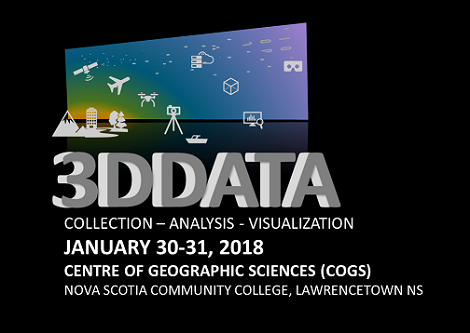
3D Data Workshop & NSCC-COGS Industry Expo 2018
Workshop: January 30-31, 2018
Expo: February 1, 2018
Lawrencetown, NS
|
|
|
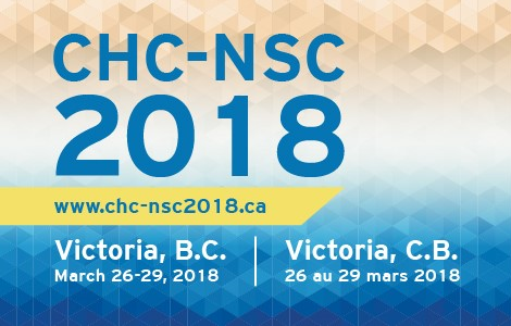
2018 Joint Canadian Hydrographic and National Surveyors’ Conference
2018 Conférence conjointe des hydrographes et des arpenteurs nationaux du Canada
Land and Sea Shaping the World
Terre et Mer Façonnant le Monde
March 26-29, 2018
Victoria, BC
|
|
|
Advertise with PSC /
Annoncez par l’entremise GPC
|
|
Please contact
Helen Derry, Administrative Coordinator for information.
Pour de plus amples renseignements, veuillez communiquer avec
Helen Derry, Coordinatrice administrative.
|
|
Horizon
Horizon is brought to you as an information service only. Articles are selected from relevant geomatics issues currently in the news and do not necessarily represent the views or priorities of Professional Surveyors Canada. Professional Surveyors Canada is not responsible for the content or pop-ups featured on third-party websites hyperlinked from this news brief. Web links and the content featured may change without notice. If you choose to access these links, you do so at your own risk.
Horizon vous est offert à titre de service d’information seulement. Les articles sélectionnés se rapportent à des dossiers géomatiques pertinents qui sont d’actualité, et ne représentent pas nécessairement les points de vue ou les priorités de Géomètres professionnels du Canada. Géomètres professionnels du Canada n’est pas responsable du contenu publié ou des fenêtres contextuelles affichées sur les sites Web de tiers dont les hyperliens sont proposés dans les présentes nouvelles en bref. Les hyperliens et le continu publié peuvent changer sans préavis. Si vous décidez d’accéder à ces liens, vous le faites à vos propres risques.
Professional Surveyors Canada | Géomètres professionnels du Canada
|
STAY CONNECTED /RESTER À L’AFFÛT
|
|
|
|
 |
|
|
|
|