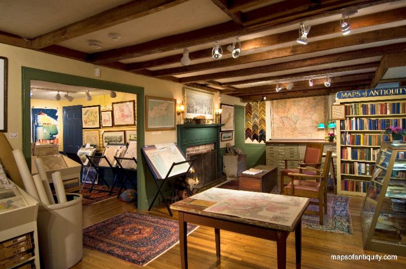
We're Open Daily!
Our shop is normally open:
Monday - Saturday:
10am - 5pm
Sunday:
12 noon- 5pm
We're also available after hours by appointment, and you can
shop online 24/7 at:
Or give us a call at:
508-945-1660
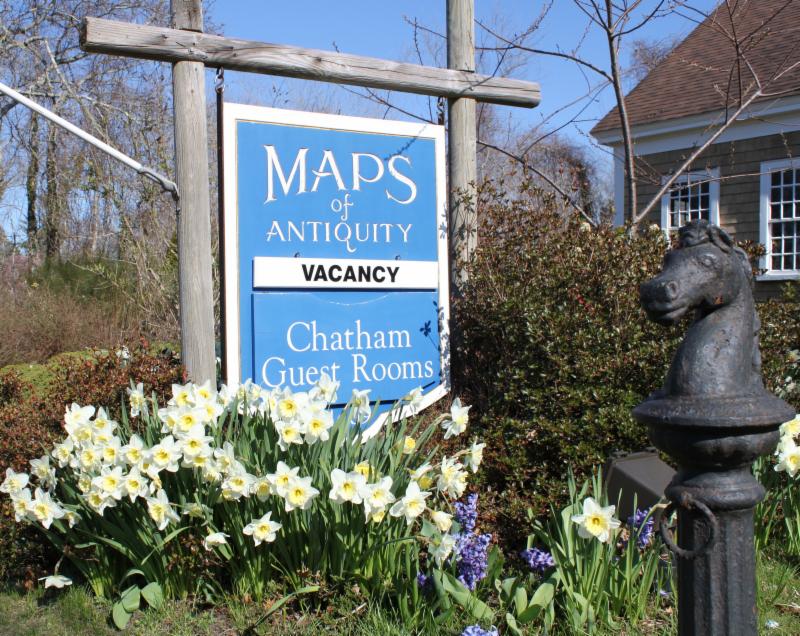
Summer is upon us! Book your vacation stay soon!
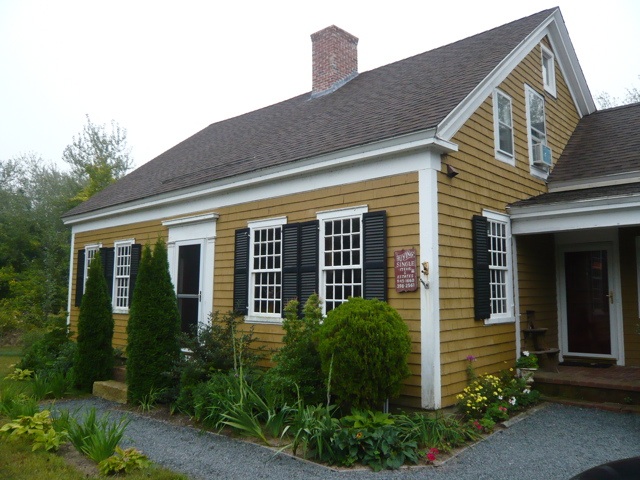
If you or your loved-ones need accomodations, send them over to our converted 18th century farmhouse,
Chatham Guest Rooms
. We have been very
well reviewed
on TripAdvisor!
|
|
|
DEAR MOA FRIENDS,
Spring is here! What a perfect time to reconnect with you and fill you in on all of the happenings here at Maps of Antiquity. In this email we will also offer a fun lesson on ward maps and some cartographic terms to add to your repertoire. Let's get right into it with the latest MOA news.
We have been recently recognized with two different awards:
We would like to thank YOU, our wonderful customers, for
your enthusiastic recommendations, referrals, reviews, and -most of all- your continued business. Because of you, we can maintain a steady business throughout the year, even in a location as seasonal as Cape Cod. Your engagement with our business, our emails, our social media posts, and our products is what keeps us going! Thank you!
As a result of your positive reviews, we continue to rank well on Tripadvisor's list of Things To Do in Chatham (#6 out of 48!), and we are proud to have received a 2016 Certificate of Excellence! If you would like to help us by giving us a positive review, we would certainly appreciate it! You can click on the Tripadvisor image above,
or click here.
Thank you!
We are also in the process of re-inventorying our entire store. Those of you who have been here in person know that this will be no small feat. After 10 years in business and with over 10,000 items on our website, we have found it is necessary to handle each item and ensure all of the information in our database is up-to-date. Our goal is always to provide the best possible customer service and having an acccurate inventory that we can search more easily is another way that we are trying to improve our customer's experience. We estimate that we have over 18,000 antique maps and prints in the store, with a good portion of that available online, and new items are being added to our database weekly. Perri, Marisa, and Marik have been very busy cataloguing maps, and expect to continue to be busy with this for many more months!
The Spring flowers are fully in bloom, including the wisteria, lilacs, and a few lingering daffodils! Stop by to see the maps and take a moment to enjoy the beautiful sights and smells of Spring!
|
|
| We are open all year round! Stop by to see us! |
|
A ward is a local authority area, typically used for electoral purposes. It is common in the United States for wards to simply be numbered. Ward maps are maps of individual wards, published in an atlas showing all of the wards of a particular city. These atlases were often used for insurance purposes and included information on the property owners and the types of buildings in the area. Insurance companies would be able to use a ward map to determine the type of building materials used in an area, such as brick or wood, and also what other buildings and land features are nearby.
At the beginning of a ward atlas, there was always an index of the town showing the numbered wards and the page numbers. You would use this index to find any ward quickly and easily. Here is an example of an index map from a Bromley atlas:
|
|
|
Index Map of Roxbury/Boston- 1915
|
The ward numbers are printed in black and the page numbers are printed in red with red delineations showing precisely what is on that page. There is a key on the index map that gives the color meanings for all of the maps in the atlas. In this case, pink represents brick buildings, tan stands for stone buildings, yellow means frame or wooden buildings, and blue indicates iron buildings.
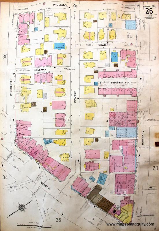
Here is a ward map from a slightly later year and a different map maker (Sanborn). This map includes the Coolidge Corner Theatre, which is still in operation today.
|
|
|
Brookline Ward Map featuring the Coolidge Corner Theatre- 1925
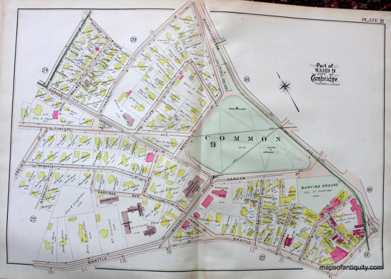
This next map is from an earlier Bromley atlas of Cambridge. In this map you can see Radcliffe College and the Common. This map has the owners' names prominently written over each property.
|
|
|
|
City of Cambridge Ward Map featuring Radcliffe College and the Common - 1903
|
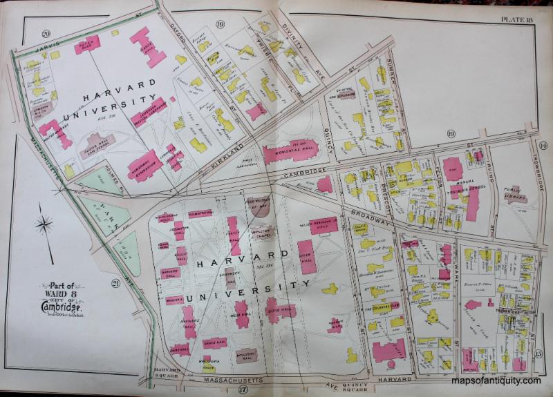
This map shows how the mapmaker coordinated two adjacent areas. The above map has Mass Ave on the right side in green and the map below shows Mass Ave on the left side in green. You could put the two maps next to each other for a larger view of the area. The map below features Harvard University as it was in 1903.
|
|
|
City of Cambridge Ward Map featuring Harvard University - 1903
|
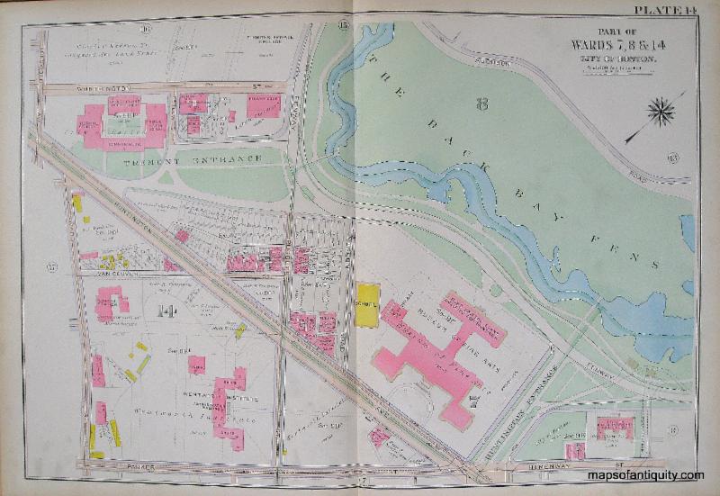
Ward maps are fascinating views into a city's past. The map below features the Museum of Fine Arts just 6 years after it had moved from its Copley Square location. It also shows the buildings that are now the Wentworth Institute of Technology and Mass College of Art and Design. Also of interest is the relatively new Isabella Stewart Gardner Museum, which opened in 1903. When this ward map was published, Mrs. Gardner was still alive and lived on the fourth floor of the building when she was in Boston.
|
|
City of Boston Plate 14 Museum of Fine Arts - 1915
|
Finally, in celebration of the 100th birthday of JFK, here is a ward map showing the house where he was born in Brookline, MA, at 83 Beals St:
|
|
|
Brookline Ward Map with birthplace of
John F Kennedy - 1925
|
His family sold the property in 1920, so they had already moved on by the time this map was published. After his assassination, JFK's mother repurchased the house and restored it to her memory of how it was in 1917 when he was born. It is now a National Historic Site that the public can visit.
|
|
MAP TERMINOLOGY MADE EASY
|
|
Ward Map:
A ward is a local authority area, typically used for electoral purposes. It is common in the United States for wards to simply be numbered. Ward maps are maps of individual wards, published in an atlas showing all of the wards of a particular city.
Index Map:
The index map appears at the beginning of an atlas or of a series of maps, and is used to indicate where in the atlas you can find a map of a certain area. It can be used much like a table of contents in a reference book. But don't be fooled by their usefulness- index maps are also decorative and enjoyable to have on your walls!
Platemark (also Plate Impression):
The platemark is a rectangular impression with rounded edges made in intaglio printing when a metal printing plate is pressed firmly into paper. In this type of printing (sometimes called etching) the paper is slightly damp and a significant amount of force is applied using a printing press. A plate mark can help you identify an antique versus a reproduction, but beware- it is possible to fake a platemark! Trained eyes can usually spot a fake, which is why it is wise to have a valuable map appraised by a professional.
|
| Planning a Wedding? Attending a Wedding? We can help commemorate the special day! |
|
|
| ... for birthdays, weddings, reunions, retirement, etc. |
In all the happy chaos of planning for a wedding, reunion, retirement, graduation, or milestone birthday party, don't forget that you'll want to remember it forever! Pick out a map or view of your special place, then let us custom cut a conservation-quality mat and place a sheet of acetate temporarily over the map. You can then display it with markers so your guests can sign the mat. Afterward, we'll frame it with UV protective glass and your favorite custom frame. Or bring it to your local framer. Whether you hang it on your own wall or give it to the guest of honor, this highly personalized piece will help that special day last a lifetime!
|
|
 |
| Find us on Social Media for more updates |
Do you tweet, follow, like, and pin? Well, Maps of Antiquity has an active Facebook page where we post map-related articles, unusual maps and prints that we add to our website, company news, and answers to frequently-asked questions.
On Pinterest, we display some of our maps and prints and add opinions and comments about specific pieces. We also provide boards with decorating ideas.
On Twitter, Maps of Antiquity offers links to articles and brief news. We also periodically update Google Plus and LinkedIn with company news and product information.
We've also added Instagram to our social media repetoire! Follow us for fun antique maps on #mapmonstermonday #whalewednesday, and more!
So if you are spending time on social media, be sure to look us up. Also, if you have a preferred social media where you think we should be active....let us know!
|
|
|