|
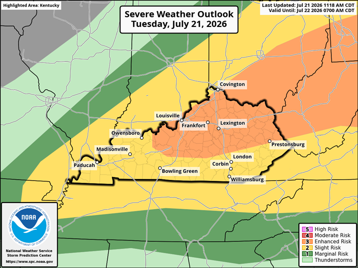
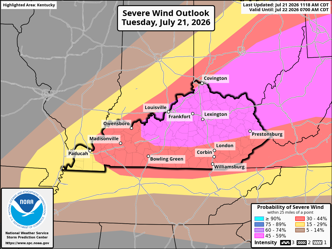
All severe weather hazards remain on the table as a broken line of storms moves south-southeast through the region. Damaging straight-line winds and torrential rainfall, which could lead to localized flash flooding, remain the primary concerns. Wind gusts up to 70 mph are possible with the strongest storms.
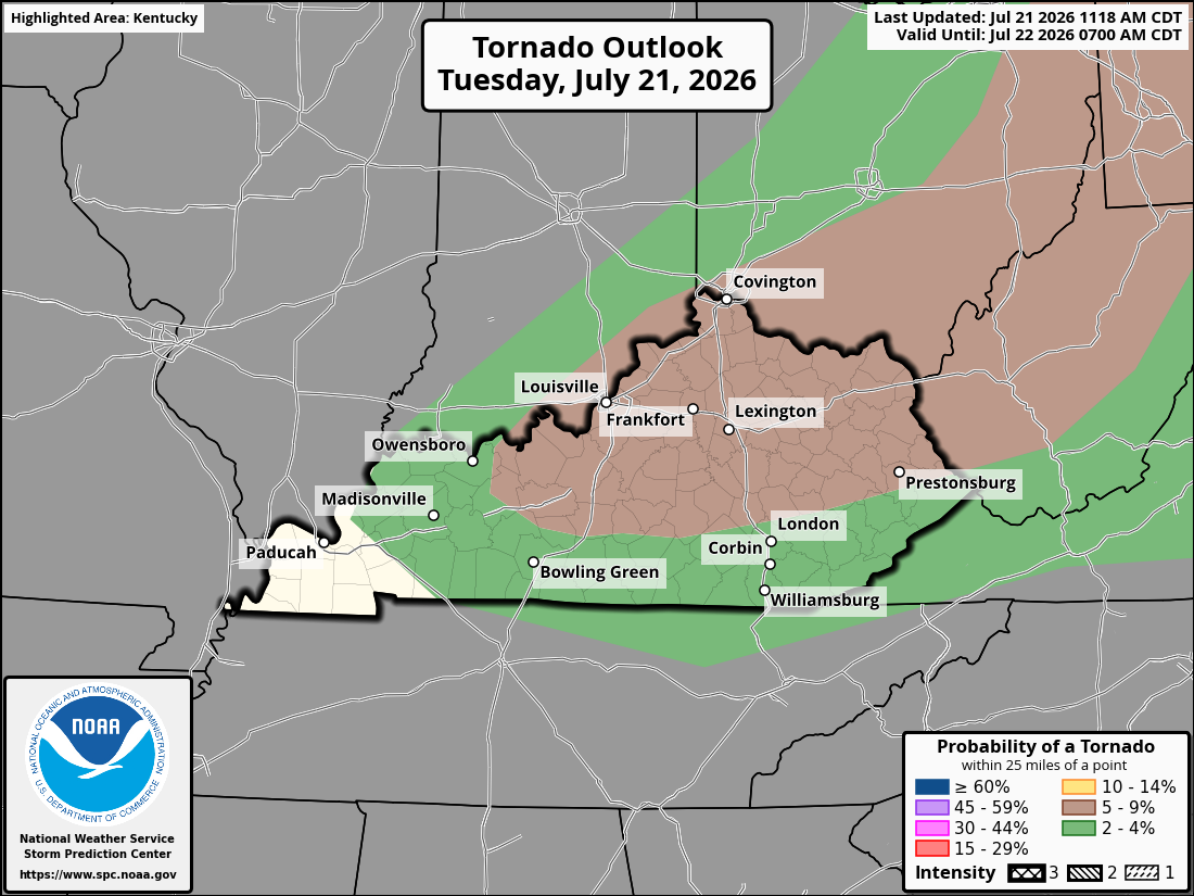
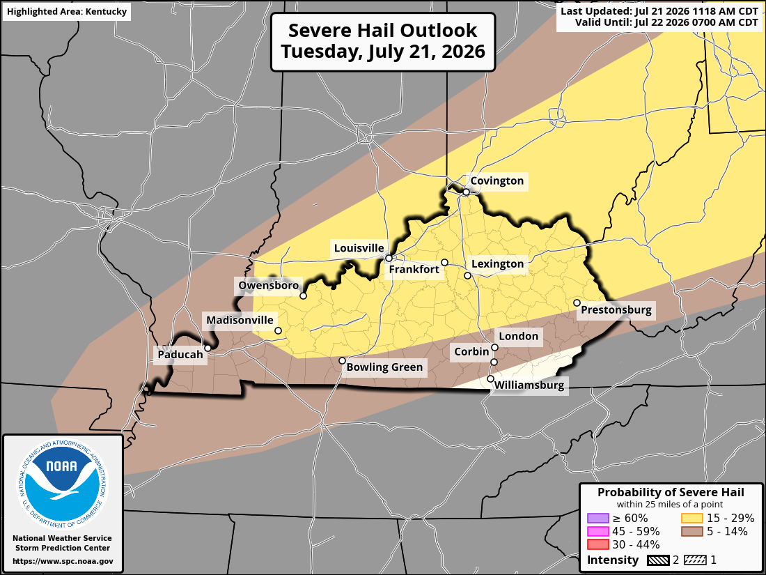
While the damaging wind threat is the main story, a few storms could also produce large hail or a brief tornado. The overall tornado threat remains much lower, but it's not zero.
The first Severe Thunderstorm Watch of the day was just issued for portions of Northeastern KY and expect another one soon for Central KY.
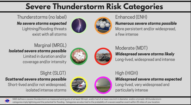
Below is a look at the latest SPC hazard probabilities. Based on the latest model guidance, the main line of storms looks to move into northern Kentucky by mid-to-late afternoon and continue pushing south-southeast through the evening and early overnight hours.
|