|
|
This quarter, YouthMappers have added over 280,000 buildings and 8,000 KM of roads to OpenStreetMap!
....Read more in our Quarterly 2020 Newsletter...
Our YouthMappers network of university chapters continues to grow and includes
212
universities
in 50
countries
! We are inspired by your enthusiasm for mapping the world a better place. To learn more about our chapters, visit the
chapter profile map
on our website.
|
|
Join us in welcoming the newest chapters approved by the YouthMappers Steering Committee this quarter:
- University of Jos, Nigeria
- University of Makeni, Sierra Leone
- Debre Birhan University, Ethiopia
- Universidade Federal da Bahia, Brazil
- North South University, Bangladesh
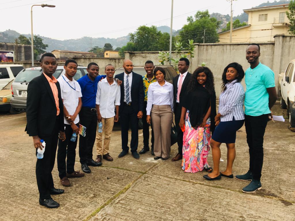
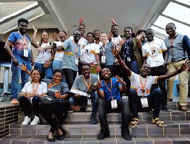
Student members of the Unimak YouthMappers chapter at the University of Makeni in Sierra Leone after their first meeting.
|
|
|
What the network has been working on
|
|
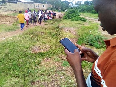
Power distribution networks in Sierra Leone are scarcely mapped, especially in rural locations. Considering this, YouthMappers, Sierra Leone chapters, and researchers at Arizona State University have teamed up to support the design of distribution networks. By using five mapping tools, this project seeks to provide power to 40 village communities and 5 communities with industrial and commercial presence with limited access to adequate electricity. Over the past few months, our mapping focus has been on low-voltage power lines or distribution networks that connect to homes and businesses. Our data will be used by PowerGen Renewable Energy to decide on the implementation strategy of 45 new mini-grids under their U.S. Trade and Development Agency (USTDA) Mini-grid Feasibility Study. This data will also be valuable to the Ministry of Energy, national utilities, and other Sierra Leone energy sector stakeholders for electrification planning.
You can find additional information for contributing to this project and data analysis
here.
The newly launched fieldwork program supports YouthMappers chapters to undertake projects related to the creation of new data and analysis in the chapter's local or regional community. Example tasks might include: the remote creation of data or some other direct support for OpenStreetMap (OSM), supporting a local research project to fulfill a remotely accessible development need with a direct link to OSM or YouthMappers, or conducting specific remote data and/or analysis activities related to YouthMappers for a local or regional USAID Mission.
In this revised call, applicants must demonstrate that all tasks can be accomplished remotely and follow the social distancing guidelines established by their local and/or national governments. Projects are not required to deal directly with COVID-19 or its effects as a topic in the proposal, but must describe how project participants will comply with local safeguards against the disease. Read the full announcement
here.
|
|
"Mapping Locally, Globally: Reflections on YouthMappers and Engaged Learning in Geography!" Virtual Panel at the 2020 American Association of Geographers (AAG) Annual Meeting
Adele Birkenes, president and co-founder of Vassar College's YouthMappers chapter chaired the panel featuring Patricia Solís, co-founder and director of YouthMappers; Mary Ann Cunningham, faculty advisor of Vassar College's YouthMappers chapter; Marynia Kolak, faculty advisor of the University of Chicago's YouthMappers chapter; Meagan Snow, faculty advisor of American University's YouthMappers chapter; and Nina Feldman, GIS analyst with the USAID Office of U.S. Foreign Disaster Assistance and former YouthMappers graduate research assistant. Panelists discussed both the challenges and successes of the network, explored current and former mapping projects, and invited student organizations to collaborate and join the network.
|
|
YouthMappers supporting HOT COVID-19 Rapid Response Microgrants in first round selections!
Two of the first five Humanitarian OpenStreetMap Team (HOT) Rapid Response Micro-grants: COVID-19 were awarded to teams working with YouthMappers.
GeoYouthMappers from Makerere University in Uganda have teamed up with Map Uganda and the Ugandan Red Cross Society to map all 40 border entry points.
iLab Liberia will work with students from the YouthMappers chapter at the University of Liberia to carry out their project to map active healthcare facilities in Liberia.
GeoYouthMappers and Regional Ambassador Stella Nakacwa organize and contribute to remote mapping activities.
|
|
|
The CovidCareMap team hosted two virtual mapathons where U.S. based YouthMappers chapters supported the collection of critical data on US healthcare capacity. During the mapathon, volunteers scanned the web for critical up-to-date information on pop-up, temporary, and expanded care facilities across the United States. CovidCareMap is a volunteer open-source geospatial effort to map beds, ventilators, supplies, staff, and other resources needed to care for COVID-19 patients.
|
|
 |
|
MapGive organized this virtual event on April 28, 2020. The mapathon hosted 155 attendees, who added over 3,600 building and completed 33% of the map during the two hour event. This OpenStreetMap (OSM) data will be used to support public health planning by the Government of Gabarone for their COVID-19 response. Learn more about this effort and MapGive here.
|
|
|
|
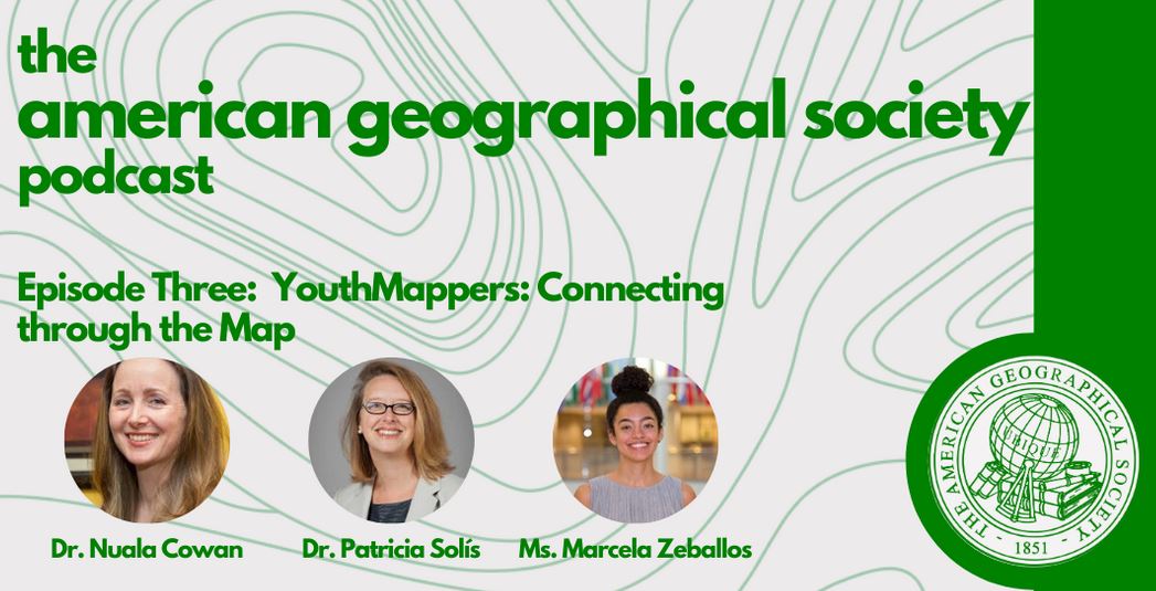
Dr. Nuala Cowan, Dr. Patricia Solís, and Ms. Marcela Zeballos, leaders of YouthMappers, join the American Geographical Society Podcast to discuss how their network of young mappers is changing the map and aiding response to COVID-19 in communities around the world. Hear also from YouthMapper Regional Ambassador Maria Fernanda Peña Valencia about how her chapter in Medellín, Colombia has activated their mapping skills to contribute vital geographical data during the pandemic. Stream the episode
here.
|
|
Regional Ambassadors Maria Fernanda Pena Valencia, Natalia da Silveira Arruda, and Ingrid Kintu designed a free and open method of crowdsourcing information for communities in need during periods of isolation under national quarantine restrictions. They developed the
Impacts of COVID-19 Survey a modifiable questionnaire covering the health and economic welfare of individuals hosted on the KoboToolbox server. Read the full article here. This article was originally published on 26 June 2020.
|
|
COMMUNITY NEWS Congrats to the YouthMappers chapter members and faculty advisors selected as
new Humanitarian OpenStreetMap Team (HOT) Voting Members:
Ataur Rahman Shaheen, Chris Eshun,
Chukwu Kingsley Chika, Dinnah Feye Andal,
Mary L.Marcellinus, Sawan Shariar, Tommy Godphery Davian Charles, and YouthMappers activity manager Rory Nealon! See the full list of HOT Voting Members
here.
|
|
|
What our chapters have been up to
|
|
|
Read more stories from YouthMappers around the world!
|
|
|
|
|
|
|
|
QUARTERLY SPOTLIGHT: YouthMappers in action
|
|
Eight YouthMappers participate in Virtual National Science
Foundation (NSF) Summer Fellowship Program
This summer, eight YouthMappers students across the United States are participating in a virtual Science, Technology and Society Fellowship Program as part of a National Science Foundation study on crowdsourced and official data landscapes in Central America and the Caribbean. The students are completing remote internships with the geographic institutes of seven countries in Mesoamerica. They are collaborating with institute staff to design crowdsourced mapping projects and improve understanding of the connection between volunteered geographic information and national agency cartographies. They are also providing support to their host countries' existing YouthMappers chapters and assisting with the creation of new chapters.
-
Vivian Arriaga, president of YouthMappers at ASU, is Interning with the Instituto Nacional de Estadística y Geografía (INEGI), the Mexican geographic and statistical institute.
-
Adele Birkenes, cofounder of Hudson Valley Mappers, Vassar's YouthMappers chapter, is completing an internship with Colombia's Agustín Codazzi Geographic Institute and the Pedagogical and Technological University of Colombia (UPTC).
-
Daniel Council is the president of Ball State's chapter of Gamma Theta Upsilon, which is also affiliated with YouthMappers. This summer, he is interning with the Land Information Center in Belize, the nation's spatial data repository.
-
Mason Jones is the former Vice President of Texas Tech University's YouthMappers chapter and is interning with the National Spatial Management Division in Jamaica.
-
Enith Lay is a former member of MCC Mapping Corps at Monroe Community College and is interning with the Geographic Institute of the Dominican Republic.
-
Sawyer McCarley from Clemson University in South Carolina has been interning with the National Emergency Geographical Information Systems Team (NERGIST), in Jamaica.
-
Emily Wulf is a member of USC's YouthMapper's chapter and is interning at the Instituto Geográfico Nacional of Costa Rica.
- Calvin Zhang organizes YouthMapper mapathons for the University of Chicago's YouthMappers chapter, the Tobler Society. He currently interns with the Instituto Geográfico Nacional Tommy Guardia in Panama.
|
|
Launched in March 2020, we feature an online series of panels and training webinars organized by YouthMappers. Follow us on social media to sign up for future webinars and watch previous webinars on our YouTube channel.
serves as a resource, guide, and repository of knowledge for all things YouthMappers.
Connect with YouthMapper Alumni on LinkedIn! Learn how to add YouthMappers to your LinkedIn profile
here.
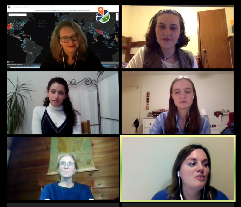
Our Activity Map shows where YouthMappers have been active in OpenStreetMap throughout the past five years. Viewers can search for all edits performed by individual OSM usernames associated with YouthMappers chapters or filter by all edits performed by an entire chapter. Explore it
here.
|
|
|
|
|
|
|
|
|