|
|
|
|
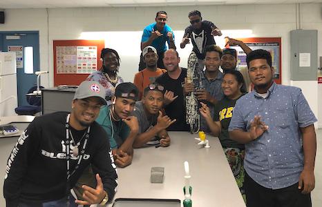
Field school students in Majuro with the PacIOOS nearshore sensor. Credit: M. Sudnovsky |
Hands-on Experience in the Marshall Islands
The focus of this program was to give students with limited or no research background the opportunity to gain invaluable experience in the exciting field of conservation, explore scientific research processes, and find out about career and graduate school opportunities. To learn about different types of ocean observation instrumentation, Sea Grant Extension Agent and PacIOOS' liaison for the Marshall Islands, Max Sudnovsky, introduced students to the
PacIOOS nearshore sensor located at Uliga Dock. In hands-on activities, students assisted with recovery, download, and redeployment of the sensor. PacIOOS co-investigator Steve Colbert from the University of Hawaiʻi at Hilo also served as an instructor for the field school in Majuro.
|
|
|
PacIOOS Instruments and Tools
|
|
|
|
|
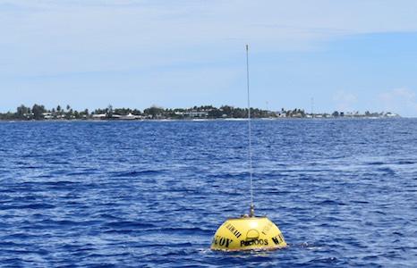
PacIOOS wave buoy off Delap Point, Majuro. Credit: T. Hull |
Majuro Wave Buoy Back Online
The PacIOOS wave bouy off Majuro Atoll in the Marshall Islands is back in the water and continues to provide real-time information on wave height, direction, and period, as well as sea surface temperature. The buoy is located approximately half a mile offshore of Delap Point on the east shore of Majuro Atoll. Many thanks to NOAA's National Weather Service Majuro Weather Service Office and Pacific International, Inc (PII) for their continuous support. Data streaming for the PacIOOS wave buoys is made possible through long-term partnerships with the U.S. Army Corps of Engineers and the Coastal Data Information Program (CDIP).
|
|
|
|
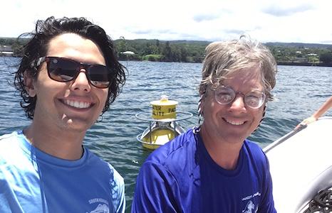
Successfully redeployed water quality buoy off Hilo, Hawaiʻi. Credit. S. Colbert |
Hurricane Lane Buoy Casualty Replaced
The PacIOOS water quality buoy at Hilo Bay, Hawaiʻi, was redeployed this month after it was lost during Hurricane Lane in August 2018. Hurricane Lane brought significant amounts of rainfall to Hawaiʻi Island, increasing stream flows that entered coastal waters. At Rainbow Falls, which are located downstream of the Wailuku River stream gauge, the base flow rose from a typical 35 cubic feet per second (cfs) to 26,000 cfs and a record-breaking maximum flow of 82,300 cfs (source: U.S. Geological Survey). Along with large amounts of freshwater, significant amounts of debris entered Hilo Bay. It is believed that large debris pieces, such as tree logs, might have caused the water quality buoy to break free from its mooring.
|
|
|
|
Honolulu Mayor Caldwell uses the Hawaiʻi Sea Level Rise viewer in his State of the City address. Credit: B. Romine |
Interactive Tool for Decision-Making
The Hawaiʻi Sea Level Rise Vulnerability and Adaptation Report along with its interactive companion tool, the Hawaiʻi Sea Level Rise viewer, have been recognized and adopted by decision-makers on the city, county, and state level. For example, a proclamation from the Maui mayor recognized the report and viewer and directed County departments to use them in planning and decision-making. The viewer was also used to inform expanded climate change and sea level rise considerations in the State Hazards Mitigation update, and was featured in the 4th National Climate Assessment.
The report was written by Tetra Tech, Inc. and the Hawaiʻi Office of Conservation and Coastal Lands, with support from Hawaiʻi Sea Grant and the University of Hawaiʻi Coastal Geology Group. The viewer was developed by PacIOOS, under the direction of Hawaiʻi Sea Grant, and with input from report authors, contributors, and end users.
|
|
|
|
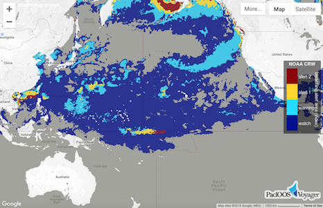
7-day coral bleaching alerts in PacIOOS Voyager. |
Up-to-date and archival data from NOAA Coral Reef Watch, including satellite-derived sea surface temperature (SST), SST anomaly, 7-day coral bleaching alerts, coral bleaching hot spots, and coral bleaching degree heating weeks can be accessed through PacIOOS Voyager and PacIOOS data servers. Users can select subsets and aggregates, or visualize all data layers in PacIOOS Voyager. Seasonal, four-month coral bleaching heat stress outlooks are available through NOAA Coral Reef Watch. The most recent forecast for the August to November timeframe suggests varied levels of heat stress threat for the U.S. Pacific Islands region.
|
|
|
|
|
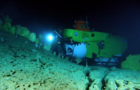
Pisces V surveying the dense deep-sea coral beds at Keāhole Point, Hawaiʻi. Credit: HURL |
30 Years of Undersea Research Data
Data collected by the Hawaiʻi Undersea Research Laboratory (HURL) at the School of Ocean and Earth Science and Technology (SOEST) at the University of Hawaiʻi at Mānoa are now available online. For more than 30 years, HURL has collected a wealth of information in the deep sea utilizing submersibles, remotely operated vehicles, and other technologies. An online map viewer, data archive, and data download function provide easy access to all information and imagery. Explore a guide of deep-sea animals, discover a piece of history in a collection of maritime artifacts preserved in the deep waters of Hawaiʻi, learn more about HURL's operation and submersible assets, and find data from dives across the Pacific to supplement your research or just to enjoy.
|
Input Needed: Ocean Resources Management Plan Update
The State of Hawaiʻi Office of Planning Coastal Zone Management Program is seeking public input to inform the update of the Hawaiʻi Ocean Resources Management Plan (ORMP). Information sharing sessions will be held on the islands of Oʻahu, Maui, Lānaʻi, Molokaʻi, Kauaʻi, and Hawaiʻi between August 19-29, 2019. The meetings will provide opportunities for attendees to share their perspective on coastal issues, both local and statewide. Check out the full schedule for exact dates, times, and meeting locations. Please help spread the word to encourage community participation in the meetings.
|
|
|
|
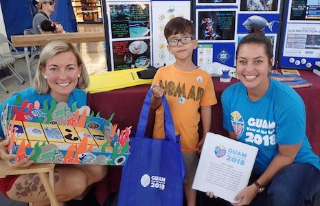
National Coral Reef Management Fellows doing community outreach in Guam. Credit: NSU |
National Coral Fellowships
Applications are now being accepted for the National Coral Reef Management Fellowship Program in American Samoa, Commonwealth of the Northern Mariana Islands, Guam, Hawaiʻi, Puerto Rico and the U.S. Virgin Islands. The program is funded and managed by NOAA, the U.S. Department of the Interior, and the respective local jurisdictional partners. Fellows will be located with the local host agency and focus on relevant management and policy issues. Deadline to apply is 23:00 EDT on Friday, August 9, 2019.
|
|
|
|
|
|
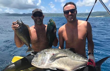
Tyler (right) and his fishing buddy with a giant trevally, parrot fish, and spined unicorn fish. Credit: T. Willsey
|
Yea or Nay: Know When to Go
Tyler Willsey is an avid spearfisherman and surfer, living on the island of Saipan in the Commonwealth of the Mariana Islands. If conditions allow, you will find Tyler in or on the water just about every day, catching a ride or catching dinner. Saipan is a small tropical island in the Western Pacific with a large lagoon on the West side and steep rocky cliffs on the East side. While ocean access on the West side is generally easy and safe, some of the best spots to fish are located on the East side of the island. The high winds and surf generated by these winds can make accessing the reef of the east side extremely dangerous. Surf is rare in Saipan due to the very narrow swell window and strong trade winds making life difficult for the small but enthusiastic surfing community.
To ensure Tyler is aware of what he is getting into, he checks the PacIOOS Tanapag wave buoy several times a day. "A majority of the fishing and surfing spots in Saipan are sensitive to minor changes in the swell direction and size. A difference of 10 to 15 degrees and half a foot could be the difference between perfect fishing or surfing and a dangerous situation," Tyler explains. Real-time wave buoy data on wave height, direction, and period allow him to keep track of these subtle nuances and make a safe call. He also shares this information with his friends to maximize the days with good conditions and to make sure all are safe out in the water.
|
|
|
|
|
|
|