|
Dear Valued Client,
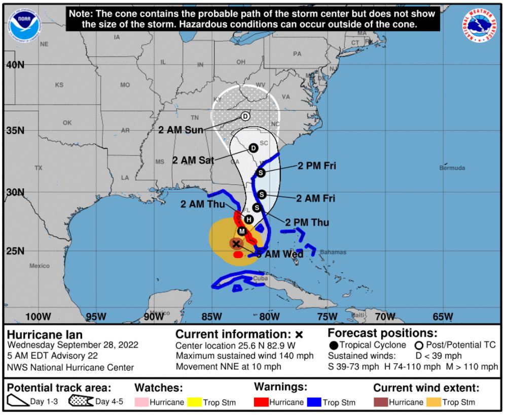
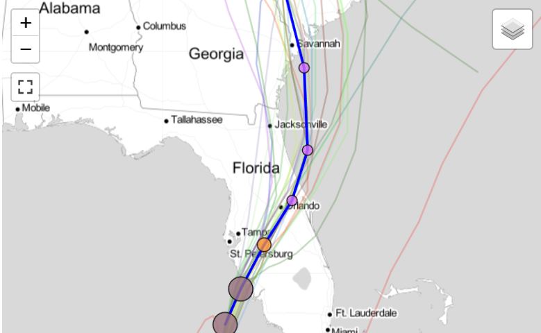
Hurricane Ian is now a major category 4 storm (winds of 140 mph) and is going to make landfall in the Fort Myers area (about 130 miles south of Tampa). As of 5am ET today, it is heading NNE at 10 mph. The NOAA forecast track has it making landfall Wednesday afternoon as a category 3-4 storm with sustained winds of between 111 -155 mph. It is also forecast to turn north on Thursday as a Tropical Storm and emerge into the Atlantic ocean late Thursday moving up the east coast.
Tropical storm and hurricane warnings have been issued for almost the entire state of Florida, Georgia and some of South Carolina and they now include storm surge warnings for tidal increases from 4-12' in certain areas.
Hurricane force winds extend out 35 miles from the center and tropical storm force winds extend out 140 miles from the center.
Given the track and intensity, this storm will impact a majority of the state (and Georgia) with winds and rain that may close bridges, schools and government, create fuel and water shortages, cause flooding, mandate evacuations, knock out electricity and generally require us to remain flexible with our regional delivery schedules.
AS SUCH, OUR TAMPA OFFICE (WHICH IS IN A FLOOD ZONE) IS CURRENTLY CLOSED AND WILL TENTATIVELY RE-OPEN NO LATER THAN NOON ON FRIDAY (9/30). WE WILL RE-EVALUATE THE OPENING TIME ON THURSDAY MORNING AND PROVIDE A REVISED ESTIMATE. AT THE MOMENT, WE EXPECT THE JACKSONVILLE OFFICE TO REMAIN OPEN DURING THE TROPICAL STORM BUT DELIVERIES COULD BE DELAYED OR AMENDED DEPENDING UPON LOCALIZED CONDITIONS AND CAPACITY.
In this scenario, you will want to think about accelerating your delivery needs to complete well before impact or cancel them to resume when it is safe to do so. We will also notify you via email when normal operations can be restored.
Daily email communications have started so that you can stay up to date on our preparations. The below cell numbers can also be used it you are unable to reach us conventionally.
- Bob Younger 904-591-9435
- Emmy Ezeonyido 904-440-4393
- Thomas Nurney 904-335-7262
- Brian Booth 813-997-9417
- Walker Allen 904-571-6466
- Brian Daniel 904-236-3904
- Cam Dozier 314-706-0030
- Associated Couriers Roslyn NY Dispatch 516-240-5321
|