|
MassBays Newsletter
Summer 2026 (Vol 23, No 4)
| |  | | For the love of this place... | | |
New Englanders know harsh winters and when spring approaches we wait with bated breath for the first green buds on a tree, the louder bird songs, signs that spring is near. More often than not the past few years, it has been more of a mud season, but we welcome it anyway. In April, the first volunteers eagerly arrive at the doors of our regional partners, hoping to count a larger number of alewives swimming up our rivers than the previous years. Watershed groups prepare to head out to collect water samples or to monitor results of habitat restoration efforts. By June, small groups can be seen walking at night along Duxbury beach, counting horseshoe crabs as they return to spawn.
Summer can be quite busy for those of us required to complete most of our field work in such a short window of time - the work is hard but exhilarating. Being out in the field, whether on a boat deploying sondes or feeling queasy while looking through cameras at eelgrass, monitoring salt marsh, or wading out in a river to check on fish, one tends to push away the challenges we face each day.
As another dam is removed, another fish ladder built, and tens of thousands of river herring return, we know we are making a difference. As shellfish beds in an embayment are given the green light to reopen after years of closure, because our water quality data helped a community address stormwater issues, we know there has been a postive change toward the preservation of our estuaries and habitats.
We know we must continue to move forward, to keep doing what we do best, striving for healthier ecosystems, resilient communities, and a thriving economy, because we love this place that is home.
Prassede Vella
MassBays Director
| | MassBays’ Jill Carr recognized with Visionary Award | |
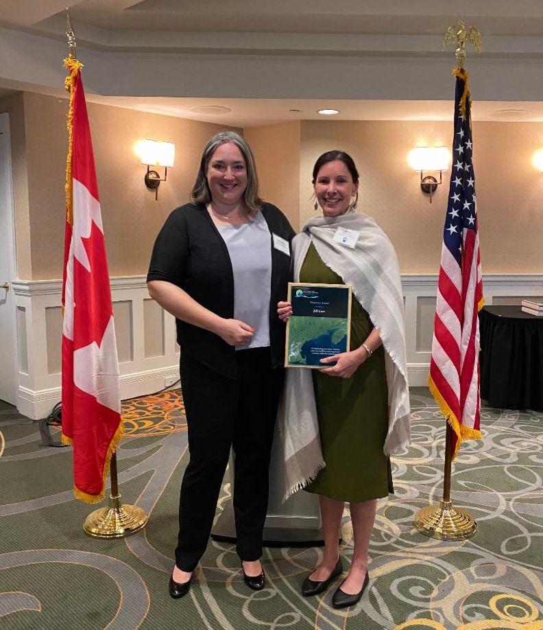
| |  | At their annual meeting in June in New Brunswick, Jill Carr was recognized with a Visionary Award from the Gulf of Maine Council on the Marine Environment (GOMC) for her dedication to protecting natural resources within the Gulf of Maine while serving as a Habitat Program Manager for MassBays.Jill is a dynamic leader, innovator, and collaborator who has spent more than two decades advancing coastal conservation while strengthening partnerships across the Gulf of Maine region. The myriad of tools she has developed are widely used by community scientists and researchers for programs that support water quality monitoring, environmental data collection, and enable public access to scientific information. Her work has made environmental data more accessible and useful for researchers, municipalities, nonprofits, and decision-makers working to protect coastal resources. Known for bringing people and ideas together to solve problems, Jill’s expertise spans seagrasses, wetlands, fisheries, water quality, and coastal habitat conservation. This award recognizes outstanding innovation, creativity, and commitment to protecting natural resources within the Gulf of Maine. Through her dedication, leadership, and commitment to conservation, Jill has made a lasting contribution toward a healthier and more sustainable Gulf of Maine watershed.
Read the award winner highlights here and media release here.
Photo above: Jill Carr, MassBays, and Alison Brizius, MA Office of Coastal Zone Management Director at the GOMC award ceremony in New Brunswick. Photo credit: GOMC.
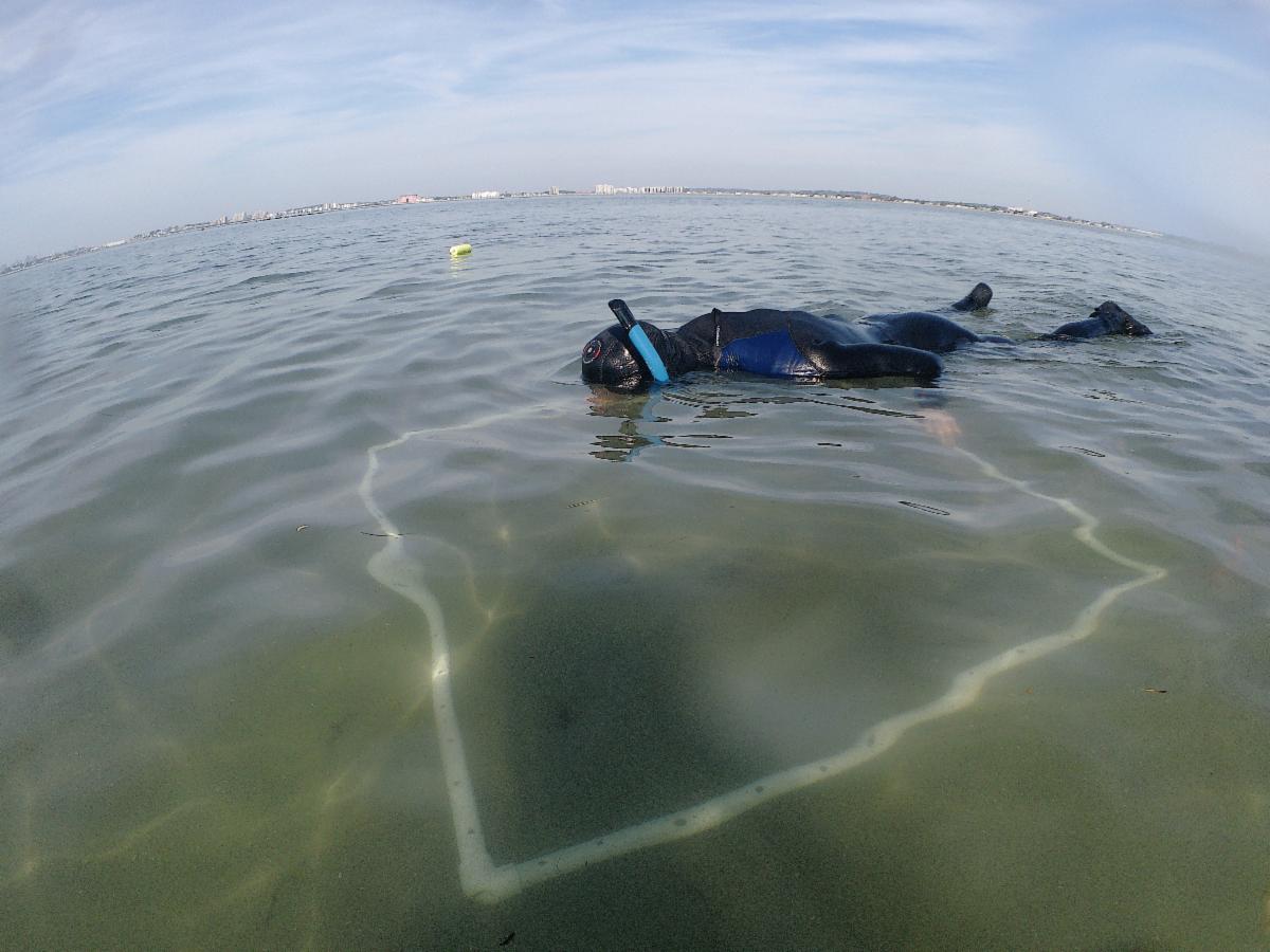
| | Eelgrass Restoration: Coming to a Bay Near You This Year | | Photo above: Monitoring restoration test plots in Nahant via snorkel | | |
Seagrasses are meadow-forming marine plants that provide critical fisheries habitat, improve water quality, buffer the shoreline from erosion, and mitigate climate change through the sequestration of carbon. In Massachusetts, our most prevalent seagrass is called eelgrass (Zostera marina) named for its ribbon-like leaves that sway in the water, reaching up to six feet in length. Another local seagrass called widgeongrass (Ruppia maritima) is a shorter grass with thread-like leaves that can tolerate more brackish conditions. Our seagrasses have declined by over 50% in recent decades due to a host of factors including degraded coastal water quality, physical impacts from human activities, storms, and disease.
MassBays is committed to turning the tide on seagrass loss. Per our Comprehensive Conservation and Management Plan (CCMP), we aim to protect and recover seagrass to its 1995 acreage across the MassBays service area. To achieve this goal, we have implemented a multi-pronged approach including: documenting existing extent, conducting research to fill ecological knowledge gaps, building capacity for large-scale restoration, and implementing restoration with a community-engaged approach.
This summer, we are in our fourth year of working with MassDEP’s Eelgrass Mapping Project to map eelgrass across the state, with a focus this year on Cape Cod Bay. MassDEP acquired high resolution aerial imagery over the study area in May 2026 and used it to identify areas of potential eelgrass cover and locations where in situ field verification is needed. The MassBays team then conducts up to 15 days of boat based missions to survey benthic conditions at up to 800 predefined stations. The aerial imagery and field ground truthing data are then combined to create eelgrass maps served on MassGIS, which are used in state water quality impairment listings, inform the permitting of construction and aquaculture projects, in restoration planning efforts, and in MassBays’ “State of the Bays” visualizations via the Ecohealth Tracking Tool.
This summer, we also kicked off a two-year restoration project funded by EPA and Restore America’s Estuaries. In this first-of-its-kind project, numerous partners from across MassBays are collaborating to restore at least four acres of eelgrass across six sites. Our regional coordinators from the Upper and Lower North Shore, Metro Boston, and South Shore are restoring eelgrass in Gloucester, Beverly, Marblehead, Nahant, Duxbury, and Plymouth. Test plots planted last year appeared very promising when we visited them this spring, so we’re looking forward to full-scale plantings this August and September!
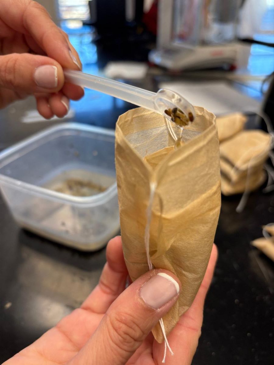
Planting methods will include a mix of seed-based approaches including the use of small biodegradable baggies, broadcasting seeds over the sediment, and suspending flowering shoots above the seafloor using a buoy system. Dozens of volunteers, students, and community members will be engaged through hands-on experiences like collecting flowering eelgrass shoots, processing shoots to isolate seeds, bagging seeds into planting units, and distributing seeds at planting sites.
A critical piece of the eelgrass restoration puzzle is infrastructure, especially when large volumes of flowering shoots are used for seed collection. For several years, MassBays and the Massachusetts Division of Marine Fisheries have partnered to revamp a portion of the Cat Cove Marine Laboratory (Salem, MA) into a dedicated eelgrass tank facility.
Infrastructure Act funds from EPA have been used to install and maintain over a dozen flow-through tanks that together can provide millions of seeds for restoration purposes. In the next year, the partnership will build a dedicated outdoor “Seed Barn” on the same property so that efforts can be expanded upon. We are also working with partners to leverage existing flow-through systems to support local restoration efforts, such as the Island Creek Oyster (Duxbury, MA) indoor upweller tanks being used for eelgrass plants during the summer season when they are not needed for oysters.
While our focus is largely on eelgrass right now, we have widgeongrass and other species of submerged aquatic vegetation (SAV) on our minds. Stay tuned as we further develop these areas of focus and continue to reach toward our restoration goals.
| | |
Photo above L: Biodegradable baggies filled with sediment and eelgrass, to be deployed at restoration sites
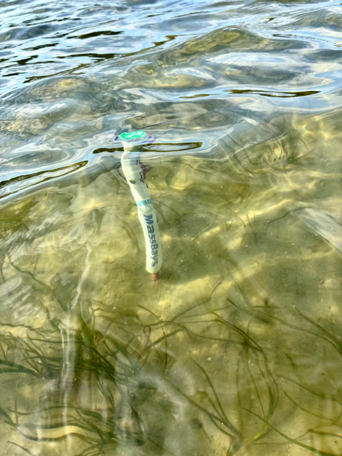
Photo above R: One of 16 light and temperature loggers deployed at restoration and reference sites
| | MassBays Regional Field Updates | | Communities Unite to Plan For a More Resilient Future on Plum Island and Salisbury Beach | | |
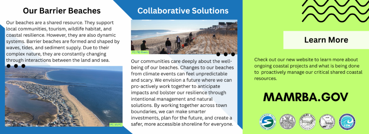
Barrier beaches are among Massachusetts’ most dynamic coastal systems. Constantly shaped by waves, tides, winds, and storms they naturally shift, erode, and rebuild over time as sand moves along the shoreline. Their dynamic nature is what allows barrier beaches to absorb storm energy, protect inland habitats and communities, and support diverse coastal ecosystems.
For the communities of Salisbury, Newburyport, and Newbury major shifts can bring serious challenges. Concerned about shoreline erosion, storm impacts, and long-term resilience, the three communities came together in a proactive regional effort to identify sustainable management strategies to manage this critical resource and explore opportunities to integrate nature-based solutions. With funding support from the Massachusetts Office of Coastal Zone Management (CZM) Coastal Resilience Grant Program, the communities launched a long-term regional planning effort focused on evaluating coastal erosion and sediment transport and the feasibility of nature-based shoreline protection strategies.
The project partners worked with Sustainable Coastal Solutions at UMass Boston to integrate the best available climate data, updated coastal modeling, and conducted a shoreline change analysis. A range of beach and dune nourishment strategies were designed and evaluated alongside natural coastal processes to enhance coastal resilience.
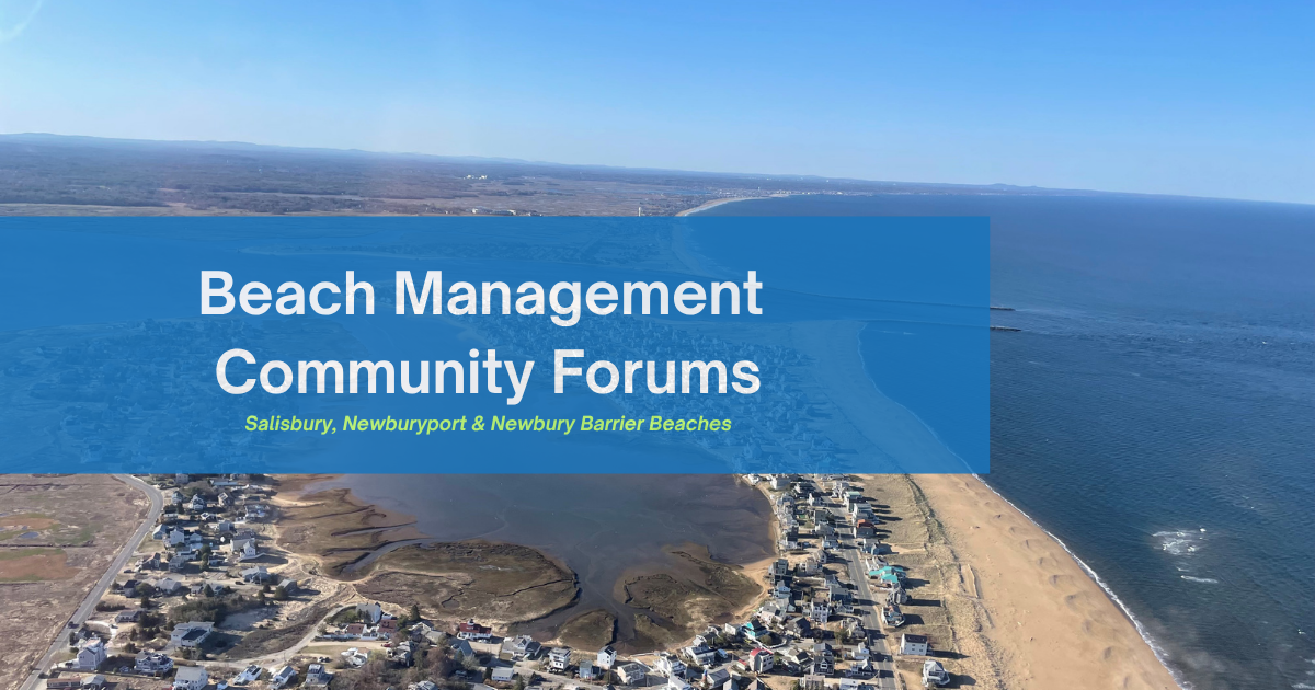
The Merrimack Valley Planning Commission (MVPC), MassBays’ Regional Service Provider for the Upper North Shore, played a key role in supporting community engagement. In June, MVPC partnered with the communities of Salisbury, Newbury, Newburyport, and other project partners to host two Beach Sediment Management Community Forums. Residents, business owners, and visitors shared their experiences, learned about the main findings from the Regional Beach Sediment Management Study; gained knowledge on ways to improve local resilience; and provided feedback on proposed management strategies.
MVPC is looking forward to supporting the next phase of this work and advancing recommendations with regional partners to further bolster resiliency for our coastal communities.
This regional effort highlights the value of collaboration in addressing complex coastal challenges that cross municipal boundaries. By combining scientific analysis with local knowledge the project is helping lay the groundwork for future actions that strengthen resilience across Plum Island Sound.
The final Upper North Shore Regional Sediment Study will be available online later this summer. For more information about the project and other ongoing regional initiatives, please visit mamrba.gov.
For more information on MVPC’s work, visit Environment | MVPC or email enviro@mvpc.org.
Link to full article on website here: MVPC Assists with Regional Beach Management Community Forums | MVPC
| | The Boston Harbor Ecosystem Network Talks Manila Clams in Boston Harbor | | |
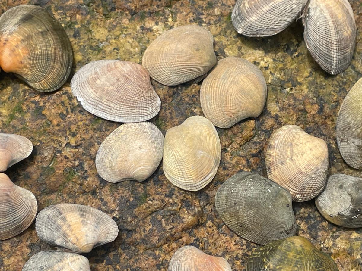
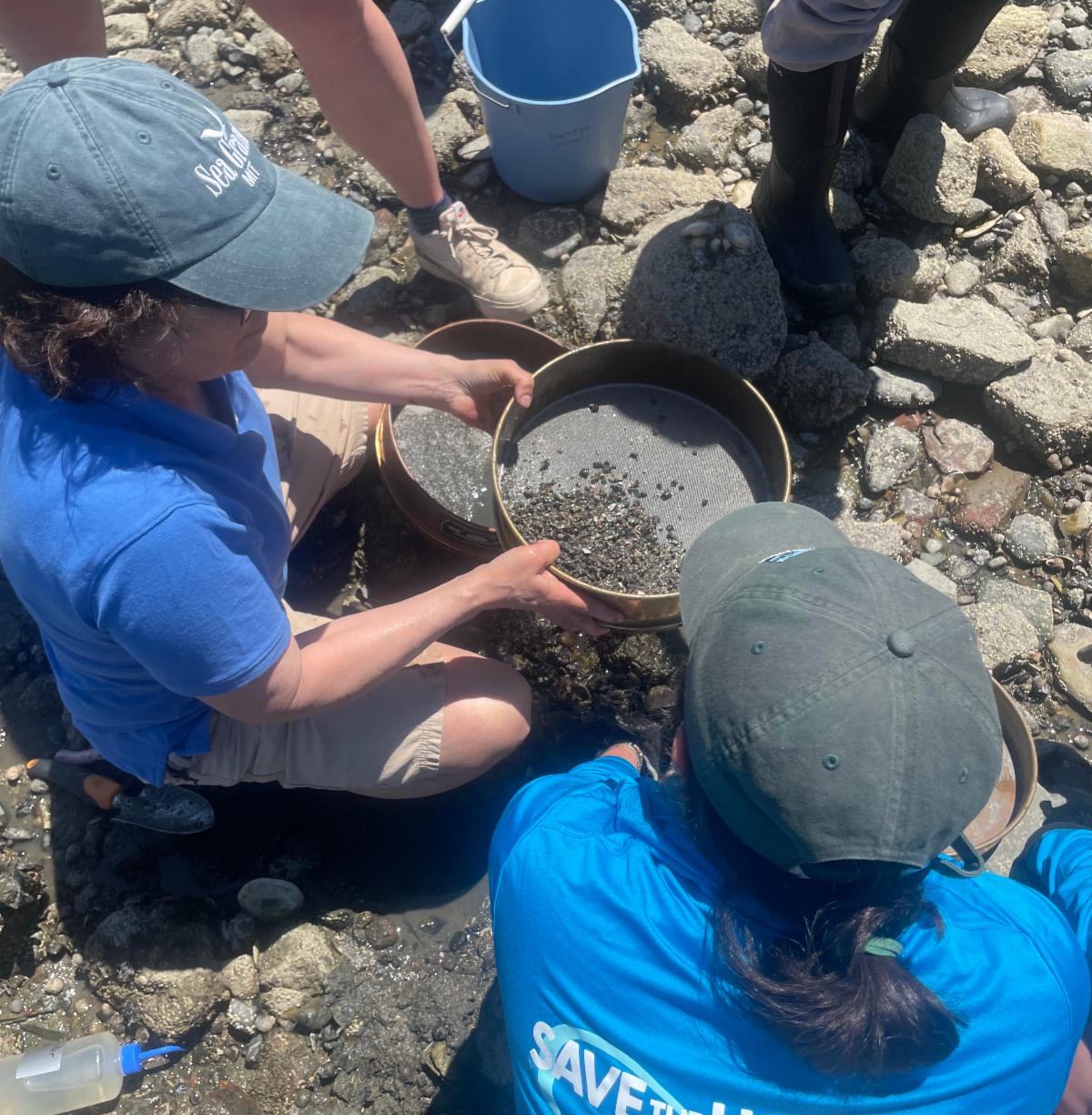
On June 9, the Boston Harbor Ecosystem Network (BHEN) led by MassBays’ Regional Coordinator for Metro Boston, Diana Chin (Northeastern University) joined an MIT Sea Grant field team. The team was led by research scientist Carolina Bastidas to observe ongoing monitoring of an intertidal site on the UMass Boston campus for Manila clams. Also known as Japanese littlenecks, Manila clams (Ruditapes philippinarum) are native to the western Pacific and have been recently observed in Boston Harbor, Cape Cod, and other areas of eastern Massachusetts.
The appearance of Manila clams has raised important questions among researchers and resource managers. MIT Sea Grant researchers are conducting monthly surveys to better understand where Manila clams are most abundant within the intertidal zone and at what time of year they may be reproducing in Boston Harbor. During the field visit, participants discussed how the species may have arrived here (in ballast water, seafood transport, or other pathways), how widespread it may become, and what role it could play in local coastal ecosystems, i.e. how Manila clams may interact with native clam species such as quahogs (Mercenaria mercenaria) or softshell clams (Mya arenaria) and the predators that depend on these shellfish for food.
Researchers from UMass Amherst, MIT Sea Grant, Northeastern University, Center for Coastal Studies and several regional partners continue to work collaboratively to better understand the ecology of the Manila clam as it becomes established along the Northeast coast, the last frontier for its occupation in the Northern Hemisphere. The team's findings, published in Biological Invasions, describe an exceedingly rare occurrence when an invasive species first lands in a new environment and begins to spread.
Photo above: Manila clam shells from the Boston Harbor Islands - photo credit: Diana Chin
| |
How You Can Help
Community observations play an important role in tracking emerging species such as the Manila clam. Join the many volunteer scientists to contribute information on local abundance and distribution by:
Report sightings of Manila clams on iNaturalist
Participate in Marine Invader Monitoring and Information Collaborative (MIMIC) activities
Photo: Sieving samples for Manila clams in the sediment - photo credit: Carina Delgado
| | Salem Sound Coastwatch – Clean Beaches and Streams | | |
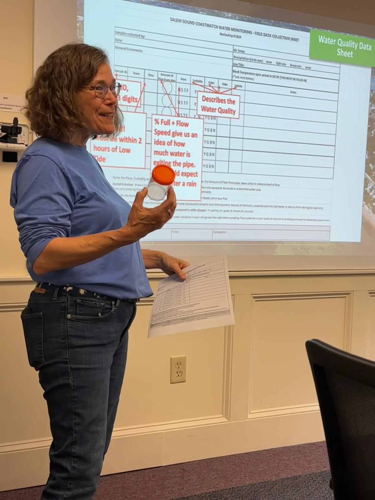
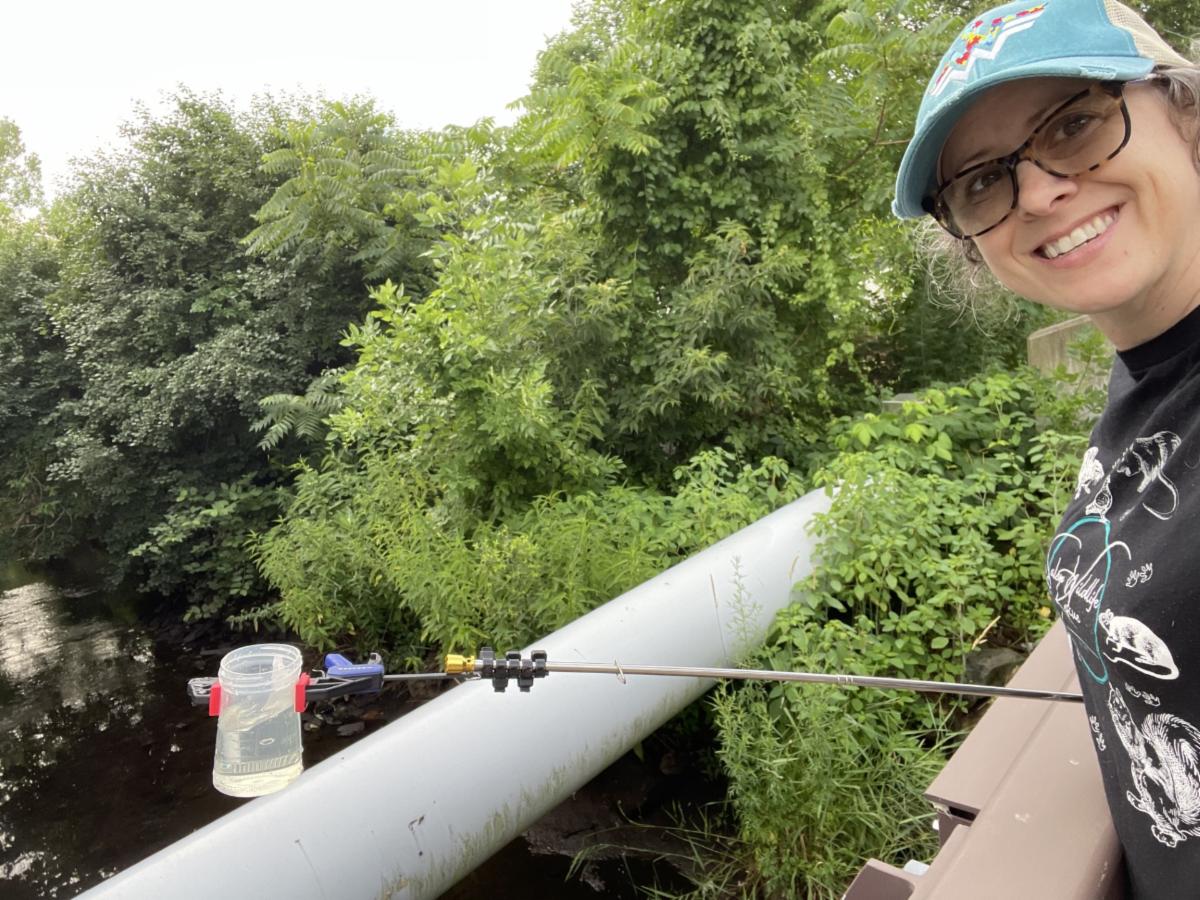
For more than 30 years, Salem Sound Coastwatch’s (SSCW) Clean Beaches & Streams Program has contributed to significant improvements in water quality throughout Salem Sound. By monitoring coastal streams and stormwater outfalls, community scientists help identify sources of bacterial pollution and provide critical information to support cleaner beaches, safer recreational waters, and healthier ecosystems. During the 2026 field season, volunteers are monitoring 26 locations across the municipalities of Manchester, Beverly, Danvers, Peabody, Salem, and Marblehead. Volunteers record observations including water color, turbidity, flow, odor, salinity, and temperature, while also testing for Enterococcus bacteria, an important indicator of fecal contamination. Results are shared with municipal officials, state agencies, and environmental partners to support ongoing efforts to locate and remove pollution sources, protect public health, and improve the health of local waters.
This spring, SSCW presented water quality monitoring findings from the Town of Manchester to the Manchester Board of Health, providing an opportunity to discuss local water quality concerns and how monitoring data can support decision-making. The conversation focused on potential sources of bacterial contamination and the Town's ongoing efforts to inspect and maintain aging septic systems near waterways with historically elevated bacteria levels. Board members also asked whether contamination could be linked to human or local wildlife sources. SSCW shared findings from a previous partnership with the U.S. Environmental Protection Agency (EPA) in the Wolf Trap Brook watershed, where in 2018 testing detected caffeine and pharmaceutical compounds associated with human wastewater, indicating that at least some contamination originated from human sources.
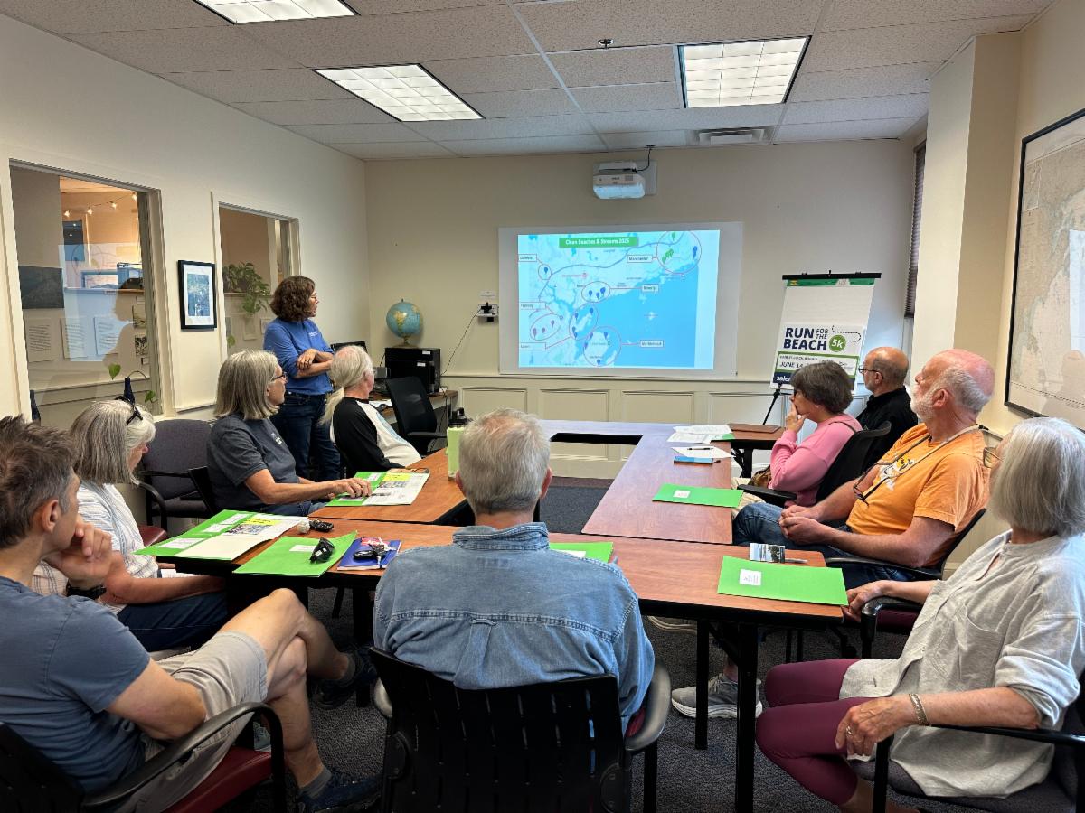
The discussion reinforced the importance of long-term monitoring and collaboration among volunteers, municipal officials, and environmental organizations. Manchester Board of Health members expressed interest in receiving 2026 monitoring results and continuing conversations about protecting local water resources. Following training in May, SSCW's dedicated volunteers are now actively collecting data throughout the watershed. Their efforts build on decades of tradition of community-based monitoring that helps municipalities identify pollution sources, prioritize investigations, and protect the health of local streams, beaches, and coastal waters.
| |
How to get involved
Learn more about the Clean Beaches & Streams Program, view current and past water quality results, and sign up to volunteer with Salem Sound Coastwatch here.
For details, visit the Salem Sound Coastwatch website and check the events calendar for upcoming volunteer opportunities and community programs.
| |
|
Recovery of Sesuit Creek Salt Marsh: If You Plant It …
They Will Come!
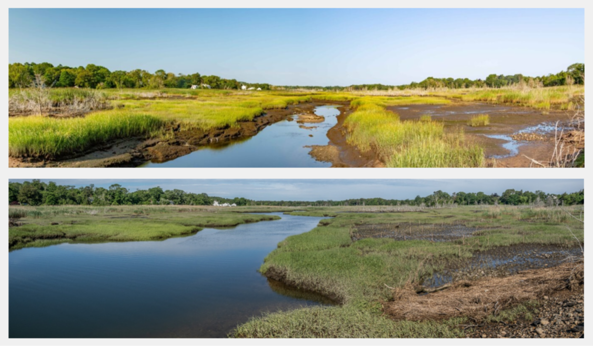
| | Photo above: Before (2018, top) and after (bottom, 2026) Spartina planting. | | |
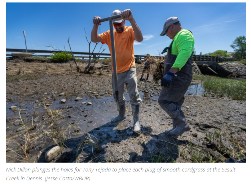
Last month, the Association to Preserve Cape Cod (APCC) completed the largest salt marsh planting documented to date on Cape Cod, and to our knowledge, in Massachusetts. In partnership with SumCo Eco-Landscaping, and with IIJA funds from EPA/MassBays, APCC planted over 90,000 Spartina alterniflora plugs across four large bare patches in the marsh. The goals of this ambitious restoration effort are to restore salt marsh habitat and improve the functions of the marsh allowing it to adapt to rising sea levels, buffer nearby communities from storm impacts, and serve as home to fish, shellfish, and birds.
When APCC’s Restoration Program Manager and MassBays’ Regional Coordinator for Cape Cod April Wobst joined APCC ten years ago, Sesuit Creek was the first marsh she stepped into. Today, it remains one of the most challenging of the many marshes she and many of her colleagues have worked in. Much of the challenge stems from the large persistent bare patches that have remained since tidal restoration was completed in 2008. After saltwater and natural tidal flow were restored, extensive areas of freshwater plants and the invasive Phragmites australis died off, leaving behind expanses of bare soil. Even under favorable conditions, these exposed areas can be challenging to traverse with remnant Phragmites stems creating unstable footing and tripping hazards. At its worst, during wet periods, the marsh transforms into a muddy, soupy landscape where boots can be lost in the ankle or knee-deep muck. This marsh became so closely associated with her work, that April’s children simply understood field days at Sesuit Creek as days when “Mommy is out working in the mud”. Despite those challenges, Sesuit Creek is a special place for April, one that is like going home. As she states, “It’s surely no day at the beach but I know the ins and outs of this marsh better than any other, it’s familiar, predictable, and important to me in ways other sites I’ve monitored or assisted in can’t quite match”.
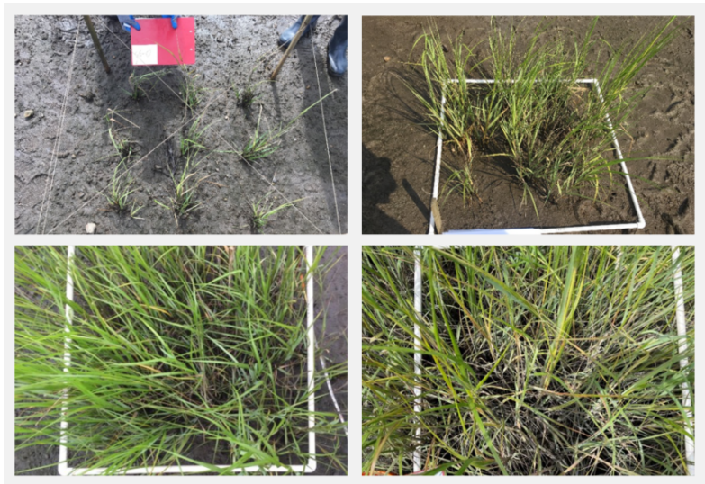
In 2018, building on monitoring conducted over the previous two years, APCC launched a pilot study, planting 324 Spartina alterniflora plugs in small one-meter square plots distributed across the bare areas. The goal was ambitious: by planting in areas located 10 meters apart the team hoped that the bare areas between plots would fill in with new vegetation within three years. Although the marsh did not recover as quickly as anticipated, the plants that survived the first winter thrived, growing tall and dense. When APCC returned in 2023 to do an assessment of progress, the results were striking.
| |
The areas that six years earlier had once contained only nine small were in many cases indistinguishable from the surrounding marsh. Many of the plots had blended with the surrounding vegetation while the marsh was showing signs of new growth and expansion. The process took longer than expected but the evidence was clear: the planting approach was working.
Rather than wait another six years to see more recovery, APCC and its partners began planning for a larger restoration effort, working with the Massachusetts Division of Ecological Restoration, the Cape Cod Conservation District and the town of Dennis. Using monitoring data collected in 2023 and 2024, the team contracted with Woods Hole Group to develop a comprehensive planting plan and secure the necessary permits. The result is what can be seen today, more than 90,000 Spartina alterniflora plants installed across 1.8 acres in priority areas most likely to respond successfully to revegetation.
The restoration team intentionally focused on locations with the highest likelihood of success. While the impacts may not be immediate, there is reason for optimism. Monitoring data and the success of the pilot project suggest that recovery is possible in the next three to six years and that future scientists returning to monitor Sesuit Creek then will have the same aha moment that April and the team had in 2023. The hope is that the members of the community who have lived and worked there for decades or who are new to the neighborhood, will look out at the marsh and see a healthy, thriving and resilient system filled with fiddler crabs, osprey, dragonflies, river herring, shellfish, and, perhaps,even some nesting salt marsh sparrows up in the high marsh.
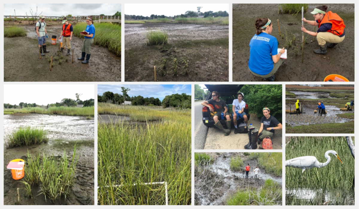
| | APCC staff and interns monitored Sesuit Creek marsh plots during and after the 2018 pilot planting, tracking early planting efforts, plant growth in 2019, and the dramatic expansion of marsh vegetation by 2023. Photos include April Wobst, APCC Restoration Program Manager, along with field crews documenting the project’s progress over time. Photo credit: Gerald Beetham, 2026. | | | |
In the News!
WBUR was in the field with APCC’s ecosystem restoration program team to learn more at Sesuit Creek.
From Barbara Moran on The race to save a Cape Cod salt marsh from sea-level rise
Read or Listen Here.
| | | A Milestone for South River Herring! | | |
Until recently, a typical herring count at Veterans Memorial Park in Marshfield followed a familiar pattern: stand at the edge of the river, peer down into the water, hope to see a migrating fish, and leave disappointed. Yet, every spring since 2008, the North and South Rivers Watershed Association (NSRWA)’s Herring Count volunteers kept coming back, week after week from April through June, in the hope of spotting a herring. For years, data suggested that few herring were making their way up this stretch of river. While the counts were often low, the volunteers’ persistence created a valuable long-term record and laid the groundwork for recognizing a remarkable change when it finally arrived.
NSRWA, MassBays' Regional Service Provider for the South Shore, has been counting fish at various sites on the South Shore since 2003 —starting with Third Herring Brook, and later expanding to streams in Pembroke, Scituate, Marshfield, and Duxbury — documenting not only the presence of herring, but also the impacts of dams and inadequate fish passage. In 2012, NSRWA teamed up with the Town of Marshfield and its Veterans Commission, MassBays, and the Massachusetts Division of Ecological Restoration to study the removal of the obsolete industrial dam at Veterans Memorial Park. Work began at the end of 2024.
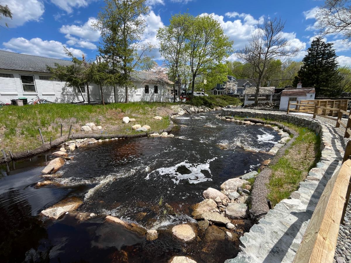
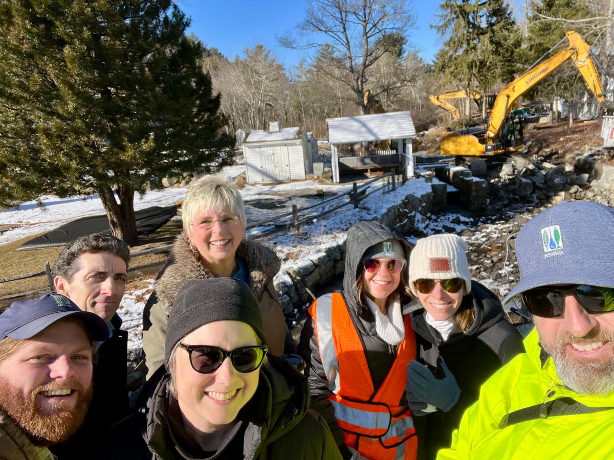
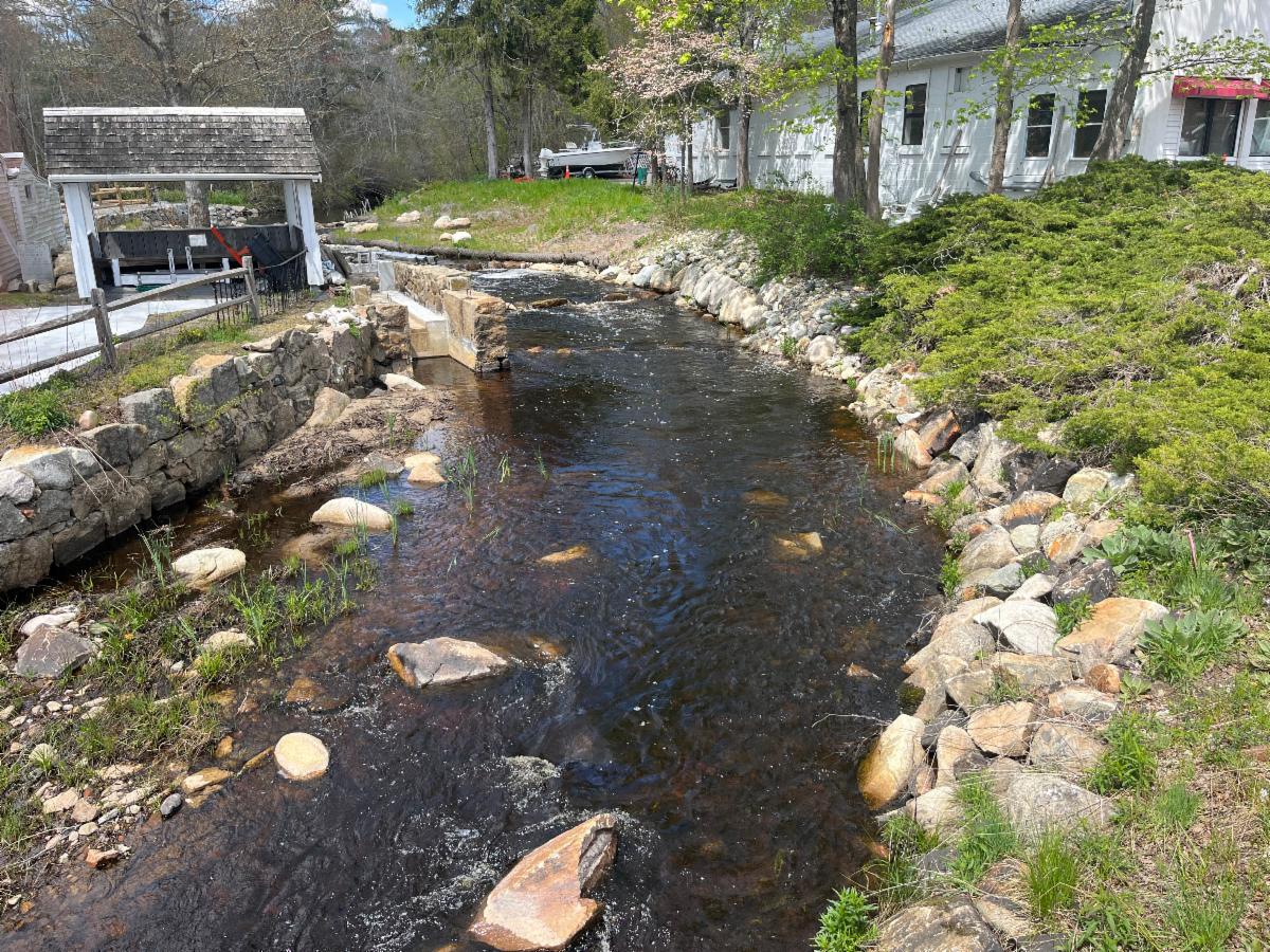
Dam removals are not simple. Time-of-year restrictions dictate when work can be done so wildlife migration and reproduction are not disturbed. At Veterans Memorial Park, a temporary bypass channel allowed fish access during the migratory season while construction work continued. The day the dam was removed was cause for celebration. Despite the bitter January cold, NSRWA staff made a special trip to Marshfield to watch as heavy equipment broke the aging structure. It was a major milestone, marking the beginning of a new chapter for the South River as it flowed freely for the first time in 400 years. But the real test of the project’s success would come later, seeing how wildlife responded. While improving flood safety and honoring Marshfield’s veterans were important goals, the primary goals of the project were ecological - to improve water quality, restore wildlife habitat, and reopen fish passage to the upper half of the South River. Following the dam's removal, the critical question became: would river herring return to habitat that had been cut off for decades? The answer, it turns out, was worth the wait.
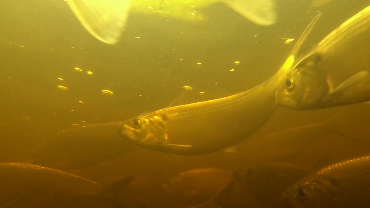
In May 2025, something spectacular happened. NSRWA’s Watershed Ecologist, Alex Mansfield (MassBays Regional Coordinator for the South Shore), posted a video of the river a half mile upstream of the park. It was filled with hundreds of herring. Responding quickly to the dam removal, they raced through the bypass channel and traveled upstream to spawning habitat. In spring 2026, volunteers returned to watch the river in anticipation for a return of herring. After weeks without sightings, the first report came in May with “Bob saw seven fish!” In the following weeks, hundreds of fish returned and were plainly visible from the bridge.
Staff observations confirmed that herring were using the entire restored river corridor and reaching areas upstream that had long been inaccessible. After decades of planning, monitoring, and restoration work, the return of herring to the South River became a powerful sign that the project was succeeding.
Following the success of the project, NSRWA is now turning to the next two dams possibly slated for removal - at Chandlers Pond in Marshfield and at Temple Street in Duxbury. Although these projects may not happen immediately, there is hope that the day will come when all of the South River is open again for migratory fish and the wildlife that depend on them!
This article was adapted from an article by Kezia Bacon. You will also find thirty years of Kezia’s Nature columns there. For more information about the “That’s My Watershed!” Contest, visit https://www.nsrwa.org/2026-nsrwa-explore-south-shore-thats-my-watershed-contest-rules/
To become a member and receive their latest newsletter, contact NSRWA at (781) 659-8168 or visit www.nsrwa.org.
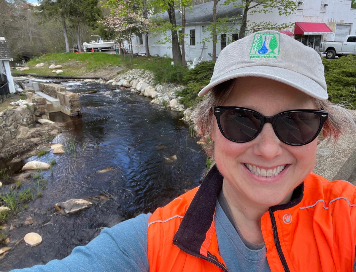
| | Top L: View from bridge Veterans Memorial Park Marshfield. - Top R: NSRWA staff at dam removal -- Bottom L: Kenzia river herring counting 2026, -- Bottom R: View of river after dam removal. | | EVENTS, WORKSHOPS, & MONITORING! | | | | |
Veterans Park Grand Opening
Thursday - August 6
10:00 a.m.
Veterans Memorial Park
Marshfield, MA
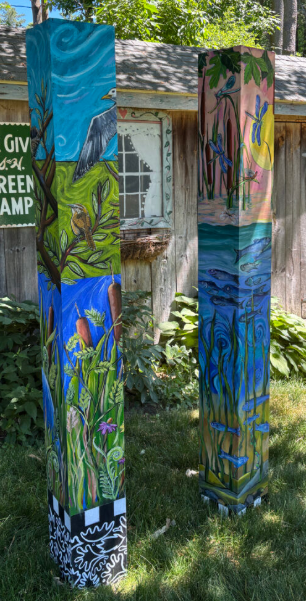
Featuring the unveiling of the NSRWA art exhibit “Let the Rivers Flow”. The artwork was created by South Shore artists Sally Dean and Cathy McCarthy, celebrating the removal of the Veterans Memorial Park Dam in 2025 and two successful spring migration seasons since.
Grand Opening event info here.
| | |
The Great River Race
REGISTER NOW!
Sunday, August 9
9:00 a.m. - 1:00 p.m.
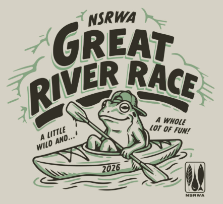
Come paddle one of the most beautiful rivers in Massachusetts and help celebrate the 36th year for the Great River Race on the beautiful North River. Funds raised through the Great River Race support the NSRWA’s environmental education and outdoor programs.
Race info & registration here.
| | |
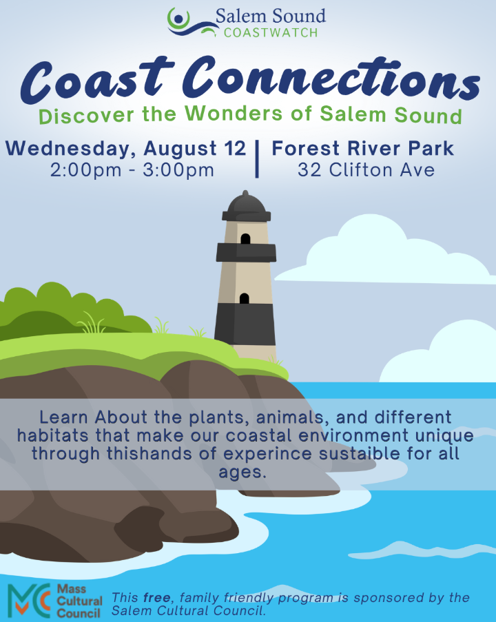
Coast Connections
August 12 @ 2:00 pm - 3:00 pm
Forest River Park
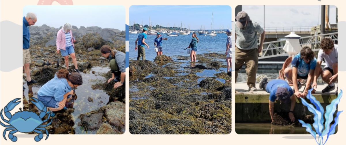
Discover the Wonders of Salem Sound! Are you curious about the creatures and ecosystems of Salem Sound? If so, join Salem Sound Coastwatch educators for hands-on activities and up-close encounters.
Event Info & Registration here
| |
Marine Invasive Species Montitoring Series
From Salem to Manchester, volunteers help monitor marine invasive species at sites throughout Salem Sound.
By participating in these surveys, community scientists contribute valuable data that supports ongoing monitoring and research efforts throughout the region. We hope you’ll join us this season!
No prior experience is necessary to participate. Volunteers are welcome to attend any monitoring event that fits their schedule.
See full list of Monitoring Events & Sign Up HERE!
| |
|
Intertidal Blue Mussel Monitoring
As MassBays develops its monitoring of current blue mussel populations along MA rocky shorelines, we are also looking to community scientists for their knowledge of where blue mussels historically occurred throughout the MassBays regions! To contribute your historical knowledge, click here.
| |
Salt Marsh Monitoring
The Neponset River Watershed Association (NepRWA) is seeking volunteers (~20 minutes 1-2 times per month for one year using an online survey app, Survey123) to help document changes to salt marsh habitat along the Neponset Greenway. For more information, contact NepRWA River Restoration Director Sean McCanty.
|
| | | |