Mid-Atlantic & Southwest Florida, Plus Bahamas Raster Updates
June 30, 2020
Sales Bulletin #2020-24
We're pleased to announce the expansion of our CMOR chart offerings for TZtouch2 and TZtouch3 to now include the Mid-Atlantic and Southwest Florida. These newly added areas join the previously introduced CMOR charts, noted in the table below.
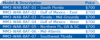
Here is a list of CMOR charts currently available for TZT2 & TZT3:
Mid-Atlantic CMOR Chart
Southwest Florida CMOR Chart
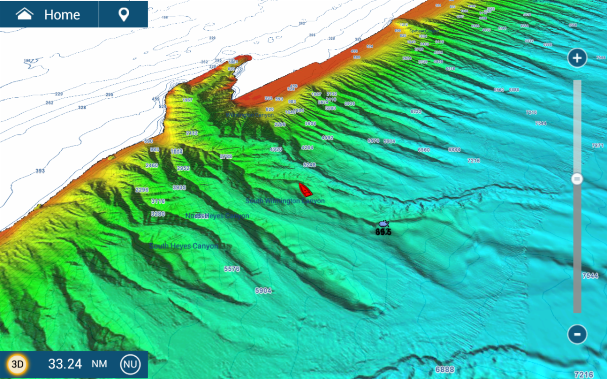
CMOR Mapping's high-resolution seafloor coverage includes parts of the Gulf of Mexico, Florida, and portions of the East Coast. The high-resolution shaded-relief bathymetric bottom images help customers identify suitable locations for fishing and diving. TZtouch2 and TZtouch3 MFDs can display a selection of these bottom maps overlaid on conventional vector, raster, or fishing charts. The ability to overlay CMOR maps on other types of charts of the customer's choosing is unique to NavNet TZtouch2 & TZtouch3. Look for future announcements as we continue to add additional CMOR chart areas. For more information on CMOR maps, please visit www.cmormapping.com.
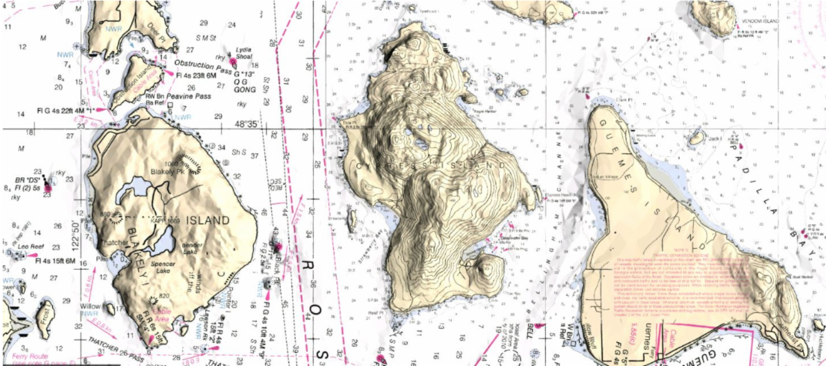
In addition to the new CMOR charts noted above, we're pleased to announce the availability of an update to our Bahamas Raster Chart (
MM3-RNA-930 - $250 List Price).
Bahamas Raster Chart
Please note that CMOR charts must be in MapMedia format to be compatible with NavNet TZtouch2 (v6.23 or higher) and all TZtouch3 MFDs. For complete details, be sure to visit the
CMOR Chart Section at
www.FurunoUSA.com.