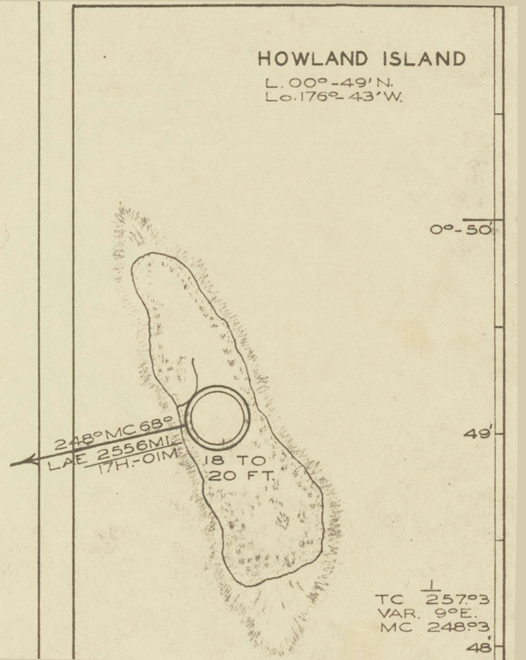
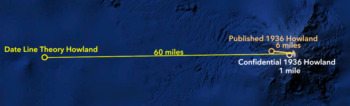
It also raises the question of where Noonan actually did think his destination was. The charts navigational consultant Clarence S. Williams prepared in 1936 for Earhart’s first world flight attempt showed Howland at its most-recently published position – 0°49' N, 176°43' W. It’s not very good – that location is six nautical miles west of the island – but the true location was classified “confidential” by the U.S. Hydrographic Office until its maps could be updated, which didn’t happen until 1938 or '39. The person who reported the revised locations to the Hydrographic Office was William Miller, an employee of the Bureau of Air Commerce who, in early 1937, had worked closely with navigator Harry Manning in planning the Pacific legs of Earhart’s world flight. That Miller would not clue up Manning to the island’s corrected position – 0° 48' 06'' N, 176° 38' 12" – is inconceivable, and if Manning knew, Noonan knew. The new coordinates, in fact, still weren’t quite right. If Noonan had those numbers, he thought Howland was one nautical mile west of where it is, but whether one mile or six miles off, it shouldn’t have prevented him from finding Howland if he was anywhere near on-course. |