Wisconsin Coastal Resilience Newsletter | |
|
Greetings from the Wisconsin Coastal Resilience Team!
This month's newsletter contains:
Collaboration Classifieds:
- Using the Watershed Game in the Classroom
- Find out how your flood plans stack up with the Flood Resilience Scorecard
Lake Michigan Water Level Update
Resource Highlight:
- Wisconsin Shoreline Inventory & Oblique Viewer: 2024 Photos Available
- Local Infrastructure Hub
- Great Lakes Environmental Justice Thriving Communities Technical Assistance Center
Around the Great Lakes:
- After years of shoaling problems, Manitou Islands docks to be relocated
Funding Opportunities:
- WCMP Coastal Management Grant RFP
Trainings:
- NOAA Economic Analysis and Valuation Training
Conferences:
- Climate Fast Forward 2024
- Wisconsin Association for Floodplain, Stormwater, and Coastal Management Annual Conference
| |
Collaboration Classifieds | |
Using the Watershed Game in the Classroom | |
|
The Bay-Lake Regional Planning Commission has conducted outreach efforts with the Sheboygan County Stormwater Coalition for the past four years. This year, alongside staff from Wisconsin Sea Grant, Commission staff facilitated the Watershed Game with seven 6th grade Science classes at Horace Mann Middle School. The Watershed Game is a hands-on simulation activity designed by Minnesota Sea Grant for both local leaders and classrooms to learn about practices that can improve and protect the water quality within a watershed. It is meant to be a team-building exercise where each participant has a role in decision making for their land-use area (city, farmland, forest, and residential) and each team has limited financial resources to reduce excess nonpoint source pollution. The game encourages students to cooperate with one another, discuss best management practices, and defend their reasoning. The game also allows students to nominate and vote on how to use their excess tools and funds to meet the watershed’s clean water goal. Students of all learning abilities were included and they discussed how human actions can have negative impacts on the water cycle if not managed properly. When brainstorming further solutions, the classes shared fundraising ideas and other methods to reduce watershed vulnerability.
Watershed Game Webpage: https://seagrant.umn.edu/watershed-game
| |
|
Find out how your flood plans stack up with the
Flood Resilience Scorecard
| |
|
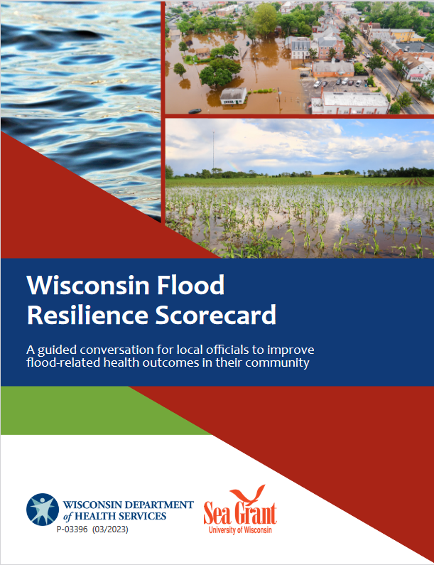
As Wisconsin’s climate gets warmer and wetter, a growing number of our communities are finding themselves under water. These changing conditions are bringing more intense storms and dumping heavy rainfalls in short timeframes, which often causes devastating floods. Recognizing the critical role that municipalities and counties play on the front lines of protecting people, infrastructure, and the environment from flood impacts, the Department of Health Services (DHS) has teamed up with Wisconsin Sea Grant to develop the Flood Resilience Scorecard, a comprehensive flood planning tool for local government.
The Flood Resilience Scorecard helps communities evaluate past, current, and projected flood risks through three distinct lenses:
- Module 1 assesses natural and physical landscape characteristics, such as soil types, slope, and impervious surfaces.
- Module 2 evaluates community policies and plans, such as existing flood mitigation and comprehensive plans, and local policies, practices and regulations that can support or hinder flood resiliency.
- Module 3 examines cultural and socioeconomic sources of vulnerability and partnerships, such as understanding flood impacts on health and needs of vulnerable residents.
Each of the three modules is broken into five sections that contains a series of multiple-choice questions. Based on responses to questions, the scorecard provides a set of customized recommendations and resources that can help communities improve their flood readiness. Resources include mitigation strategies, policy templates, best practices, a list of experts with contact information, grants, potential partner organizations, and more.
The scorecard framework is flexible and provides detailed instructions and reference materials, including a Data Companion that compiles 32 technical flood indicators for 600+ Wisconsin cities and villages and all 72 counties providing easy data access. This can be especially valuable for smaller municipalities who may not have stormwater engineers or staff with floodplain management expertise.
In addition to the Flood Resilience Scorecard, the DHS Climate and Health Program offers a suite of tools to help communities prepare for and respond to floods. The Risk Assessment Flood Tool (RAFT) integrates 32 flood-related spatial data layers in one customizable ArcGIS map, and the Wisconsin Flood Toolkit provides guidance on managing the health and safety aspects of flood events, including information for the public in English and Spanish.
Visit http://www.dhs.wisconsin.gov/flood/frs.htm to access the Flood Resilience Scorecard and recommendations.
If your community is interested in completing the scorecard with a Data Companion, contact the DHS Climate and Health Program at dhsclimate@dhs.wisconsin.gov or 608-267-3242.
| |
Fall 2024 Water Level Update | |
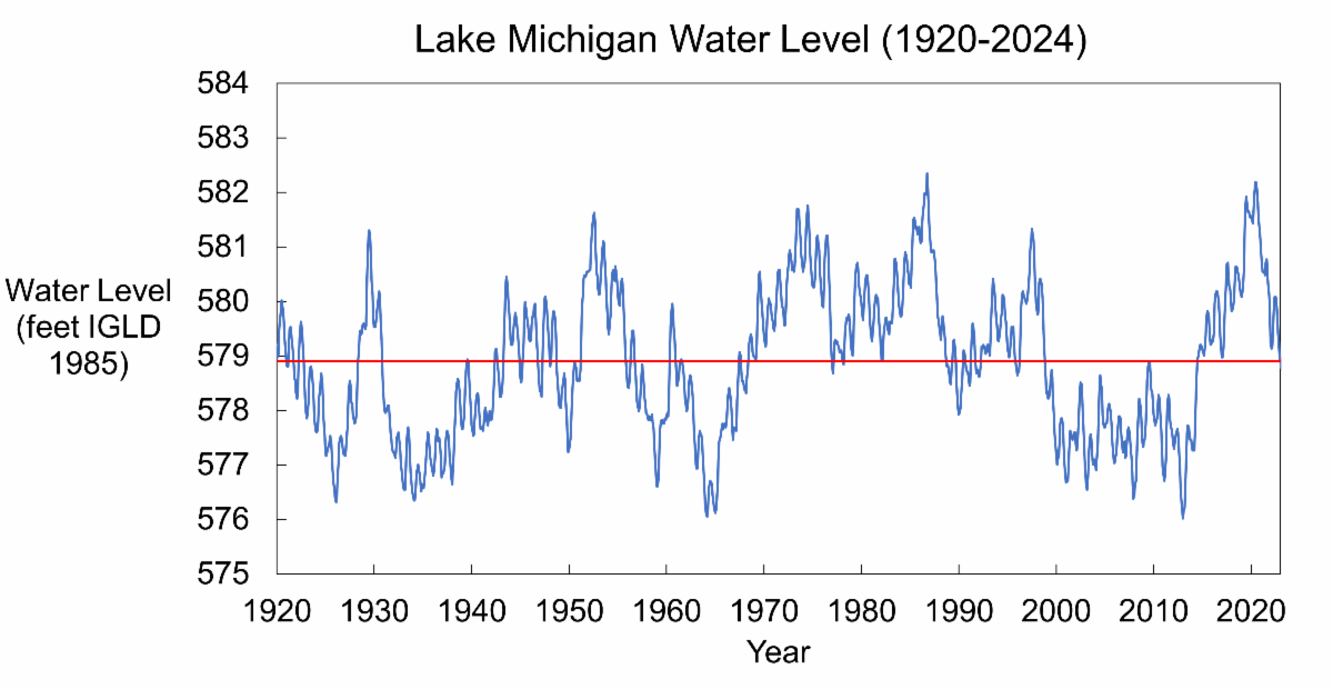
Lake Michigan water levels have begun their seasonal decline. Water levels are expected to continue to drop through February. Below average precipitation late this summer and increased evaporation led to a decreased water supply to Lake Michigan. Over the next 6-months the USACE predicts that Lake Michigan water levels will be near the long-term average. La Niña conditions are likely to emerge by November and persist in the Northern Hemisphere through winter. | |
|
2024 Shoreline Photos Available in the
Wisconsin Shoreline Inventory & Oblique Viewer
| |
|
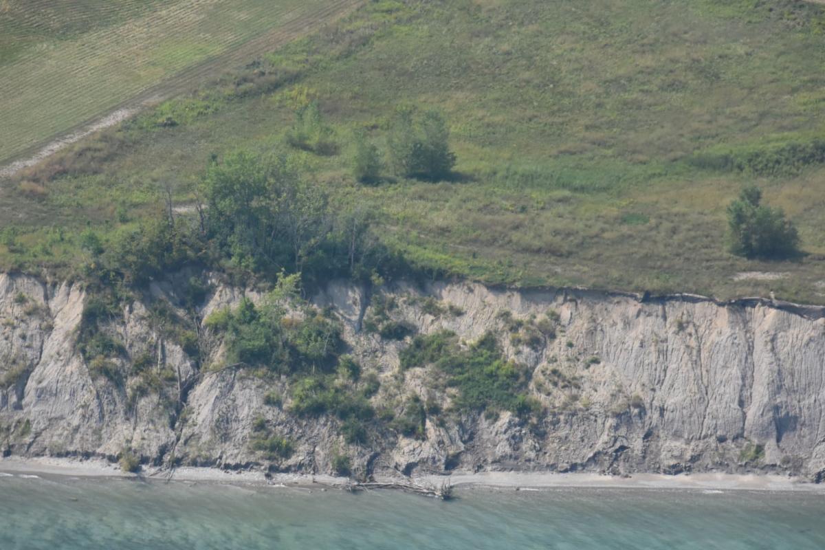
The 2024 shoreline oblique photos are now available on the Wisconsin Shoreline Inventory and Oblique Viewer (Shoreline Viewer). The Shoreline Viewer is a web-based, interactive map of Wisconsin coastal data that enables users to visualize the temporal changes to Wisconsin’s shorelines. Below are some resources to help navigate the Shoreline Viewer and interpret the images.
| |
The Local Infrastructure Hub is a national consortium led by Bloomberg Philanthropies that is helping small and midsized communities develop competitive infrastructure grant applications. This includes boot camps and trainings on grant applications. | |
Great Lakes Environmental Justice Thriving Communities Technical Assistance Center (Great Lakes TCTAC) | |
The Great Lakes TCTAC provides information on current federal funding opportunities, helps to navigate which opportunities match your needs, and offers guidance throughout the application process. Sometimes, they can offer additional support by partnering with community organizations on concept development and planning, engineering consultation, GIS mapping, or post-award grant management. | |
After years of shoaling problems, Manitou Islands docks to be relocated | |
|
The accumulation of sediment, known as shoaling, has consistently caused navigation issues at two docks in Sleeping Bear Dunes National Lakeshore. Dredging at these docks has become increasingly expensive over the years. As a long-term solution, the National Park Service is permanently relocating the docks to areas less likely to experience shoaling.
| |
WCMP Coastal Management Grant RFP | |
|
The Wisconsin Coastal Management Program (WCMP) is seeking project proposals that support the management, protection, and restoration of Wisconsin's coastal resources, and increase public access to the Great Lakes. WCMP will make available approximately $1.6 million of WCMP Grants for:
- Coastal wetland protection and habitat restoration
- Nonpoint source pollution control
- Coastal resource and community planning
- Great Lakes education
- Public access and historic preservation projects
WCMP Grant projects totaling $60,000 or less require a 50% match. Projects with a total budget larger than $60,000 require a 60% match. Match may be in-kind, cash, or a combination of the two.
Applicants are encouraged to contact staff to discuss potential applications.
Application Deadline: November 1, 2024
Coastal Grants Program Webpage: https://doa.wi.gov/Pages/LocalGovtsGrants/CoastalGrants.aspx
Recording of Grants Program Informational Webinar: https://doa.wi.gov/DIR/Coastal_RFP-Webinar-2025-26.mp4
| |
NOAA Economic Analysis & Valuation Training | |
|
NOAA's Office for Coastal Management is offering online training this November that provides a practical introduction to economic analysis and valuation for a general audience. Register using the links below.
Module 1: Introduction to Economic Analyses and Valuation
Register: November 7, 2-4p ET
This module provides an introduction to economic analysis terminology related to benefit-cost analysis, economic impact analysis, cost-effectiveness analysis, benefit valuation methods, and more. Understanding these basics will help participants identify the most appropriate approach and the data needed.
Module 2: Pathways to Valuing Ecosystem Services
Register: November 14, 2-4p ET
This module provides an overview of three common paths used to estimate the value of ecosystem services: site-specific studies, benefits transfer, and tools with built-in benefits. Each path will include information on its strengths and limitations, and on relevant support tools such as BlueValue (for benefits transfer) and the FEMA Benefit-Cost Analysis Toolkit (for tools with built-in benefits).
Module 3: Introduction to Benefit-Cost Analysis
Register: November 21-22, 2-4p ET (both days)
This hands-on module provides the necessary contextual and background information to supervise a basic benefit-cost analysis. Learners will explore an applied example and practice completing steps of a benefit-cost analysis. It’s designed for anyone who (1) needs to supervise, contract, or evaluate a benefit-cost analysis or (2) better understand benefit-cost analysis tools.
| |
Climate Fast Forward 2024 | |
November 14-15, 2024
Rothschild, Wisconsin
The Climate Fast Forward conference, hosted by the Wisconsin Academy, will bring together over 400 stakeholders representing many different sectors and audiences, including climate change policy and planning, climate justice, natural climate solutions, building efficiency, resilient infrastructure, renewable energy, and more.
| |
Wisconsin Association for Floodplain, Stormwater, and Coastal Management (WAFSCM) Annual Conference | |
|
November 6-7, 2024
Milwaukee, Wisconsin
The Wisconsin Association for Floodplain, Stormwater, and Coastal Management (WAFSCM) will hold its 22nd Annual Conference on Wednesday, November 6th and Thursday, November 7th at the Hyatt Regency in Milwaukee, Wisconsin. A field tour, workshops and a social reception will be held on Wednesday, and the main conference included plenary and speaker sessions throughout the day on Thursday. Professional Development Hours (PDHs) and Continuing Education Credits (CECs) can be earned at the main conference.
| |
|
For questions about the CALM Network, or to submit something to the newsletter, contact:
Lydia Salus
lydia.salus@wisconsin.gov
608-266-3687
| |
|
For questions about Lake Michigan coastal hazards or how to address them, contact:
Adam Bechle
bechle@aqua.wisc.edu
608-263-5133
| |
University of Wisconsin Sea Grant Institute | (608) 262-0905 | 1975 Willow Drive, 2nd Floor, Madison, WI 53706 | | | | |