Ivan Zvonkov has created a tutorial for users of OpenMapFlow, a novel Python package for the classifying of crops and other land cover/land use types with limited training data. Accurate agricultural mapping is vital in understanding a region's productivity and properly informing policymakers. Often the areas that would most benefit from accurate crop maps lack the training data that is necessary for the modeling techniques that produce these maps. Developed by Zvonkov - alongside Harvest's Dr. Hannah Kerner, Dr. Catherine Nakalembe, Gabriel Tseng, and Eva Utzschneider - OpenMapFlow was designed to overcome this challenge by supplementing sparse data labels in the area of interest with data from Harvest-created CropHarvest - an Earth observation dataset of over 90,000 labeled data points. OpenMapFlow can be accessed through Github and users are able to move through the modeling and mapping process alongside Zvonkov in this tutorial. |
|
|
|
Harvest partner Dr. Kaiyu Guan co-authored a study on the use of hyperspectral remote sensing to quantify soil organic carbon concentrations. Soil organic carbon is essential for determining soil health as it affects multiple properties of soil, including: water absorption, moisture-holding capacity, nutrient availability, ecosystem services, and global carbon cycles.
|
|
|
|
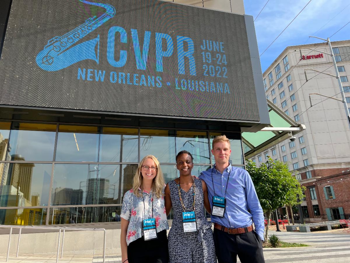
Members of the NASA Harvest consortium attended the 2022 Conference on Computer Vision and Pattern Recognition and presented a tutorial for conference attendees on the use of remote sensing data to map and monitor global agricultural conditions. Attendees also participated in a hands-on session where they got to practice training and evaluating machine learning models and use their model to produce a cropland classification map.
|
|
|
|
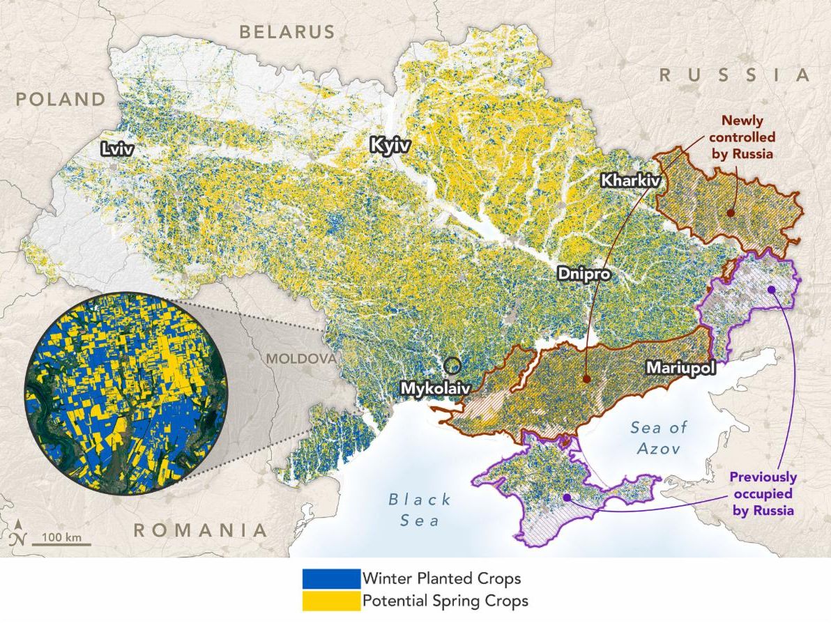
NASA's Earth Observatory looks at how the Russian invasion of Ukraine is impacting global food supply and prices. Harvest's Dr. Inbal Becker-Reshef, Dr. Sergii Skakun, and Dr. Gary Eilerts, describe the analysis NASA Harvest and its partners at GEOGLAM are undertaking to track food production, storage, exports, and the resulting impacts on global supply and price hikes. |
|
|
|
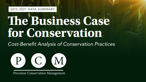
PCM's annual report includes a number of discoveries from their work with local farmers in the US Midwest, including: an analyses of the most profitable strategies for corn and soybean production, tillage application data and recommendations, nitrogen application information, and an evaluation of corn and soybean cover cropping.
|
|
|
|
Harvest Consortium Researcher Kimberly Slinski of University of Maryland's Earth System Science Interdisciplinary Center and NASA Godard Space Flight Center is Principal Investigator on “Earth Observation-Based Monitoring and Forecasting of Rangeland Water Resources.” This newly funded project aims to develop novel capabilities for monitoring and forecasting water availability in African rangeland ponds.
|
|
|
|
The Earth Science Applications Guidebook is a web-based, multimedia product synthesizing best practices and lessons learned on the use of Earth science information for decision-making. This online guidebook mixes interactive features with multimedia content to provide and explain the uses of Earth science information, practical guidance on all steps of developing an application, and scientist perspectives on what it takes to succeed. |
|
The Journal Remote Sensing is accepting manuscripts for the special issue "Monitoring Climate Impacts on Agriculture Using Remote Sensing Techniques." Guest editors Hannah Kerner (NASA Harvest AI Lead) and Laura Harrison (Climate Hazards Center, UCSB) are seeking submissions that "showcase successful recent endeavors in climate impact detection using remote sensing data and to communicate about promising new methods and datasets." The special issue is an opportunity for authors to spread word about their successes in detecting, measuring, and understanding climate impacts on agriculture, using remote sensing data as one of their tools. Manuscripts are accepted through September 15, 2022.
|
|
Guest editors from the University of Maryland, including Harvest's Data Lead, Mike Humber, are accepting submissions to their Special Issue "Remote Sensing Applications in Wildfire Research and Management" in the journal Remote Sensing. The editors "aim to collect recent accomplishments in the field of remotely sensed wildfire products, modeling, and monitoring with the hope to inspire further development of fire-related remote sensing methodologies. These works can include developments related to remote-sensing-derived fire products as well as developments in the estimation and understanding of how fire interacts with other variables at the landscape scale, such as fuel build-up, fuel post-fire succession, fire regimes, and vegetation type." Manuscripts are accepted through October 20, 2022.
|
|
Frontiers in Remote Sensing is accepting manuscripts for the special issue "Women in Remote Sensing." The editors hope to see a varied set of submissions from female-led research groups or individuals representing the true breadth of topics within remote sensing, as well as reflecting the array of institutional types, regions, backgrounds, diversity, rank, and organizations. The group of editors for this issue represent four female remote sensing researchers at various stages in their careers who are all excited to lead and engage with these diverse topics. Submissions for this issue are due by September 30th, 2022 and the organizers would appreciate an initial reflection of interest also be submitted in the form of an abstract, to allow management of submissions and reviews to operate as efficiently and smoothly as possible.
|
|
NASA's Director of the Earth Science Division, Karen St. Germain, will be a featured speaker at Agri-Pulse's 2022 Summit on Food and Agricultural Issues. Her talk will focus on how NASA data is helping farmers and policymakers adapt to changing water cycles in the Western US. The summit is focused on economic and policy issues impacting farmers like improved irrigation management and advancing climate smart policies and practices. |
|
|
The International Food Policy Research Institute (IFPRI) is organizing policy seminar with Tufts University and the World Bank on accessibility of healthy food in various global populations. The seminar will introduce attendees to the data and methods available to analyze this accessibility, explore use cases, and discuss how these tools could be further implemented. Registration is free and open to the public. |
|
|
Registration for the 2022 NASA PACE Applications Workshop is now open. Join the conversation on
advancing the application readiness and societal value of PACE satellite data. Workshop attendees will discuss
barriers and gaps to ensure PACE data is accessible and actionable.
|
|
|
|
|
|
|
|