|
Reno Connect | Development Projects
Connecting Citizens to our Community
| | Current Development Projects | |
Reno Connect Development Projects is our effort to highlight proposed development projects in the City of Reno and provide information on how to provide feedback. For questions regarding these projects, please call or email the City of Reno staff contact assigned to each listed below. Public comment for these projects will be taken up to and during the scheduled public hearing. We encourage the public to offer their comments early to allow the project applicants time to address concerns.
For commenting agencies, please provide comments by July 7, 2026, unless otherwise noted. Projects requiring comments to be submitted sooner are marked with an asterisk.
| | Rilite Aggregate Pit Master Plan Amendment and Rezoning Vicinity Map ** | | |
Case Number: LDC26-00073
Project Type: Master Plan Amendment, Zoning Map Amendment
Property Information:
Ward 6
Councilmember: Brandi Anderson
Parcel Number(s): 016-730-61, 016-370-44, 016-370-45, 016-730-03, 016-730-06, 016-730-60, 016-730-62, 143-120-16
Important Dates:
Neighborhood Advisory Board: August 3, 2026
Planning Commission: August 19, 2026
Staff Contact:
Nathan Gilbert, Principal Planner
775-334-2698
GilbertN@reno.gov
** This application is to be reviewed by Northern Nevada Public Health
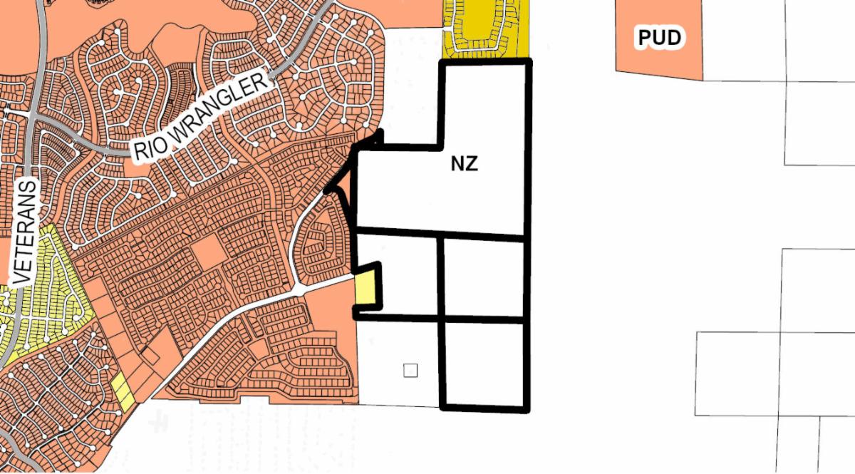
| |  | A request has been made for: 1) a Master Plan Amendment from the Washoe County Master Plan land use designations of Rural (R) and Suburban Residential (SR), and the City of Reno Master Plan land use designation of Special Planning Area (SPA), to Single-Family Neighborhood (SF); and 2) zoning map amendments to: a) amend the Carmella Ranch Planned Unit Development (PUD) by removing a ±3.92-acre parcel (Rilite Pit mine entrance) and assigning the Rilite Specific Plan District (SPD), and b) rezone ±38.0-acres of Large-Lot Residential - 1 acre (LLR-1), ±202.00-acres of Unincorporated Transition -40 acres (UT-40), and ±9.10-acres of Unincorporated Transition - 5 acres (UT-5) to Rilite SPD. The ±253-acre site is generally located east of Western Skies Drive and South of Precious Metal Drive, on parcels primarily consisting of the existing Rilite Aggregate Pit, within the City of Reno Sphere of Influence. | | TID Systems Conditional Use Permit ** | | |
Case Number: LDC26-00099
Project Type: Conditional Use Permit
Property Information:
Ward 6
Councilmember: Brandi Anderson
Parcel Number(s): 016-411-16
Important Dates:
Neighborhood Advisory Board: August 3, 2026
Planning Commission: August 19, 2026
Staff Contact:
Mike Railey, Planning Manager
775-990-2621
RaileyM@reno.gov
** This application is to be reviewed by Northern Nevada Public Health
| | | |
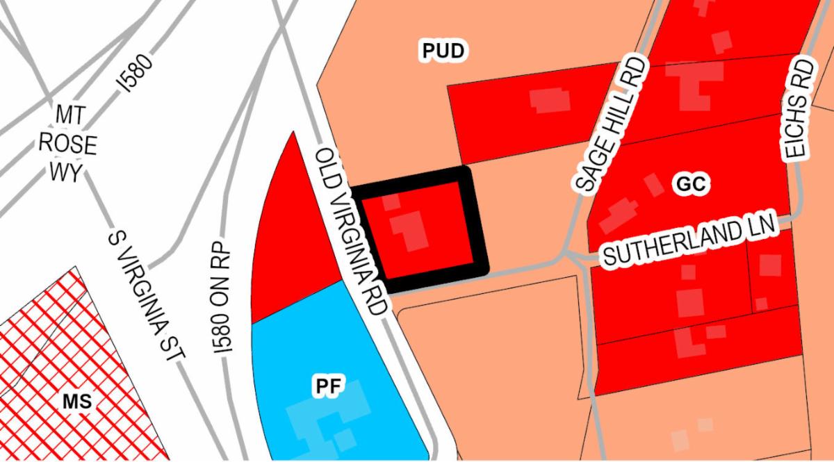
A request has been made for a conditional use permit to allow for a heavy machinery and equipment, rental, sales, and service use on a ±1-acre site located at the northeast east corner of Old Virginia Road and Sutherland Lane (13905 Old Virginia Road). The site is located within the General Commercial (GC) zoning district and has a Master Plan land use designation of Suburban Mixed-Use (SMU).
| | 55 S. Wells Auto Service and Repair ** | | |
Case Number: LDC26-00101
Project Type: Conditional Use Permit
Property Information:
Ward 1
Councilmember: Kathleen Taylor
Parcel Number(s): 012-113-37
Important Dates:
Neighborhood Advisory Board: July 13, 2026
Planning Commission: August 19, 2026
Staff Contact:
Jeff Foster, Associate Planner
775-393-4165
FosterJ@reno.gov
** This application is to be reviewed by Northern Nevada Public Health
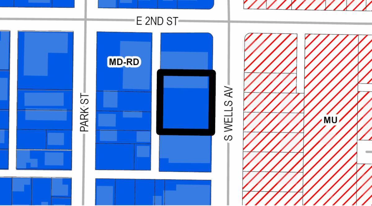
| | | A request has been made for a conditional use permit to reestablish a nonconforming use (auto service and repair) in the Mixed-Use Downtown - Riverwalk District (MD-RD). The ±0.45 acre parcel is located on the west side of South Wells Avenue, ±100 south of East 2nd Street. The site has a Master Plan land use designation of Downtown Mixed-Use (DT-MU). | | Reno's Neon Line District Area Identification Structure** * | | |
Case Number: LDC26-00102
Project Type: Minor Site Plan Review
Property Information:
Ward 1
Councilmember: Kathleen Taylor
Parcel Number(s): 006-152-01
Important Dates:
Decision Date: July 24, 2026
Staff Contact:
Leah Piccotti, Associate Planner
775-870-5531
PiccottiL@reno.gov
** This application is to be reviewed by Northern Nevada Public Health
*Comments for this project are due July 2, 2026
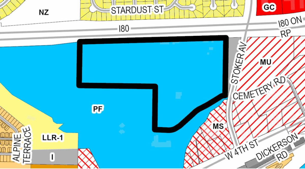
| | | A request has been made for a minor site plan review to allow an area identification structure exceeding 45 feet in height within the Public Facilities (PF) zoning district. The proposed structure will be located on the northern portion of a ±31-acre site located on the south side of Interstate 80, ±100 feet west of the Stoker Avenue/Cemetery Road intersection (437 Stoker Avenue). The subject has a Master Plan land use designation of Public/Quasi-Public (PQP). | | Reno's Neon Line District Pedestrian Walkways ** | | |
Case Number: LDC26-00103
Project Type: Conditional Use Permit
Property Information:
Ward 1
Councilmember: Kathleen Taylor
Parcel Number(s): 007-274-44, 007-281-39, 007-542-15
Important Dates:
Neighborhood Advisory Board: July 13, 2026
Planning Commission: August 19, 2026
Staff Contact:
Leah Piccotti, Associate Planner
775-870-5531
PiccottiL@reno.gov
** This application is to be reviewed by Northern Nevada Public Health
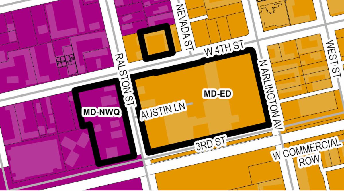
| | | A request has been made for a conditional use permit to allow for two skyways (elevated pedestrian walkways) connecting the J Resort with properties across West Fourth Street and Ralston Street. The ±9.14-acre site is comprised of three parcels generally located at the southwest and southeast corners of West Fourth Street and Ralston Street and on the north side of West Fourth Street approximately ±100 feet east of the West Fourth Street/Ralston Street intersection (345 Arlington Avenue, 311 Ralston Street, and 411 West Fourth Street). The properties are zoned Mixed-Use Downtown - Entertainment District (MD-ED) and Mixed-Use Downtown - Northwest Quadrant (MD-NWQ), are located within the Downtown Gaming Overlay (DTG), and have a Master Plan land use designation of Downtown Mixed-Use (DT-MU). | | Mira Loma to Walker Transmission Line ** | | |
Case Number: LDC26-00105
Project Type: Conditional Use Permit
Property Information:
Ward 3
Councilmember: Miguel Martinez
Parcel Number(s): 016-350-53, 016-720-08, 016-810-02, 016-810-03, 016-810-04, 016-810-05, 016-810-06, 016-810-09, 016-810-10, 016-810-11, 016-810-12, 016-820-06, 016-820-09, 016-820-10, 016-820-11, 016-820-12, 016-820-13, 016-820-17, 016-820-18, 016-820-19, 016-830-04
Important Dates:
Neighborhood Advisory Board: August 4, 2026
Planning Commission: August 19, 2026
Staff Contact:
Nathan Gilbert, Principal Planner
775-334-2698
GilbertN@reno.gov
** This application is to be reviewed by Northern Nevada Public Health
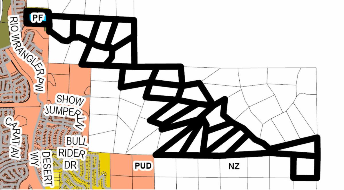
| | | A request has been made for a conditional use permit to establish a major utility to allow for the construction of a new overhead 345kV electrical power line. The ±3.63-mile utility corridor alignment is generally located between the Mira Loma substation (6500 Desert Way) extending southeast into Storey County. The request is a Project of Regional Significance (PRS) and requires an amendment to the Truckee Meadows Regional Plan to establish a new regional utility corridor. | | TMWA Santerra-Quilici 2 Water Storage Tanks ** | | |
Case Number: LDC26-00106
Project Type: Major Site Plan Review
Property Information:
Ward 5
Councilmember: Devon Reese
Parcel Number(s): 038-190-48
Important Dates:
Neighborhood Advisory Board: July 14, 2026
Planning Commission: August 19, 2026
Staff Contact:
Jeff Foster, Associate Planner
775-393-4165
FosterJ@reno.gov
** This application is to be reviewed by Northern Nevada Public Health
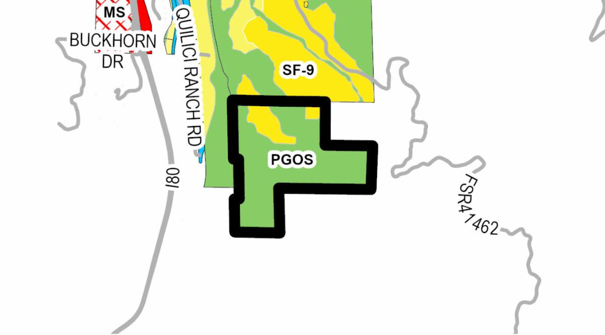
| | | A request has been made for a major site plan review to allow: 1) hillside development; 2) grading resulting in cuts greater than 20 feet and fills greater than 10 feet in height; and 3) nonresidential development adjacent to residential zoning associated with the construction of two 400,000-gallon water tanks to serve the previously approved Santerra-Quilici Ranch subdivision. The ±4.23 acre site is a portion of an overall ±242.86 acre parcel located ±0.68 miles south of the intersection of Quilici Meadow Parkway and Quilici Canyon Parkway, ±0.2 miles east of Quilici Ranch Road. The site is zoned Parks, Greenways and Open Space (PGOS) and Single-Family Residential – 9 units per acre (SF-9), is located within the Mortenson-Garson Overlay District (MGOD), and has Master Plan land use designations of Parks, Greenways and Open Space (PGOS) and Single-Family Neighborhood (SF). | | |
Case Number: LDC26-00108
Project Type: Zoning Map Amendment
Property Information:
Ward 2
Councilmember: Naomi Duerr
Parcel Number(s): 040-880-14
Important Dates:
Neighborhood Advisory Board: July 21, 2026
Planning Commission: August 19, 2026
Staff Contact:
Jeff Foster, Associate Planner
775-393-4165
FosterJ@reno.gov
** This application is to be reviewed by Northern Nevada Public Health
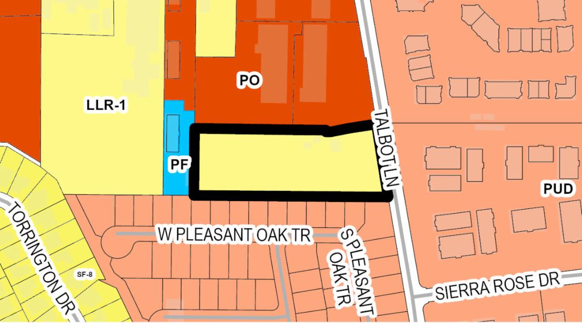
| | | A request has been made for a zoning map amendment from the Large-Lot Residential – 1 acre (LLR-1) zoning district to Specific Plan District (SPD). The ±3.03 acre parcel is located on the west side of Talbot Lane, ±575 feet south of South McCarran Boulevard. The subject site has a Master Plan land use designation of Suburban Mixed-Use (SMU). | | DPII Tentative Map Time Extension ** | | |
Case Number: LDC26-00109
Project Type: Tentative Map Time Extension
Property Information:
Ward 6
Councilmember: Brandi Anderson
Parcel Number(s): 145-030-07
Important Dates:
Planning Commission: July 15, 2026
Staff Contact:
Mike Railey, Planning Manager
775-990-2621
RaileyM@reno.gov
** This application is to be reviewed by Northern Nevada Public Health
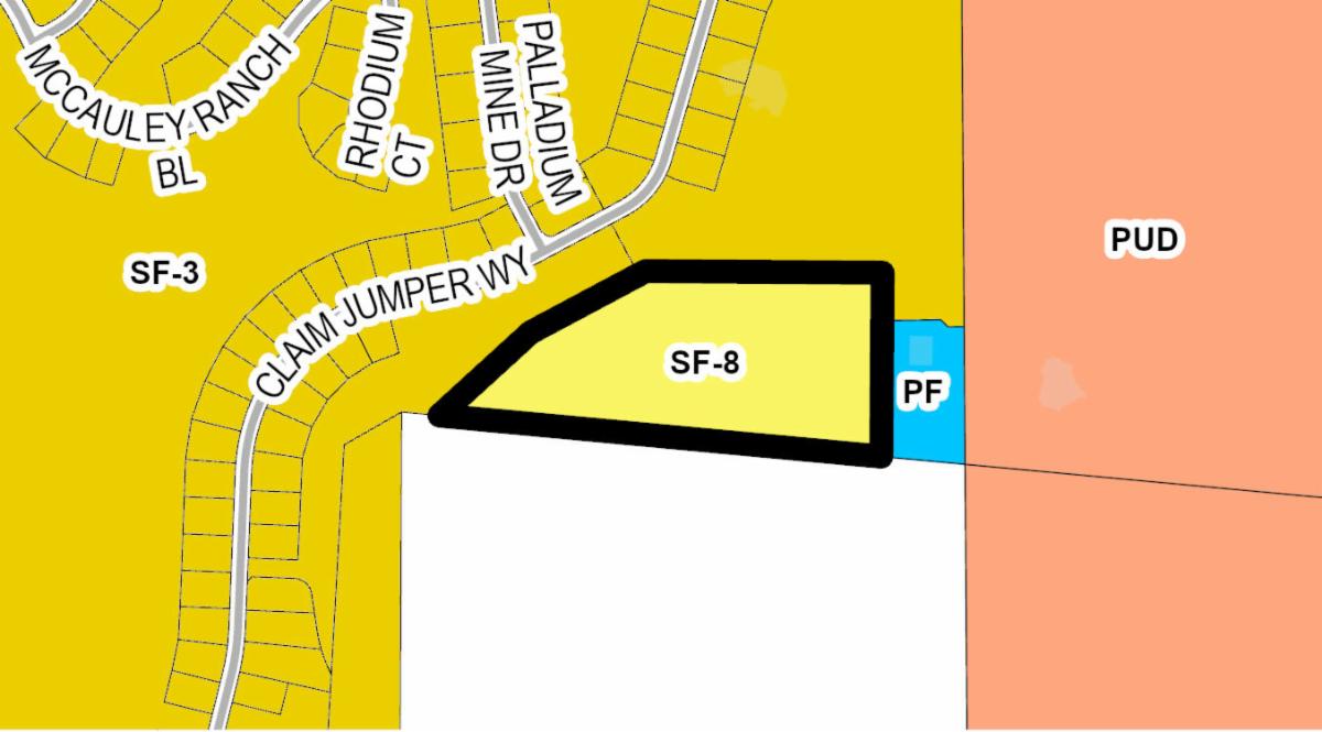
| | | A request has been made for a two year time extension to record a final map for a previously approved tentative map set to expire on August 4, 2026 (LDC22-00082 – DPII). The project includes: 1) a tentative map to establish an 18 lot townhome (attached single-family) subdivision; 2) a conditional use permit to allow for: a) hillside development; b) grading resulting in cuts greater than 20 feet and fills greater than 10 feet; and c) cluster development; and 3) a minor deviation to hillside density requirements. The ±8.05 acre site is located ±1,000 feet south of the intersection of Claim Jumper Way and Tellurium Mine Drive. The site is zoned Single-Family Residential – 8 units per acre (SF-8) and has a Master Plan land use designation of Single-Family Neighborhood (SF). | | | | |