|
Stay informed on shoreline protection, climate resilience, and community initiatives. |
| |
Feature: Plymouth's new sensors met their first nor'easter | |
Coastal Measures finished installing the Town of Plymouth's monitoring network this summer. Five stations now report to CUMULUS, our data platform, around the clock:
-
Long Beach — a wave radar that maps rough and breaking water out to about 1.2 miles, every hour (see it live)
-
Cape Cod Bay, off the beach — a wave buoy recording height, period and direction, deployed with ARII in 2025 (see it live)
-
Plymouth Harbor — a water-level gauge reading every 10 minutes (see it live)
-
The Harbormaster's office — a weather station (see it live)
-
The inner harbor — a water-quality sonde: temperature, salinity, oxygen, turbidity, chlorophyll (see it live)
The storm built from Wednesday, September 23 and peaked around midnight Saturday, on the spring tides of the full moon. What the network recorded:
- Seas off Long Beach stayed above 5 feet for 81 hours and peaked at 9.7 feet (hourly average; one ten-minute reading reached 10.5 feet). Offshore, NOAA's buoy east of Boston reached 16 feet.
- Nine-tenths of the wave energy arrived within 20 degrees of straight onshore. The storm hit the beach head-on.
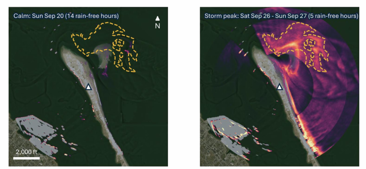
- The radar watched waves break first on the shoal northeast of the spit, then along the whole ocean face of the beach. Behind it the harbor stayed quiet: rough water covered 37 percent of the ocean side in the radar's view and 4 percent of the harbor side.
- At the Harbormaster the barometer fell from 1034 to 1004 millibars, five inches of rain fell, and the National Weather Service reported a 58 mph gust in Plymouth.
- Eight consecutive high tides ran above a normal high tide, Friday night through Tuesday afternoon. The harbor peaked late Saturday night, a foot and a half above an average high tide, with about two feet of storm surge on top of the tide.
- In the inner harbor, salinity fell from 34 to 31 as the rain ran off, and turbidity rose more than tenfold.
| |
Long Beach through the radar: a calm day (left) and the storm peak (right). Brighter means rougher, breaking water. Waves broke on the offshore shoal and along the ocean face of the beach while the harbor behind stayed quiet.
Long Beach does not stop the tide or the surge; they enter through the harbor mouth. What it stops is the waves. For three days the barrier took 9-foot seas head-on so that the wharves, the mooring field and the downtown waterfront behind it saw about a foot of wind chop. The instruments stay in place, so the next storm, and any change after nourishment, gets measured the same way.
"Plymouth takes the brunt of nearly every major storm on the South Shore, yet most decisions about its coastline are still made with data collected miles away. We want to change that," said Dr. Josh Humberston, founder and CEO of Coastal Measures. "When a town can see exactly how high the water rose at its own wharf, or what Long Beach held back in a single nor'easter, it can plan with evidence instead of guesswork. Plymouth is where we're starting, but the goal is a coastline where every community has that kind of insight."
The Plymouth network is supported by the Massachusetts Clean Energy Center's InnovateMass program.
Topic of the Quarter: One storm, one picture
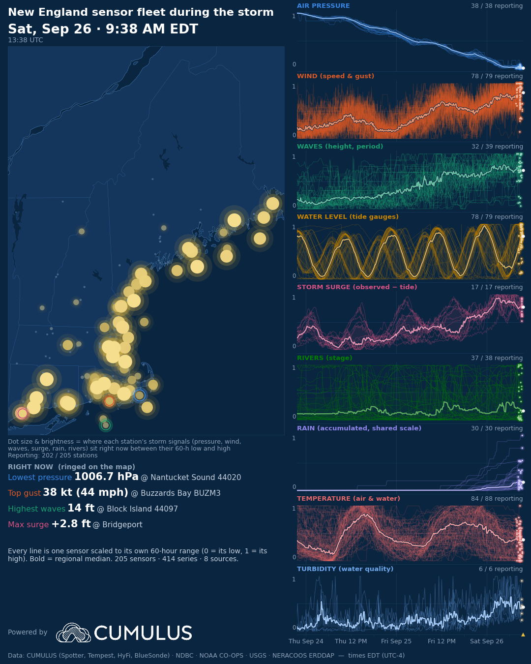
During the September nor'easter, CUMULUS put the New England coast on one screen: 205 sensors from eight networks, including NOAA buoys and tide gauges, USGS river gauges, NERACOOS stations, and CUMULUS's own network of partner instruments from Plymouth to Saco Bay.
The region moved together: air pressure fell at every station. But every place had its own storm. Gusts hit 54 mph in Buzzards Bay while Downeast Maine saw 14 to 18 mph. Waves reached 14 feet off Block Island and 10 feet in Cape Cod Bay. Surge peaked hours apart from Boston to Long Island Sound.
None of this is one organization's data, and no single network tells the whole story. In Plymouth, the NERACOOS tide gauge at Scituate showed the surge arriving on the South Shore while the town's own sensors showed what it did locally. A regional storm is a system of systems. CUMULUS turns them into one picture.
| |
The New England sensor fleet through the storm, Wednesday to Saturday. Each dot is a station; bigger and brighter means closer to its storm peak.
|
| |
Community Corner
Seeing the data for yourself.
Readings from all five Plymouth stations are public on CUMULUS: https://cumulus.coastalmeasures.com/waves/spotter/SPOT-32727C.
Check the water level in Plymouth Harbor, watch the waves off Long Beach, or see the wind and rain at the Harbormaster's office.
For people who work the water. Behind Long Beach sit Town Wharf and T Wharf, the commercial fishing and aquaculture fleet, the marinas and mooring field, and the ferry, whale-watch and charter boats. Real-time wave and water-level data helps with everything from timing a haul-out to understanding how storms are changing the harbor. Tell us what would be most useful: meaghan@coastalmeasures.com.
Sarah McCormack, Natural Resources & Sustainability Specialist, Town of Plymouth: “We had access to some federal data in Cape Cod Bay or the greater Boston area, but overall, there was a lack of available data along the South Shore. This collaboration has been invaluable for the Town.”
“Through partnership with Coastal Measures, Plymouth seeks to help advance the acceleration of meaningful climate mitigation technologies, while gathering real-time data to reduce risk for residents and better inform our policy decisions," Mike Cahill – Climate Resiliency and Sustainability Planner, Town of Plymouth:
|
|
Soundings No. 1: The Ocean Needs More AI, Not Less
This month we launched Soundings, a series of essays on where coastal and ocean science is headed. In the first, founder Josh Humberton argues that the ocean needs more AI, not less: foundation models built for the coast, anchored in physics and trained on open, well-kept records. "The hardest part of ocean AI is not the model," he writes. "It is the record the model learns from." Plymouth's network is that kind of record. Read Soundings No. 1 →
|
Quarterly events
BlueTIDE 2026 — August 26–27, Newport, RI
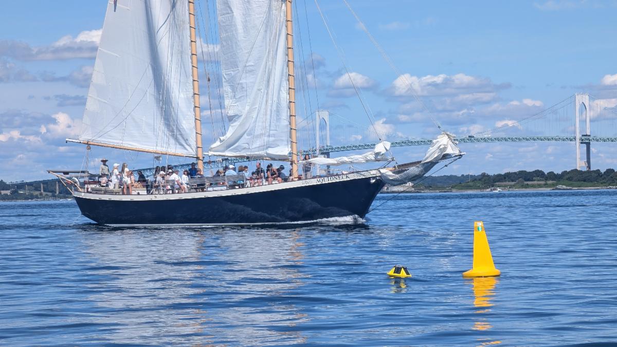
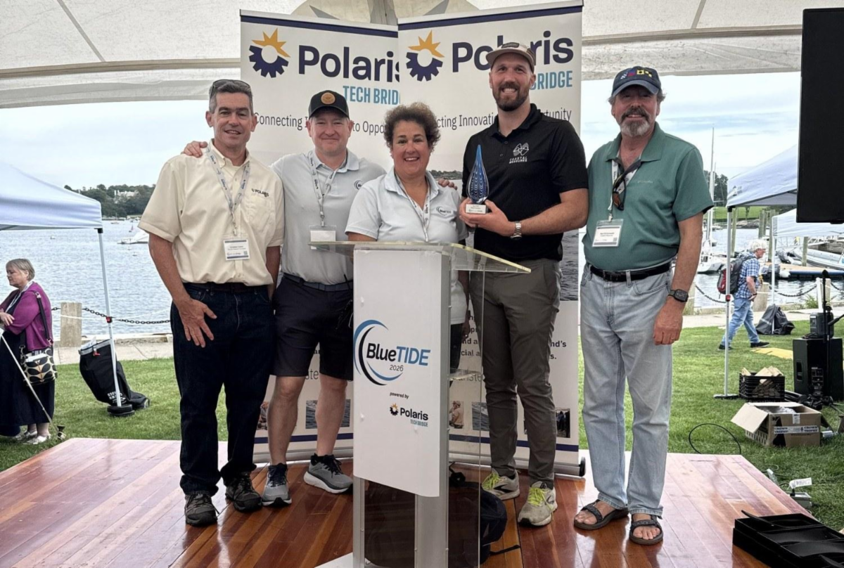
Coastal Measures was selected for the live in-water demonstration at BlueTIDE, the maritime technology showcase hosted by Polaris Tech Bridge with the U.S. Navy and the Naval Undersea Warfare Center, Division Newport, and came home with the Digital Innovation Award for turning live sensor feeds into real-time situational awareness.
| Josh Humberton and Neil Schonwald with the Digital Innovation Award, Sail Newport, August 27. |
MassCEC site visit — September 11, Marshfield, MA
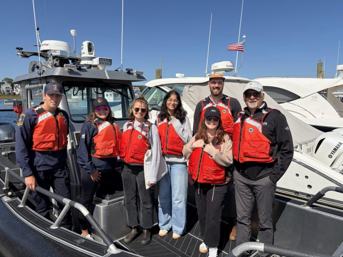
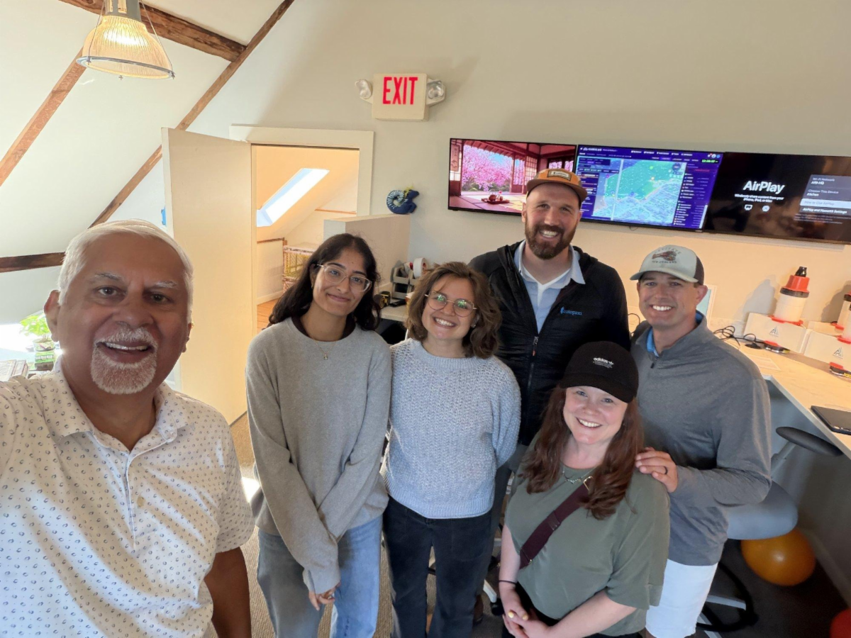
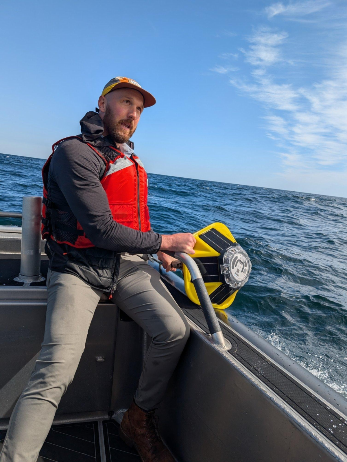
The Massachusetts Clean Energy Center's InnovateMass team came to see the network at work: out on the water with the Harbormaster, a Spotter wave buoy over the side, then CUMULUS on the big screen back at ARII.
| With the MassCEC team and the Harbormaster. | Back at ARII, with CUMULUS on screen. |
Partner Corner: SeaSignal Technologies
The radar that watched Long Beach take the storm is a SeaSignal X-band wave radar, one of the Works With CUMULUS partner systems.
Who they are. Detroit-based SeaSignal Technologies builds X-band radar systems and the processing that turns radar returns into wave height.
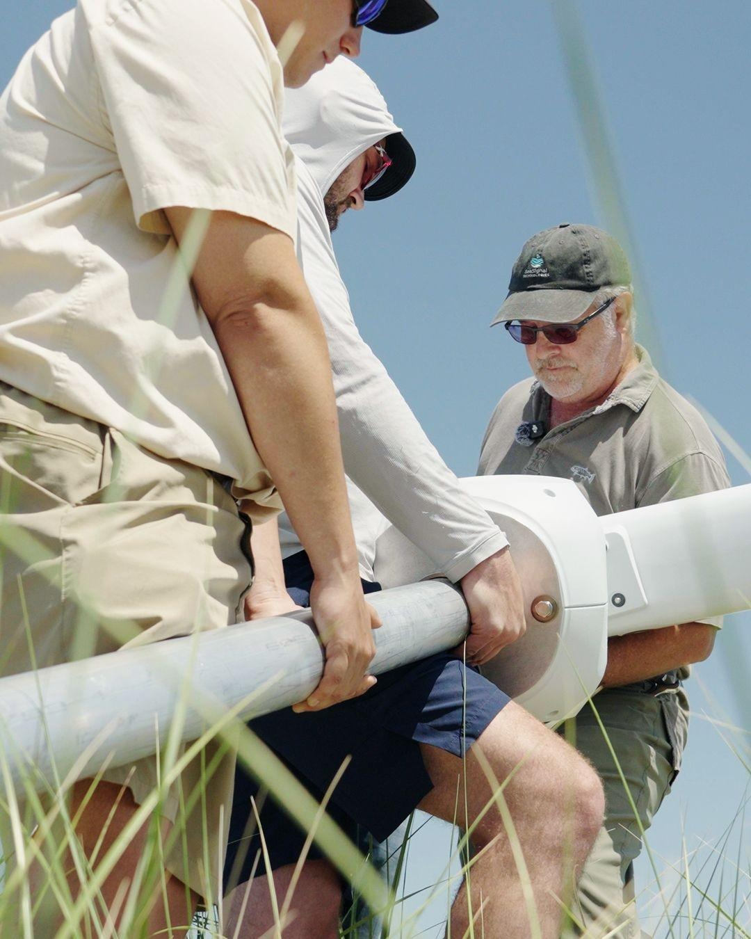
How we work together. SeaSignal builds the radar; CUMULUS ingests every sweep, averages them hour by hour, masks boats and moorings, and turns echo strength into a map of where waves are breaking. This summer we put radars up together on Long Beach in July, on the back of a pickup at BlueTIDE in Newport, and on Ram Island, Maine, with the University of New England in August. In Alaska, we completed a salmon-counting project together with the Bristol Bay Regional Seafood Development Association in August.
Why it matters. A buoy or a gauge measures one point. Radar sees the whole water surface, which is how we know the offshore shoal took the first hit and the beach face took the rest.
“We spend all our time making the hardware work, figuring out how to turn radar returns into wave height, but no real way to deliver it to a broader audience. And that's where the partnership with Coastal Measures is perfect.” — Jesse McNinch, CEO, SeaSignal Technologies
| | | | |