|
Good evening, folks! It's definitely been a while since we last talked, but I'm going to start pushing these updates more frequently as the growing season is right around the corner! That said, today's update is reserved for a strong storm system set to pass through the state overnight.
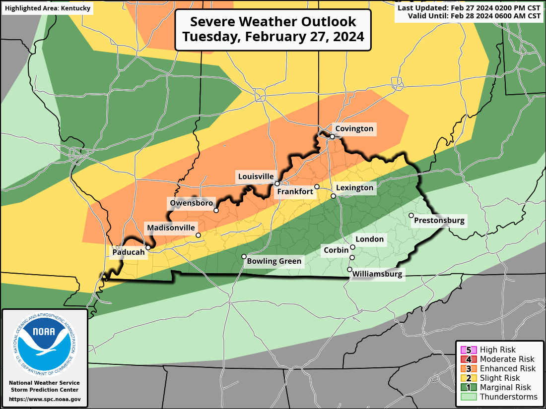
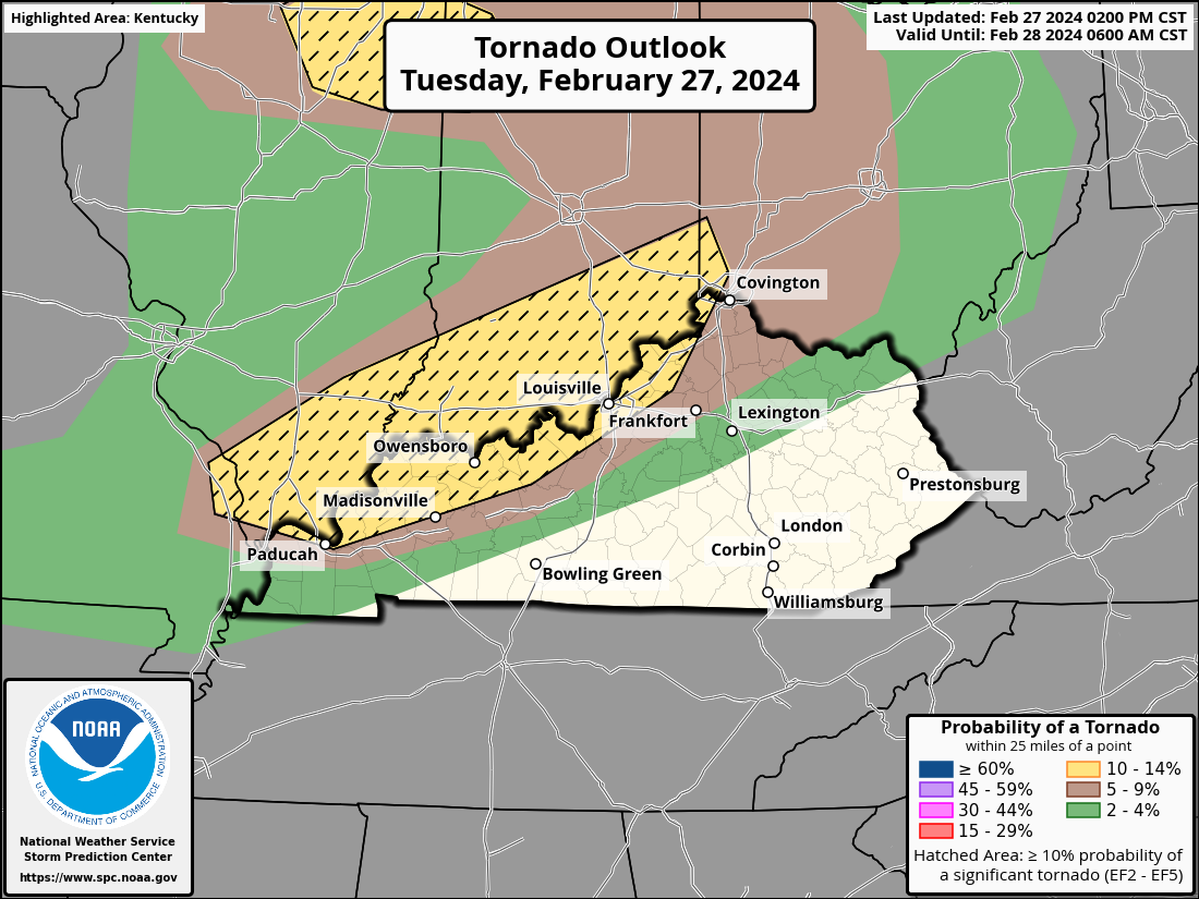
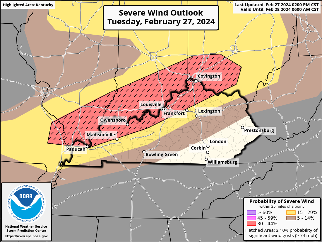
Currently, portions of Kentucky, primarily along the Ohio River, are under an enhanced risk of severe weather, as indicated by the Storm Prediction Center (image above). This is a level 3 out of 5 risk, with storms capable of producing all modes of severe weather, including tornadoes, damaging winds, and large hail. As seen in the maps below, the first two modes carry the highest probability. You might also notice the dashes on the map, indicating a "hatched" area. In the tornado outlook, this means that there is a 10% or greater probability of EF2-EF5 tornadoes within 25 miles of any point in that area. Looking at the severe wind outlook, "hatched" denotes a 10% chance of wind gusts exceeding 74 mph within 25 miles of any point. Large hail could be a possibility too, mainly across the Green River region of Kentucky.
The activity will come in two waves, with the first featuring discrete thunderstorms late this evening and early overnight (highest tornado risk). This will then be followed by a line of storms moving to the southeast (damaging wind potential).
|