|
FIELD NOTES
November 2025
| |
Staying the Course
Despite this year’s challenges and disruptions, we’ve kept our focus on what we do best: getting meaningful work done. Hand in hand with our community and agency partners, we’ve continued our restoration efforts across the region.
A special thank you to our Federal partners: the US Forest Service, US Fish and Wildlife Service, and National Oceanic and Atmospheric Administration; Foundations: the National Forest Foundation and National Fish and Wildlife Foundation; and the many other state funds and private donors who stepped up to support our restoration efforts in the region this year.
As the field season comes to a close, we’d like to take a moment to highlight some of the progress made on these important projects and thank our partners for persisting, and our funders for helping us stay the course.
| | | |
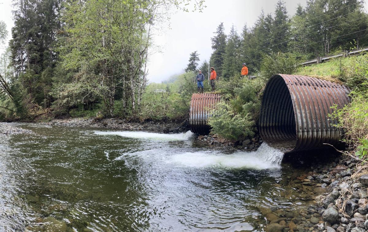
FISH FRIENDLY CROSSINGS ACROSS SOUTHEAST
What happens when the salmon crosses the road? Well, in an ideal world there would be a fish-friendly culvert and the salmon would cross under the road without skipping a beat. In reality, however, there are many undersized or failing culverts throughout the region that impede fish from moving freely up and down stream. This year, we continued working with partners across the region to replace or remove problem culverts and improve habitat access for the fish our communities rely on.
| | Photo: Perched and undersized culverts at Threemile Creek in Klawock. | | |
We kicked off design work in Threemile Creek, an important sockeye stream in Klawock on Prince of Wales island. In partnership with the Alaska Department of Transportation and US Fish and Wildlife Service, we will replace these undersized culverts with a bridge and improve instream habitat.
Monitoring of sockeye salmon spawning was conducted by US Forest Service, Klawock Cooperative Association, and Klawock Indigenous Stewards Forest Partnership staff.
In Thorne Bay, the Prince of Wales Tribal Conservation District crew assessed 25 culverts to identify and prioritize those that are blocking fish passage.
Final designs for four culverts in Metlakatla were finalized this summer, moving us one step closer to implementation. Construction of three culverts on Graveyard and Gillnet Creeks are slated to take place during the summer of 2026.
| | |
Thank you to all of our partners around the region helping to restore fish passage! A special thanks to the US Fish and Wildlife Service who provide the financial and technical support that make these projects possible.
| |
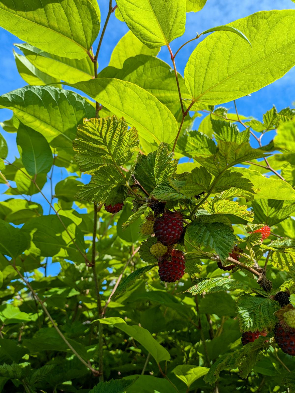
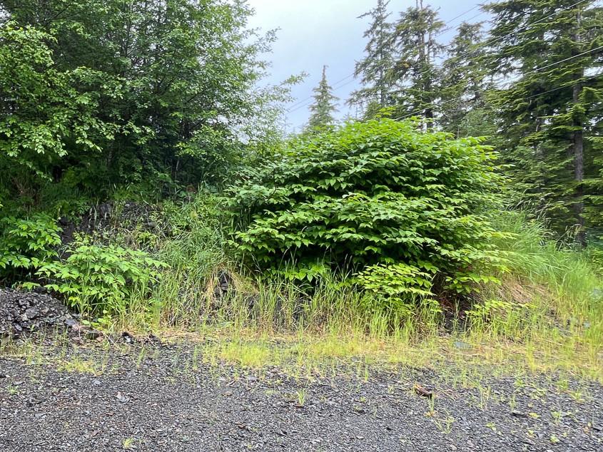
TACKLING KNOTWEED IN KAKE
Our regional invasive plant coordinator Reed travelled to Kake in July as part of a team that included the Keex' Kwáan Community Forest Partnership crew, Alaska Youth Stewards, and Tongass National Forest. The trip was focused on documenting, controlling, and raising awareness about invasive plants, and was motivated by community concerns that invasive knotweed (Reynoutria spp) has been displacing native plants like salmonberry. Knotweed is in the top 100 most invasive species in the world.
Photo: Knotweed shading out a salmonberry bush in Kake (photo by Laura Holloway, TNF).
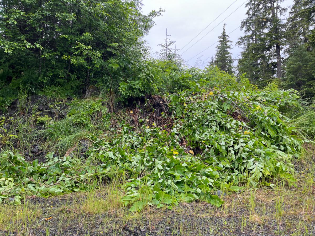
Over a week, the team manually controlled more than three acres of knotweed, bending and cutting stems to slow spread and decrease the impact on native plant populations. Bending knotweed opens the canopy so more sunlight can reach native plants. They also led a community meeting to start a conversation about invasive plant management in Kake, discussing the impacts of invasive plants and options for control.
| | Photo: Knotweed patch before and after manual control. | | |
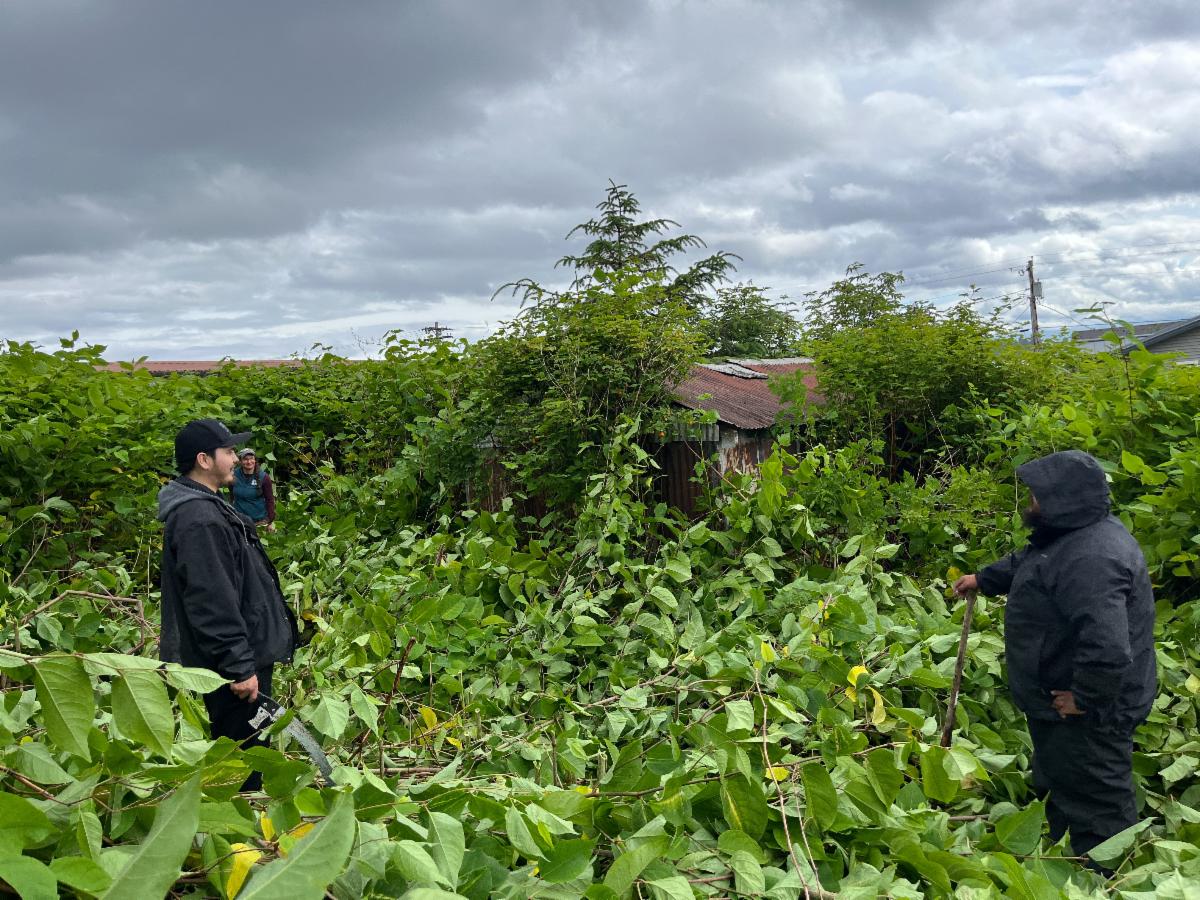
Photo: Laura Holloway (TNF), Travis Adams, and Skyler Copsey (KKCFP) admire their work after bending and cutting a swath of knotweed in downtown Kake.
In addition to knotweed, the team found an incipient population of invasive white sweetclover at the Kake airport – the first record of the plant in Kake. They spent several hours pulling plants and made plans for additional control in the spring. Hurray for early detection and rapid response!
Reed was tipped off about the sweetclover by an observation submitted on iNaturalist; reporting invasive plants helps bring them to the attention of professionals! Learn how here.
Thank you to our partners, and to the US Forest Service for funding this work.
| |
Welcome, Toby!
Toby Robinson started with SAWC in April as a seasonal member of the Cube Cove field crew and has moved into a full time position as a watershed technician, assisting with fieldwork and mapping. He will also collaborate with partners and tribal stewardship crews to implement watershed stewardship projects.
Toby has been working in the Tongass National Forest for 5 years, where he has worked with the Forest Service collecting second growth forest stand data on Prince of Wales and Mitkof Islands and maintaining wilderness cabins and trails on Admiralty Island. He has also worked on canopy mapping and harvesting wild bull kelp in Northern Southeast Alaska with Barnacle Foods.
When he isn’t working, Toby likes to go get lost outside somewhere.
| |
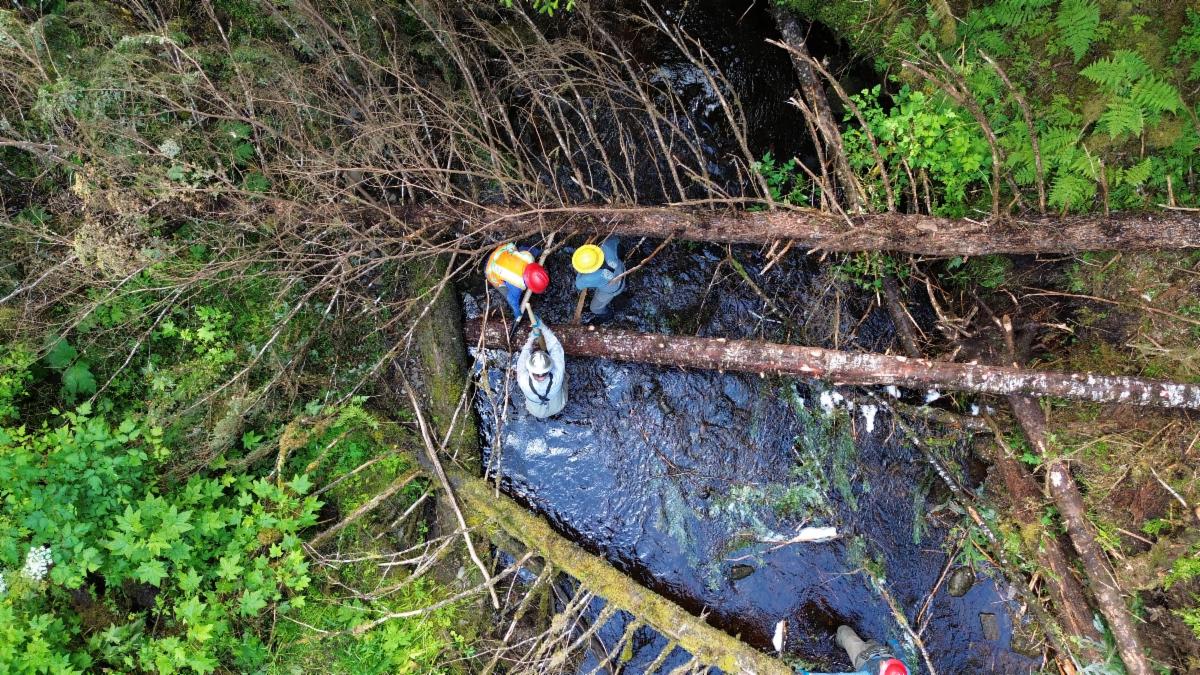
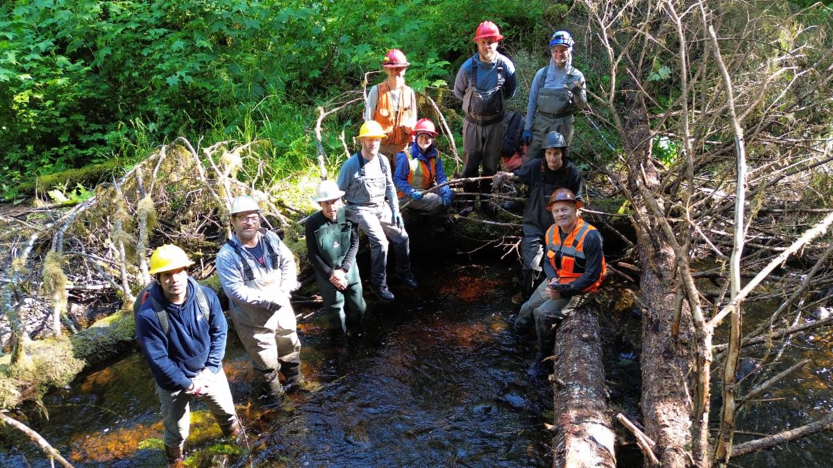
| | SHAHEEN CREEK GETS A HELPING HAND | | |
Photo: Some of the more than a dozen folks who worked on the Shaheen Creek project.
The story of the Shaheen Creek watershed is the same as that of many other watersheds across Prince of Wales Island. Old-growth trees were harvested from the banks and floodplain without regard for their crucial role in maintaining productive salmon habitat; in the years since timber harvest, streambanks have eroded and habitat-forming large woody material in the creek (i.e. fallen trees) has decomposed. With no old growth in the riparian zone, there is nothing to replace this key wood in the stream. Consequently, habitat complexity – marked by widely varying channel widths, depths, sediment sizes, and flow velocities – has declined.
| | |
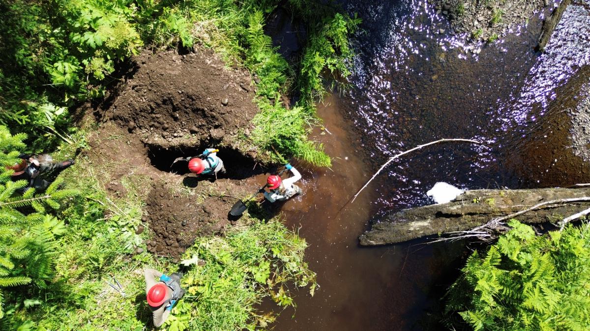
Photo: Forest Service staff dig a trench in the bank that will be used to anchor a log spanning the stream channel.
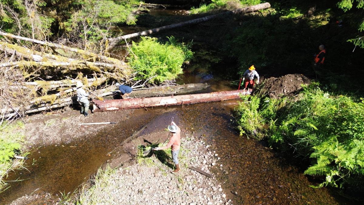
In July, we helped the US Forest Service restore the south fork of Shaheen Creek using hand tools. With assistance from the Klawock Indigenous Stewards Forest Partnership, dozens of trees were selectively cut and placed into the channel. This woody material will provide overhead cover for salmon, scour pools, and sort and store sediment for spawning. Forest Service staff will monitor progress by conducting quantitative habitat assessments and using game cameras to capture changes during high flows. Today, the creek is flowing towards a happy, healthy tomorrow.
| | Photo: The log after placement in the trench. | |
TRANSFORMATIVE RESTORATION ON THE MENDENHALL
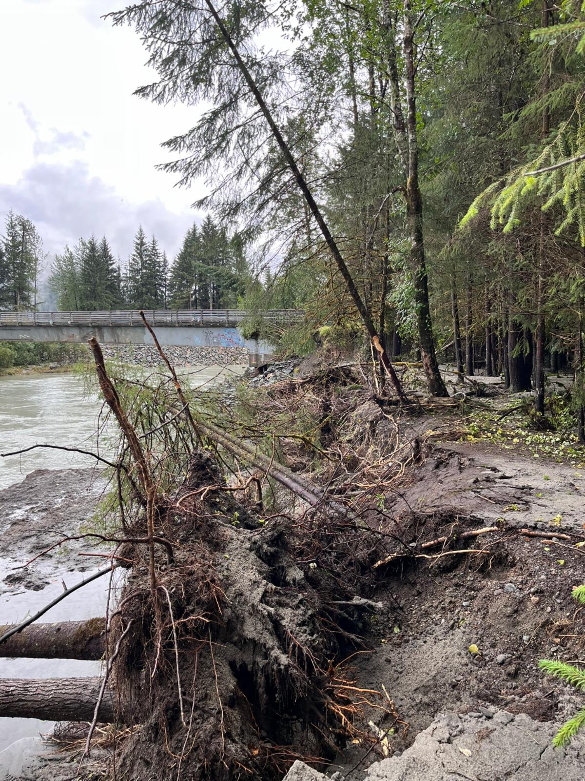
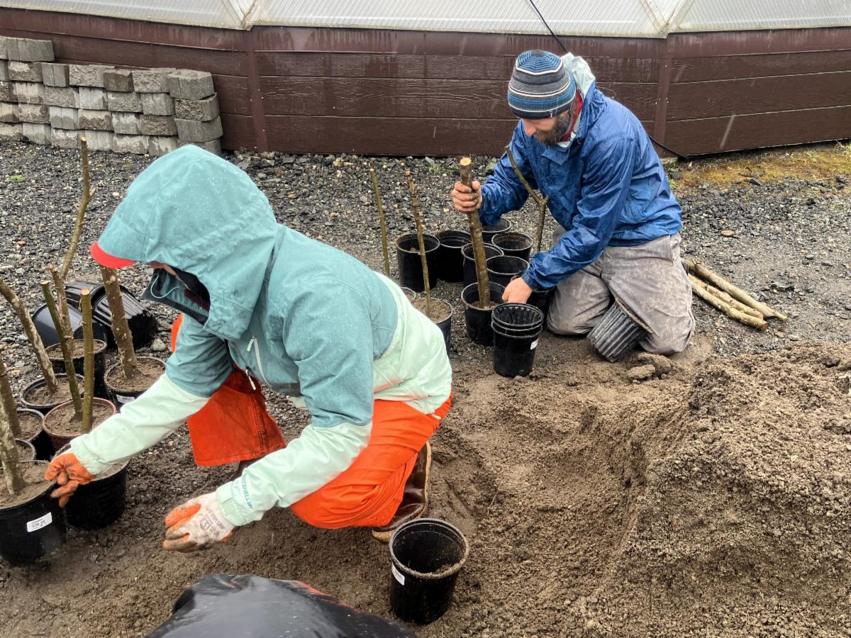
Closer to home, we kicked off on-the-ground work on our Transformative Restoration project for the Mendenhall watershed in Juneau. The goal of the project is to identify opportunities to integrate fish habitat into flood and erosion risk reduction along the river. This summer we began aquatic and terrestrial resource studies, stockpiled native plants to plant on top of riprap, and began design work for a nature-based bank stabilization project above the Dimond Park pedestrian bridge.
| | | Photo: Recent glacial outburst floods have severely eroded the bank upstream of the Dimond Park pedestrian bridge. We are working with the City and Borough of Juneau, NHC, and DOWL to design a bank protection strategy that integrates fish habitat features, protecting salmon and our infrastructure. | | Photo: In partnership with the Central Council of Tlingit and Haida Indian Tribes of Alaska, we potted willow cuttings at Taay Hit native plant nursery to supply riprap restoration projects early next year. | | |
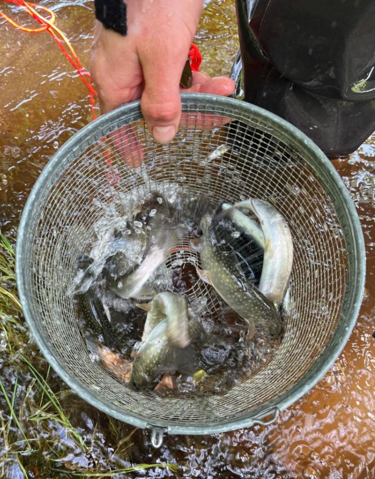
We also initiated a fish trapping and water quality study, in partnership with Alaska Department of Fish and Game Habitat Division staff, to better understand how juvenile salmon, Dolly Varden, and other resident fish use different habitats along the river throughout the year. This work will build on past studies to identify the most valuable habitat areas and how they might be protected or replicated. Discovery Southeast’s Richard Carstensen has been contracted to map riparian and floodplain habitats around the river to better understand the value of existing terrestrial habitat and how natural and human forces could alter them in the future. Funding for the Mendenhall project is provided by NOAA’s Habitat Conservation Division.
| | Photo: Juvenile coho, Dolly Varden, and stickleback were trapped in Dredge Lakes, an area with ephemeral surface water connection to the Mendenhall River. | |
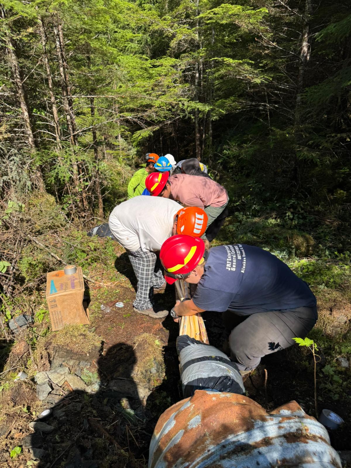
RESTORING WATERSHED CONNECTIVITY IN CUBE COVE
Field work at Cube Cove on Admiralty Island wrapped up at the end of September. This field season, we focused on blasting sections of old logging roads to reconnect disrupted stream channels in the Ward Creek watershed. The Cube Cove project was featured in The Guardian in August.
Photo: Forest Service, SAWC staff, and the Kootz Crew feed explosives into a culvert.
Thank you to Jamie Daniels, Roger Williams Jr., and Walt Washington from the Kootznoowoo Stewardship Crew, and Sean Rielly, Jack Greenhalgh, and the rest of our friends at the Forest Service for their hard work throughout the season. We also want to extend our appreciation to the US Fish and Wildlife Service, National Forest Foundation, Tongass National Forest, and HECLA for their support.
We’re excited to return to Cube Cove with the Kootz Crew in 2026 when we will shift our attention to the Lake Kathleen watershed.
| | | | |