|
2100 Thursday August 25
We had a long days run of about 58 nautical miles. Regretfully, there was very little wind, meaning we motored almost all of the day – over 11 hours from hoisting anchor at 0630 this morning. The goal was to reach our farthest north point for this summer. The push was well worth it. At about 1700 we entered the narrow twisting channel into Fogo Harbour on Fogo Island. I visited here 45 years ago; the island still has a magical charm.
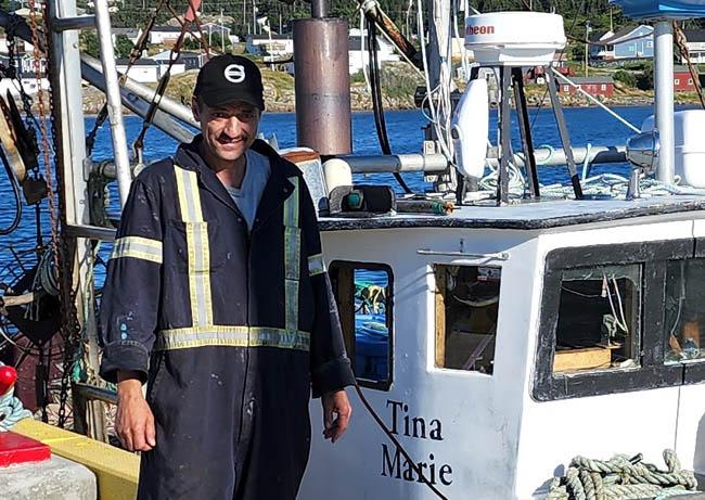
The only available wharf space we saw was at the fish processing plant – they mostly process snow crab and sea cucumber here since the crash of the cod fishery. On the pier was Derrick Bennet, a local fisherman waiting out the off season between crabbing and the next opening of the cod fishery on September 11th. Like all Newfoundlanders, Derrick was as friendly and helpful as could be. He assured us we could spend the night alongside; he then jumped off his boat, the Tina Marie, onto the wharf to catch our lines. He was curious where we came from, wanted to know about our lives. He suggested a place or two where we could get dinner ashore. A wonderful fellow!
Fogo Island is the largest of the outlying islands off of Newfoundland. It is about 16 miles by 8 miles and is perched at the beginning of Notre Dame Bay, the largest and most northern of Newfoundland’s big east coast bays. By the 1500s the Portuguese were doing seasonal fishing out of Fogo Harbour. I gather the island takes its name from the Portuguese word for fire. In time, the English would be take over this section of the coast. By the 1700s this region was known as the English Shore. The island’s isolation has meant that some islanders still have a touch of Elizabethan English or Irish accents. (Newfoundland has over 30 recognized dialects!) Understanding people is sometimes a challenge.
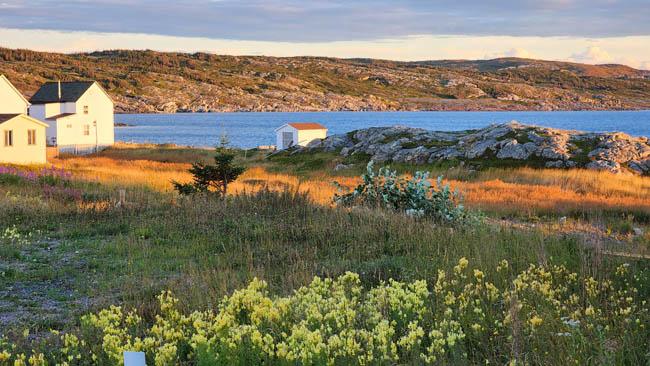
Today the island population is slowly declining as youth prefer to move away; now there are a little over 2,000 residents. Fogo Harbour itself is accessed through either of two narrow channels. Once inside, there is protection from storm winds of any direction. It is almost as if one is inside a huge bowl with dramatic, rocky hills and cliffs in every direction. David and I both agree it is the most picturesque and appealing of the ports we have visited.
Having arrived fairly late in the day, we plan to explore ashore in the morning before we think about moving on. This is a place to be taken in with thought, deep breaths and a pause. It feels really good. I am sharing one photo below from our walk back from dinner, which included yummy cod fritters.
Bill
|