|
Greetings!
It’s been a busy few weeks here at GCOOS, with new papers published, the beginning of the busiest part of hurricane season and planning for our Fall Members’ Meeting under way.
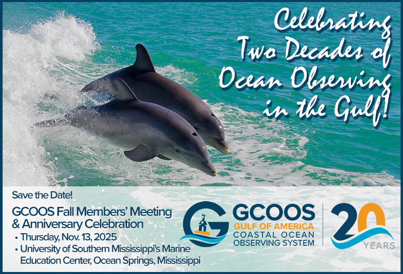
Please mark your calendars for Thursday, Nov. 13, and plan to join us at the University of Southern Mississippi's Marine Education Center in Ocean Springs, Mississippi, for our meeting. Afterward, we’re planning a special reception in celebration of GCOOS’s momentous 20th Anniversary, and we hope many of you will be able to attend.
We’re proud of GCOOS’s role in helping to build relationships and provide a structure for ocean observing in the Gulf — and certainly, after 20 years, we have much to celebrate!
The expansion of the high-frequency radar network and autonomous vehicle operations and piloting services, a better understanding of the Loop Current, support for the offshore energy industry and more and more ocean data coming in real-time and near-real time, means that our nation’s forecasting capabilities are much improved from where we started two decades ago. We’ve also seen amazing expansion in biological monitoring for the smallest organisms — like the Karenia brevis that causes red tides in our region — to the largest whales and rarest whales and other megafauna in the Gulf.
Some of the tools we use today, weren't even envisioned 20 years ago, and it will be exciting to see what the next 20 years hold!
Until next month,
| | Mark Your Calendar: GCOOS Fall Members’ Meeting & Anniversary Celebration | | |
We’re pleased to report that we’ve set the date for the GCOOS Fall Members’ Meeting and Anniversary Celebration! Please be sure to mark your calendars and plan to join us in person!
Details are still being finalized but we’re planning a great meeting with all the latest from the Gulf’s ocean observing community, followed by and evening reception to celebrate GCOOS’s 20th Anniversary.
- When: Thursday, Nov. 13, 2025
-
Where: University of Southern Mississippi's Marine Education Center, Ocean Springs, Mississippi
| | |
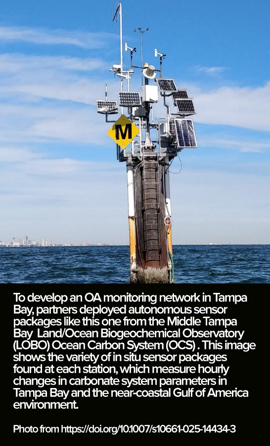
A new paper published in the journal Environmental Monitoring and Assessment Management — “Considerations for establishing a coastal acidification monitoring system from U.S. Coastal Acidification Networks” — provides an overview of decision-making considerations for entities interested in establishing local-to-regional scale ocean acidification observing systems.
The paper, which includes authors Dr. Kimberly Yates, GCOOS Board Chair, and Jennifer Vreeland-Dawson, former GCOOS-GCAN Coordinator, offers context-specific examples of effective decision-making processes from established OA observing networks in the U.S. The regional case studies outlined in the paper offer information on scientific questions, observing techniques and the methodology employed to establish and manage OA observations in the coastal zone.
-
Read the paper here
-
Citation: Wright-Fairbanks, E.K., Lord, N., Dugan, D. et al. Management considerations for establishing a coastal acidification monitoring system from U.S. Coastal Acidification Networks. Environ Monit Assess 197, 990 (2025). https://doi.org/10.1007/s10661-025-14434-3
| Webinar: Coastal and Ocean Acidification Communication in Aquariums and Zoos | |
The next GCAN-SOCAN-sponsored webinar has been scheduled for September and will focus on ocean acidification and the role that public education and outreach venues play in ocean acidification research and education. The webinar will feature:
- Katie St. Clair, Manager of the Sea Life Facility at Texas A&M University: “From Lab to Ocean: How Experimental Facilities Drive Marine Conservation Research”
- Dr. Kristen Ranges, Education Manager at Mote Marine Laboratory’s Science Education Aquarium: “Transforming Abstract Concepts into Applied Science Through Authentic Ocean Acidification Research”
- Jamie Lynn Lankenau Community Engagement Supervisor at Jacksonville Zoo and Botanical Gardens: “Building Resiliency in Northeast Florida through Climate Education at the Jacksonville Zoo and Botanical Gardens”
| | Alabama Buoy Back on Station | | |
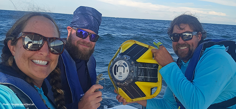
The Sofar Spotter buoy installed by the Dauphin Island Sea Lab as part of the Alabama Real-Time Coastal Observation System (ARCOS) is back in place after its mooring line was cut. The buoy reported its first off-watch message on Aug. 9 and could have been accidentally cut by a boater’s prop. Fortunately, the buoy was recovered the next day by the University of South Alabama and returned to the Lab.
By Friday, Aug. 15, the buoy was back on station about nine miles south of Dauphin Island, reports PI Dr. Brian Dzwonkowski. The buoy — the second-most visited station on the ARCOS website since its installation — was funded by GCOOS as part of the Supporting Coastal Resilience with Inflation Reduction Act supplemental NOAA-IOOS award. It collects and reports significant wave height, mean wave direction, surface water temperature and barometric pressure. NWS-Alabama requested the buoy to enhance their rip current advisories and validate their predictive models. Its data will be added to the GCOOS Data Portal.
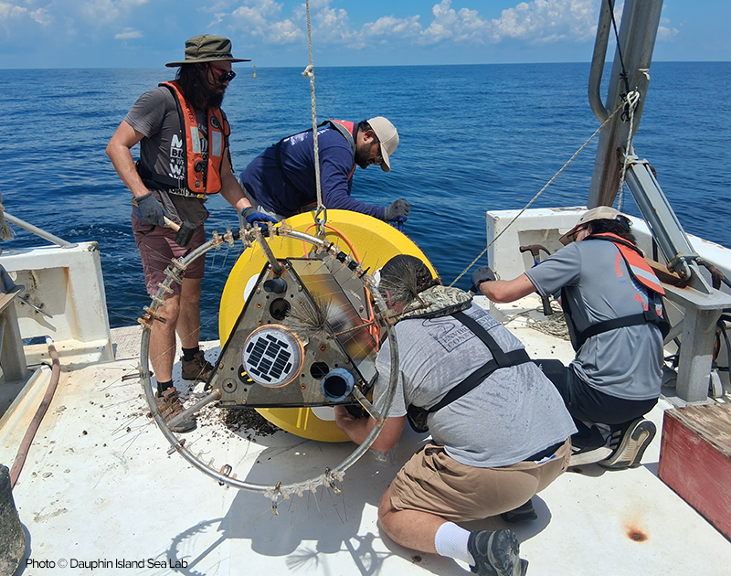
While bringing the Sofar buoy back to station, the DISL team also did some work on another nearby buoy located about one nautical mile east of the Sofar buoy that measures wind speed, direction, air temperature, relative humidity and barometric pressure, along with hydrographic parameters — water temperature, salinity and dissolved oxygen.
DISL is also working on adding a second GCOOS-funded Sofar buoy aimed at enhancing public safety south of Pensacola Beach. The deployment is pending permit approval.
| | Tracking the Season’s First Hurricane | | |
Erin became the first named hurricane of the 2025 season on Aug. 15 — going from a category 1 storm to a 5 in just 24 hours. By Thursday, the storm remained a Category 2 storm causing coastal flooding off North Carolina and Virginia. The National Hurricane Center called it a "sprawling" hurricane with tropical wind field more than 500 miles wide — making it larger than 90 percent larger than similar storms that have occurred in the same region.
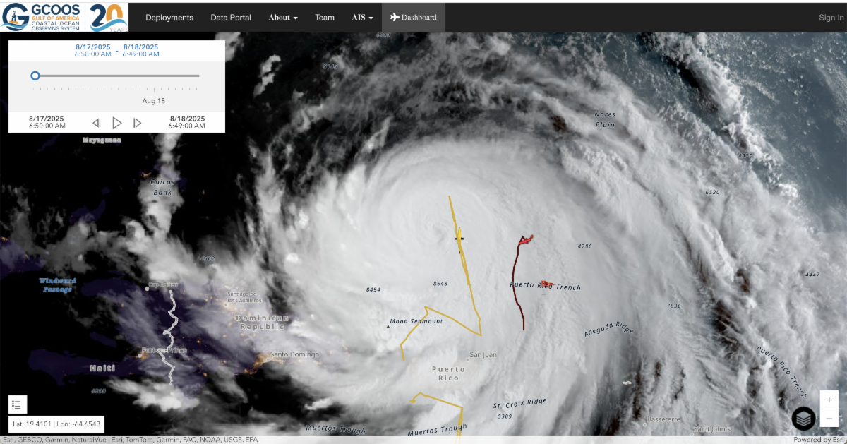
GANDALF, the GCOOS-developed autonomous vehicle tracking and piloting dashboard, is following two vehicles directly in the storm’s path near Puerto Rico: Seaglider SG668 operated by NOAA's Atlantic Oceanographic and Meteorological Laboratory (AOML) and a Slocum glider nicknamed Echo operated by Germany's Helmholtz-Zentrum. GANDALF is providing the visualization portal for the pilots, whose data supports forecast models.
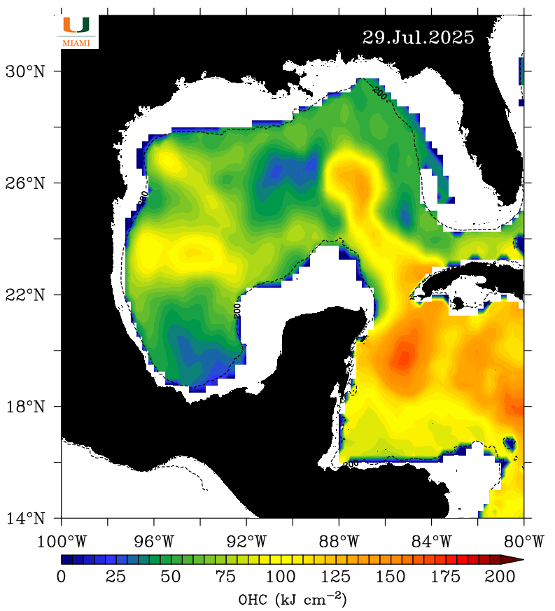
“It’s amazing to see how much heat content Erin consumed as it passed overhead, and the additions of temperature and salinity profiles by GCOOS’s Scientific Computing Specialist Xiao Qi are proving extremely useful for modeling,” said GCOOS Product Developer Bob Currier, who created GANDALF.
In addition to those gliders, GANDALF is tracking another nine Slocum and Seagliders operated by Texas A&M University, Mote Marine Laboratory, CICESE and Rutgers University. Be sure to bookmark the link to follow what we’re tracking throughout hurricane season!
| | Speaking of Hurricane Intensification… | | |
With Hurricane Erin cranking up intensity over such a short period of time — much the way Hurricane Ian did in 2022 — we asked GCOOS Board Member Dr. Nick Shay, Professor in the Department of Ocean Sciences and Director of the Upper Ocean Dynamics Laboratory/WERA Operations in the University of Miami’s Rosenstiel School of Marine, Atmospheric and Earth Sciences for his insights about the conditions needed for rapid intensification (RI). This is what he shared:
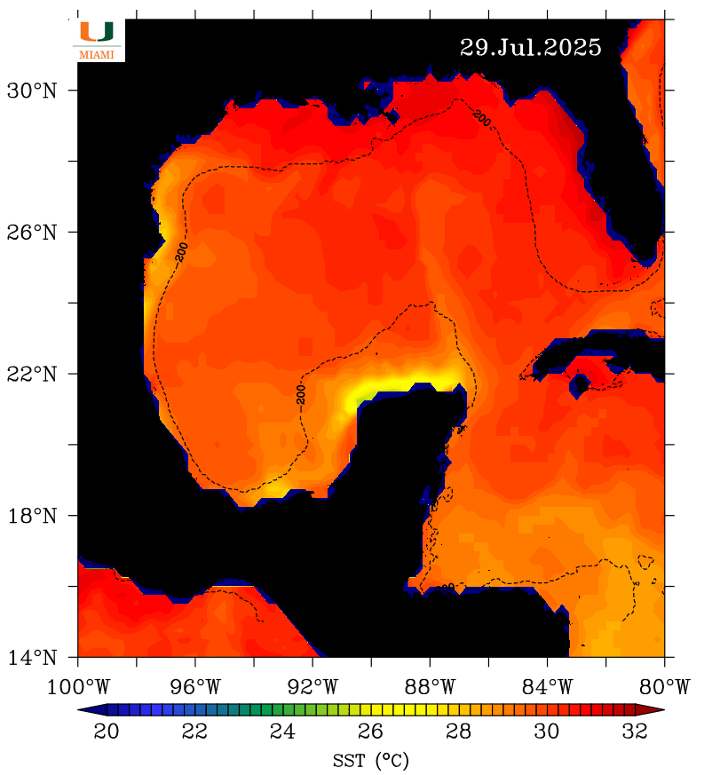
Rapid intensification (RI) involves several factors, including a well-developed inner core circulation, low to moderate shear in the atmosphere, moist air, a well-developed anticyclonic exhaust fan in the troposphere (similar to Michael in 2018 at landfall), air-sea interface fluxes of heat and moisture, and warm ocean temperatures.
RI doesn’t always occur despite having many of these key ingredients (typically 10 to 15% of the time). However, when conditions are right, storms can explode and deepen fairly quickly. The problem is that it often occurs within 24 to 36 hours of landfall, leaving little or no time for John and Jane Q Public to prepare.
An indicator of RI is associated with eyewall replacement cycles (ERCs) where storms go through a brief decrease in intensity as the inner eyewall begins to collapse and an outer eyewall develops. As time evolves, the outer eyewall becomes the new eyewall that moves closer to the center of circulation. Just like a skater on ice bringing their arms closer to their body to spin faster, winds accelerate as the outer eyewall moves closer to the center of circulation.
A second important aspect of the ERC is that the wind field broadens. Most of the really intense hurricanes go through these cycles, so it’s something to watch for. For example, Ian went through an ERC over the west Florida Shelf in 2022 (Irma in 2017 went through seven ERCs just prior to landfall in the lower Keys). We have found that successful ERCs often occur over the Loop Current and warm core eddies.
This issue of a broadening wind field cannot be overstated, especially when the forward speed of a storm decreases and coastal areas are subjected to strong winds for prolonged periods of time. Helene (2024) is such an example where the center of circulation was 150 to 200 miles from the coastline. However, strong tropical storm force winds over a prolonged period still induced a storm surge for residents along Florida’s west coast.
Hurricanes come in different flavors and no two are identical, yet they can induce significant damage from winds and surges (and severe weather).
| | |
Forecasters from NOAA’s National Weather Service have updated the number of expected named storms (winds of 39 mph or greater) this season to 13-18, of which five to nine could become hurricanes with winds of 74 mph or greater, including two to five major hurricanes with winds 111 mph or greater.
The adjusted ranges are for the entire season though Nov. 30, and are inclusive of the four named tropical storms that have already formed. In the Atlantic basin, a typical hurricane season will yield 14 named storms, of which seven become hurricanes and three become major hurricanes.
The likelihood of above-normal activity is 50%, a 35% chance of a near-normal season, and a 15% chance of a below-normal season. This updated prediction is similar to the initial outlook issued in May.
| During hurricane season, we add a special hurricane section to our enewsletter. If you’ve got a hurricane data highlight or other hurricane-related news you’d like to share between now and November, please email our communications lead, Nadine Slimak, at Nadine@VettedCommunications.com. | | Communicating Red Tide Risk | | |
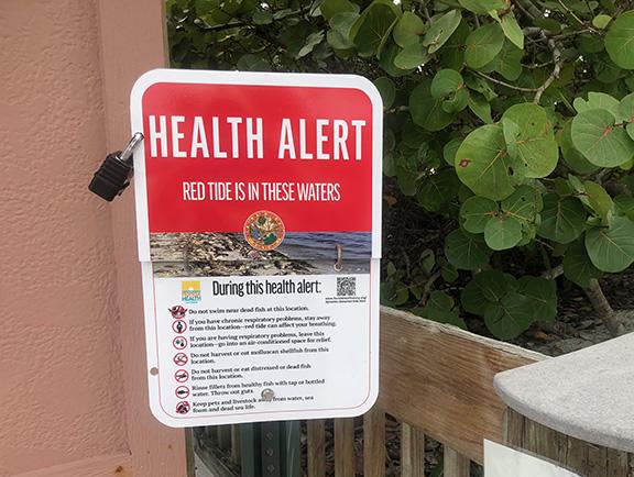
A new paper in the Journal of Environmental Management — “Can you just tell me-is it safe or not?” key challenges and lessons from communicators about red tide in Florida — provides a comprehensive overview of red tide messaging and strategies based on focus group discussions conducted with professionals from the natural resources and public health sectors who detailed, their communication challenges and successes.
The paper, which includes GCOOS Outreach and Education Manager Dr. Chris Simoniello as a co-author, offers new insights into how science and health professionals navigate challenges and offers a transferable framework for others aiming to enhance harmful algal bloom risk understanding, public preparedness and community resilience, including the idea that risk communication models must tailor their messages to local needs and communication channels. The work was part of a broader effort funded by the Florida Fish and Wildlife Conservation Commission (FWC) to evaluate red tide information needs and preferences, including how demographics influence communication effectiveness.
-
Read the paper
-
Citation: Elizabeth Staugler, Chris Simoniello, Madison Cordle, Paul Monaghan, “Can you just tell me-is it safe or not?” key challenges and lessons from communicators about red tide in Florida, Journal of Environmental Management, Volume 392, 2025, 126835, ISSN 0301-4797, https://doi.org/10.1016/j.jenvman.2025.126835.
| | Study Offers Recommendations for Sargassum Monitoring and Forecasting | | |
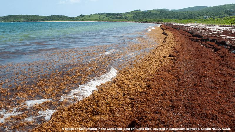
A new paper published in the journal Harmful Algae provides a model for key elements needed for operational monitoring and forecasting systems for Sargassum, a macroalgae that has caused recurrent seasonal coastal inundations in the tropical Atlantic since 2011. The paper includes co-author Dr. Chuanmin Hu, a GCOOS PI and Professor of Oceanography at the College of Marine Science, University of South Florida.
“Systems to monitor and forecast pelagic Sargassum inundation of coastal areas across the North Atlantic: present tools and future needs” reviewed 25 existing monitoring and forecasting systems, noting the unique aspects and common features among them and identifying the current gaps and provides specific recommendations for integrating improved monitoring and forecasting elements to the NOAA Atlantic Oceanographic and Meteorological Laboratory’s Sargassum Inundation Risk and Ocean Viewer interactive maps.
-
Read the study
-
Citation: Nathan F. Putman, R. Taylor Beyea, Emilie G. Ackerman, Joaquin Trinanes, Matthieu Le Hénaff, Chuanmin Hu, Rick Lumpkin, Systems to monitor and forecast pelagic Sargassum inundation of coastal areas across the North Atlantic: present tools and future needs, Harmful Algae, Volume 149, 2025, 102933, ISSN 1568-9883, https://doi.org/10.1016/j.hal.2025.102933.
| | |
Healthy Ecosystems & Living Resources
| | Mass Spawning in the Sanctuary | |
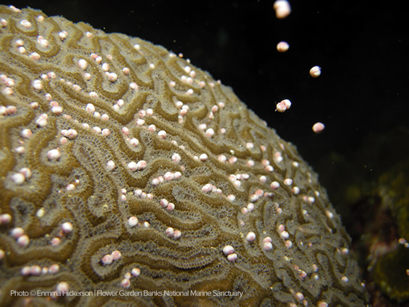
The Gulf community is proud to be home to one of the healthiest coral reef ecosystems in North America off the coasts of Texas and Louisiana in an area that makes up the Flower Garden Banks National Marine Sanctuary (FGBNMS). Events like the annual mass spawning that typically occurs late at night about a week following the full moon in August (which the M/V Fling by Texas Caribbean Charters reported on Aug. 15) are cause for celebration.
Several species, including boulder brain coral (Colpophyllia natans), great star coral (Montastraea cavernosa), lobed, mountainous and boulder star corals, all in the genus Orbicella, symmetrical brain coral (Pseudodiploria strigosa) and blushing star coral (Stephanocoenia intersepta) take part in the fantastic spawning display, which is among the most abundant displays in the entire Caribbean due to the high-density cover of broadcast spawning species in the sanctuary. Researchers have been documenting these events since they were first reported by divers in August 1990. Fast forward more than three decades and the cues that trigger the mass event have sparked curiosity and interest for many reasons. A combination of lunar and solar cycles, water temperature, and chemical and light cues are thought to influence the precise synchronicity across species in a given area. Timing is critical because the coordinated release allows for maximum benefit — specifically genetic mixing and dispersal of offspring over large distances, with the sheer volume of the event increasing the odds of fertilization and the survival of a significant number of larvae. Understanding the drivers of large-scale events like this are integral to the work of the Marine Biodiversity Observation Network (MBON) that aims to guide management decisions that protect the end-to-end life cycle of both individual organisms and entire ecosystems.
-
Learn more about coral spawning in the FGBNMS here
-
And check out video of the Aug. 15 spawning from the M/V Fling here
| | Protecting Sea Turtles and Restoring Populations | | |
The Open Ocean Trustee Implementation Group of the Deepwater Horizon restoration recently completed a project addressing juvenile sea turtle bycatch in the Gulf otter trawl shrimp fishery. In partnership with the fishery, the project team developed and tested modified turtle excluder devices (TEDs), finding that a reduction in bar spacing on the TED grid successfully excludes small turtles and maintains shrimp catch.
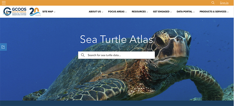
Another aspect of the Deepwater Horizon restoration process, is the Sea Turtle Atlas, a sea turtle data repository being developed by GCOOS with funding from NOAA via the Open Ocean Trustee Implementation Group. The dashboard is designed to provide more comprehensive access to sea turtle nesting and threat data and includes interactive reports, including a list of reported sea turtle interactions observed in southeast shrimp fishery vessels.
-
Check out the Sea Turtle Atlas here
| | Gulf Dead Zone Smaller Than Predictions | | |
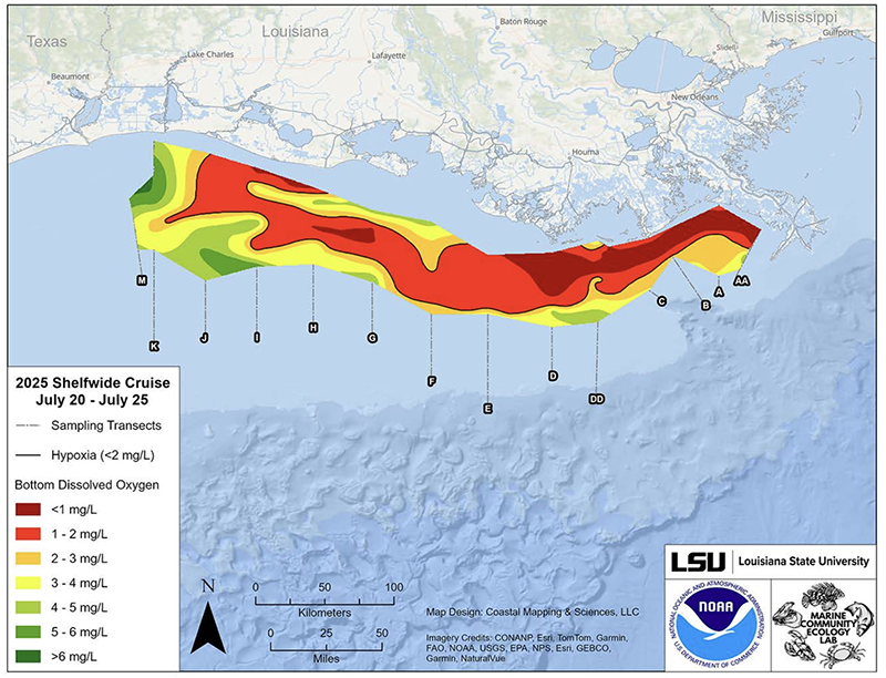
NOAA-supported scientists have announced that this year’s Gulf “dead zone” — an area of low to no oxygen that can kill fish and marine life — is approximately 4,402 square miles. This is 21 percent smaller than predications made in early June and the 15th smallest measurement on record. This equates to roughly 2.8 million acres of habitat potentially unavailable to fish and bottom-dwelling species, a reduction of 30% from the previous year.
Scientists at Louisiana State University (LSU) and the Louisiana Universities Marine Consortium (LUMCON) led the annual dead zone survey July 20-25 aboard LUMCON research vessel the Pelican. This annual measurement is a key metric that informs the collective efforts of the Mississippi River/Gulf of America Hypoxia Task Force, which has set a long-term goal of reducing the five-year average extent of the dead zone to fewer than 1,900 square miles by 2035.
| | |
The Marine Biodiversity Observation Network (MBON), is seeking contributions for Operational BioTrack, a NOAA-funded MBON project designed to assess and monitor biodiversity hotspots where marine species share habitat. By integrating satellite and acoustic tracking of marine animals with remotely sensed environmental data, and modeling techniques, BioTrack aims to map these biodiversity hotspots and their intersections with areas of human use and interest, such as marine sanctuaries and wind energy leasing blocks.
There are currently 50 PIs, contributing data on more than 70 species for development of aggregate maps like this one .
The current invitation for collaborators and coauthors includes two main ways to participate:
- Sharing of historical and/or ongoing tracking data under the BioTrack data-sharing agreement
-
Deployment of new tags provided by the project on priority species.
Interested participants should complete this form
A second effort is exploring how hyperspectral satellite ocean color data from NASA’s new Plankton, Aerosol, Cloud, ocean Ecosystem (PACE) mission can support animal telemetry research across NOAA. PACE has been providing global, hyperspectral ocean color data since early 2024, offering an unprecedented view of surface and near-surface marine conditions.
Collaborators interested in sharing recent telemetry datasets (2024–present) will help explore connections between animal movement patterns and environmental variability observed by PACE. In return, collaborators receive matched satellite data products for tagged individuals.
| | UG2 Webinar: Piloting Tips & Tricks | |
Save the date for the next webinar hosted by the Underwater Glider User Group (UG2): Piloting Tips & Tricks. Bring questions, share your expertise and discuss challenges with a panel of experienced pilots during an informal Q&A.
- When: 2-3:30 p.m. ET Aug. 28
-
Webinar link
| | |
National Marine Sanctuary Foundation (NMSF)
GCOOS Board Member Joins NMSF Panel
| | |
The NMSF has announced new members to its Board of Directors, including Dr. Ruth Perry, who has served on the GCOOS Board of Directors for about a decade. Perry is a leading ocean scientist and policy advisor with more than 15 years of experience in marine environmental strategy and ocean technology. At Shell, she leads global permitting and regulatory efforts and has pioneered initiatives that blend scientific research, industry innovation and responsible stewardship. She has served on numerous NOAA and National Academies advisory boards, including the Flower Garden Banks National Marine Sanctuary Advisory Council and the NOAA Science Advisory Board, championing ocean conservation and sustainable energy practices. Congratulations, Ruth!
| | |
NOAA
Gulf Name Change is Official
| | |
NOAA has announced a final rule to amend existing regulations to rename the Gulf of Mexico as the Gulf of America, consistent with Executive Order (E.O.) 14172. NOAA can make name changes in its own regulations consistent with existing law, but cannot modify the text of statutes enacted by Congress. There will remain limited statutory references to the Gulf of Mexico Fishery Management Council and Gulf of Mexico until or unless legislation is enacted to update statutes to reflect the Gulf of America name.
| |
Gulf of America Alliance (GOAA)
DWH Tracker Updated
| | |
The Deepwater Horizon Project Tracker, supported by the Alliance and Ducks Unlimited, received updates to streamline accessibility, reporting and increase user functionality. The project tracker allows users to track restoration, research and recovery projects resulting from the 2010 Deepwater Horizon oil spill. The new updates included a dashboard for better visualization and summary of selected filters, including funding program, total funding, project category and more within an area of interest. To date, it contains 1,976 projects representing $10,707,887,339 in Deepwater Horizon oil spill funding.
| |
-
Hello.gov - Sr. Cloud and Data Engineer
-
University of Miami: Assistant Professor in Physical Oceanography
- Mote Marine Laboratory
-
University of Louisiana at Lafayette – Research Associate; Water Quality Monitoring
Postdoctoral Positions:
-
Monterey Bay Aquarium Research Institute: Postdoctoral Fellowship
-
National Research Council: Research Associateship Programs Postdoctoral and Senior Research Awards
-
Mississippi State University: Postdoctoral Associate
-
Downeast Institute: Research Scientist
Fellowships:
-
Ph.D. Position: Florida State University (Deadline has been extended)
-
National Academies of Science, Engineering and Mathematics: Early Career Fellowships
- Department of Defense: Visualization of Coastal Data, Coastal Vulnerability Assessment Fellow
| |
-
National Academies of Sciences, Engineering and Medicine, Gulf Research Program: Environmental Literacy for Community Resilience
-
National Academies of Sciences, Engineering and Medicine, Gulf Research Program: Empowering K-8 Through Place Based Education
-
Gulf of Mexico Alliance: Increasing Participation in Clean and Resiient Marine Programs
-
Seagrant: Addressing Priority Research, Extenision and Education Needs
-
The National Academies of Sciences, Engineering, and Medicine: Early Career Research Fellowship
| | 18-20: UG2 Underwater Glider User Group, St. Petersburg, Florida, Details coming soon. | | Dr. Jorge Brenner, Executive Director • Marcus Ogle, Associate Director • Dr. Uchenna Nwankwo, Oceanographer • Dr. Chris Simoniello, Outreach & Education Manager • Dr. Renata Poulton Kamakura, Science Policy Fellow • Felimon Gayanilo, Systems Architect, Co-Data Manager • Bob Currier, Product Developer, Co-Data Manager • Tuomo Saari, Scientific Computing Specialist • Xiao Qi, Scientific Computing Specialist • Megan Howson, Marine Mammal Biologist and Data Scientist • Sandeep Jilla, Software Developer • Siobhan Kassem, Interim GCAN Coordinator • Grant Craig, Project Manager and HABscope Volunteer Coordinator • Nadine Slimak, Public Relations & Content Marketing, Vetted Communications, LLC • Laura Caldwell, Program Assistant | | | | |