|
Greetings!
Ocean observing activities will be heating up in the Gulf as we head further into hurricane season. While the season’s first tropical storm was named over Texas this week, the good news is that this season is expected to be less active than normal. We can all hope for the best, but in the meantime, the Gulf’s glider operators are getting the fleet ready. We expect most deployments will take place later this summer, when tropical storm and hurricane activity is typically at its highest.
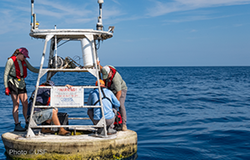
Crews — like the team from the University of South Florida’s Ocean Circulation Lab — are also servicing buoys in the region to make sure they’re in top shape for the season. Their work is especially meaningful, given the devastating fire USF’s marine sciences building suffered to lab and office space in May. We’re working to support our PIs there as we are able.
In the meantime, we continue to work with the IOOS Association to champion ocean observing activities in the Gulf and across the U.S. Later this month, we’ll be heading to Washington D.C. for a Congressional briefing on the importance of the system and urging our federal lawmakers to include funding for NOAA and the IOOS system in the FY2027 budget. A new study looking at what would happen if ocean observing systems — not just here in the U.S. but across the world’s oceans — were to be abandoned provides a stark reminder of the important work that we do and the risks we face without robust ocean observing capabilities in place.
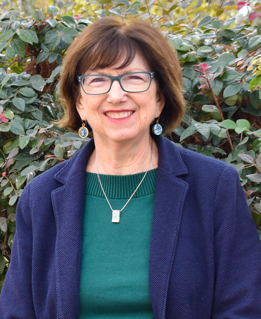
I also wanted to take a moment to recognize Dr. Nan Walker, GCOOS Board Member and a long-time contributor to the Gulf’s ocean observing system, who officially retired from Louisiana State University this month. She helped to champion the importance of satellite observations and has spent more than three decades working to improve our understanding of physical processes and air-sea interactions in the Gulf. She also helped to train the next generation of scientists so that they may carry this important work forward. We’re glad that Nan will continue to serve on the GCOOS Board and continue to share her knowledge and experience to help guide ocean observing in the Gulf!
Until next month,
| | GCOOS Heads to D.C. for Ocean Data Day | |
On Wednesday, June 24, GCOOS will join the IOOS Association and members of the nation’s other regional associations on Capitol Hill for a special briefing exploring how IOOS data and tools support coastal communities and the nation’s seafood economy in advance of Ocean Data Day.
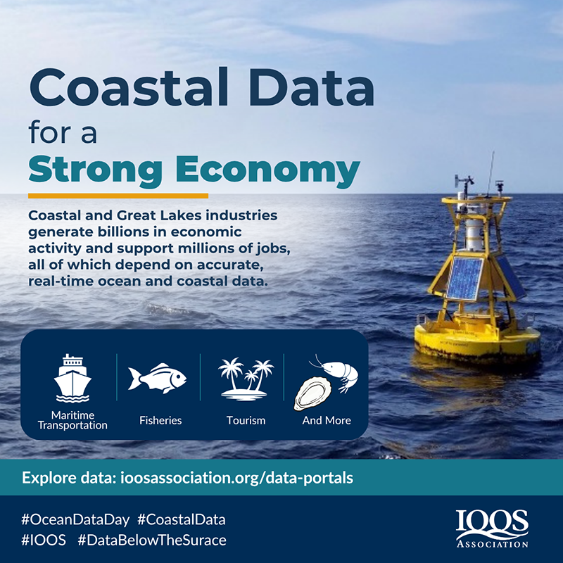
Ocean Data Day, observed annually on June 25 during World Ocean Month, highlights the value of ocean, coastal, and Great Lakes data to our economy, environment and public safety. This year's theme — Coastal Data for a Strong Economy — underscores how ocean and coastal data power economic activity, from guiding vessels safely into port to informing fishing operations and supporting coastal businesses. The briefing will bring together seafood industry leaders and regional partners to share how ocean observations and forecasts support their operations, strengthen coastal economies, and inform decisions from shellfish farms to commercial fishing fleets.
During the briefing, GCOOS will also present the Ocean Hero award to House Representative Mike Ezell (R-Mississippi) for his steadfast support of the nation’s ocean and coastal observing system and his introduction of bills to renew Congressional reauthorization of the act that created the U.S. Integrated Ocean Observing System.
-
Click here to learn more about Ocean Data Day and find resources you can share on social media and across your network
- Congressional briefing details: 3-5 p.m. ET, Wednesday, June 24 Rayburn House Office Building, Room 2060, 45 Independence Ave SW, Washington, DC 20515
| | Congratulations to GCOOS Board Member | |
 | | GCOOS offers its congratulations to Dr. Nan Walker, GCOOS Board Member and Principal Investigator, who officially retired on June 16 after more than 30 years on the faculty of Louisiana State University. Dr. Walker served as an LSU faculty member in the Coastal Studies Institute and the Department of Oceanography and Coastal Sciences, where she taught graduate and undergraduate courses, advised Master’s and Ph.D. candidates and has directed the Earth Scan Laboratory (ESL) since 2003. She transformed the lab into a well-recognized center for satellite remote sensing and coastal research and her work in satellite tracking and hurricane monitoring has been instrumental in advancing understanding of severe weather and supporting emergency response efforts across the Gulf Coast. Dr. Walker specializes in using satellite data to advance the understanding of physical processes and air-sea interactions, and has conducted research in the Gulf of Mexico, Florida Keys/Bahama Bank region, the southern African region and the Caribbean Sea. Her research interests have included Loop Current eddy circulation, air-sea interactions related to hurricanes and winter storms, estuarine-shelf exchange processes, surface sediment transport, coastal upwelling, and ocean climatology. Most recently, she focused on understanding Loop Current frontal eddy cyclone impacts on circulation and on ocean-atmosphere interactions that impact hurricane intensity changes.
She and ESL system manager Alaric Haag became involved with GCOOS even before it was officially a regional IOOS association, dating back about 25 years. From its earliest days in the 1990s, the ESL provided surveillance of hurricanes and ocean/coastal currents in support of safe oil and gas activities in Gulf.
In retirement, she plans to continue supporting GCOOS with satellite image products and looks forward to having more free time to travel, visit friends, visit her daughter's family and 6-year old grandson in Richmond Hill, Georgia. Nan says she looks forward to finally attending GCOOS board meetings in person, since teaching responsibilities will no longer conflict with GCOOS meetings and she will continue to serve on the GCOOS board through (at least!) 2028. Congratulations Nan!
| | GCOOS Begins Development of New Decision-Support Platform | |
GCOOS is pleased to announce a new partnership with Tetra Tech, which will develop a new OceansMap to be deployed for GCOOS as a cloud-based metocean data and decision-support platform designed to bring together a wide range of marine and coastal information in one dynamic environment.
The system will serve as a Gulf-centric hub for discovering, visualizing, and analyzing environmental data, combining real-time observations, historical records, model predictions, and contextual GIS layers to support better situational awareness and more informed operational decisions.
The new GCOOS OceansMap is expected to launch this fall.
Initially, OceansMap will prioritize regional and national datasets that are most relevant to Gulf operations and stakeholder needs, including GCOOS-hosted observation networks, modeled products, contextual GIS layers, weather radar and more. The platform will also support a catalog structure that makes data easy to organize, browse and use, with observation stations grouped by source and model layers organized by key variables of interest to GCOOS stakeholders. OceansMap is designed to be scalable, modular and “future-proof,” allowing new data services, tools and functionality to be added over time without forcing a major rework of the platform.
In addition to the data catalog, Tetra Tech will work with GCOOS and stakeholders to develop custom insights tailored to stakeholder priorities. These insights will help translate complex oceanographic data into practical, actionable information that can be shared through the OceansMap platform and referenced on the GCOOS website. GCOOS data will continue to be accessible via data services in ERDDAP and other platforms.
Overall, the project will deliver a secure, flexible, and operational OceansMap deployment that strengthens collaboration, improves access to critical metocean information, and supports planning, monitoring, and response across a wide range of Gulf-focused applications.
| | Ocean and Coastal Acidification Workshop Series | | |
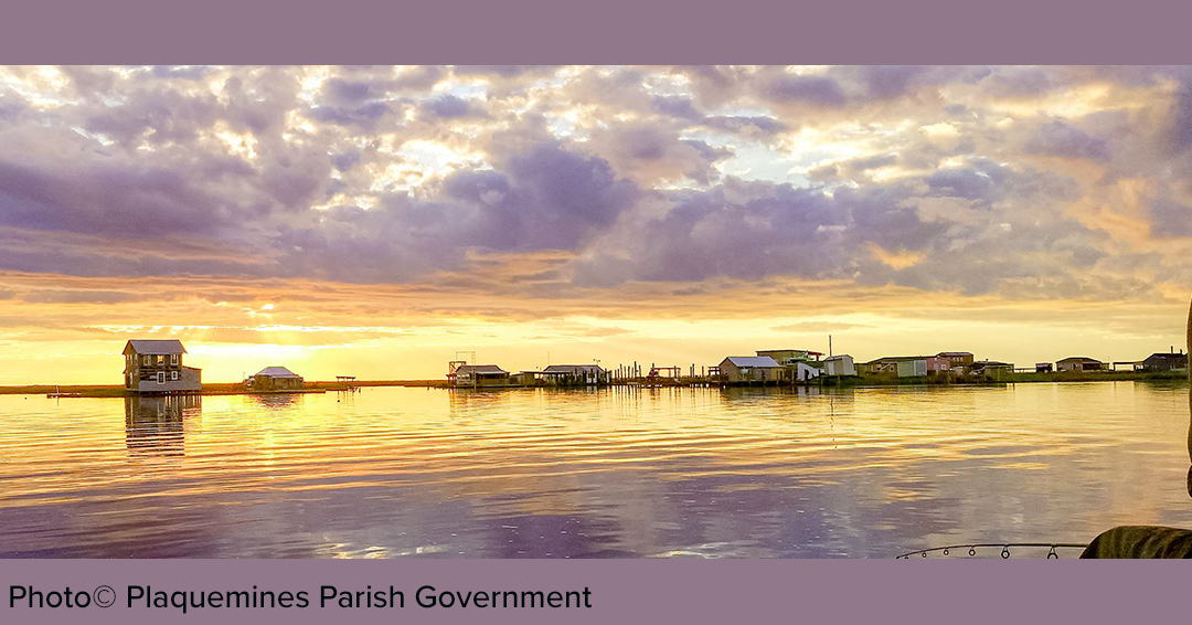
Louisiana State University and the University of Louisiana Lafayette hosted the first session of a workshop series on Ocean and Coastal Acidification this month in Port Sulphur, Louisiana. Through NOAA grant support, LSU and ULL partnered with Plaquemines Parish Government to help participants understand OCA impacts to fisheries and coastal communities through knowledge sharing, partnerships and community action. The grant also helped to provide a stipend for up to 30 attendees. Additional workshops are planned to take place between August and October — so watch this space for details!
-
Learn more about the project here
| |
|
Did you know that the Gulf of America Acidification Network (GCAN) hosts webinar series on ocean and coastal acidification? We’re planning the next one for later this summer, but in the meantime, you can visit our website to watch recordings of previous webinars.
-
Click here to visit the archives
-
Would you like to present an OCA-related webinar? Email Dr. Natalia López Figueroa Natalia.lopez@gcoos.org, GCAN Coordinator and National Academies of Sciences Policy Fellow at GCOOS.
| | 19 Million+ Historic Hypoxia and Nutrient Gulf Records Now Validated | |
In early 2013, GCOOS consolidated hypoxia and nutrient datasets originally collected by the Department of the Interior's Minerals Management Service (MMS), which was reorganized into three agencies in 2010. These datasets, spanning 1922 to 2014, were collected from 31,332 sampling sites across the Gulf and published on the GCOOS data portal in late 2014. The compilation of more than 19 million historical data records was initiated by the late Dr. Matthew Howard, who served as Data Manager for GCOOS.
In early 2026, GCOOS revalidated the dataset, culling all entries containing invalid inputs such as incorrect dates, null values or unrealistic measurements. Today, the current dataset includes 19,907,246 newly validated records from across the Gulf that can provide users with a historic picture of important water quality parameters and the ability to discover how they have changed over time.
Due to the large file sizes, data are organized separately by observed parameter: chlorophyll-a concentration, dissolved oxygen concentration, enterococcus abundance, fecal coliform counts, nitrogen species (nitrite, nitrate, ammonia, and organic nitrogen) concentration, pH, dissolved total phosphorus concentration, salinity, water temperature and silicate concentration.
-
To download the data, visit the GCOOS ERDDAP here
- Users are encouraged to check the file sizes before downloading the data, as most data are over 100 MB.
- Because we are unable to notify users of the previous collection of these changes, we’re also asking the community to share news of this update with colleagues.
-
Relevant read: NOAA is forecasting an above-average deadzone — 7,027 square miles — at the mouth of the Mississippi River in the Gulf. This annually-forming hypoxic zone is primarily a result of excess nutrient pollution from human activities in cities and farm areas throughout the Mississippi-Atchafalaya watershed. Click here for details
| | |
Coastal Hazards/Hurricane Season
| |
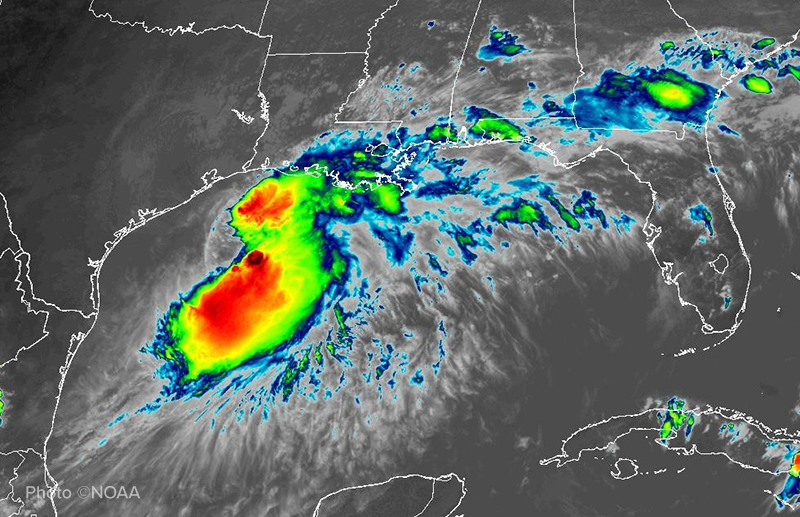
Some good news for the Gulf and Atlantic region, even as the National Hurricane Center is tracking the season’s first tropical storm, Arthur: Forecasters are predicting a below-average hurricane season in 2026.
-
Colorado State University hurricane researchers are predicting 11 named storms, with five anticipated to become hurricanes and two to become major hurricanes (Category 3 or higher).
-
NOAA’s National Weather Service is forecasting eight to 14 named storms with three to six anticipated to become hurricanes, including one to three major hurricanes.
An average season has 14 named storms with seven hurricanes, including three major hurricanes.
In the Gulf, researchers are getting gliders ready for the season, with GCOOS-funded deployments expected to be focused on the late summer/early fall when hurricane activity typically ramps up. Underwater glider pilots from Texas A&M University’s Geochemical and Environmental Research Group, Mote Marine Laboratory, University of South Florida, University of Southern Mississippi and the Dauphin Island Sea Lab work together across the Gulf to deploy gliders to gather information needed to inform meteorological models and storm predictions. Operators will focus on collecting in-situ data within ocean features ahead of storms so that information can be assimilated into National Weather Service models. Of particular importance is gathering temperature and salinity data.
Ahead of the season, GCOOS has created a special “Hurricane Resources” web page that brings together key forecasting information and data sources to help you stay ahead of the storms. The page also includes a link to GANDALF, the glider piloting dashboard developed by GCOOS that allows you to see the glider data being collected in near-real time throughout the deployment season.
| Readying for Hurricane Season Despite Adversity | |
Not even a catastrophic fire that destroyed the offices and lab spaces of long-time GCOOS partners at the University of South Florida can stop their ocean monitoring data from flowing. Less than two weeks post-fire, researchers from the USF Ocean Circulation Lab (OCL) headed offshore aboard the R/V Tocobaga ahead of hurricane season to service buoys equipped with sensors needed to help forecast storm surge, rapid intensification and other key hazards associated with tropical storms.
For decades, the lab has acquired data used to inform high resolution models that forecast the movement of water along Florida’s west coast and in Tampa Bay. OCL director Dr. Yonggang Liu uses the suite of sensors to validate model forecasts that have proven invaluable across a range of critical events, including hurricanes Ian and Idalia, tracking wastewater discharge following the Piney Point spill in Tampa Bay, aiding local forensic investigators searching for bodies in the Bay, and predicting where and when red tide is likely to be encountered. OCL’s activities continue to demonstrate the value of sensor-validated models and the societal importance of high-resolution forecast capabilities that protect lives, property and the environment.
| Earth Scan Lab Launches New Website | |
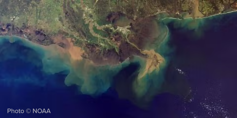
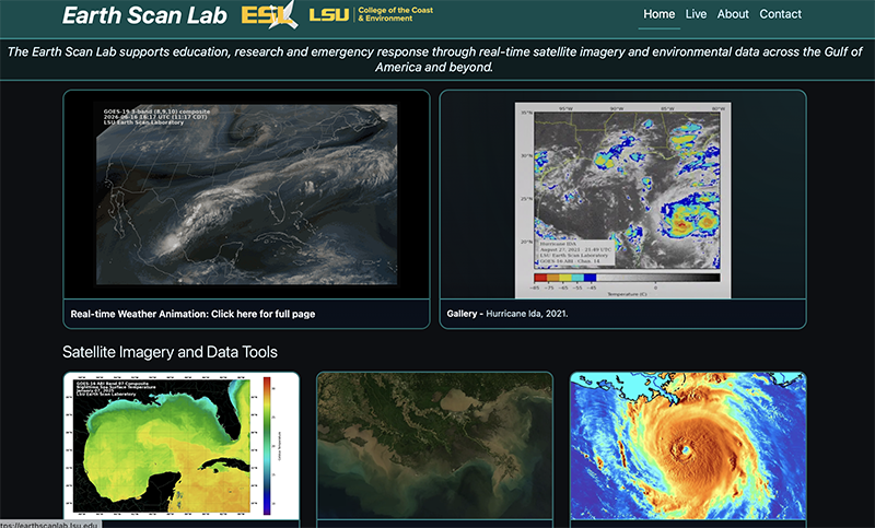
Louisiana State University’s Earth Scan Lab has launched its new website, just in time for the start of the 2026 hurricane season. On the new site, users can visualize hurricanes approaching the coast in real-time, explore Gulf sea surface temperatures defining the Loop Current and warm eddies, study the motion of sediment-rich flood-waters during Mississippi and Atchafalaya river floods and explore new interactive tools showcasing coastal, oceanic and atmospheric conditions across the Gulf of America and beyond.
| New Study Demonstrates Value of HFR | |
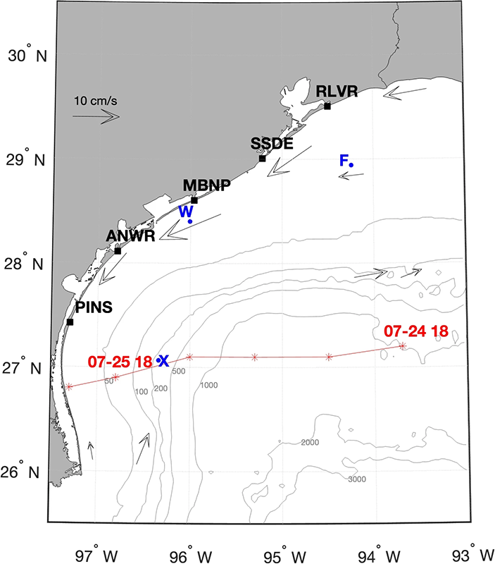
A new study led by Dr. Uchenna Nwankwo, GCOOS Oceanographer, and colleagues at Texas A&M University, the University of Southern Mississippi and the U.S. Coast Guard demonstrates that modern coastal high frequency radar systems provide a much clearer and more reliable picture of how water moves along the Texas coast, improving our ability to monitor, predict and respond to ocean and coastal events.
“Review of the Texas shelf currents using high frequency radar surface currents data” in the journal Ocean Dynamics, shows that HFR networks are becoming an essential tool for tracking currents that influence fisheries, harmful algal blooms, oil spill response, marine transportation and coastal resilience.
For many years, ocean conditions were monitored mainly using a limited number of offshore buoys. The high-frequency radar network can observe and record surface currents over a much larger area, from nearshore waters to beyond the continental shelf. This broader view helps scientists track circulation patterns, pollutant transport, harmful algal blooms, oil spills, and search-and-rescue operations more effectively. The team also found that older radar data needed more consistent quality control. But by reanalyzing and correcting the historical measurements using modern standards, they created a more reliable long-term record of Texas shelf currents. This improved dataset can help scientists better understand long-term changes in Gulf circulation and support forecasting and coastal management decisions.
-
Citation: Nwankwo, U., Nechaev, D., DiMarco, S. et al. Review of the Texas shelf currents using high frequency radar surface currents data. Ocean Dynamics 76, 57 (2026). https://doi.org/10.1007/s10236-026-01813-8
- Read the paper
| WebCOOS Grows with Newest Gulf Installation | |
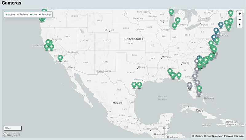
We’re pleased to share the news that GCOOS, in collaboration with the Southeast Coastal Ocean Observing Regional Association (SECOORA), has installed two additional web cameras in Alabama intended to support rip current monitoring. The cameras are the region’s latest and have been deployed as part of the Webcam Coastal Observation System (WebCOOS) being implemented nationwide by SECOORA with NOAA funding.
The network supports quantitative scientific analysis, public safety and resource management for coastal municipalities, scientists and local communities. WebCOOS includes cameras across all 11 of the IOOS regional associations.
The newest cameras in the Gulf region are located in Orange Beach, Alabama, on the Phoenix Gulf Towers and include west and south views. Other Gulf cameras are located on the Pier Lab in Aransas Pass, Texas, the point of access to the Port of Corpus Christi — the largest crude oil export gateway in the U.S. — and on the Tidewater Beach Resort at Panama City Beach, Florida.
|
New Study Highlights Vulnerability of Global Ocean Observing Network | |
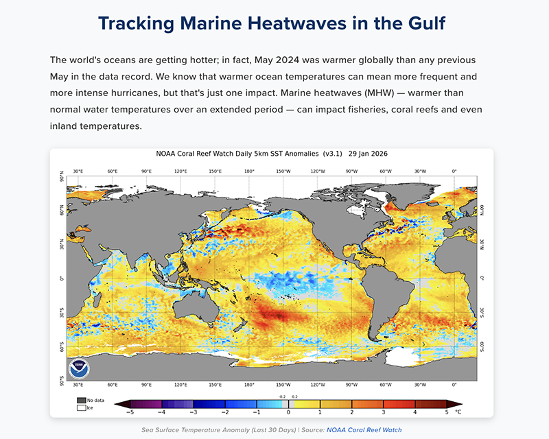
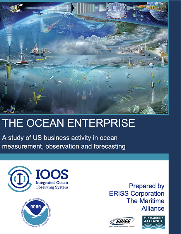
A new study from the journal Nature Climate Change that looked at the world’s ocean observing network highlights for the first time how vulnerable it is to policy and economic issues and what could be lost if parts of the system were allowed to degrade or were removed altogether. At particular risk, according to the paper “Critical dependence of global ocean heat monitoring on the ocean observing system,” are data that measure ocean heat content.
These data underpin understanding of climate variability, including El Niño and long-term climate change, and enable tracking sea-surface temperatures, including marine heatwaves that have direct impacts on weather and marine ecosystems. The loss of such data would also impact the accuracy of shorter-term weather predictions.
To assess how the degradation of the Global Ocean Observing System could affect climate monitoring, the authors used ocean heat content (OHC) as an integrated metric and conducted random data-removal experiments in which 20%, 40%, 60% and 80% of existing observations were removed to mimic plausible observing-system degradation. The “removal” was done separately for instrument type to account for their distinct deployment and sampling characteristics.
The authors also considered the consequences resulting from the degradation of parts of the system operated by the five countries that contribute the most observing data: the U.S. (53%); Australia (17%), Japan (5%), France (5%) and Germany (3%). They also considered the contribution (12%) of all the countries in the European Union.
Because the U.S. observations have the widest geographic coverage, the loss from its data would have an outsized — 163% — increase in the relative error of the global annual OHC estimate resulting in severe degradation of the ocean warming signal.
“Taken together, our results emphasize that GOOS is a global endeavor with inherently shared responsibilities and distributed benefits,” the authors write. “Ensuring its long-term adequacy will depend on durable international coordination, contributions that scale with capacity and a collective recognition that nations depend on the state of the global ocean, not only on the portion of the ocean close to their own coastlines.”
-
Citation: Zhu, Y., Cheng, L., Trenberth, K.E. et al. Critical dependence of global ocean heat monitoring on the ocean observing system. Nat. Clim. Chang. 16, 657–660 (2026). https://doi.org/10.1038/s41558-026-02661-6
-
Read the study
Relevant Reads
| | New Literature Review: Potential Impacts of Marine Heatwaves | | |
The term “marine heat wave” is a relatively new one, just coming into use in the scientific literature around 2010; today MHWs are generally understood to be “five or more days of temperatures warmer than the 90th percentile based on a 30-year historical baseline” but debate remains on whether the definition is equally applicable across different regions of the world. That’s because MHW can vary by their cause and intensity depending on location. Their impacts can also vary widely, even among similar species, based on those same parameters.
A new paper “Review of potential impacts of marine heatwaves in the Caribbean, Gulf, and Southeastern U.S” published this month in the journal Environmental Research Communications by lead author Dr. Renata Kamakura, former National Academy of Sciences Policy Fellow at GCOOS, and other GCOOS authors and colleagues summarized an extensive literature review on the potential impacts of extreme water temperatures in the Caribbean, Gulf and Southeastern U.S. The review is focused on impacts to weather, including coastal temperature, humidity, severe thunderstorms and hurricanes; and marine species, including corals, micro- and macro-algae, seagrasses, oysters, clams, urchins, crabs, finfish, seabirds, sea turtles and marine mammals.
It found that the extent and intensity of MHW impacts in the region are relatively well understood for hurricanes and corals but impacts on other species and processes — including the interactions between marine heat waves and heatwaves over land — remain widely under-studied. It also found few, if any, regional studies of MHW impacts, making it challenging to identify whether MHW impacts seen elsewhere are likely to occur in the Gulf, Southeastern U.S. and Caribbean.
“The impacts of MHWs in the Caribbean, Gulf, and Southeastern U.S. remain unclear for numerous important taxa, especially for mobile species, and would benefit from more MHW-focused research,” the paper concludes.
-
Citation: Kamakura, R. P., Simoniello, C., Rao, D., Dzwonkowski, B., Qi, X., Howson, M., & Brenner, J. (2026). Review of potential impacts of marine heatwaves in the Caribbean, Gulf, and Southeastern U.S. Environmental Research Communications, 8(6), 062002. https://doi.org/10.1088/2515-7620/ae78b5
-
Read the paper now
-
Dive in: Kamakura and colleagues also developed a series of white papers “Marine Heatwave Impact Reports” (available in English and Spanish) about MHW impacts on individual species and weather systems, and GCOOS has also developed a MHW data analysis tool. Check them out here
| | NOAA Gulf of America Forum Webinar Highlights GCOOS MHW Tool | | |
Speaking of the MHW Dashboard: GCOOS Scientific Computing Specialist Xiao Qi presented the June NOAA Gulf of America Forum webinar, which introduced the new interactive GCOOS Marine Heatwave Analysis Tool that brings together marine heatwave reports, recent news, buoy data, and high-resolution satellite data to show both current and historical marine heatwave conditions. Users can explore marine heatwave events, compare different detection methods, view temperature anomalies, and examine event statistics at specific locations. The webinar also highlighted a new AI assistant designed to help users ask questions, understand the data, and explore the tool more easily.
Together, these features make marine heatwave information more accessible and useful for researchers, resource managers, educators, and stakeholders interested in coastal ocean conditions and climate-related impacts.
The launch of the tool is very timely as severe MHW events are becoming more frequent and intense, with potential impacts to marine ecosystems, fisheries, coastal communities, and severe weather.
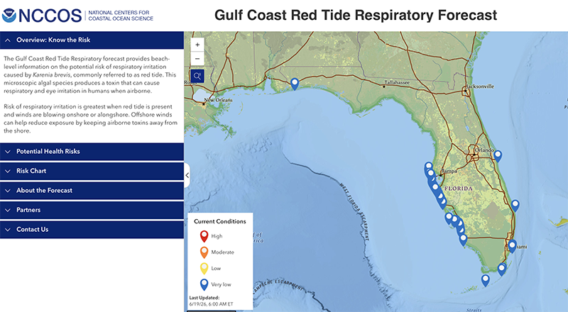
| | Red Tide Respiratory Forecast Fully Operational; Moves to NOAA-NCCOS | |
The Red Tide Respiratory Forecast, initially developed by GCOOS in partnership with NOAA's National Centers for Coastal Ocean Science (NCCOS), the Florida Fish and Wildlife Conservation Commission-Fish and Wildlife Research Institute (FWC-FWRI) and Pinellas County Environmental Management, is now fully operational and has moved to a new full-time home at NCCOS.
The forecast was developed through funding from the NASA Health and Air Quality Program and the “Monitoring and Event Response for Harmful Algal Bloom (MERHAB)” program as part the U.S. IOOS and a nationwide effort to improve monitoring of and response to harmful algal blooms (HABs) along U.S. coasts.
Now known as the "Gulf Coast Red Tide Respiratory" forecast, it continues to provide beach-level information on the potential risk of respiratory irritation caused by Karenia brevis, commonly referred to as red tide.
|
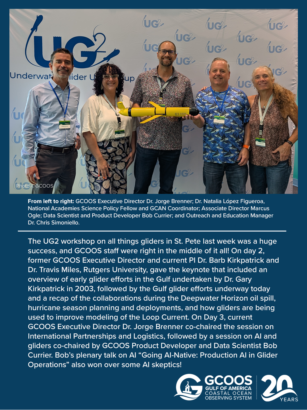
| The UG2 workshop on all things gliders in St. Pete in May was a huge success and GCOOS staff were right in the middle of it all! | | |
The call for abstracts for the 6th Ocean Radar Conference in Asia-Pacific (ORCA-2026) is now open. The conference will be hosted by the International Centre for Interdisciplinary Science Education (ICISE) in the city of Quy Nhon, Central Vietnam, Oct. 19-22, 2026.
The International Summer School on Oceanographic Radar Applications in Marine Sciences (ISSOR-2026) will occur in conjunction with ORCA-2026 and take place Oct. 20-23 in the same location. The focus of the Summer School is to bring together users of HFR remote sensing products in the field of marine science, including students and researchers in oceanography, engineers from public institutions and private companies, who wish to develop or deepen their expertise in the use of oceanographic radars for marine science applications. Scientific, technical, and operational aspects of radio-oceanography will be addressed through plenary and thematic sessions, as well as through training sessions.
-
Click here for details and abstract submission
- Abstract submission deadline is Sept. 5
| | |
Healthy Ecosystems and Living Resources
| | |
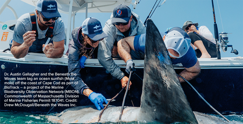
The Southeast U.S. MBON project continues to provide support for research activities that include the collection, analysis and processing of multiple NASA satellite data streams, collection of samples and radiometric observations during cruises conducted every two months off South Florida and in the eastern Gulf, and conducting extensive analyses of the biogeography of the region, including within the National Marine Sanctuary System, to understand how large-scale changes may be affecting national waters.
The project advances and validates the Seascape Pelagic Habitat Classification (SPHC) projects that combine satellite data from multiple sensors to routinely and automatically map surface ocean biogeographic regions (e.g., seascapes).
These products now include the hyperspectral PACE sensor and the Moderate Resolution Imaging Spectrometer (MODIS-Aqua) to understand anomalies and trends in marine biogeography. MBON SPHC products that identify spatially explicit water masses with particular biogeochemical features as eight-day composites at a 5 km spatial resolution are available on the NOAA Coastwatch website.
| | |
NOAA/IOOS
Seeking Input on Continuation of Economic Survey
| | |
NOAA and IOOS are seeking public comment on the continuation of a web-based survey designed to gather information on the U.S. ocean enterprise. The survey provides critical assessment data and is necessary to collect demographic, financial, and functional information for organizations with regards to their involvement with the IOOS. Data from the web survey will be analyzed and used to produce a report demonstrating the size and economic impact of the IOOS enterprise to the United States marine ocean sector.
-
Review past reports here
-
Learn more and submit comments here
| | |
NOAA
Nominations Sought for Ocean Exploration Advisory Board
| | |
NOAA is seeking nominations to fill vacancies on the Ocean Exploration Advisory Board (OEAB), which advises NOAA leadership on priority areas for survey, discovery and opportunities for collaboration and partnerships. The board role includes development of a five-year strategic plan for the fields of ocean, marine, and Great Lakes science, exploration and discovery. Members are appointed by the Under Secretary of Commerce for Oceans and Atmosphere, and NOAA Administrators and include representation among scientists, engineers, educators, and science policy experts reflecting the breadth of NOAA's areas of responsibility. Members are appointed for three-year terms, renewable once for an additional term of up to three years.
|
| |
-
Texas A&M University - Corpus Christi: Research Specialist I-III
-
University of Southern Mississippi: Visiting Instructor or Assistant Teaching Professor
-
Hello.gov: Sr. Cloud and Data Engineer
- Mote Marine Laboratory
-
CODAR Ocean Sensors seeks to fill an algorithm and software engineering role.
Postdoctoral Positions:
-
Sustainable Marine Solutions: postdoctoral researcher to play a leading role in a five-year project, "Cooperative Research and Management for Fish Spawning Aggregations in the Gulf of America
- Knauss Marine Policy Fellowship
- Marine Research Scientist / Postdoctoral Scientist
-
Monterey Bay Aquarium Research Institute: Postdoctoral Fellowship
-
National Research Council: Research Associateship Programs Postdoctoral and Senior Research Awards
-
Mississippi State University: Postdoctoral Associate
-
Downeast Institute: Research Scientist
Fellowships:
- ARL Distinguished Postdoctoral Fellowships
-
National Academies of Science, Engineering and Mathematics: Early Career Fellowships
- Department of Defense: Visualization of Coastal Data, Coastal Vulnerability Assessment Fellow
| |
-
Gulf of America Alliance: Biodiversity Net Positive Impact
-
2026 US HAB CTI: Funding Opportunity
-
National Oceanic and Atmospheric Administration: Ernest F. Hollings Undergraduate Scholar
-
National Academies of Sciences, Engineering and Medicine, Gulf Research Program: Empowering K-8 Through Place Based Education
-
Gulf of Mexico Alliance: Increasing Participation in Clean and Resiient Marine Programs
-
The National Academies of Sciences, Engineering, and Medicine: Early Career Research Fellowship
-
National Oceanic and Atmospheric Sciences: Prevention, Control, and Mitigation of Harmful Algal Blooms
-
BOEM: Environmental Studies Planning
| | GCOOS Fall Meeting (date TBD) | | 7-11: AGU 2026, San Francisco, California | | Dr. Jorge Brenner, Executive Director • Marcus Ogle, Associate Director • Dr. Uchenna Nwankwo, Oceanographer • Dr. Chris Simoniello, Outreach & Education Manager • Dr. Natalia López Figueroa, GCAN Coordinator and GCOOS 2025-26 Gulf Science Policy Fellow with the National Academies of Sciences, Engineering and Medicine • Felimon Gayanilo, Systems Architect, Co-Data Manager • Bob Currier, Product Developer, Co-Data Manager • Pallavi Tummeti, GIS Administrator and Developer • Tuomo Saari, Scientific Computing Specialist • Xiao Qi, Scientific Computing Specialist • Megan Howson, Marine Mammal Biologist and Data Scientist • Sandeep Jilla, Software Developer • Grant Craig, Project Manager and HABscope Volunteer Coordinator • Nadine Slimak, Public Relations & Content Marketing, Vetted Communications, LLC • Laura Caldwell, Program Assistant | | | | |