|
August Gila Trails Update | |
In this Newsletter:
- Current Conditions
- Local Events/Trainings
- Day Adventures
- Backcountry Adventures
- Spring Trail Project Schedule
|
| Near Pine Flats - West Fork Gila River | | |
Are you new to Silver City, or want to explore some new local areas but don’t know where to go.
Check out this new website - Silver City Trails | Southern New Mexico's Hiking Paradise
"Silver City Trails provides detailed, up-to-date, accurate descriptions of the best moderate hiking trails within a 30-minute drive from Silver City, New Mexico, including driving directions, gpx tracks, recent photos and links to additional resources."
| | |
The north side of the Gila Wilderness offers many spectacular opportunities for adventure.
However, for many of us, the area is remote, making it difficult to know what conditions are like before heading out.
Wonder no more!
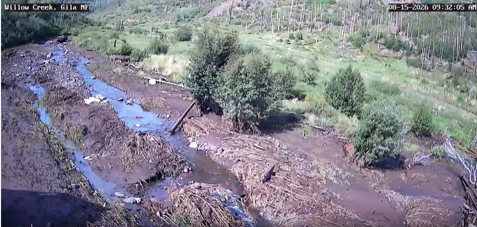
Check out the Willow Creek Weather website, maintained by a local resident. It provides current weather conditions, helpful information about area fires and post-fire conditions, and even a daily time-lapse video of Willow Creek.
Want to see Willow Creek flash flood?
Check out this time-lapse from August 2nd after 4 pm. And August 12th after 4:30.
| | Photo from Willlow Creek Weather Website | | Post Sacaton Fire - Update | | Photo Credit: Sara - Mogollon Baldy Lookout. Post Sacaton Fire | |
| | |
Follow Up
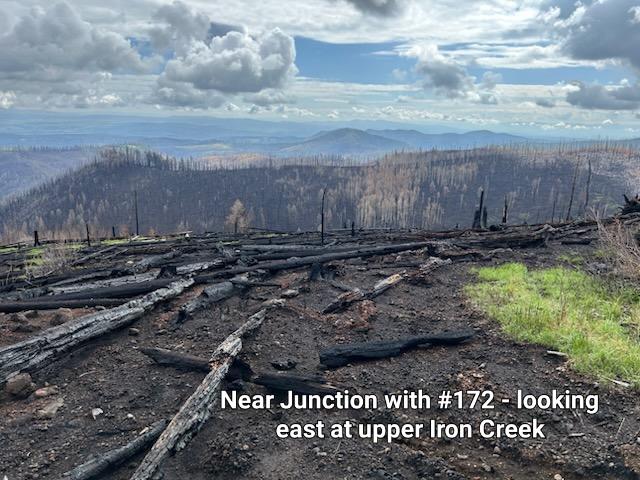
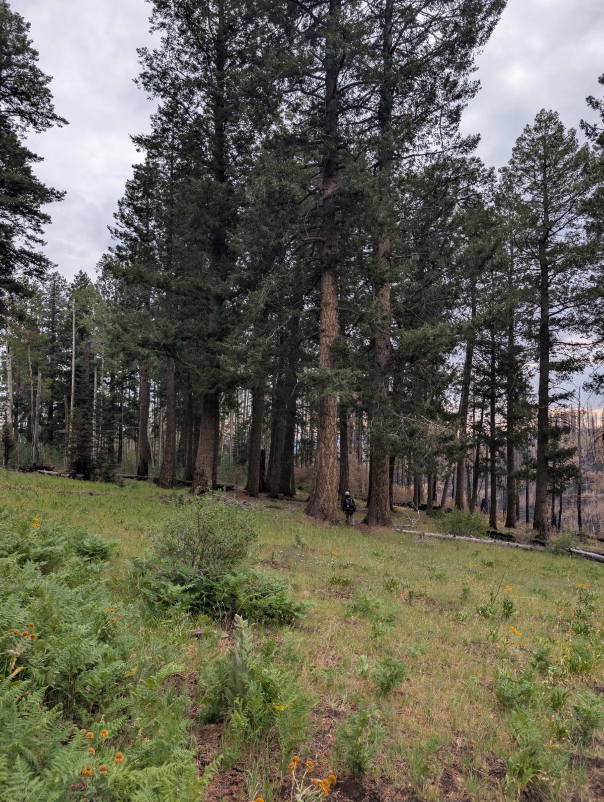
In the last newsletter, we talked about the few remaining mixed conifer stands that were potentially affected/destoryed by the Sacaton Fire.
| | |
Mix conifer by Apache Cabin – no updates
Mixed conifer on #172 by Centennial Spring: While some of the smaller stands were lost, amazingly, the stand of huge mixed conifer remained. See photo
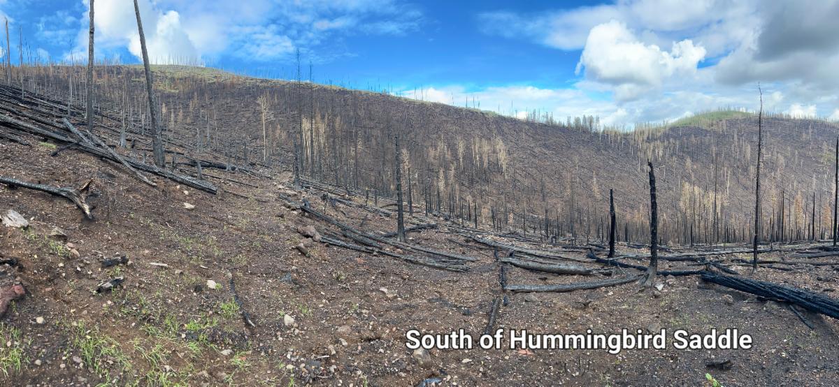
| Mixed conifer by Hummingbird Saddle: While a little bit was spared around Hummingbird Saddle itself, the majority of the stand was toasted hot and is no longer. See photo. | | Photo Credit: FS Fire Crew | | Photo Credit: Sara - Mogollon Baldy Lookout. Post Sacaton Fire | |
|
Other Wins
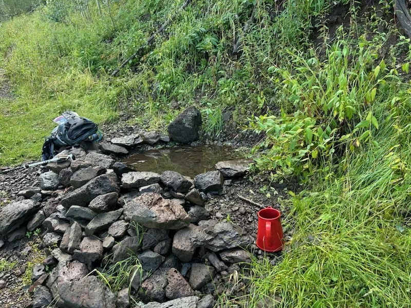
Thankfully, Hummingbird Spring was not burned and still provides a valuable water source for those camping and hiking by Hummingbird Saddle.
2 key camping areas were relatively unaffected by the burn – Hummingbird Saddle and the big Conifers near Centennial Spring, as referred to and photographed above.
The west side of Whitewater Baldy was less affected, so the Whitewater Trail leaving Hummingbird Saddle is still in decent condition.
| | |
Other Affects
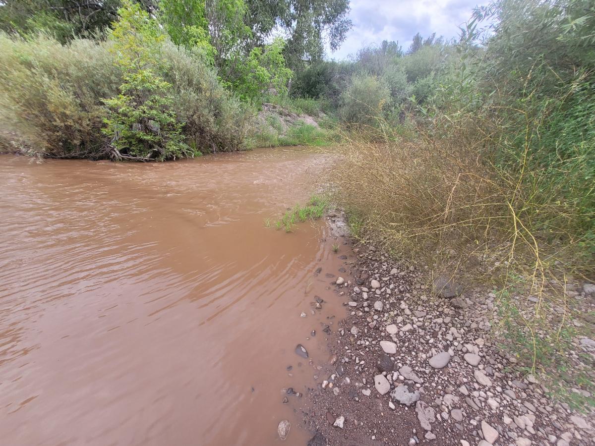
The muddy debris flows are affecting areas far beyond the fire scar. The muddy water flowing through Willow Creek taints the water downstream, all the way to Gila Hot Springs and beyond.
Despite clear water flowing in from the other unaffected drainages and the West Fork, the entire length of the Middle Fork still looks like chocolate milk and has been affected by the fire scar.
See photo
| | Muddy water in Gila Hot Springs - caused by the post Sacaton Fire runoff | | Before and after south of Hummingbird Saddle | |
| Adventures in the White Mountains | | |
The White Mountains offer many great adventures.
It is cooler there in the summer than much of the Gila, and it offers great fall colors as long as you pick the right area.
Ready to plan your next adventure to the White Mountains? Check out the trail guides, inspiring stories, and current trail conditions of Arizona's White Mountains.
Love to volunteer working on trails?
Sign up here to volunteer with them.
| | | Forest Service Downloadable PDF Maps | | |
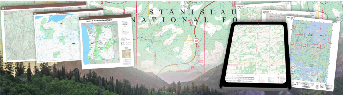
This past year, the U.S. Forest Service released an updated series of maps covering its lands in New Mexico. The new maps correct several errors and omissions found in the previous USFS map series published in 2012 and 2016.
They come in a variety of scales, including the standard topographic 7.5-minute maps, scales featuring Ranger Districts, and whole-forest maps. All maps can be downloaded as PDF files and are printable for hard-copy backups. Most appear to be georeferenced, meaning most mapping software will align the maps properly in space, and they seem to work fairly well with CalTopo.
| | |
Trail Work:
Restoring the Paths and Stories of American's Public Lands
| | |
This is a book for all the trail nerds out there!
Blending geology, history, and personal reflection, Osleger looks at trails as more than just footpaths. He explores them as one of the nation’s greatest infrastructure investments, reflecting centuries of movement, exchange, and human connection to public lands.
This book may change the way you see trails or deepen your appreciation for them.
Check it out!
| | | Campground Improvements to Bighorn and Cosmic Campgrounds | | |
Have you every camped at Bighorn or Cosmic Campground?
Located off HWY 180 on the west side of the Gila National Forest, these campgrounds are easy to get to. And now they will be even nicer.
In late August, the campgrounds will be temporarily closed to install shade ramadas. This will make a big difference on th0se hot summer and fall days.
| | Pre-ramada conditions as the Cosmic Campground. Photo Credit US Forest Service | | |
Be aware that hunting season starts Sept 1.
This can affect trailheads and backcountry camping, and where you decide to explore.
Map of Unit Areas
The dates below are for hunting seasons in:
Sept 1 to 24 : Elk and deer bow hunts
Sept 25 to Oct 9th: no hunting except bear tags
In general, this time of year is a great time to explore the Gila. Cooler temperatures, green grass, and a lower likelihood of lightning make it an especially enjoyable time to get out and explore.
Oct 10th to 28th: Elk rifle
November is deer hunting all month except for Thursdays and Fridays each week.
For the first 2 weeks of Dec, there is hunting in some areas
| | Green Grass & Dry Springs/ Creeks | | |
Don't be fooled by the green grass growing everywhere. We did not get enough rain in most places to replenish the creeks or springs. In some places, there is water in the tanks only because one or two gully-washers filled them. Rain has been spotty and localized.
A few examples of dry springs/creeks include McKenna Springs and Rawmeat Creek as of early August. Clear Creek also reportedly had only small pools a few weeks ago. Please use extra caution when planning your backcountry trips.
| | Check out the Water Updates, and please submit one when you return from a trip in the Gila. | | McKenna Spring - bone dry in early August | | Waterfall in Little Creek barely running - early August | | Local Wilderness Medicine Training through WNMU | | September 10, 6:30-8:30 pm | | |
Want to have more medical training before going into the backcountry. WNMU is offering Wilderness First Aid, Wilderness First Responder, and Recert for Wilderness First Responder in Feb 2027.
To learn more about what each class entails and who is meant for or to sign up:
Wilderness Medicine - Outdoor Programs - WNMU
| | Photo Credit: Marion MacDonald | | |
Want views but don’t want to hike uphill to get them? Check out the eastern part of the Signal Peak Trail accessed via Signal Peak Road. At a minimum, you will need a medium-clearance vehicle.
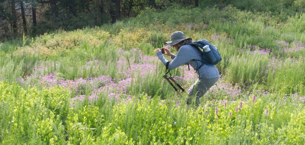
Above 7,000 feet, the Signal Peak Trail is much cooler than the lower elevation trails, and the wildflowers are in full bloom thanks to the 2014 Silver Fire and the 2025 Trout Fire. This trail has a high risk of lightning exposure. Hikers need to be careful and plan this hike thoughtfully to avoid potential thunderstorms.
The Signal Peak Trail is 1.4 miles one way but can be made into a loop by combining it with a section of the CDT and Signal Peak Road (see map). It was recently maintained (logged and brushed) in late July/early August of 2026. However, the tread was not worked on. It is adequate but very uneven in places. Bring walking sticks and pay extra attention to your foot placement!
Don’t have a medium-clearance vehicle? You can hike the western part of the Signal Peak Trail that starts at HWY 15 and goes up past the Signal Peak Lookout for a great workout and beautiful views along the way!
Read about one hiking group's adventures there: Black Peak Signal Peak Trail
Directions to the east side of the Signal Peak Trail:
Take Highway 15 to Signal Peak Road. A medium-clearance vehicle is recommended. Road conditions can change rapidly, especially during heavy monsoon rains. The drive up Signal Peak Road is scenic, with wildflowers and numerous overlooks along the way. However, locust trees and other vegetation have encroached on portions of the road, making it difficult to see oncoming traffic and challenging to pull over when meeting another vehicle. Drive slowly and carefully.
Continue on Signal Peak Road until you reach a closed metal Forest Service gate just below the lookout tower. Parking is available next to the gate. From there, you will see a trail sign and the trail heading east.
This trailhead is not adequate for horse trailers.
| | Mineral Creek from the Top | |
Last year we cleared the upper part of Mineral Creek and South Fork Mineral Creek Trails.
This year, the FS Trail Crew and NM Wild crew have continued work on the Mineral Creek Trail.
As of 2 weeks ago, they had logged and retreaded down to the junction with the Bearwallow Trail.
More to explore either on a day hike or overnight adventure!
| | Mineral Creek near juntion of South Fork Mineral Creek and Mineral Creek Trails | | Redstone Trail and Part of Whitewater Trail | | |
The trailhead for Redstone Trail #206 has been relocated as part of a long-planned effort to create a more sustainable trail. After years of planning and preparation, the new route is finally ready for use; hikers only for now.
The new trailhead is at Silver Creek Divide. From there the new trail travels 1.1 miles to the existing Redstone Trail, which continues down to Whitewater Creek.
The original trail, which the new route bypasses, was once a great trail. Unfortunately, the 2012 Whitewater-Baldy Fire and subsequent flooding caused extensive damage, washing away much of the hillside and making the old route unsustainable.
To read about AZ Wild’s work on the reroute: wild stew field crew: Completing the Redstone Reroute - Wild Arizona
| | AZ Wild Cre building new tread on the Redstone Reroute. Photo Credit Kile Stumbo - AZ Wild | | |
To complement the Redstone Trail reroute, the Forest Service trail crew reopened Whitewater Trail #207 from Hummingbird Saddle to Redstone in June.
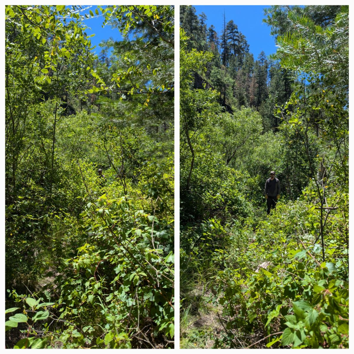
The trail has good tread overall, but the effects of the 2012 Whitewater-Baldy Fire are still evident. Locust grows back quickly, and numerous trees continue to fall across the trail, requiring annual maintenance. There may also be additional fallen trees since the trail was reopened in June.
Thankfully, the Sacaton Fire caused little damage to both Trail #207 and the Crest Trail between Sandy Point and Hummingbird Saddle. Hummingbird Saddle also remains a decent camping spot, with water available at Hummingbird Spring as of mid-August. See photo.
Together, these trails create a 16.5-mile loop, with only a short 1.6-mile road walk required to connect the routes.
| | Before and after photo credit: FS Trail Crew | Hummingbird Spring, mid-August. Photo Credit: Sara - Mogollon Baldy Lookout. | | Join Us on a Trail Project in 2026 | |
Turkeyfeather Spring and Clear Creek
| | |
New Trail Project !!
Dates: Oct 3 - 9, 2026
Trail Work: Logging, trail markers, tread & brushing
Project Difficulty: Moderate
Map: https://caltopo.com/m/FTR2FSS#
Backpack to Basecamp 1: 6.25 miles
Backpack to Basecamp 2: 5.75 miles
Hiking during the trail work days: up to 3.5 miles
Backup project if lack of water: Turkeyfeather-Spring-and-172.pdf
| | | | |
Check out the rest of the spring Trail Project Schedule
CDT - multiple locations
CDT Access Trail #741
Scenic Trail #796
Powderhorn Trail #82
And more…
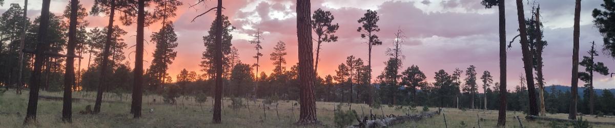
| | | Monsoon season makes for great sunsets - northwest of Willow Creek | | |
| How did you like this email? | | | Sign up for our Monthly Gila Trails Newsletter |
| | | |