November Gila Trails Update

In this Newsletter:

- Current Conditions

- Day or Multiday Adventure

- November Day Project

- Spring Trail Project Schedule


Little Whitewater Trail # 214

Current Conditions

Gila Centennial Loop Trail Update


The Forest Service Trail Crew just finished work on the #172 Whitewater Baldy Trail. This was the last impassable part of the Gila Centennial loop. Now it is open!


Snow is already falling in the high country, so it might be a good trip for next year.


Here are a few notes from experienced backpackers who did the Centennial Loop in Sept/ Oct 2024. Trails were in decent condition except for these places of note:


" 159 from Turkey CR to Miller SP is a little rough with poor tread on the initial steep climb and brushy overgrowth in the fire scar. 101 is difficult to find in several places around private land at Double SP. More cairns or blazing are needed there as it is a low-use trail with poor tread in places. Where 164 comes into Turkeyfeather Pass the tread weakens considerably and so could use some cairns. Finding the start of 164 might be challenging if doing the trail the other direction (clockwise)."

Improved Horse Trailer Parking

at CDT on the Bear Creek Road

Take Bear Creek Road west from Pinos Altos to get there. 

See map links.


The FS crew worked on the CDT in this area in the spring, so it should be in decent condition for an adventure - hiking, mountain biking, and equine.


The parking is big enough for multiple horse trailers.

Interactive Map
Geospatial PDF Map

Snow in the High Country


As this is being written (early November), there are predictions for multiple inches of snow at Mogollon Baldy and Hummingbird Saddle. The question is, will we get the amount predicted, and will it stick around?


Thankfully there is a snow gauge near that area at Silver Creek Divide. See links:

Snow Data for Snow Creek Divide

Snow Data for all New Mexico locations


Note that Mogollon Baldy and Humming Bird Saddle likely have more snow accumulation than Silver Creek Divide.

..........................................


It is exciting to finally get some moisture since the Gila greatly needs it. But it's a bummer since several trails up there just received significant trail improvements. It would have been nice to experience them before winter storms affect these trails. The trails just worked on by the Forest Service Crew and AZ Wild include:


#172 Whitewater Baldy Trail

#182 Crest Trail sections 1 and 2

# 181 Holt Apache Trail from the Crest to Apache Cabin


Adventure at your own risk.

Trail conditions change.


Recreate Responsibly

Day Or Multiday Adventure?

Holden Prong Trail #114

In the Black Range

Before and After - Photo Credit: Josh Kinsel

Holden Prong Trail # 114 - improved for hikers!

From the Kelsey Place to Holden Prong Saddle.


Thanks to Natural Curiosity, the Forest Service Montana Trail Crew, and the Forest Service Hillsboro Lookout.


Equine riders: stay tuned as more work will be done on this trail. There are some stretches of critical tread work to be done before stock travel is advised.


Hikers: Trail notes - For your average hiker, the stretch between Kelsey Place and the junction with the Hermosa trail could still benefit from additional cairns and brushing, so the trail may need to be clarified in some places.


There are a few ways to access Holden Prong Trail #114.

One way is via Railroad Canyon Trail #128.

This trail was recently improved (logged and brushed) from Railroad Campground to 3 miles upstream. Thanks to Gila Back Country Horsemen, funded by the National Forest Foundation. The remaining mile is passable but may be brushy with a few logs. At the saddle is the start of the Holden Prong Trail.

Interactive Map of Work
Geospatial PDF  Map

Photo Credit: Josh Kinsel

Impressive CCC Walls

Along Whitewater Trail # 207

*Hikers Only*

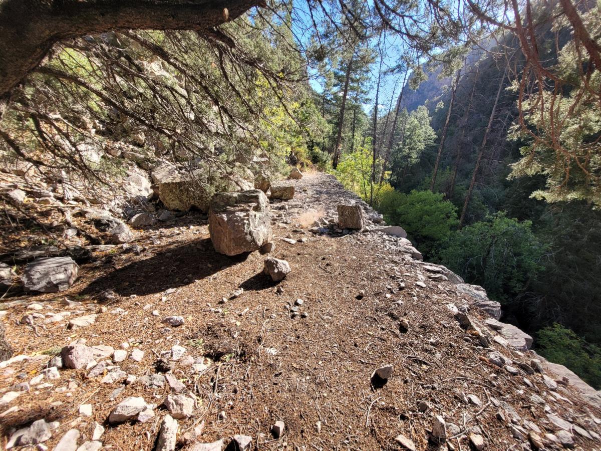
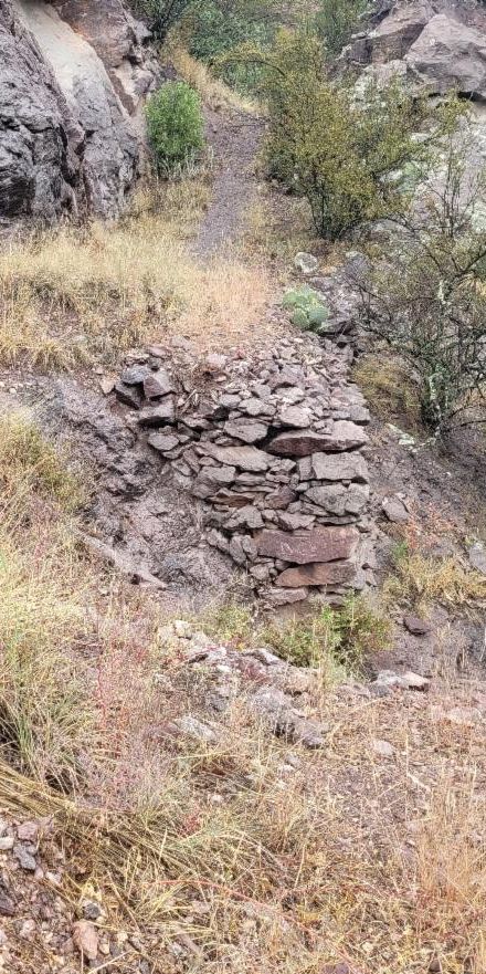
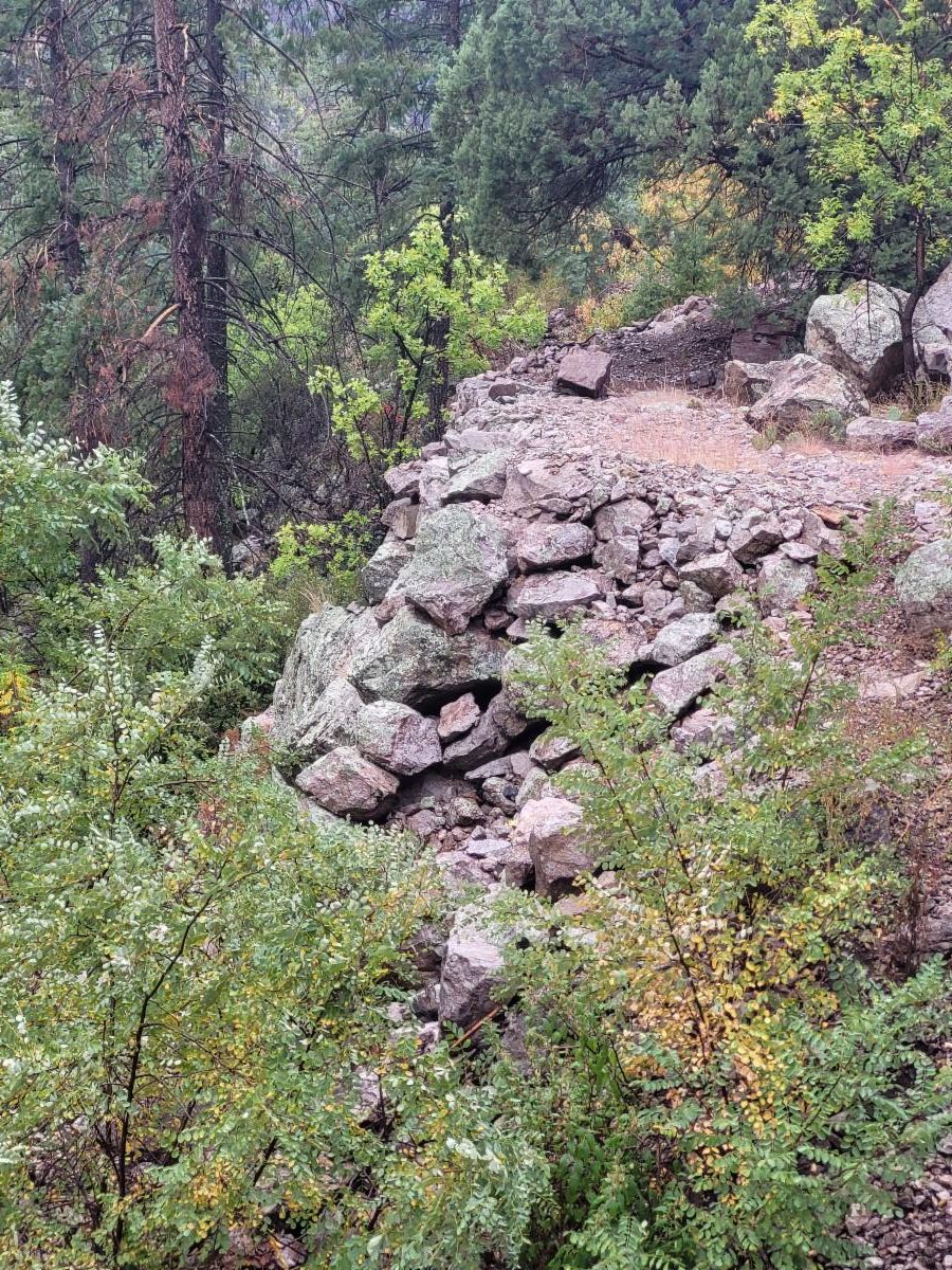
The Whitewater Trail #207 was created in part by the amazing rock wall work done by the CCC around 1934. These walls are on steep, rugged hillsides holding up the trail tread.


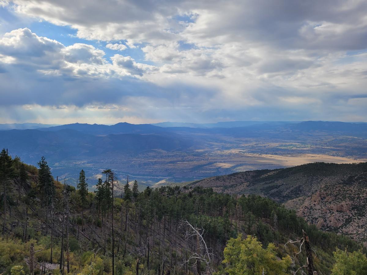
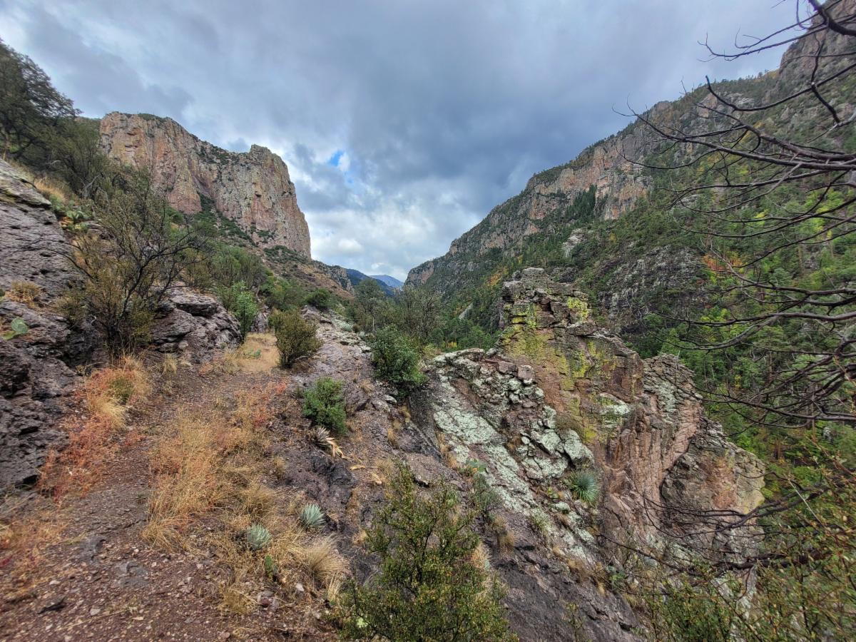
The Whitewater Trail #207 is a unique hiking experience, with much of it winding between towering cliffs and the sounds of the river echoing from below. The steep, rocky, and treacherous hillsides it traverses are a challenge, but the CCC has created a peaceful path through this rugged terrain.


The most impressive wall is over 20 feet tall and over 50 feet long. Sorry no photos since my camera could not capture it from on top of the wall. This wall is located at 33.35861, -108.77975. It is approximately 1.6 miles upstream from the Powerhouse Road. If you hike from the Powerhouse Road, you will see other smaller but impressive walls along the way to the big wall.


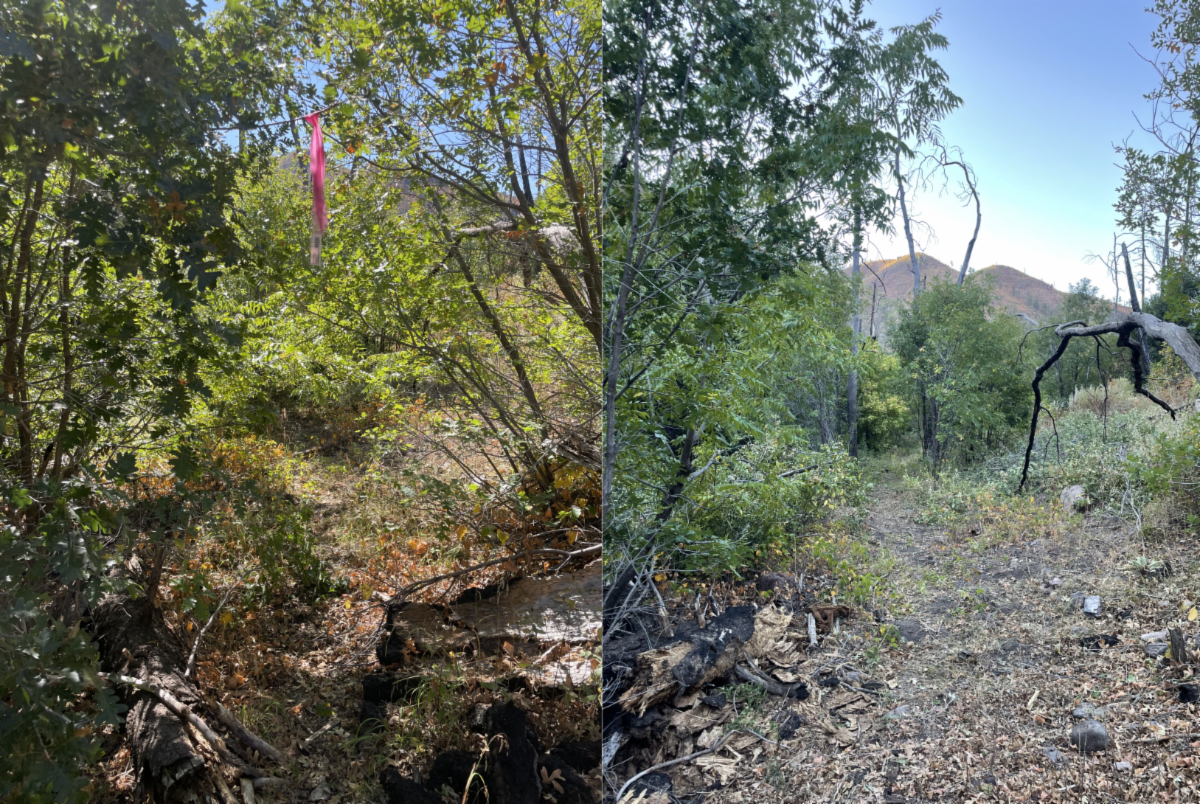
Regrettably, some of the trail and walls along the Whitewater Trail were damaged in the 2013 mega flooding. However, the Forest Service (FS) staff, recognizing the trail's grandeur and history, have undertaken the monumental task of finding a way around these washouts. Both FS Trail Crews and Conservation Crews have been working diligently to repair this section of the Whitewater Trail, making significant progress towards making it passable for hikers and backpackers. It's important to note that the trail is no longer open to equine.


This adventure could be a Day or Overnight Adventure. See details and maps below.


Day Trip Option

Overnight Option

First, the drive to the trailhead is an adventure in and of itself. It requires driving part of the narrow one-lane NM 159 Road towards the town of Mogollon. Eeekk if you are afraid of heights.


After about 6.7 miles turn off on Powerhouse Road #810. Take this 1.4 miles and park at the kiosk.


From here, hike down the very steep ATV road to Whitewater (2 miles). Take the Whitewater Trail out 1.6 miles upstream to the largest of the CCC walls and enjoy the many other walls along the way. There are no creek crossings required for this day hike option.

Then return the way you came.


Hiking poles may be nice for the steep section on Powerhouse.

Interactive Map
Geospatial PDF Map

Follow the details under the day trip option and see maps.


Continue up the Whitewater Trail after the large wall.


From here, the trail gets a bit more rugged, and there are short, extremely steep sections that the Forest Service may be fixing soon. It is passable for many as long as one is sure of their footing and uses caution.


The trail also travels closer to the creek and crosses the creek a handful of times.


Well worth the adventure.

Just before and around the signed junction with the Deloche Trail # 179 is a flattish area for camping.


From there you can explore up the Deloche Trail to the north or explore up creek. Note that the FS crew has yet to work upstream from here. And note the trail GPS correction for the Deloche Trail on the map.


Then, return the way you came.

Join Us on a Trail Project

Winter 2024 and Spring 2025

November Day Project

Brushing from Woody’s Corral Trailhead to Little Creek

Project Details

Dates: Nov 19th


Trail Work: Brushing


Project Difficulty: easy work, moderate hiking


Map: https://caltopo.com/m/LUJD8QP


Hiking during the dayBetween 6 and 8 miles depending on individual interest level in hiking to Little Creek or turning around at the earlier junction. 

Spring 2025 Trail Project Schedule

Includes:

Mimbres River Trail #77,

CDT in the Burros,

Brushy Mountain Trail #403,

Packsaddle Area and West Fork Corral Trail # 814,

CDT near Brannon Park and Big Timber Trail # 95,

Gallinas # 129, Railroad # 128 & Crest # 79,

and more.

View Spring Schedule


Questions or to RSVP: groundworktrails@gmail.com


Enjoy Gila Trails!

Gila River Near Turkey Creek - Photo Credit Jayne Hempstead

Donate