August Gila Trails Update

In this Newsletter:

- Current Conditions

- Day Adventures

- Backcountry Adventures

- Fall Trail Project Schedule


Current Conditions

New Corrals at Woody's Corral Trailhead


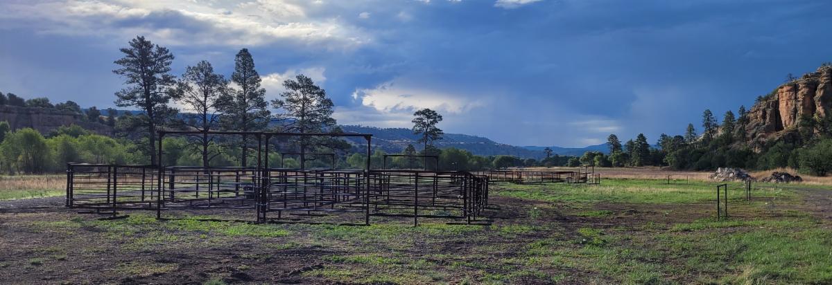
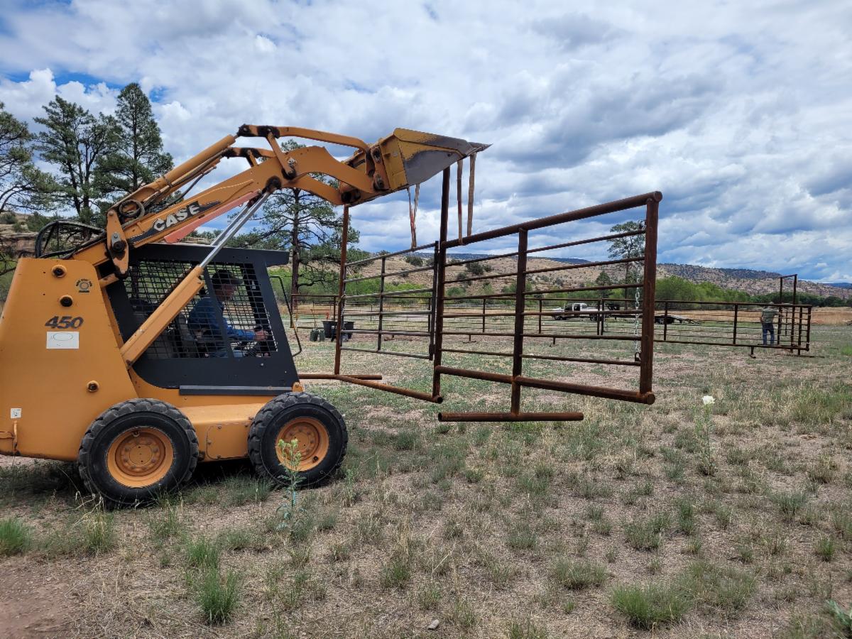
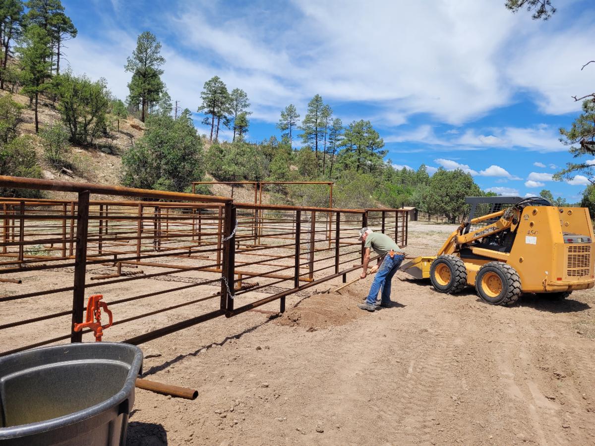
New Corrals in time for hunting season!


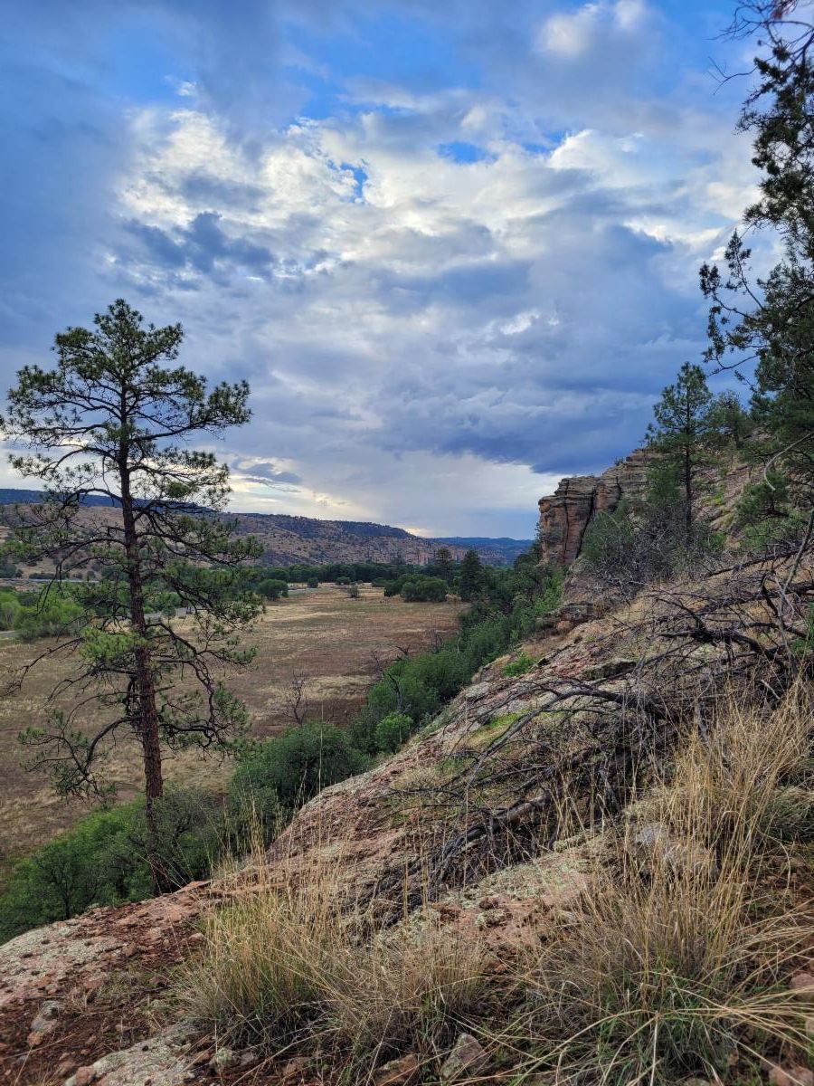
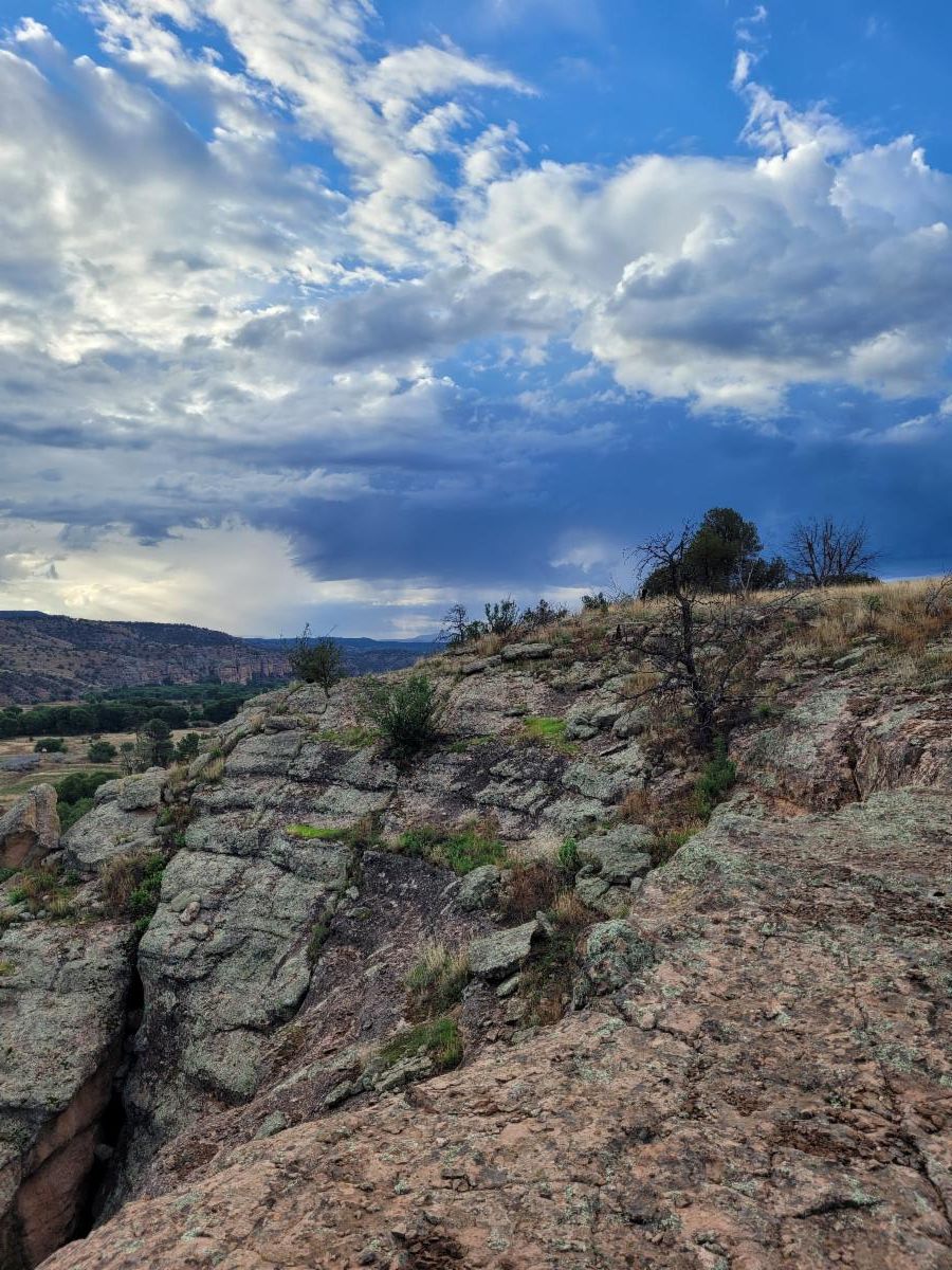
During hunting season, Woody’s Corral Trailhead, gateway to the Gila Wilderness, is crowded with hunters, equine, and trailers, but only 4 corrals. 


Now there are 8 more corrals at the trailhead thanks to a joint effort between Gila Back Country Horsemen, the Gila Cliff Dwellings National Monument, New Mexico Department of Wildlife, and Gila National Forest. And funded by New Mexico Economic Development Department’s Outdoor Recreation Division’s Trails+ Grant.


The new corrals are designed to improve access and enjoyment for horseback riders of all kinds. 

Photo Credits Nancy Imler

Trout Fire - Trails in the

 Signal Peak and Black Peak area


While much of the Trout Fire involved low soil severity, the trails in the area appear to have been heavily affected. If you haven’t had a chance to visit the CDT (Signal Peak and Black Peak area), here are some photos.

Looking south on the CDT at the junction with the Signal Peak Trail.

Photo Credit: Dave Turner

Hunting Season starts Sept 1

Be aware that hunting season starts Sept 1.


This can affect trailheads and backcountry camping, and where you decide to explore.


Map of Unit Areas


The dates below are for hunting seasons in:


Sept 1 to 24 : Elk and deer bow hunts


Sept 25 to Oct 10th: no hunting.

In general, this time of year is a great time to explore the Gila because of the cooling temps and the green grass and less likelihood of lightning.


Oct 11th to 29th: Elk rifle


November is deer hunting all month except for Thursday's and Fridays each week.


First 2 weeks of Dec is hunting in some areas

Fire Danger and Drought Levels

Fire Danger has been downgraded from Very High to High.


Drought is still Exceptional to Extreme throughout the Gila


Rain remains spotty. Some places experience flash flooding while other places don't get any rain. Water sources are still very unreliable.


Most places are still below average. For example, Mogollon Baldy (which catches much more storms than the lower country) received 7.3 inches. 10 inches is average.


Here is a chart of where we are in terms of rain deficiency. It is for this general area so it may not be completely accurate for a given location due to spotty rain.


A LONG WAY TO NOWHERE:

short film about a backcountry trail crew


The 28-minute documentary captures the experiences of a crew working to revitalize a collection of hiking trails across the rugged Kalmiopsis Wilderness Area in Oregon. It highlights the challenges and rewards of working in remote wilderness settings, showcasing the crew's dedication to environmental restoration. 


The Siskyou Mountain Club is a non-profit trail organization. "We started in 2010 as a small group of volunteers determined to restore a single route through the infamous Kalmiopsis Wilderness Area. Since then we’ve become the area’s only organization dedicated to wilderness and trail stewardship. We are leading the way to preserving the most threatened trails throughout Southwest Oregon and Northwest California."


Adventure at your own risk.

Trail conditions change.


Recreate Responsibly

Day Adventures

Tadpole Ridge Trail #232


This trail offers views overlooking the Trout Fire and the Goose Fire (in the distance).

This trail continues to receive seasonal maintenance by dedicated volunteers.


Out and back - so travel as long as you want - up to 8.2 miles one way.


Note: You don't want to travel in this during a lightning storm.

West Fork and Main Gila River Trails

These two trails were maintained in the last year. And with the low water levels and minimal rain, the leafy river vegetation is much shorter than normal. And with this heat, hiking in the river is a huge relief.


The Middle Fork is also pleasant, but the water is more likely to turn brown from the Turkeyfeather Fire runoff. So not as ideal as the West Fork. And the Gila River is watered down brown since the West and East Fork add clear water.

Backcountry Adventures

South Fork Whitewater Trail #212 and Beyond

This area still has water and was recently improved by the Forest Service Glenwood trail crew.


Hikers only - no Equine: on the section from Whitewater to Tennessee Meadows. Camp Creek Saddle to Tennessee Meadows is passable for stock,


There is intermittent water from the junction with Whitewater to Tennessee Meadows.


There are a few ways to access this trail:


Near the junction of South Fork Whitewater and Whitewater is the hidden old Powerhouse station.


The South Fork Whitewater also connects to Holt Apache Trail # 181, which was cleared last year from the Sheridan Corral Trailhead to Camp Creek Saddle. So, it could be done as a longer backpack if you are up for running a shuttle.

There was water reported (small but consistent flow) at Holt Spring last week.


Spud Patch Trail #111

Thanks to amazing work by Natural Curiosity, Spud Patch has been reopened after many decades of disrepair.


This trail offers views and ends up on the Crest, about 1.75 miles from Reeds Peak.


For road conditions, check out the info on Natural Curiosity website. This will get you to Hermosa, where their field station is, and then the trailhead is just another half mile up Morgan Creek. It is a commitment to get there, so plan in extra time for driving to the trailhead and make sure you have the correct vehicle for the time of year.


And if you wait until later this fall, there will be a whole loop opened up. Natural Curiosity trail crews are working hard to open up the hiking loop to Reed's Peak and the Continental Divide from Hermosa (via Spud Patch Ridge and Rattlesnake Canyon/Morgan Creek). Stay Tuned!

Join Us on a Trail Project in 2025

Fall Trail Project Schedule

Backcountry Projects

Big Timber Trail #95


Dates: August 25 -28, 2025


Trail Work:  logging, spot retreading, removing rocks from the trail, trail markers and a little brushing


Project Difficulty: Easy to Moderate


Map:  https://caltopo.com/m/Q10P0BG


Backpack to basecamp: 4.5 miles


Hike during the day: up to 6.4 miles

Brushing the Lilley Park Trail #164 near Little Bear   


*Day Project*


Dates: Wednesday, Sept 3rd, 2025


Trail Work: Brushing


Project Difficulty: Moderate due to amount of hiking


Map: https://caltopo.com/m/QTP5BCA


Hike during the day: up to 7 miles round trip

Check out the rest of the spring Trail Project Schedule


Includes:

(Upper) Mineral Creek Trail #201,

Aeroplane Mesa Trail #705,

Clear Creek Trail #165,

West Fork Corral Trail #814,

Railroad Trail #128,

Crest Trail #79,

(Lower) Turkey Creek Trail #155,

Sycamore Canyon Trail #234


Enjoy Gila Trails!

Sign up for our Monthly Gila Trails Newsletter