Snap.

Report.

Inform.

View as Webpage

Extreme High Tides This Month

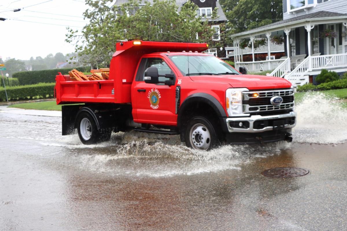
Groton, CT | Photo Credit: Judy Benson

August 3, 2026

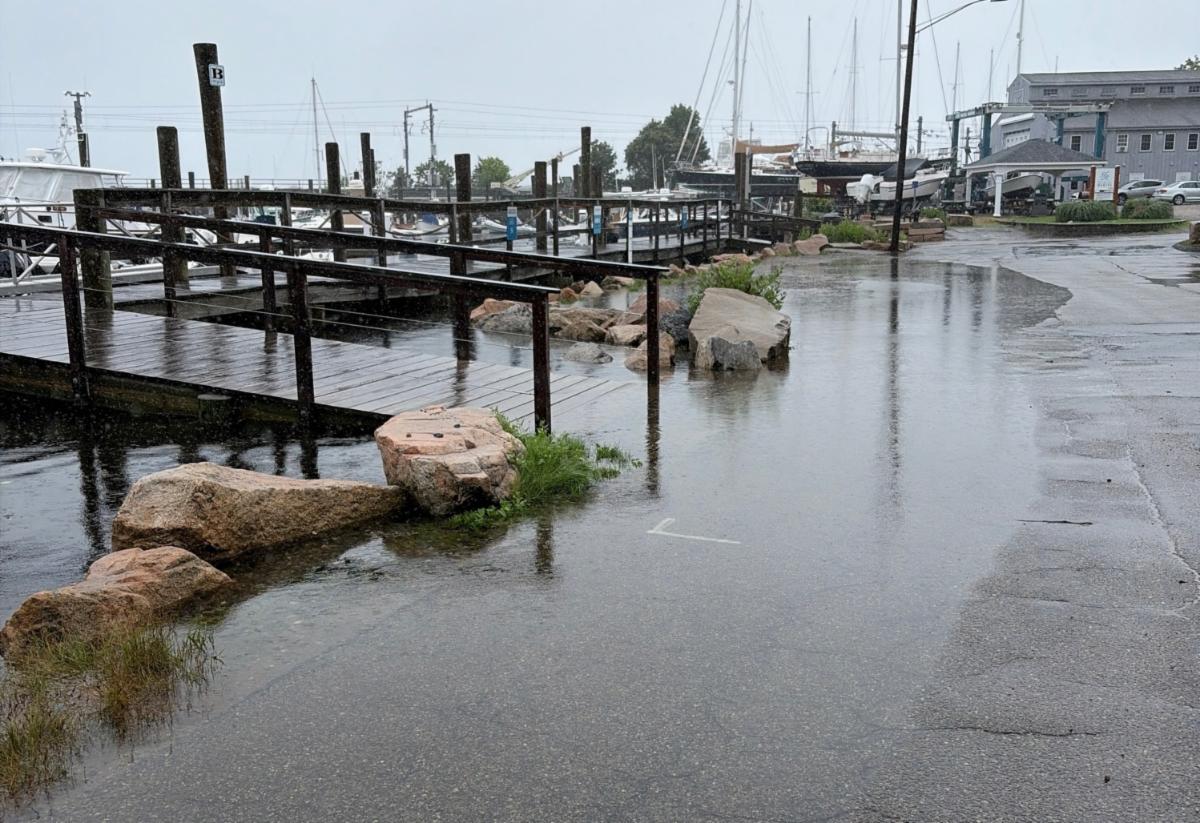
Groton, CT | Photo Credit: Dave Prescott

July 7, 2026

Recent rain events and flooding captured on camera by community champions.

Help us continue to document these issues in your neighborhood!


While recent intense rain storms in July led to local flooding, sunny summer days in August can also lead to flooding in low-lying coastal areas when certain high tides rise higher than normal. These events provide a valuable opportunity to observe how water levels are changing along Connecticut’s coast. 


We wanted to share that we have some extra high tides on the rise for this week.


You can help us track flooding this month by taking and sharing photos during these events using the MyCoast app.

Visit the MyCoast CT Reports page to see the photos you and your fellow community members have uploaded.

Highest High Tides - August

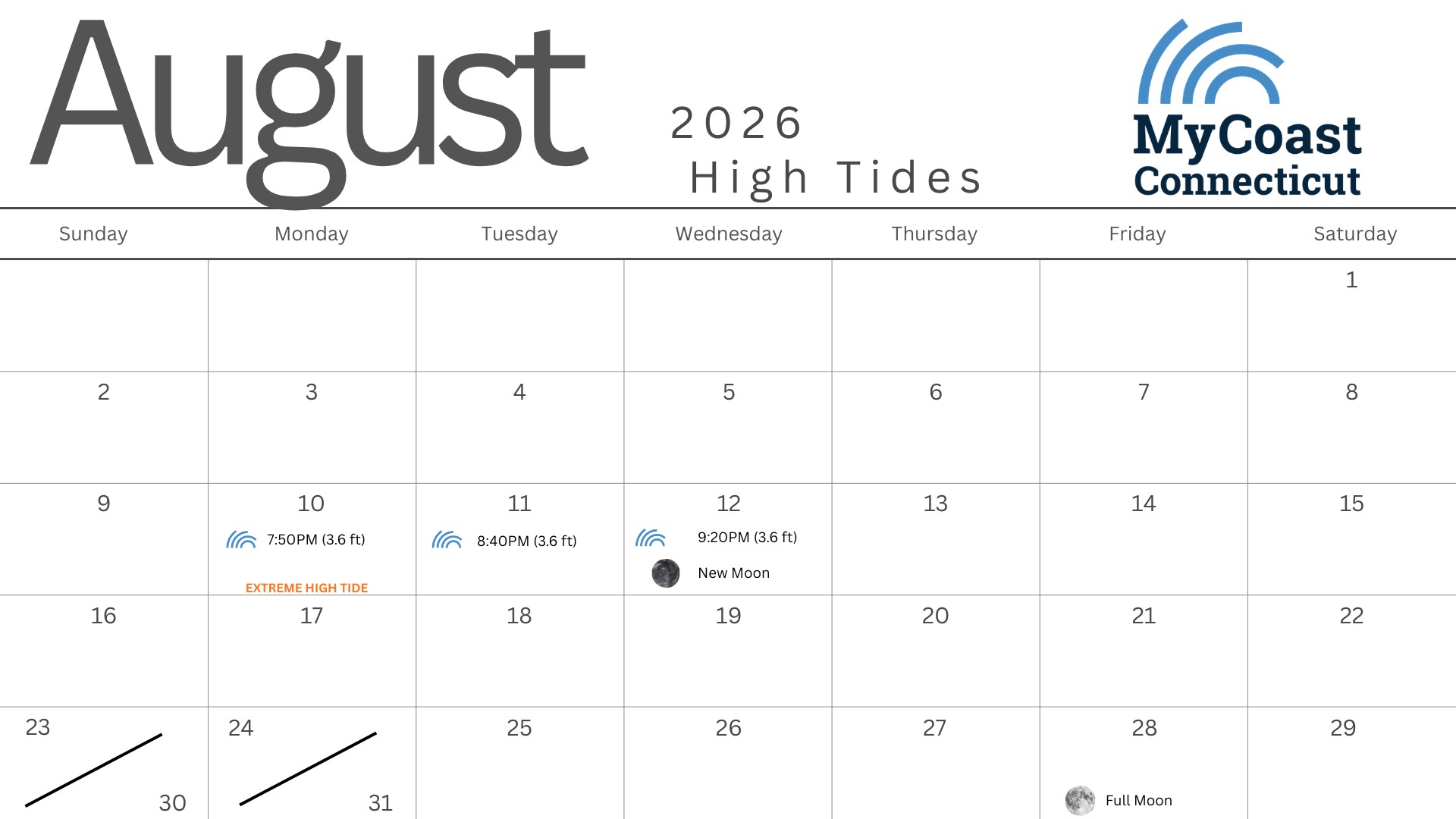
The highest high tides for August will be in the evening hours and while it may be more difficult to capture photos, we encourage you to keep and eye out for flooding in the hours leading up to, and the mornings after these tides. We've prepared a calendar to help you keep track of the upcoming tides and you can find it on our website.

Grab your phone 
and take a photo when tides may be higher than usual during these dates & times.

Extreme High Tide Outlook: 


  • August 10 | 7:50 pm (3.6 ft)
  • August 11 | 8:40 pm (3.6 ft)
  • August 12 | 9:20 pm (3.6 ft)

How to Submit a Photo

Whether it’s during an extreme high tide, after a storm, or on a clear day, your observations make a difference. Please take safety precautions while taking photos. 


  1. Download the MyCoast app in the iOS App Store or Google Play Store 
  2. Open the app and snap a photo: Flooded roads, water on sidewalks, overtopped seawalls, beach erosion, or clear/dry areas, all are useful 
  3. Upload photo through the app 
  4. MyCoast automatically adds location, tide, and weather data 

Safety First

  • Follow local emergency alerts and evacuation notices 
  • Avoid walking or driving through floodwaters 
  • Take photos only when it is safe to do so—never during dangerous conditions 
  • Report Spills or other Environmental Emergencies to the CT DEEP at: 860-424-3338

Why it Matters

Your photos go straight to the MyCoast Connecticut Database to help planners, scientists, and local leaders: 

  • Understand where and when flooding is happening 
  • Monitor how the shoreline is changing over time 
  • Make better decisions about coastal infrastructure and preparedness


This is a simple but powerful way to support resilience planning in your community. 

Thanks for you sharing your photos 

Your participation helps make Connecticut’s coast more resilient. 

Even one photo can make a difference. 


– The MyCoast CT Team 

This pilot program is led by Connecticut Sea Grant, Connecticut Institute for Resilience and Climate Adaptation, and Connecticut National Estuarine Research Reserve to improve storm readiness and coastal resilience and is funded by the Long Island Sound Futures Fund.

Learn More

Contact Us

Download the App

Know others that might be interested?

Please do not forward this email.

Instead, use the "Share This Email" button.