SHARE:  
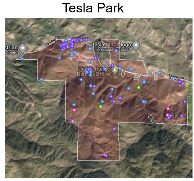
Tesla Park is part of the Diablo Range in eastern Alameda County. For thousands of years, its lands were seasonal hunting, gathering, and trading grounds for Indigenous people. And for a few decades in the late 1800s and early 1900s, a large mine operated on the site and supported a company town named Tesla.

California State Parks purchased the Tesla land in the 1990s as an expansion area for the nearby Carnegie State Vehicular Recreation Area. Instead of allowing ATVs in the park, conservation advocates secured permanent protection for Tesla Park from off-highway vehicles in 2021.

Calflora aggregates wild plant data from many sources to create this dynamic list of surveys and observations from Tesla Park. As information is added to the database from thousands of sources, lists update automatically.

From the legend,

  • green squares represent the plant surveys conducted in the area, including two in 2023 by David Gallagher and Neal Kramer

  • pink points represent polygons showing the extent of a specific plant population, e.g., for a third of an acre of Eriophyllum jepsonii

Click on any icon on the map to learn more about a particular observation or plant survey. At the top of this link under TOOLS, see What Grows Here for this area, and an illustrated plant list. Here is an illustrated plant list for the rare plants that grow here.

All of these links are dynamic: as observations and surveys are added to the database, this list automatically updates.

Tesla Park is not yet open to the public; learn more from East Bay CNPS article Tesla Park is Finally Protected.
(Jepson's woolly sunflower)
by R.A. Chasey
Photo of Tesla Park by David Gallagher
Fritillaria agrestis (Stinkbells)
by Dee Shea Himes
Calflora is an independent 501(c)(3) charitable organization, EIN 31-1689940. Please reply to this email or contact spprt@calflora.org with any questions.


--
1700 Shattuck Avenue #198
Berkeley, CA 94709
(510) 883-3148