|
Welcome to the inaugural issue of CSDA Orbit, a new quarterly newsletter from NASA's Commercial Satellite Data Acquisition (CSDA) Program created to keep our partners and stakeholders up-to-date on the program's latest developments.
| |
Featured Publication:
Determining the Dimensions of Hypervelocity Impact Structures with DEMs
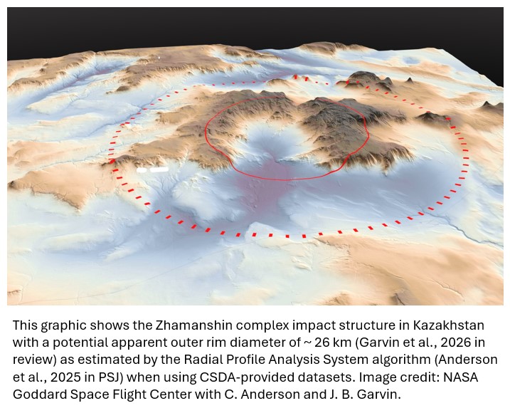
Hypervelocity impacts of asteroids and comets on planetary bodies are a fundamental geological process within the solar system. However, determining the physical dimensions of the topographic features resulting from a hypervelocity impact with Earth is challenging due to the erosion of these features. In response, a team of researchers at NASA's Goddard Space Flight Center developed the Radial Profile Analysis System algorithm that uses a digital elevation model (DEM) to identify the topographic rings associated with the outer rim of a complex impact structure. To determine the effectiveness of the Radial Profile Analysis System methodology, the researchers applied it to several DEM datasets, including those created CSDA commercial partners (Planet and Vantor), with differing spatial resolution (2–30 meters) over five terrestrial impact structures of varying diameters and complexity. Their results indicated that apparent outer rim diameters of complex impact structures that maintain some topographic expression can be estimated using these methods with reasonable reliability, but prediction efficacy decreased with decreasing DEM vertical fidelity.
Impact: The application of the Radial Profile Analysis System methodology to high-resolution DEMs provides a pathway for the reassessment of terrestrial impact structures with uncertain apparent outer rim dimensions.
To read more about their research, see "Identifying the Dimensions of Degraded Impact Structures Using Digital Elevation Models: A Proof of Concept for Silicate Planets" in The Planetary Science Journal (Volume 6; Number 3, March 2025).
|
CSDA Informs NASA Disaster Response
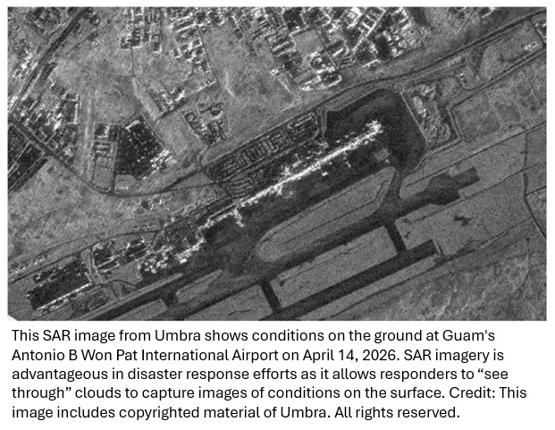
NASA’s Disasters Response Coordination System (DRCS) was activated from April 14 to 29, 2026, in response to Typhoon Sinlaku, and from March 10 to April 1, 2026, in response to flooding in Hawaii following a period of heavy rain. In both instances, the DRCS supplemented satellite imagery from NASA and its partners with assets from the Commercial Satellite Data Acquisition (CSDA) program, including multispectral imagery from Planet and synthetic aperture radar (SAR) imagery from Capella Space, ICEYE US, and Umbra, to help response teams monitor conditions on the ground and assess critical infrastructure.
To learn more about the DRCS activations for Typhoon Sinlaku and the Hawaii Floods, visit the DRCS website.
| | |
NASA, ESA and USGS Release Joint Earth Observation Mission Quality Assessment Framework - Optical Guidelines Documents
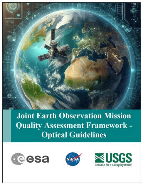
NASA's Commercial Satellite Data Acquisition (CSDA) program, in conjunction with the European Space Agency (ESA), and the U.S. Geological Survey (USGS) has released the Joint Earth Observation Mission Quality Assessment Framework – Optical Guidelines. Created for the benefit of the Earthnet Data Assessment Project (EDAP) and the CSDA program as part of a collaboration between ESA and NASA, the document presents the methodology the agencies use to assess the quality of optical data from commercial satellite data providers.
| |
Satellogic and Tomorrow.io Quality Assessment Reports Released
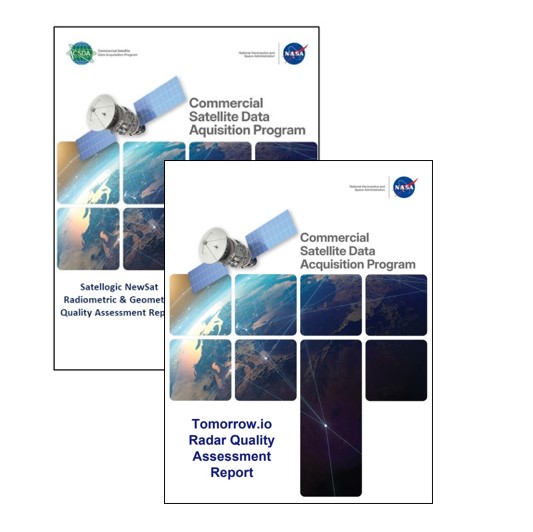
The CSDA program recently completed technical evaluations of radiometric and geometric data from Satellogic’s NewSat constellation and precipitation radar data from Tomorrow.io's R1 and R2 spacecraft.
The quality assessment reports are available on the Satellogic and Tomorrow.io vendor pages under the "evaluations" heading.
| |
CSDA Thermal Infrared Cal/Val Support Pilot
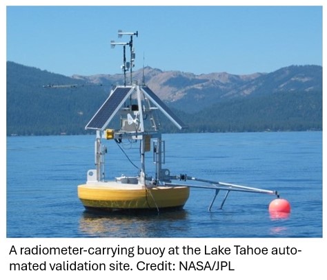
The CSDA is planning a pilot study to support the calibration and validation of new mid to thermal infrared commercial datasets. As part of this pilot project, the CSDA will provide Top of Atmosphere (TOA) radiances, at the time of vendor satellite-system overpass, over the Lake Tahoe and Salton Sea automated validation sites, convolved to the vendor satellite-sensor system, and 12 clear-sky validations will be performed per year, per vendor, for up to 2 years (total of 24 validations per vendor).
Commercial data providers will be responsible for supplying the clear sky scenes and necessary system response functions for the mid and thermal infrared bands. The CSDA Calibration and Validation (Cal/Val) Team will be responsible for supplying skin temperatures and atmospheric profiles at time of overpass, which will be made publicly available. Further, The CSDA Cal/Val Team will work with the vendor to perform the forward calculation to TOA radiance and convolution of radiances to vendor satellite-sensor system.
Information on how to apply to the pilot will be released soon. Stay tuned to the CSDA website for more information.
|
Coming Soon: Call for AGU Abstracts
NASA's CSDA program will be holding a session, "Commercial Data Observation: Leveraging Commercial Earth Observation Data for Rapid Disaster Response," during the 2026 American Geophysical Union (AGU) conference December 7–11 in San Francisco, California. Stay tuned to the news section of the CSDA website for a session description and details for abstract submissions.
|
CSDA Launches Publications Library on Zotero
NASA-acquired commercial Earth observation data are used in many scientific investigations and have a range of practical applications. Please reference our CSDA Program Publications Library on Zotero to search published research incorporating CSDA-distributed data. Users can filter search results by science key words and commercial vendor. To submit your paper for consideration, please send us an email with your paper title and DOI.
*Note: Not every CSDA Commercial Vendor is represented in this publication repository at this time.
| |
Are you using commercial Earth observation data acquired through NASA's Commercial Satellite Data Acquisition Program? If so, please send us an email with your paper title and DOI link and we will consider it for inclusion in our NASA CSDA Program Publication library on Zotero.
| | |
NASA’s Commercial Satellite Data Acquisition Program Releases Archived and Tasked Multispectral Data from Satellogic
February 25, 2026 - The CSDA Program announces the release of a new Level 1D Orthorectified multispectral archive and tasked data product from Satellogic. Now available through the program’s Satellite Data Explorer, this product provides imagery with 99-centimeter resolution and Top of Atmosphere radiometric correction.
CSDA Program Announces Eight New Data Agreements
February 18, 2026 - The CSDA Program announced eight new agreements with seven of its commercial partners—Airbus Defense and Space GEO Inc (Airbus U.S.), Capella Space Corporation, ICEYE US, MDA Space, Planet Labs, Umbra, and Vantor (formerly Maxar)—to give users more access to near‑global multispectral and synthetic aperture radar (SAR) data
Digital Surface and Terrain Models from Vantor’s Precision3D Product Line Added to Satellite Data Explorer
February 2, 2026 - Three digital elevation and digital terrain products from Vantor’s Precision3D Product Line have been added to the CSDA's Satellite Data Explorer (SDX) data access and discovery tool.
Vantor Archive Imagery Added to Satellite Data Explorer
January 27, 2026 - The CSDA Program announces the addition of imagery from Vantor to its Satellite Data Explorer data access and discovery tool. The imagery, which was obtained by Vantor’s Legion satellites, comes from Vantor’s 125-plus petabyte imagery archive, which dates back to 1999.
Tomorrow.io Pathfinder Precipitation Radar Data Archive Now Available
The full archive of Tomorrow.io Pathfinder precipitation radar data is now available through NASA's CSDA program. Authorized users can access the data through the CSDA's Satellite Data Explorer. Additional tasking for the Pathfinder precipitation radar can be requested by contacting the CSDA Data Management Team.
|
| CSDA Partner & Vendor News | |
2026 Joint Agency Commercial Imagery Evaluation (JACIE) Workshop Summary
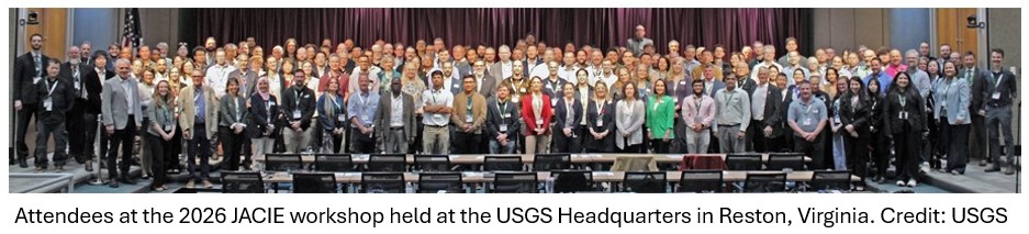
The 2026 JACIE Workshop was held at the USGS Headquarters in Reston, Virginia, from April 13--17, 2026. The workshop brought together more than 400 remote sensing professionals from 20 countries (both in‑person and online) and reinforced the notion that the most valuable aspect of JACIE is the collaboration among federal agencies, non-governmental organizations, and commercial data providers. Over five days, the workshop offered 98 oral presentations, 22 posters, and 15 exhibitors; dedicated side meetings for the Radiometric Calibration Network (RadCalNet), Committee on Earth Observing Satellites (CEOS), and the RIT Open Community eXperiment (ROCX); and demonstrated that interest in high-quality, well-characterized, and trusted Earth observing data continues to grow. Presentation topics covered calibration/validation, geometric and spatial performance, ARD and interoperability, AI and automation, quality impacts to data fusion, and hyperspectral, thermal, active, and atmospheric sensors.
To learn more about the JACIE collaboration please visit Annual JACIE Workshop website. To access any of the JACIE presentations or session recordings, please visit JACIE Workshop Presentations Search. And please Save the Date for 2027 Joint Agency Commercial Imagery Evaluation (JACIE) Workshop scheduled for April 5–9, 2027 at the USGS Headquarters in Reston, VA.
|
Save the Date: VH-RODA 2026
The Very High-resolution Radar & Optical Data Assessment (VH-RODA) 2026 Workshop will be held in ESA-ESRIN, Frascati (Italy), from November 16-20, 2026.
The Workshop will provide an open forum discussions about the current status and future developments related to Earth Observation (EO) data quality, calibration and validation of space-borne very high-resolution SAR, Optical, and atmospheric constellations, sensors and data products, with a dedicated focus on commercial EO data providers and related Cal/Val activities, synergies between optical, SAR and atmospheric communities, presentation of standards and best practices for data quality.
For more information, visit the European Space Agency website.
|
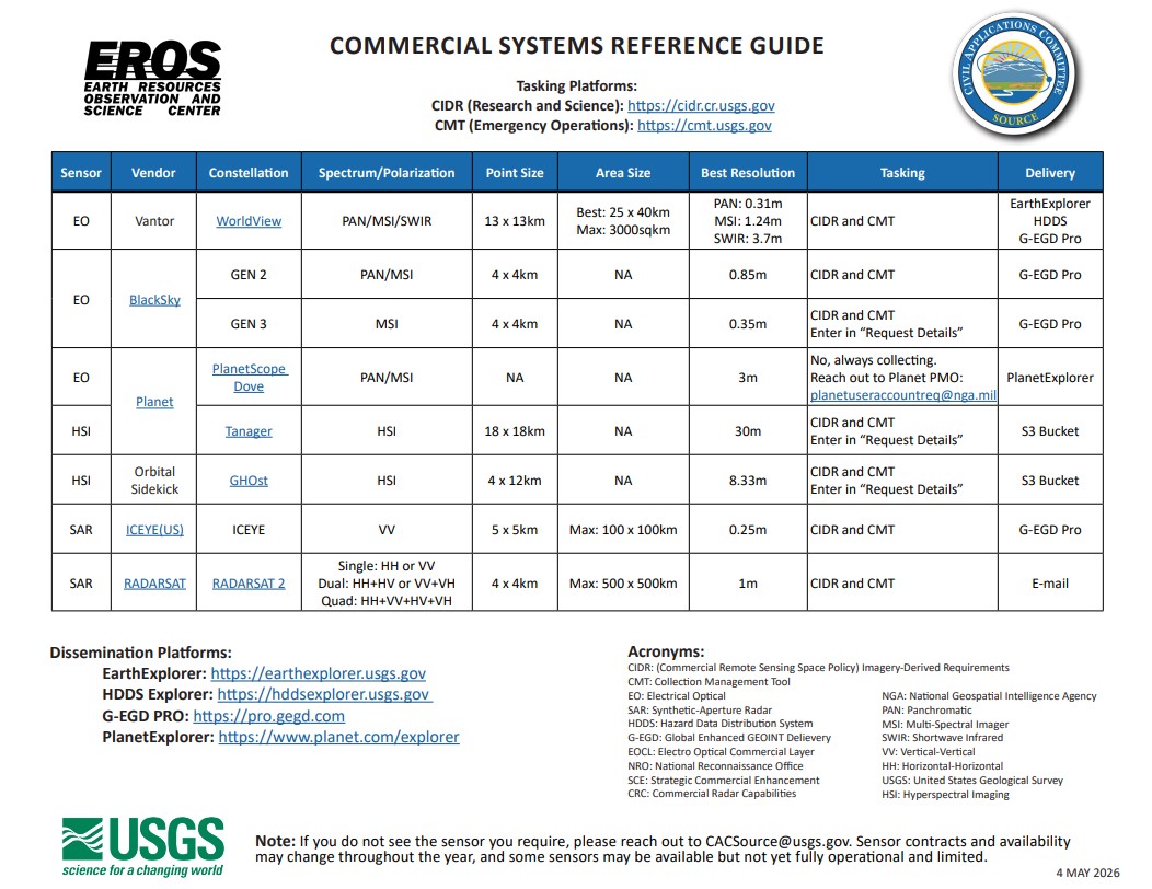
Civil Applications Committee Releases Commercial Systems Reference Guide
The Civil Applications Committee (CAC), operated by the U.S. Geological Survey, facilitates appropriate civil use of military, intelligence, and commercial remote sensing data to support science, natural resource management, and disaster response across federal, state, local, and tribal partners.
This graphic provides an overview of currently available commercial electro-optical, synthetic aperture radar (SAR), and hyperspectral imaging systems, along with tasking pathways and data access platforms. (Click the image to see a larger version.)
Users should submit science, research, and operational requirements through the Commercial Remote Sensing Space Policy Imagery Derived Requirements (CIDR) Tool and hazard or disaster response requirements through the Collection Management Tool.
For questions, please contact cacsource@usgs.gov.
|
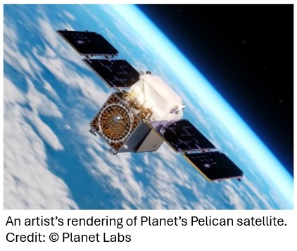
Planet Launches Three High-Resolution Pelican Satellites
On May 3, Planet Labs PBC announced the successful launch of three additional Pelican satellites. The spacecraft were launched to orbit aboard the CAS500-2 rideshare mission with SpaceX from Vandenberg Space Force Base in California. Planet has begun the commissioning process for the three satellites after successfully making initial contact. For more information about the launch, visit the Planet website.
|
Taskable InSAR Enables Continuous Monitoring for Disaster Response
Capella’s new taskable InSAR capability delivers automated, high-frequency (~3-day) SAR collections for millimeter-scale ground movement detection. The solution enables consistent, InSAR-ready time series data to support disaster response, infrastructure monitoring, and geohazard analysis.
For more information, visit the Capella Space website.
|
PlanetiQ Releases Poster for AMS 2026
PlanetiQ has posted its AMS 2026 poster, "Space weather observations of TEC, Es layers & ionospheric scintillations from GNSS RO data," covering total electron content (TEC) calibration, the assimilation of TEC into ionosphere and upper atmosphere models, the geolocation of F-region irregularities, and sporadic E layer characterization and geolocation.
|
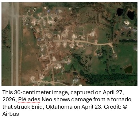
Airbus Releases New Imagery Collections to Support NASA Disasters Program
Pleiades Neo 30-centimeter resolution data from Airbus, is now available. This product offers ~3.5m geolocation accuracy while supporting disaster research with high-resolution imagery and rapid tasking for damage assessment and response.
Learn more about this product on the Airbus website.
|
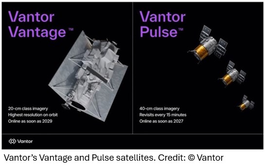
Vantor’s Next-Generation Constellation: Advancing Commercial Earth Observation
Vantor is expanding its constellation with Vantage 20 cm-class imaging and Pulse 40 cm-class high-revisit satellites, giving CSDA users sharper imagery and faster global monitoring.
Learn more about the Vantage and Pulse satellites on the Vantor website.
|
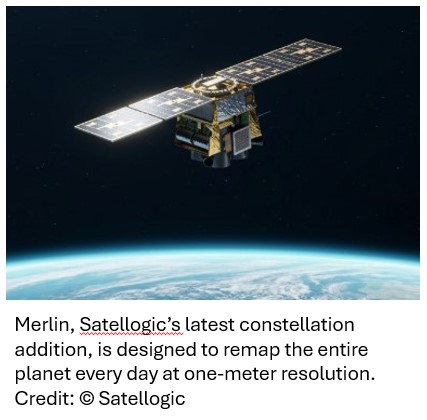
Daily Global Remapping Enabled by Merlin Constellation
Satellogic has announced plans to launch Merlin, its latest constellation designed to remap the entire planet daily at one-meter resolution.
The first Merlin satellite is scheduled for launch in October 2026, with full operational capability by mid- 2027. To learn more about Merlin, visit the Satellogic website.
On-Demand Webinar: Beyond the Data Gaps: Continuous Global Sensing with the Tomorrow.io Microwave Sounder Constellation
Learn how Tomorrow.io's Microwave Sounder (TMS) constellation delivers continuous global atmospheric data, showcasing 60-minute global revisit through real observations over oceans and ground-radar gaps. The webinar was first broadcast on April 29, 2026, but the recording is now available on demand.
| | Webinars, Workshops, & Trainings | |
CSDA Vendor Focus Webinar - MDA Space
Learn more about MDA Space C-band synthetic aperture radar (SAR) RADARSAT-2 products and services available through NASA's CSDA program.
View the recording
| |
CSDA Vendor Focus Webinar - Satellogic
Learn more about high-resolution multispectral Satellogic data available through NASA’s CSDA program, and how it complements NASA Earth science data holdings for research and applications.
View the Recording
| |
National Civil Applications Center: Connecting Space-Based Resources to Civil Science, Research, and Disaster Applications
Learn about the National Civil Applications Center (NCAC) and the Civil Applications Committee (CAC) national and commercial space-based remote sensing resources available to civil science, research, federal operations, and disaster response.
View the Recording
| |
CSDA Vendor Focus Webinar- PlanetiQ
During this NASA CSDA program vendor webinar, attendees learned about PlanetiQ and the company’s Global Navigation Satellite System (GNSS) Radio Occultation (GNSS-RO) and related capabilities.
View the Recording
| |
Free Training from NASA ARSET
NASA’s Applied Remote Sensing Training (ARSET) program provides free training, such as webinars, self-paced courses, and in-person or virtual events, on how to access, analyze, and apply NASA satellite data for real-world applications. Visit the NASA ARSET website for more information.
| |
Stay Informed!
To subscribe to announcements for CSDA webinars, workshops, and trainings, send an email to the CSDA Program webinars listserv at: nasa-csda-webinars-join@lists.nasa.gov with the word 'subscribe' in the subject line.
| |
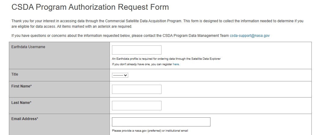
How do I become an authorized CSDA data user?
All NASA and U.S. government funded researchers can get access to commercial datasets. To learn more, see the Frequently Asked Questions area on the CSDA website.
| |  |
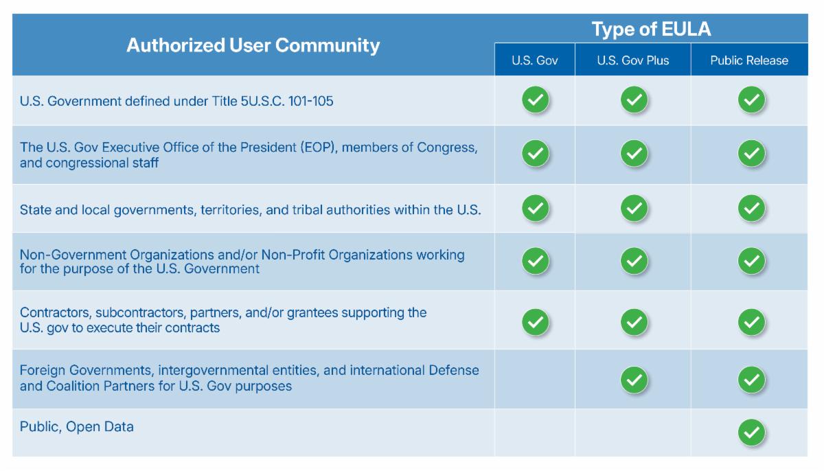
What terms and conditions govern the use of commercial satellite data?
Data distributed by NASA's CSDA are available under different scientific use licenses and various access portals. To learn more about the End User License Agreements (EULAs), visit the CSDA website.
| | |
Do You Use CSDA Data?
Are you using CSDA data in your research or work? Do you want to use CSDA data, but you're not sure how to get started? No matter how you're using -- or not using -- CSDA data, we want to hear about it. What are your comments and questions? Let us know via our feedback form available from this QR code.
| | | | | |
National Aeronautics and Space Administration
NASA explores the unknown in air and space, innovates for the benefit of humanity, and inspires the world through discovery.
Visit nasa.gov
| | | | | |