|
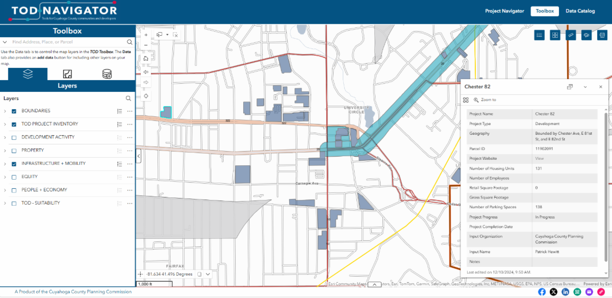
County Planning is proud to introduce the TOD Navigator—a new tool for visualizing Transit-Oriented Development (TOD) projects across Cuyahoga County.
Tracking TOD can be helpful when analyzing where investment has occurred along frequent transit corridors within Cuyahoga County. The TOD Navigator compiles TOD projects across Cuyahoga County into an interactive mapping tool and provides detailed project information that includes project name, location, parcel number, building square footage, number of units, number of parking spaces, and more. Project types featured in the Navigator include building construction, corridor plans, zoning updates, and infrastructure investments.
Using the Toolbox tab in the upper right-hand corner of the Navigator allows users to turn on and off various map layers including, but not limited to, population and job density, parcels, and transportation routes.
The TOD Navigator is in beta form, and data is still being added. If you see missing data, incorrect data, or have questions about what is being shown, please contact us at info@countyplanning.us or use the online form on the TOD Navigator webpage.
|