|
Columns
GIS Tips & Tricks - Authoritative Elevation Data?
By Al Karlin, Ph.D., CSM-L, GISP
| |
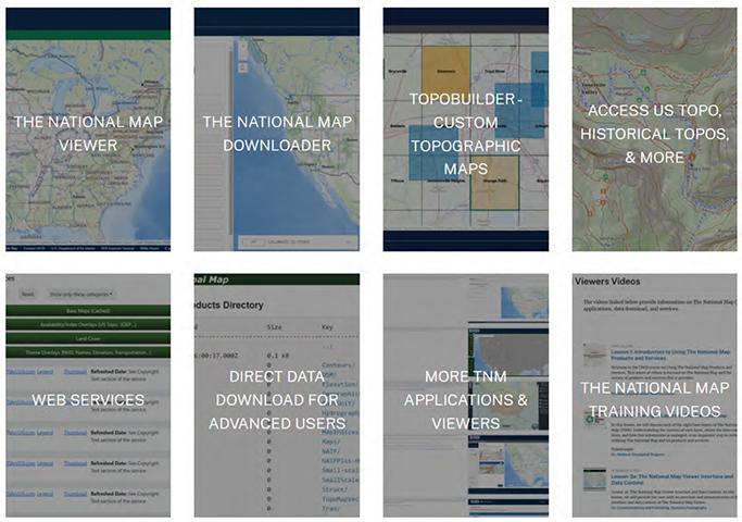
Among the first things that entry-level GIS analysts learn when tasked with performing analyses and making maps, is the importance of data, what type is needed and where it can be found. Sometimes, finding the authoritative data source (ADS), i.e., a recognized, trusted, and official repository of information serving as the primary source for a specific data element, can be a bit tricky and often confusing. With so many open-source GIS data repositories available, such as OpenStreetMap, Natural Earth, EarthExplorer, ArcGIS Online, ArcGIS Living Atlas of the World, and the list goes on and on, a beginning GIS analyst can quickly become overwhelmed. To add to the volume of sources, there are additional federal, state, state agency, and local government GIS data portals that can provide data.
| | |
PE&RS Special Issue Call for Papers
Please visit https://my.asprs.org/pers (right hand column) for more details on each Special Issue Call for Papers.
- A New Era of Earth Observation: Applications of Google DeepMind’s 10‑m AI-Generated Remote Sensing Embeddings of the Planet Earth
- Large Language Models in Remote Sensing: Across Different Modalities
- Advances in SAR Data Analysis: Methods and Applications for Earth Observation
- 3D Reconstruction and Applications of Urban Scenes
- Hyperspectral Remote Sensing (imaging spectroscopy) to make Gigantic Leaps in Land and Water Science
| | |
*Open Access
Evaluating U.S. Geological Survey Three-dimensional Elevation Program Lidar Data as a Source for Building Height*
Jung kuan Liu, Ethan Shavers, Samantha T. Arundel, and Rongjun Qin
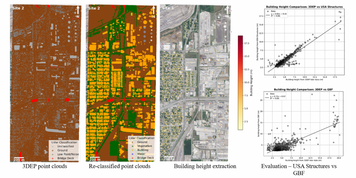
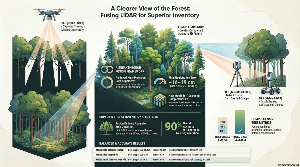
| Accurate building height information is used for numerous urban applications, including infrastructure modeling, disaster risk assessment, and energy demand estimation. The U.S. Geological Survey collects airborne lidar data to support the three-dimensional elevation program (3DEP). The high point density and vertical accuracy of the lidar point clouds are optimal for 3D mapping. Few studies have systematically evaluated building height extraction from 3DEP lidar point clouds in urban areas. This study assesses the accuracy and consistency of building height estimates from two publicly available data sets by comparing them to the 3DEP lidar data. | | |
Reserve Identification Model for Oil Tank Based on Satellite Image Analysis under Complex Observation Angles
Yang Li, Jin-Rong Yang, Ke-Hang Liu, and Hong-Wei Chen
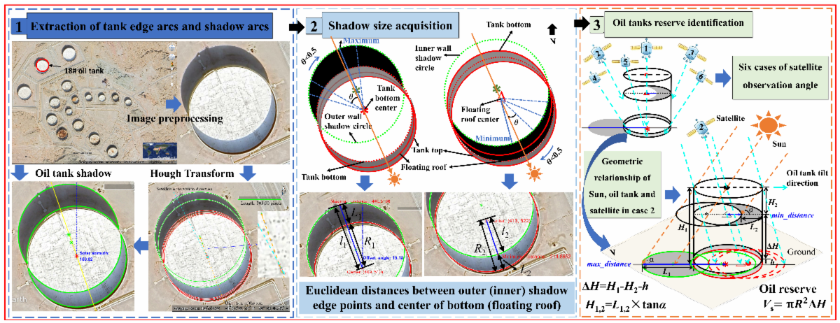
| | The reserve volume of oil tanks can be obtained through in-depth analysis of satellite images. This approach addresses the urgent demand for precise and rapid acquisition of global oil tank reserves. A novel method for extracting oil tank shadows based on projection characteristics of a cylinder was proposed that extracts the shadows obscured by the oil tank’s side wall under complex observation angles. | | |
A Producer’s Guide to Reference Data (Training and Validation Data) in Leading Geographic Information System Applications*
Benjamin T. Fraser and Russell G. Congalton
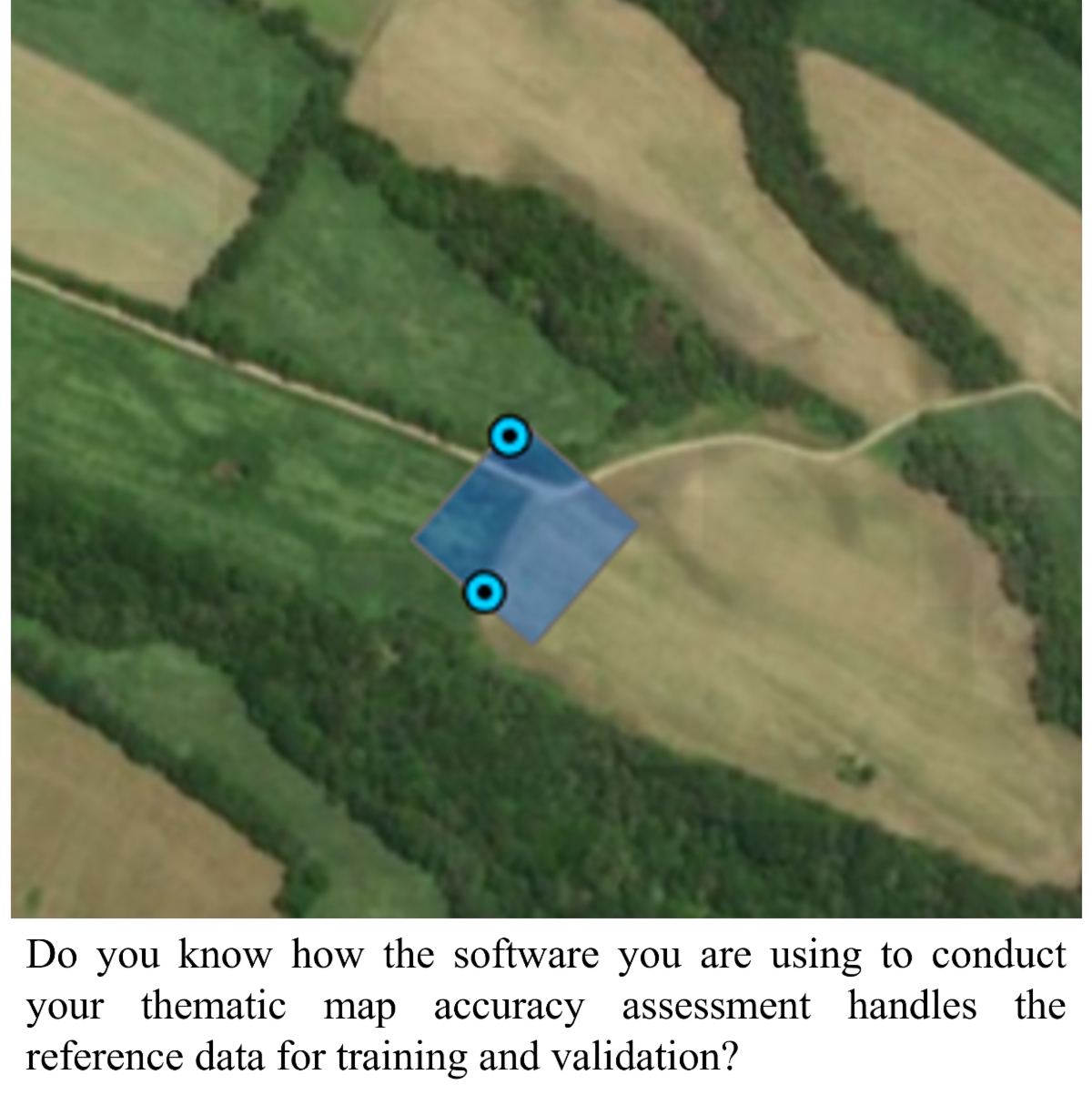
| | Leading geographic information system (GIS) applications offer producers streamlined tools for conducting digital image classifications and subsequent thematic map accuracy assessments. Such tools are used daily by countless practitioners for critical analyses of land use and cover and other thematic maps due to their ease of implementation and increasingly available remotely sensed imagery. Despite a robust history of discussion and research surrounding the sources of error that could be introduced during such practices, as well as the careful considerations one should undertake when carrying out such methods, many analyses are still performed using invalid or inappropriate methodologies. These issues largely stem from the GIS software applications considering the reference data as points (x, y coordinates) and not as imagery (pixels). In this paper, three key characteristics and their issues in how reference data are handled by leading GIS applications are addressed. | | |
Toward Automatic Vector Extraction from Scanned Historical Aerial Photo Indexes*
Salim Malek, Elisa Mariarosaria Farella, Giulio Perda, Gianluca Cantoro, and Fabio Remondino
| | National archives worldwide have recently dedicated significant efforts to preserve fragile historical collections (e.g., maps, documents, photographs) through scanning and digitization. Advancements in digital technologies have opened new opportunities for processing and accessing these materials; however, as these collections grow, significant challenges arise in efficiently managing, linking, and using vast volumes of digital data. This paper addresses the challenge imposed by the digital transformation of vast archive collections, with a focus on scanned materials preserved in historical photographic and mapping archives and intended for the creation of digital databases and online catalogues. | | |
Lidar-based Simultaneous Localization and Mapping with Connecting Traverse Constraints for Underground Mine Mapping
Zhihua Xu, Yuanyuan Li, Ershuai Xu, Jing Wu, Jiaxuan Lin, Yuansheng Zhang, Bisheng Yang, and Suping Peng
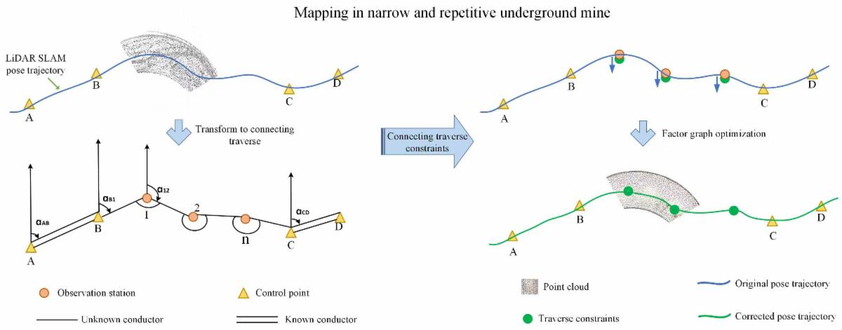
| | Underground 3D mapping plays a vital role in mineral resource exploration and development. Lidar-based simultaneous localization and mapping (SLAM) has become a key technology in this domain, offering autonomous navigation and real-time mapping capabilities. However, in narrow and geometrically repetitive underground mine corridors—characterized by long passages and a lack of loop closures— conventional lidar-SLAM systems suffer from significant error accumulation, leading to degraded mapping accuracy. To overcome these limitations, we propose a novel lidar-SLAM method incorporating connecting traverse constraints. | | |
Semantic Change Detection with Constrained Dual-Head Convolutional Neural Network Architecture for Oil/Gas Well Site Monitoring*
Hongzhang Xu, Hongjie He, Ying Zhang, Dedong Zhang, and Jonathan Li
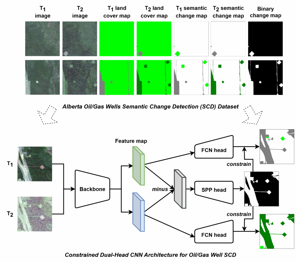
| High-resolution mapping of land disturbance and reclamation is important for assessing the cumulative environmental effects of oil/gas production. The growing availability of high-resolution satellite imagery, combined with recent advances in deep learning, offers a desirable solution for detecting land surface changes on disturbed land. In this study, we constructed the Alberta oil/gas wells semantic change detection (SCD) data set in Alberta, Canada, based on high-resolution satellite imagery from WorldView-2 and SPOT-6. In addition, we proposed a constrained dual-head convolutional neural network (CNN) framework that jointly learns semantic change and binary change tasks. | | | | |