July 2024

Landsat Science News


July 31, 2024

Banding Together: Landsat Introduces New Spectral Band Comparison Tool


Ross Walter, from the Landsat Outreach Team, has turned a much used, but static, Landsat Spectral Band Comparison graphic into a dynamic, multifaceted tool that enables users to compare different sensors and output the comparison graphics they need.

 
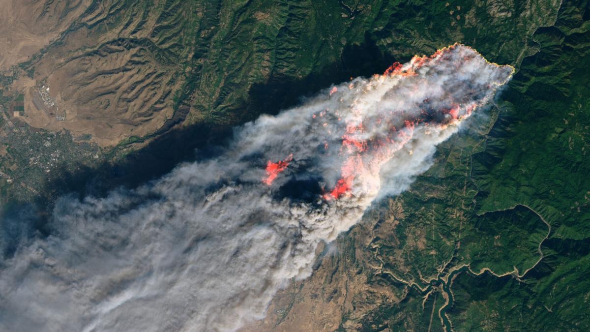
Landsat image of the Camp Fire in California acquired in 2018. The natural-color image is overlaid with a shortwave infrared signature.

July 31, 2024

Drought is Driving Fires to Burn Overnight


A new study (Luo et al., 2024) tracks the shifting dynamics of wildfires in western North America. Using Landsat-derived datasets and active fire information from geostationary satellites, researchers found that fires are burning through the night more often—and drought is partially to blame.

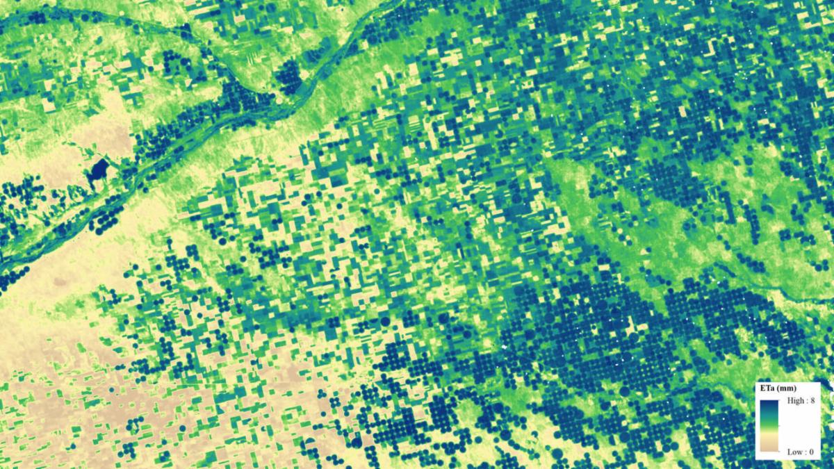
Example of Landsat Provisional Actual Evapotranspiration (ETa) product near the Colorado/Nebraska border near the Platte River. ETa measures the amount of water evaporated from land surfaces and transpired by plants.

July 30, 2024

Landsat is Vital to American Agriculture, Forests

Source: USGS Landsat Missions


A recent national report finds Landsat satellites to be a vital source of data to support U.S. agriculture and forest activities in the United States.

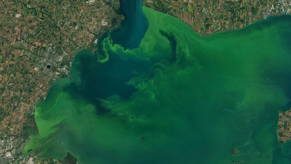
Landsat 8 image of an algae bloom in Lake Erie.

July 11, 2024

Be Part of What's Next: Emerging Applications of Landsat Data at AGU24


Anyone making innovative use of Landsat data to meet societal needs today and during coming decades is encouraged to submit an abstract for the upcoming “Emerging Science Applications of Landsat” session at AGU24. Abstracts are due Aug. 5, 2024.


“[T]o look at long-term changes, you’re going to need Landsat because Landsat is the only thing that’s going back four decades.” 

—Sean Vitousek, USGS Research Oceanographer

(referring to the 30-meter, seven-plus-spectral-band Landsat Thematic Mapper-era and beyond)

July 15, 2024

Mapping the California Coastline, USGS Eyes on Earth Podcast


Reaching Out


July 23, 2024

A Rendezvous with Landsat


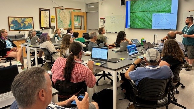
NASA outreach specialists led educators through a workshop on accessing and utilizing Landsat data at the annual Earth Educators’ Rendezvous.


Upcoming Outreach Events

The Landsat Communications and Public Engagement Team will be at the following event in August 2024:

 
Ecological Society of America (ESA) Annual Meeting logo.

Ecological Society of America (ESA) Annual Meeting


August 4-9, 2024

Long Beach Convention Center

Long Beach, California


Landsat+Ecology: Getting to Know Our Wide & Wild World

NASA Hyperwall Talk, Sunday, Aug. 4 at 7:15p, Exhibit Hall A


PUBLICATION SPOTLIGHT


Groundwater-Dependent Ecosystem Map Exposes Global Dryland Protection Needs 


| Rohde et al., 2024


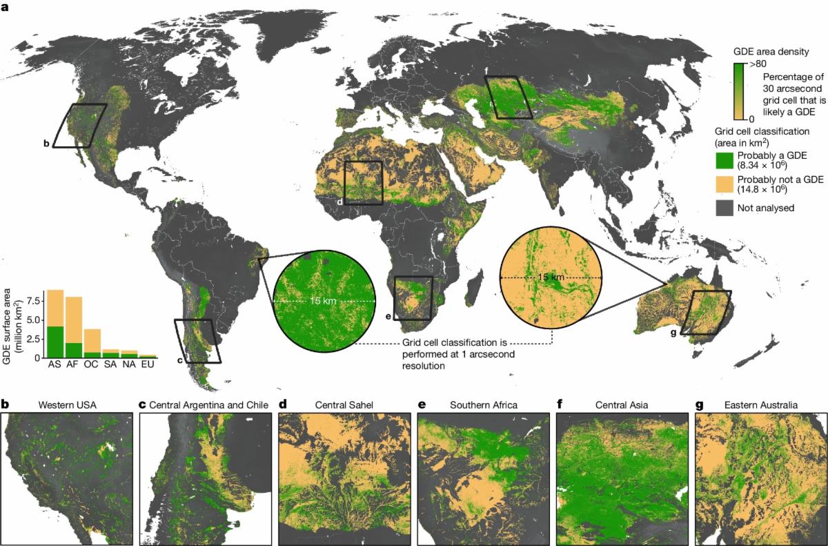
A recent map of ecosystems dependent on groundwater in drylands around the globe placed over half of these ecosystems in areas with declining groundwater trends. To build this map—the first global map of groundwater-dependent ecosystems—researchers analyzed six years of Landsat data, using vegetation and water indices to identify characteristics of water availability. The team correlated these characteristics with over 30,000 data points of known groundwater-dependent ecosystem locations to train a machine learning model. The resultant map, created using a random forest algorithm for 2015-2020, establishes a methodology which can be used in future mapping to detect changes over time and help inform policy and conservation decisions.  

A global map of groundwater-dependent ecosystem density created by Rohde et al., 2024. Green represents areas of high density of groundwater-dependent ecosystems, and tan represents areas of low density of groundwater-dependent ecosystems.

A global map of groundwater-dependent ecosystem density. Green represents areas of high density of groundwater-dependent ecosystems, and tan represents areas of low density of groundwater-dependent ecosystems. Image credit: Rohde et al., 2024

Find more selected Landsat publications on our website.


NASA Earth Observatory

Selected Landsat Images

July 30, 2024

After the Park Fire's Rapid Growth


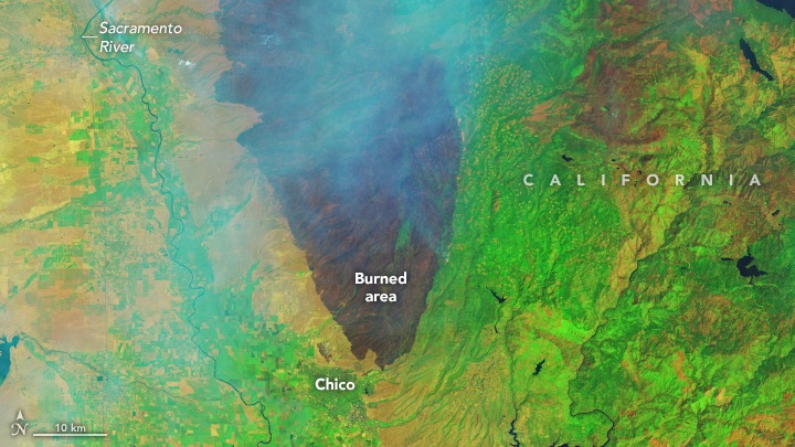
The Northern California blaze expanded at lightning speed amid record heat and high winds, leaving behind a vast burned area.

Infrared-color Landsat 9 image of a wildfire in Northern California, acquired on July 27, 2024. The burned area is evident in the false-color image showing shortwave infrared, near infrared, and visible light (band combination 6-5-3). This band combination makes it easier to identify unburned vegetated areas (green) and the recently burned landscape (brown). Thicker areas of the smoke plume appear light blue. White text highlights Burned area, California, Chico, Smoke, Lake Almanor, and the Sacramento River.

July 25, 2024

Paris Olympics from Above


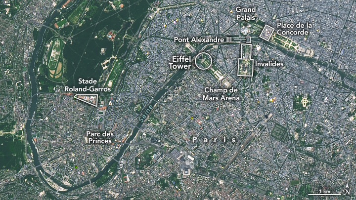
From Paris to Tahiti, the venues of the 2024 Summer Olympics showcase some of France’s iconic landmarks.

A natural-color Landsat 9 satellite image of Paris, France. White borders and text in this image highlight the Grand Palais, Place de la Concorde, Pont Alexandre III, Invalides, The Eiffel Tower, Champ de Mars Arena, Stade Roland-Garros, and Parc des Princes. This image was acquired on June 7, 2024.

July 19, 2024

Fires Char the Siberian Arctic


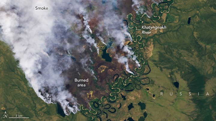
Large wildland fires are burning in the tundra of northern Russia.

Detailed natural-color Landsat 8 image of a large fire burning in the Abyysky district of Yakutia, a region of northern Russia also known as the Republic of Sakha. Burned areas appear brown. Darker green areas are forested and likely include dwarf larch and birch. Tundra grasses, mosses, and lichen are dominant in the lighter green areas. The image was acquired on July 10, 2024.

July 10, 2024

Carriacou After Beryl


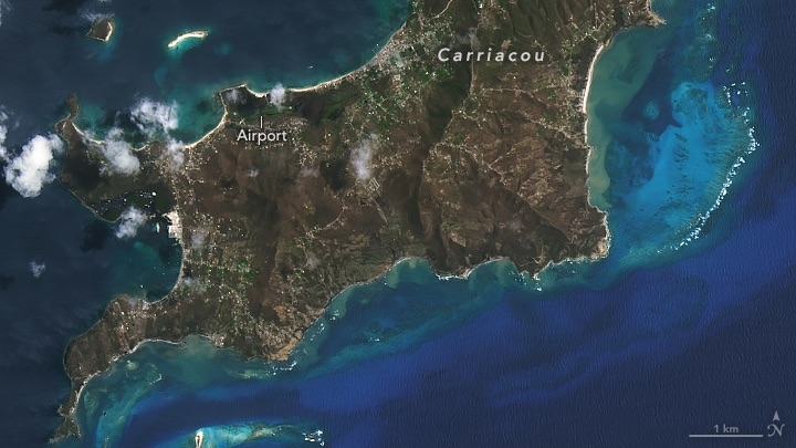
The Category 4 hurricane caused widespread damage to infrastructure and vegetation on the Grenadine island.

A natural-color Landsat 8 image of Carriacou Island acquired on July 6, 2024. In this image, the now damaged vegetation appears greenish-brown with light blue reefs lining the island encompassed by dark blue ocean. White text in the image highlights Carriacou and an airport located on the island.
 

In Case You Missed It

 
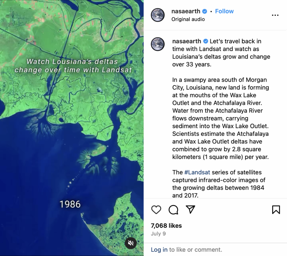
Screenshot of Instagram reel on the NASA Earth account showing how Landsat satellites have viewed Atchafalaya Bay and Wax Lake.

Landsat and Atchafalaya Bay


An Instagram reel posted on the @nasaearth account showing how Landsat monitors coastal areas like Louisiana's Atchafalaya Bay has accumulated over 300k views.


Landsat satellites captured a 33-year infrared-color time series showing new land forming at the mouths of the Wax Lake Outlet and the Atchafalaya River.


A combination of shortwave infrared, near infrared, and green light was used to accentuate differences between land and water


+ Get reel


Did someone forward this newsletter to you? Subscribe here if you'd like to be on our mailing list.


landsat.gsfc.nasa.gov

Facebook  X