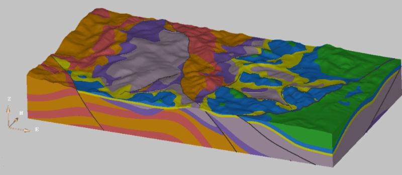
3D Geology model built in 3D Geomodeller software
|
Dear Colleague,
We know that we are not Coursera but after 20 years of working in projects and education for hydrogeologist and geologist we accumulate a lot of knowledge which we want to share with you. Here are which courses we can offer you to increase and build your professional strength with different software's:
1) Groundwater Vistas and Visual MODFLOW Flex (MODFLOW, MODPATH, MT3DMS, MODFLOW USG, MODFLOW SURFACT, PEST)
2) QGIS (free GIS software)
3) ArcGis (not sure which GIS you want to use, click here for great comparison between QGIS and ArcGis)
4) Remote sensing courses for beginners - learn how to manipulate satellite images from LANDSAT, Sentinel 2A and ASTER with free software QGIS
5) Karst, fractured and intergranular aquifer vulnerability mapping with QGIS (free) and ArcGis
6) 3D Geology modeling with state of art software 3D Geomodeller. If you are not familiar with this software or just simply want more info click to link to our web page
If you are interested in this offer and want to expand your knowledge contact us for more info or just reply on this email
|
|
Stay in touch!

|
|
|
|
|