|
|
Harvest partners at Stanford University's Center on Food Security and the Environment are exploring how lidar data from the NASA GEDI mission can help create crop type maps. Their recent work combines lidar & Sentinel 2 Earth observation data to differentiate maize crops and create wall-to-wall crop type maps.
|
|
|
|
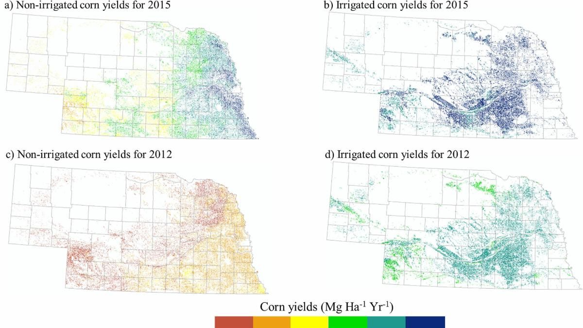
Harvest, in partnership with the USDA’s Agricultural Research Service, is pleased to announce GEO-CropSim, a modeling framework for assessing water use and simulating crop yields at the regional level. GEO-CropSim uses satellite imagery, climate data, and farm management information to estimate crop yields and water consumption at a high spatial resolution.
|
|
|
|
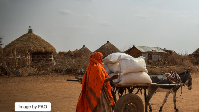
In this article from IFPRI's Food Security Portal, 11 agricultural scientists, including Harvest's Dr. Michael Humber and John Keniston summarize advancements in the real-time monitoring of food security risks by various agencies and academia. The report focuses on approaches that account for climate-related risk factors.
|
|
|
|
Meet NASA Harvest's Dr. Mehdi Hosseini! Dr. Hosseini specializes in the development and refining of synthetic aperture radar (SAR) based models for yield forecasting, crop condition assessments, and crop type mapping. His interview discusses agricultural applications of remote sensing and his recent work developing Sentinel-1 based soil moisture models capable of penetrating crop canopy.
|
|
"Recent Advances for Crop Mapping and Monitoring Using Remote Sensing Data" is a Special Issue being published in Remote Sensing and edited by Dr. Mehdi Hosseini, Dr. Ritvik Sahajpal, and Dr. Hannah Kerner. This special issue is accepting submissions that demonstrate recent advances in EO applications in agriculture including "crop type mapping; crop yield prediction; cover crop mapping; crop residue monitoring; and crop water stress and disease monitoring." Papers utilizing advanced remote sensing techniques like multiresolution data fusion; SAR and optical data integration; and SAR polarimetry and interferometry are particularly welcome.
Manuscripts are accepted through Feb 28, 2022
|
|
The University of Strasbourg, ICube is seeking an outstanding researcher at the Post-doctoral/Research Scientist level, with a strong interest in agriculture and machine learning to join a diverse team working on satellite remote sensing applications for agricultural monitoring and food security, within the framework of the ESA World Cereal Project and the NASA Harvest Program. Interested candidates can find more information on the position here.
|
|
The University of Maryland is looking for an Assistant Professor experienced in remote sensing and applying satellite data to Earth System Science. The position will be part of the University's new Center of Excellence in Remote Sensing and has an expected start date of August 2022. Candidates with background experience in SAR remote sensing, hyperspectral remote sensing, and remote sensing fusion are encouraged, though all backgrounds will be considered. Further the position encourages experience in machine learning and data analysis as it applies to remote sensing data. Interested applicants can learn more about the position here.
|
|
The National Institute for Research in Digital Science and Technology (INRIA) is hiring for a Junior Chair Professorship, a research position that will use Earth observation data and machine learning to develop real-world applications in agriculture and the environment. The Chair position is a fixed-term contract for 3-6 years before potential for tenure as an INRIA senior researcher. Position is in Montpellier, France. Deadline for application is February 13, 2022. More information on the position can be found here.
|
|
Interested applicants are invited to apply for an open position at Tetra Tech. The job posting is for a Data and Analytics Staff Associate in the Agriculture and Economic Growth sector. The opening is an early career position that combines project management, advanced data analytics, and the use of remote sensing technology with a focus on agriculture. Information including qualifications and requirements is here.
|
|
Harvest looks forward to contributing several presentations and partner-led demo sessions on EO data applications for improved agricultural understanding to the inaugural NASA booth at the upcoming 2022 Commodity Classic. The Commodity Classic is America’s largest farmer-led, farmer-focused convention and trade show, providing a unique opportunity to engage with end users and share our many satellite-based innovations to agriculture.
|
|
|
|
|
|
|
|