|
Hello there!
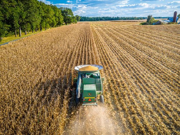
Welcome to our March Recap Newsletter! In this issue, we are bringing you the latest updates and insights from the NASA Acres Consortium.
| | | | |
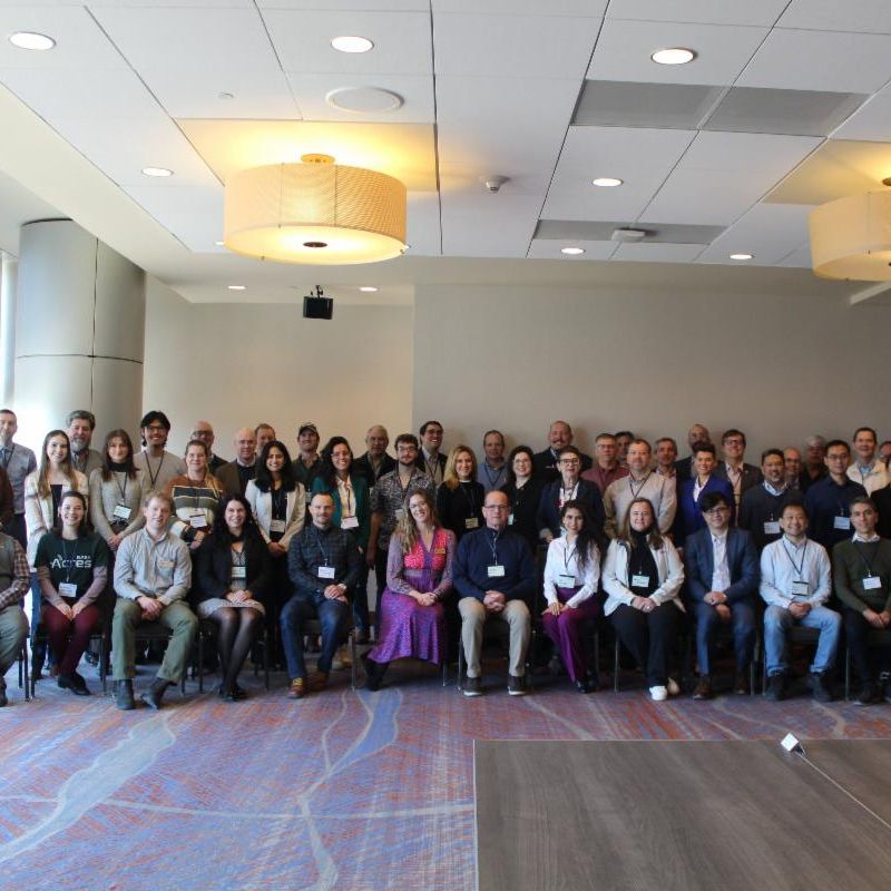
Shaping FIAT: a new era of farmer-NASA collaboration
Since the launch of NASA Acres, we’ve worked alongside farmers to ensure that satellite data provides real value to U.S. agriculture. In early March, we took that collaboration to another level. For the first time, we brought together a dedicated group of farmers alongside research partners from across the U.S. in Denver, Colorado to begin shaping the Farmer Innovation Ambassador Team (FIAT) program.
This meeting marks the beginning of FIAT's journey. While there's still much work to be done, we're excited to be co-develop the program and chart the next steps!
| | | | |
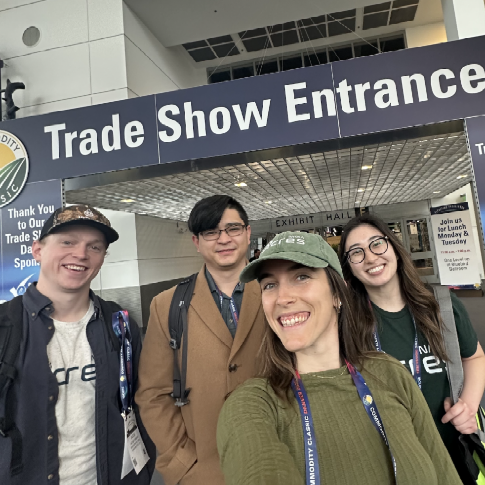
The Conversation with farmers & ag-related businesses continues at Commodity Classic
Commodity Classic is America's largest conference led by and for farmers. Our team, along with other NASA Ag-related programs, attended the conference to directly connect and hear from farmers and other agri-food businesses from across the country. We heard from many how satellites are already transforming how they produce food and manage resources, from detecting nutrient stress in individual fields to supporting large-scale operational planning. We also had insightful conversations on how to enhance their benefits for agriculture.
| | |
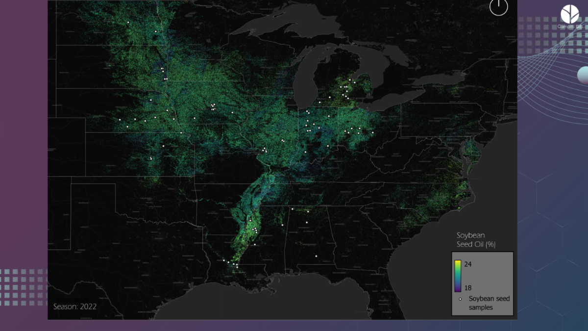
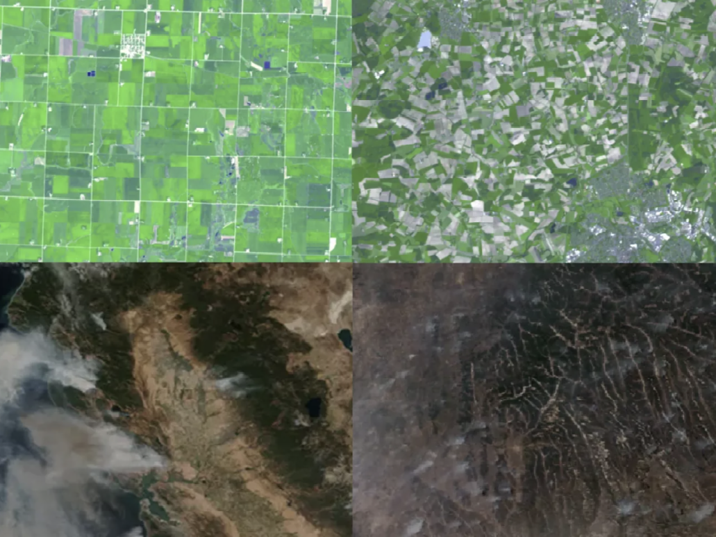
Researchers are Using Satellite Imagery to Help Predict Soybean Quality Before Harvest
Soybean production in the U.S. has steadily been on the rise over the past two decades, driven by both its versatility and economic value - with national acreage growing by over 18 percent. Each soybean is made of both meal and oil, which are used in products from food, to biofuel, to fiber. Given their wide range of uses and market importance, there is a growing interest in improving soybean management practices and better understanding seed quality traits. To support this effort, a team of researchers, led by Ignacio Ciampitti (formerly at Kansas State University, now at Purdue University) and Carlos Hernandez (Kansas State University), is advancing research that integrates in-field crop data with open-source satellite imagery to better understand factors that influence soybean quality and predict traits, such as protein and oil content, before harvest time.
This map shows predicted seed oil content for soybean fields across the U.S. Midwest for the 2022 growing season. Its values range from 18% (blue) to 24% (yellow). By forecasting traits before harvest, farmers and agronomists can make more informed decisions about management practices, like optimizing harvest timing, and can better position their crops for market demand.
| | | | |
How Satellites Are Transforming Agriculture
Earlier this month, Mike Humber represented NASA Acres at the SATELLITE Conference & Exhibition, where he joined a panel discussion on how advancements in satellite technology are driving innovation in the agriculture industry. He shared how privacy-protective tools, such as data anonymization, can enhance the responsible use of Earth observation data, enabling sustainable digitalization and innovation in agriculture.
| | | | |
UI’s most influential: Kaiyu Guan, professor in agroecosystem modeling, sensing
Dr. Kaiyu Guan and his team at University of Illinois Urbana-Champaign have been recognized for their groundbreaking research leveraging satellite data, AI, and supercomputing to help make agriculture more productive and sustainable. At the core of their work is a commitment to translating satellite data into real-world solutions that meet the needs of farmers across the U.S. and drive progress in the broader agri-food sector.
| | | | |
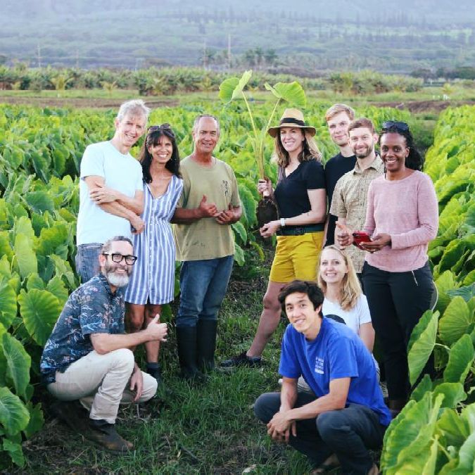
Harvesting satellite insights for Maui County farmers
Hawaiian farmers face a unique set of challenges, including the small amount of available land, water scarcity and high operating costs. The state must import approximately 90% of its food and grocery prices are some of the highest in the nation. Researchers in Arizona State University's School of Computing and Augmented Intelligence are hoping insights from the NASA satellite data they collect might help farmers make the most of their resources. Using AI, Ana María Tárano and the team in the Hannah Kerner Lab have created the Maui Nui Crop Monitor, a newsletter that provides localized data to Hawaiian agricultural stakeholders. The team gathers information including climate data, temperature conditions and soil water content to assist farmers in planning irrigation, planting and harvesting. The researchers seek to support Hawaiian-led efforts to restore food sovereignty to the islands. The project is funded by NASA Acres.
| | | | |
LEAD Maryland Alumni Committee
AI In Action: Satellite Data for Enhancing Food Production and Farm Resilience
April 15, 2025 | 10am-4pm (Eastern)
In-Person | Washington, D.C.
The workshop brings together experts from NASA Harvest, NASA Acres, and the Climate Resilience Network to explore cutting-edge applications of remote sensing, satellite data, and artificial intelligence (AI) in agriculture. Registration closes April 7, the fee includes lunch.
| | | | |
NASA PACE Land Data Users’ Group Kickoff Meeting
Tuesday, April 15 | 2-3pm (Eastern)
Virtual
NASA’s PACE observatory provides novel, freely available hyperspectral and polarimetric data products with exciting potential to serve the terrestrial remote sensing community in new ways. They have found a growing group of data users enthusiastic about PACE’s unique terrestrial products, but less familiar with PACE and how to obtain/utilize the land data. They've created this group to interface with, grow, and inform this user community. At their kickoff meeting they will discuss group objectives, provide an overview of land data products available, and have a tutorial on where/how to access these products.
| | | | |
NOAA Satellite Applications Symposium Series: Workshop On Land and Agriculture
Tuesday, April 15 | 9am-3:30pm (Eastern)
Hybrid | Hybrid, Silver Spring, MD
Topics will include land cover/land use change, agricultural and forestry monitoring, fire detection, spread, and emissions, flooding, inundation and drought, crop condition, phenology and yield, as well as lightning, atmospheric sounding and composition, for agriculture, forestry and other terrestrial ecosystems. Pre-registration is requested.
| | | | |