|
Hello there!
Welcome to our May Recap Newsletter! In this issue, we are bringing you the latest updates and insights from the NASA Acres Consortium.
| | |
New synthesis highlights the potential – and current limitations – of satellite data in rangeland management
A new article released by researchers Tony Vorster and Nicholas Young at Colorado State University’s Natural Resource Ecology Laboratory, in partnership with the NASA Acres Consortium, explores how satellite imagery and other remote sensing technologies can inform rangeland management across the American West. The paper, "Opportunities and Limitations of Remote Sensing for Rangeland Management", offers land stewards a grounded, practical guide to navigating the growing suite of digital tools.
Drawing from years of field experience and data analysis, the authors offer insights into how free, satellite-based tools—such as the Rangeland Analysis Platform, the U.S. Drought Monitor, and Grass-Cast—can support decisions ranging from grazing management to drought planning. The article synthesizes dozens of open-access remote sensing products now accessible to ranchers, consultants, and land agencies, and provides examples of how these tools can be used to inform rangeland management.
| | |
Meet Allison Bredder, Strategic Engagement Officer at NASA Acres
Earlier this year, we welcomed Allison Bredder to the NASA Acres team as our Strategic Engagement Officer, and we’re excited to formally introduce her to the broader community!
Since joining in January, Allison has been busy growing and strengthening partnerships across the Consortium - including leading engagement for our Farm Innovation Ambassador Team (FIAT) initiative. FIAT is designed to connect researchers and early-adopter farmers in co-developing satellite-based tools and products that directly support producer decision-making and resilience.
Allison brings a powerful combination of expertise and passion to this role. She is completing her Ph.D. in Geographical Sciences at the University of Maryland, where her research integrates remote sensing, machine learning, and epidemiological methods to study the health impacts of wildfire smoke. Her previous work includes contributions to land use change science, data visualization, and science communication - experience that underscores her strength in building stronger connections between research and real-world impact.
"There’s so much potential in bringing together satellite data with insights from the agriculture community," says Allison, "I’m excited to be part of work that’s strengthening that connection."
We’re so glad to have Allison on board and look forward to all the exciting work ahead!
| | | | |
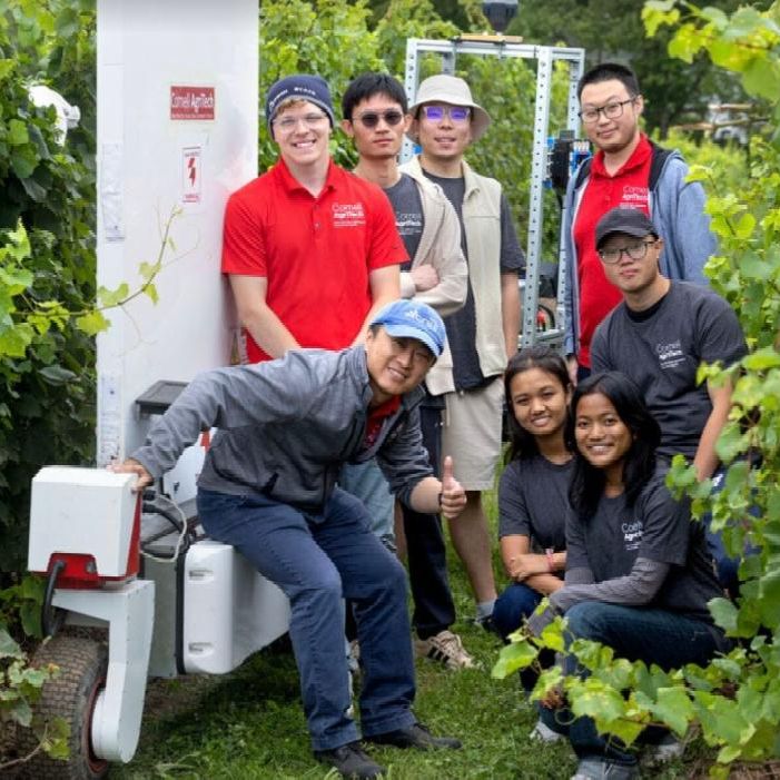
A robot’s ‘eyes’ and a satellite’s view are changing the way we detect crop diseases
Katie Gold and Yu Jiang of Cornell University are pioneering new ways to monitor crop health using a mix of ground robotics, hyperspectral sensors, and satellite calibration.
In test vineyards in New York, their autonomous "PhytoPatholoBots" collect detailed visual and spectral data to detect early signs of disease in grapevines. This ground-based data is helping prepare for NASA’s upcoming Surface Biology and Geology satellite mission, which will offer global, high-resolution imaging of Earth's ecosystems, including crops.
Their long-term vision? To combine satellite imagery, drone and aircraft data, and AI-powered models to create dynamic risk maps that farmers of any size can use to make smarter, faster decisions about crop care improving yields, reducing losses, and building resilience. NASA Acres is proud to support this work.
| | | | |
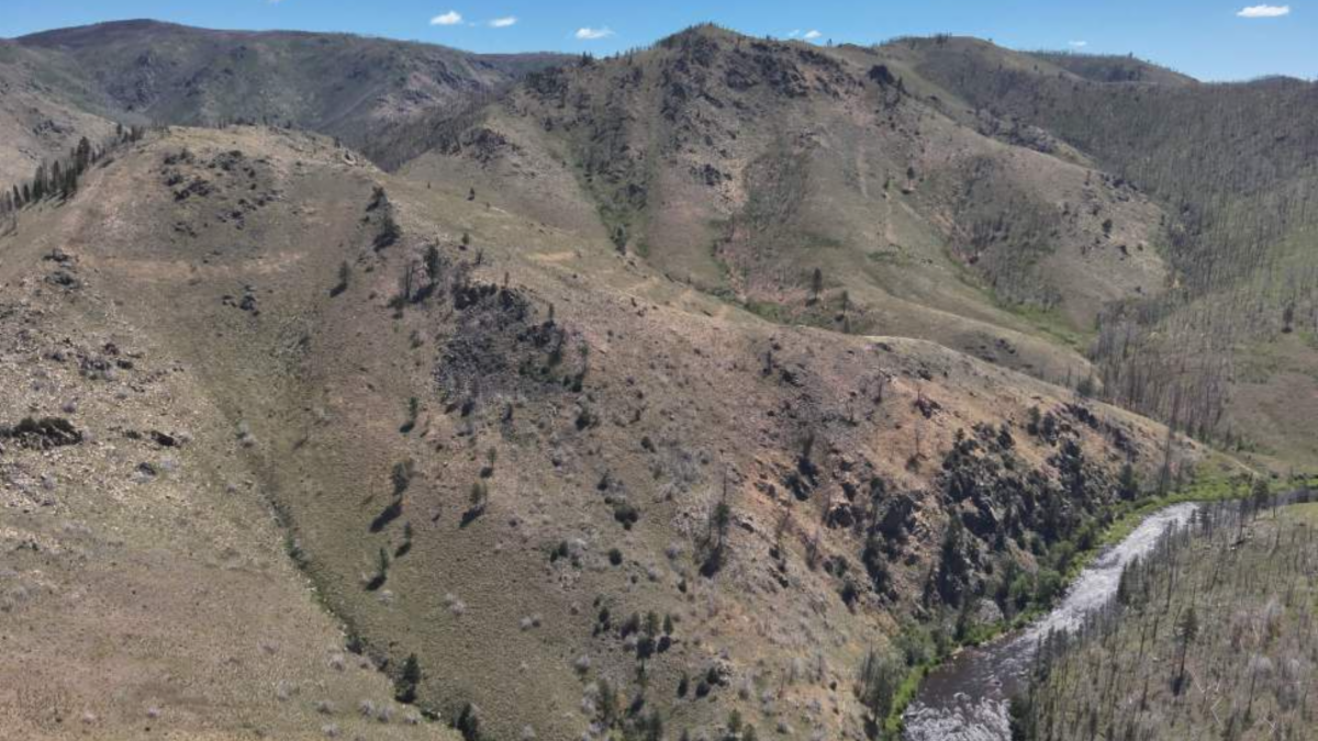
A tornado scars Southern Illinois
A powerful EF-4 tornado tore through southern Illinois on May 16, leaving a 16-mile scar across Williamson County. NASA’s Landsat satellites captured the storm’s dramatic path, offering a striking view of the damage and highlighting the value of satellite imagery in disaster assessment and recovery efforts.
| | | |
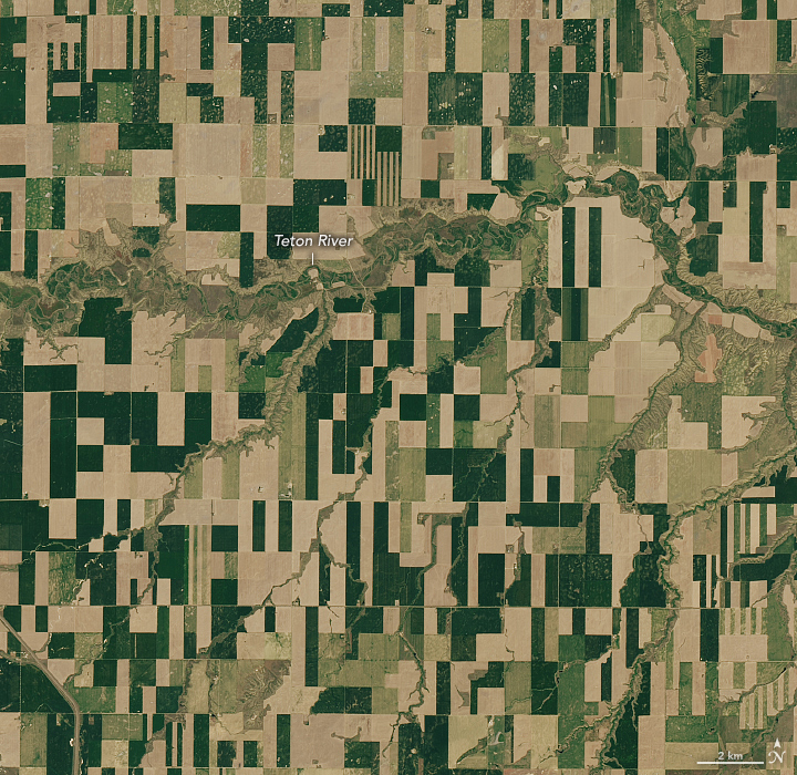
Geometry in the Golden Triangle
In these satellite images, geometric agricultural land in north-central Montana mingles with the sinuous Missouri River and its tributaries. The images were acquired on June 14, 2024, with the OLI (Operational Land Imager) on Landsat 8.
Across Montana, wheat is the most valuable field crop. In 2024, around 5 million harvested acres of wheat were valued at more than a billion dollars, topping the charts in terms of production value, according to the USDA National Agricultural Statistics Service. Hay, pulses, barley, and several other crops also generated substantial revenue.
| | | | |
Volunteer opportunity:
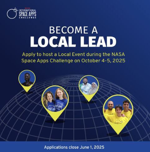
Become a Local Lead for the 2025 NASA International Space Apps Challenge
The 2025 NASA International Space Apps Challenge is seeking passionate volunteers to serve as Local Leads—community champions who help bring the world’s largest global hackathon to their cities or towns.
Local Leads organize in-person or virtual events, foster local participation, and build excitement around NASA’s open data. Their efforts are essential to the success of the Space Apps Challenge, helping connect global challenges with local innovation.
This year, NASA Acres and NASA Harvest have submitted a challenge inviting participants to explore the power of agricultural data.
Interested in leading the charge in your community?
Check out the 2025 Local Lead Recruitment Info Guide to learn more and apply!
| | | | |
Call for submissions:
ERL Focus Issue on Climate-Resilient Agricultural Production
Environmental Research Letters (ERL) is inviting contributions to upcoming Focus Issue on Predictive Decision Support for Climate-Resilient Agricultural Production. This special collection will highlight research that takes cutting-edge climate predictions and turns them into practical tools for farmers.
Researchers are encouraged to submit studies that link advanced climate science with everyday farming practices, focusing on resilience and sustainability. Submissions can include research letters, perspectives, and topical reviews.
The submission deadline is flexible, with final contributions due by September 30, 2025.
| | | | |
Junior researcher/post-doc opportunity:
Agroecosystem Sustainability Center (ASC) at UIUC
The Agroecosystem Sustainability Center (ASC) at the University of Illinois Urbana Champaign is hiring for two junior researcher/post-doc positions.
1) Agricultural policy and data analytics
2) Ecosystem modeling (pastureland focused)
Both of these candidates will have the opportunity to work with Dr. Kaiyu Guan, Chief Scientist at NASA Acres.
Deadline: Ongoing
| | | | |
Join us for the second meeting of the PACE Land data Users’ Group (PLUG)
July 1, 2025 | 2-3pm (Eastern)
Virtual
NASA’s PACE (Plankton, Aerosol, Cloud, ocean Ecosystem) observatory, launched just over 1 year ago, provides novel, freely available hyperspectral and polarimetric data products with exciting potential to serve the terrestrial remote sensing community in new ways. We have found a growing group of data users enthusiastic about the unique terrestrial products only available from PACE, but less familiar with the observatory and how to obtain/utilize the data. In response, we’ve created PLUG as a forum for interfacing with, growing, and informing the PACE terrestrial data product user community. PLUG meeting content is user-driven, covering the most requested topics from the group.
| | | | |
NASA ARSET: Fundamentals of Remote Sensing
Asynchronous
Virtual
NASA ARSET is re-releasing their free Fundamentals of Remote Sensing course. In this self-paced course, you’ll learn the underlying science behind how remote sensing works and the basic functional characteristics of satellites and sensors. You will explore the kinds of satellite remote sensing data that are available, advantages and disadvantages of remote sensing, and some basic tools to visualize data. By the end of the course, you’ll be equipped to begin your journey using NASA’s no-cost, open-access remote sensing data and resources.
| | | | |