|
Good morning,
Confidence continues to increase that a significant winter storm will impact much of NC over the weekend with impacts lingering into early next week. While it remains too early for specific types and amounts, the forecast will continue to be refined over the next few forecast periods. Now is the time to prepare for winter weather and the potential for power outages across your area.
- Low relative humidity this afternoon will increase the threat for wildfires across western NC, especially where fuel moisture is low. However, winds will remain light across the region which will help mitigate the risk for wildfires.
- Mostly dry conditions are forecast Wednesday, but a weak cold front will cross the region this evening into Friday bringing the chance for light precipitation. Light wintry precipitation will be possible across the mountains through Friday. Accumulations will be light with only minor travel impacts possible, especially for higher elevations. Outside of the mountains, light rain is in the forecast Friday as the slow moving cold front finally pushes out of the region.
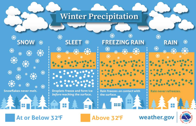
- The most impactful precipitation will be over the weekend where a wintry mix is forecast across much of the state. While confidence continues to increase, precipitation types and amounts remain uncertain. Cold air will spill into the region Friday as moisture moves in early Saturday and lingers into Monday morning. All wintry precipitation types are expected but it remains unclear where exactly temperatures at the upper levels will be warm enough to support melting, resulting in sleet or freezing rain instead of snow.
- The probability of moderate impacts is 50-90% across much of NC from all precipitation types. The probability of major impacts is the greatest for northern areas and is largely due to snow accumulation. Major impacts may cause considerable disruptions to daily live with dangerous or impassable driving conditions. Widespread closure and disruptions of infrastructure may occur.
- Avoid travel if possible but if you are on the roadways, reduce speed and leave plenty of distance between you and the vehicle in front of you. Be sure to clear your car of any snow or ice to allow visibility as you drive.
- Dangerously cold wind chills will likely develop Monday night into Tuesday morning and snowpack/ice accumulation may linger through early next week. Highs and lows will likely be record breaking for some areas Monday and/or Tuesday. A Cold Weather Advisory or Extreme Cold Watch/Warning will likely be needed.
Please let me know if you have any questions.
|