|
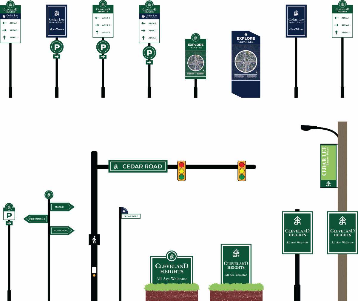
Developed in partnership with the City of Cleveland Heights, the Gateway & Wayfinding Signage Plan identifies existing signage typologies, conditions, and locations within Cleveland Heights. It offers best practices for wayfinding signs, gateway signs, mobile wayfinding, and includes case studies of signage in other cities.
County Planning undertook a robust process to inventory the signage in Cleveland Heights. This city-wide signage inventory was assembled with data collected from both walking and driving audits of the community's main corridors, 11 business districts, and at city facilities. The plan includes information on design, fabrication, installation, and maintenance of new signage and recommends locations, typologies, and style considerations that Cleveland Heights can apply to its future signs.
|