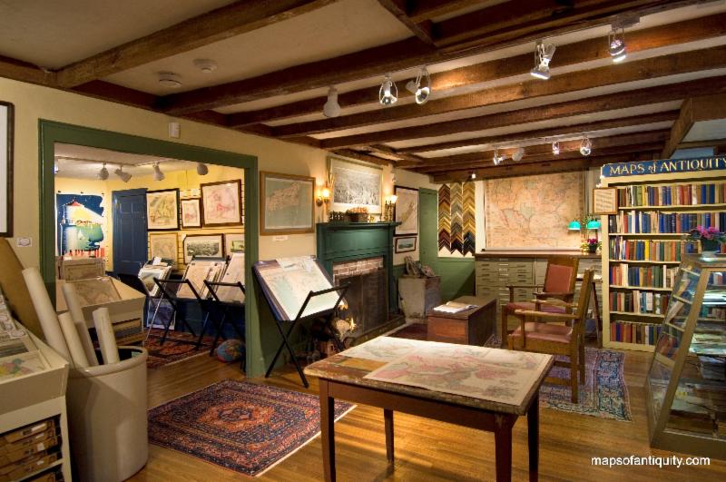
We're Open
Year 'Round!
Our shop is normally open:
Monday - Saturday:
10am - 5pm
Sunday:
12 noon- 5pm
We're also available after hours by appointment, and you can
shop online 24/7 at:
Or give us a call at:
508-945-1660
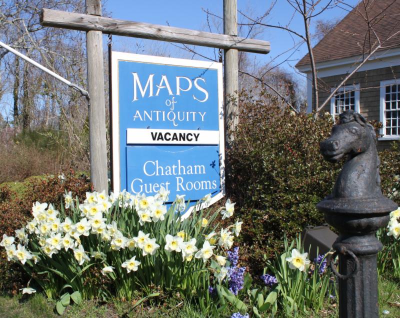
If you or your loved-ones need accomodations, send them over to our converted 18th century farmhouse,
Chatham Guest Rooms
. We have been very
well reviewed
on TripAdvisor!
Cape Cod is quieting down, but this time of year is a great time to vacation here! Most restaurants are open but with less traffic you will have more time to have fun. Maybe take a walk along the beach or visit one of the Cape's many excellent museums? Or just pop into the map shop to browse!
|
|
|
DEAR FELLOW MAP LOVERS,
The end of October is looming and Chatham has been quieting down. As such, we have been busy adding new maps to our website lately! We have a wide variety of new items, so there is something to interest everyone. You can see many of our newest maps by
watching our Newly Listed category, which is updated weekly or more frequently. Without further ado, here are our Top Ten New Items for October:
|
|
Top Ten New Maps in October 2017:
(in no particular order)
|
#1: Amerique Septentrionale - 1802
This early map of the United States was done by Guthrie, published in 1802. The United States extends as far west as the Mississippi River, and as far south as Georgia, etc., at this time. How different things might be if these borders hadn't changed!
#2: VI. Tableau- Hauteurs comparees du Globe & Accidens divers de la Terre- 1877
|
|
| Comparing some of the Mountains and Rivers of the World |
An interesting comparative map of the mountains and other natural features of the world. Published by Fayard in the "Atlas Universel," 1877. Text is in French.
See more Comparative maps here.
#3: City of Somerville Mass. - 1889
One of the MOA staff worked and studied in Somerville, so she has a fondness for this fun town. This map is from the Atlas of Middlesex County, MA, 1889, by Walker. Shows Tufts University, the McLean Asylum, Mystic Steam Pump and Reservoir, and the Mystic Trotting Park. Colored by ward.
#4: Le Pluvier A Collier - 1780
Our newest avian prints are sure to capture any bird enthusiast's heart. Take, for example, this detailed rendering of the Common Ringed Plover, with title in French. Published by Buffon, 1780.
#5: Carte Du Portugal - c. 1820
It is somewhat rare to have a map of this size and quality of Portugal alone (normally Spain is shown as well). This map is part of a multi-volume "Description of Egypt," commissioned by Napoleon, and published by Ambroise Tardieu, c. 1820.
#6:
Northern Celestial Hemisphere & Southern Celestial Hemisphere
- 1879
|
|
Northern and Southern Hemispheres
|
Simple in color and design, yet detailed and interesting, this celestial map is sure to sell quickly. It includes the Milky Way and the constellations of the Northern and Southern Hemispheres, published by Black, 1879.
#7: Plan of New York and Brooklyn - 1867
Great map of New York from the Atlas of New York and Vicinity, by Beers, 1867. This map shows Manhattan and Brooklyn very nicely with Central Park, Queens, the Bronx, and more. This map is significantly discounted because of its condition (a vertical line of image loss near the center where someone colored in the areas where the image was lost to make the imperfection less noticeable). If you have been waiting for a deal on a New York City map, this might be the one for you!
#8: Chart of the West Indies with the adjacent Coast of South America shewing the Tracks of Don Christopher Columbus - 1828
|
|
| Columbus in the Caribbean |
From A History of the Life and Voyages of Christopher Columbus by Washington Irving. Famously, this book is the very embellished "history" of Columbus in which the "flat earth" story was first published. This map represents the Caribbean well, with the Bahamas to the Antilles including the Virgin Islands and the coast of South America, part of Central America, and the tip of Florida.
We have another map from the same book showing Columbus' journeys across the Atlantic, which you can see here:
#9: Le Serval & Le Guepard (Pl. 218) - c. 1830
Birds aren't the only creatures that have been added to the website lately. They are joined by fish, butterflies, shells, plants, and more, including animals such as this illustration of a serval cat and a cheetah. Published by Lejeune, c. 1830.
#10: Air France Book Jacket - 1950
|
|
| Air France Map of the World |
We saved the brightest for last! This is an unusual one, but this antique printed color pictorial map of the world was apparently a book jacket, printed in 1950. This small and colorful map shows the routes of Air France flights with a highly decorative border that features representations of people, plants, and animals from various parts of the world.
|
|
 |
| Find us on Social Media for more updates |
Do you tweet, follow, like, and pin? Well, Maps of Antiquity has an active Facebook page where we post map-related articles, unusual maps and prints that we add to our website, company news, and answers to frequently-asked questions.
On Pinterest, we display some of our maps and prints and add opinions and comments about specific pieces. We also provide boards with decorating ideas.
On Twitter, Maps of Antiquity offers links to articles and brief news. We also periodically update Google Plus and LinkedIn with company news and product information.
Follow us on Instagram for fun posts like #MapMonsterMonday and snapshots of the shop!
So if you are spending time on social media, be sure to look us up. Also, if you have a preferred social media where you think we should be active....let us know!
|
|
|