Do you need geospatial data products, (DTM, DSM, DEM), for your environmental engineering projects? | |
Whiteout Solutions provides comprehensive geospatial data acquisition services for engineering projects of every scale.
From 1-acre sites to 100,000+ acre regional surveys, we deliver high-accuracy topographic and bathymetric LiDAR, aerial imagery, and remote sensing solutions that create complete, seamless datasets for engineering design and analysis.
Our team specializes in challenging environments; including river corridors, wetlands, coastal systems, transportation infrastructure, and pre-construction planning.
| | |
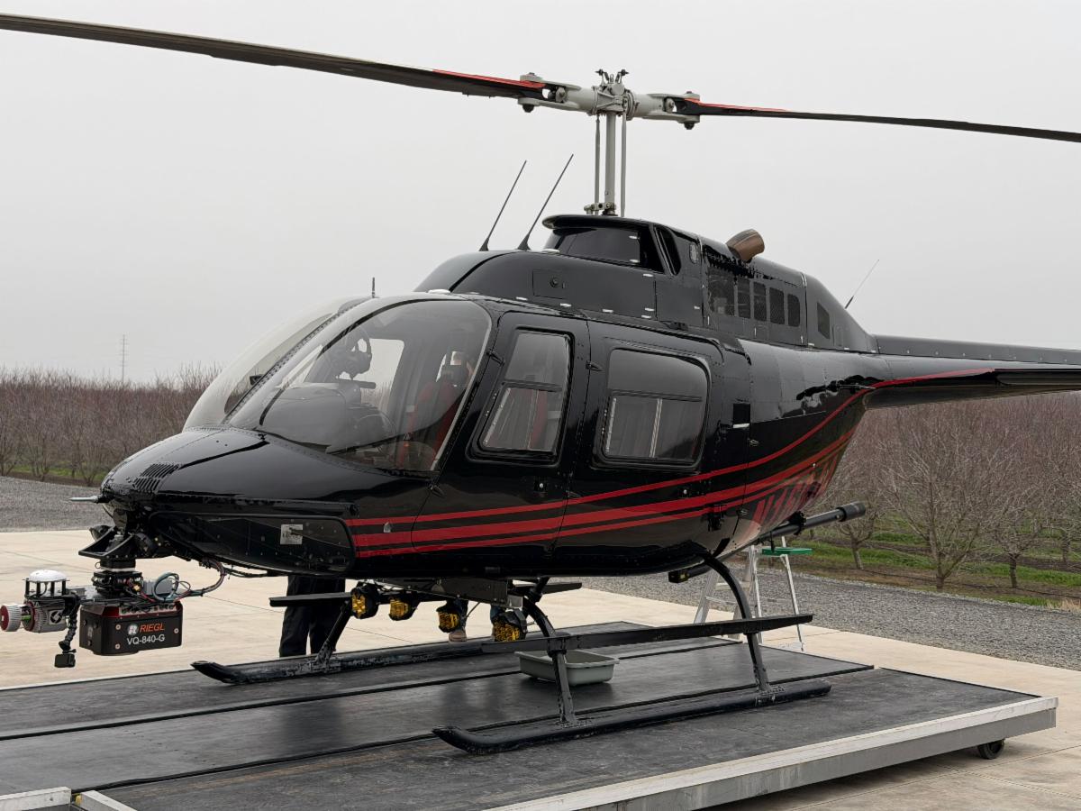
Whether collected by helicopter, fixed-wing aircraft, or UAS, our team acquires, processes, and delivers geospatial datasets tailored to your project's needs, including:
- Digital Terrain Models (DTMs) for grading, drainage, hydraulic analysis, and earthwork planning.
- Digital Surface Models (DSMs) for infrastructure, vegetation, and built-environment assessments.
- High-resolution Digital Elevation Models (DEMs) for engineering design and site planning.
- Contours, slope, aspect, hillshade, and other terrain derivatives for detailed surface analysis.
- HEC-RAS-ready terrain models and geometry inputs that streamline hydraulic modeling and floodplain analyses.
- Multi-temporal change detection to monitor erosion, sediment transport, shoreline migration, vegetation change, and construction progress.
- Predictive terrain models for riverine, coastal, and floodplain environments.
- Seamless topographic and bathymetric datasets that create continuous land-to-water elevation models for hydraulic, environmental, and coastal engineering applications.
Need something not listed? Our team regularly develops customized deliverables and workflows to meet unique engineering, environmental, and infrastructure project requirements.
| |
Whiteout Solutions is isn't just a geospatial services company; we're also a software company. And we couldn't help but creating solutions to our own geospatial collecting, processing, data storage, and delivery problems. All of those solutions can be found in geoSAP.
Every project starts with reliable data; but turning raw geospatial datasets into engineering-ready deliverables often requires multiple software packages, lengthy processing, and time-consuming collaboration.
geoSAP streamlines that workflow.
| | |
Designed for engineering, surveying, and environmental professionals, geoSAP transforms LiDAR, imagery, and topographic data into the terrain models and analyses your team depends on to make confident design decisions.
| |
Build the Models Your Projects Depend On
geoSAP enables engineering teams to generate and analyze:
- Digital Terrain Models (DTMs) for grading, drainage, and hydraulic analysis.
- Digital Surface Models (DSMs) for infrastructure, vegetation, and built-environment assessments.
- High-resolution DEMs for engineering design and site planning.
- Contours, slope, aspect, hillshade, and elevation derivatives for terrain evaluation.
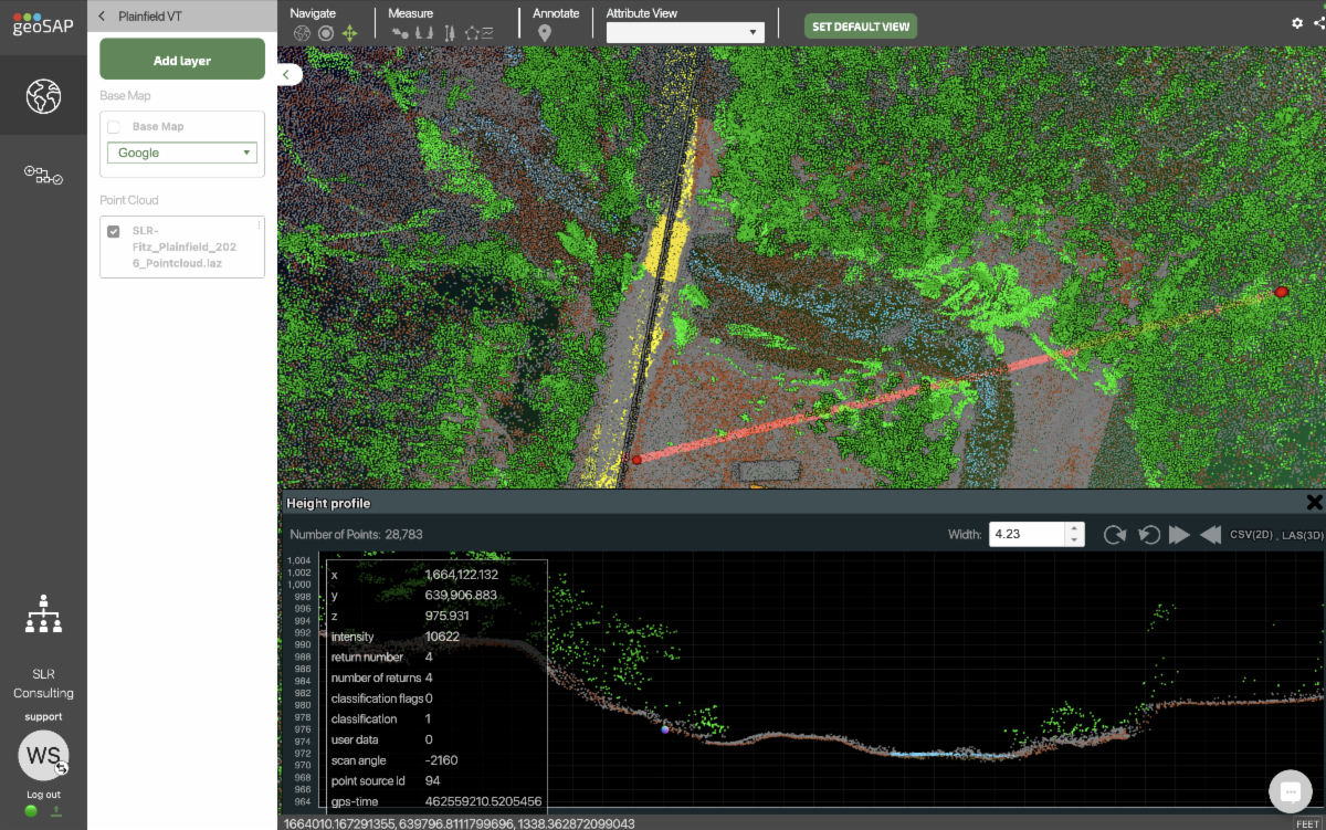
- Cross sections and elevation profiles for corridor design, stream restoration, transportation, and utility projects.
- HEC-RAS-ready terrain models and geometry inputs to support hydraulic modeling workflows and streamline floodplain, river, and water resource engineering analyses.
- Multi-temporal change detection to monitor erosion, sediment movement, shoreline change, and construction progress.
- Predictive terrain models for riverine and coastal environments.
- Integrated topographic and bathymetric datasets that provide a continuous model across the land-water interface for hydraulic and environmental applications.
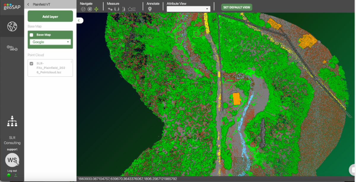
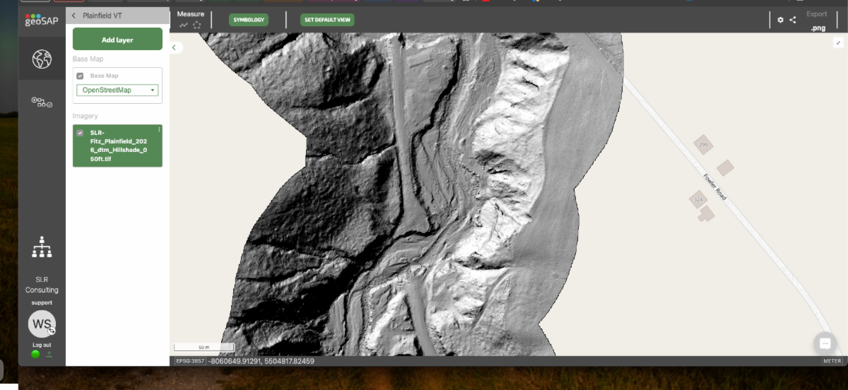
| Above pictured is a top-down view of a section of Great Brook River in Vermont, demonstrating high resolution data through a detailed DTM for assessing floodplain predictions, mitigations and restoration efforts. | Above is the same section of Great Brook river above but shown through a point cloud visualization. The crosscut pictured gives a reference point for point density as well as topo-bathy penetration and further analysis. |
Collaborate Without the Bottlenecks
With just geoSAP Cloud, your team can:
- Access massive LiDAR and imagery datasets directly in a web browser.
- Measure, analyze, annotate, and share projects without specialized desktop software.
- Collaborate with engineers, GIS professionals, project managers, clients, and stakeholders using a single source of truth.
The Complete geoSAP Platform
However, geoSAP is more than just Cloud:
- geoSAP Projects organizes project planning, resources, documents, timelines, and deliverables into a single collaborative workspace.
- geoSAP FMS manages flight planning, sensor acquisition, telemetry, and mission monitoring.
- geoSAP Field validates acquisition quality in real time with coverage analysis, QA/QC, and reflight identification.
- geoSAP Fusion automates processing workflows to generate engineering-ready terrain models, deliverables, and QA/QC reports.
- geoSAP Cloud & Vault securely stores, visualizes, shares, and manages geospatial data while enabling collaboration across engineering teams.
| |
Whether you're designing transportation infrastructure, restoring river systems, planning utilities, assessing flood risk, or managing environmental projects, geoSAP helps engineering teams move from raw data to informed decisions; faster.
Reach out with any questions or inquiries!!
| | Our Company | Contact Us | FAQs | Privacy Policy | | | | |