| | |
MONTHLY NEWSLETTER
October 2025
| |
Preserve Calavera Supporter
| | |
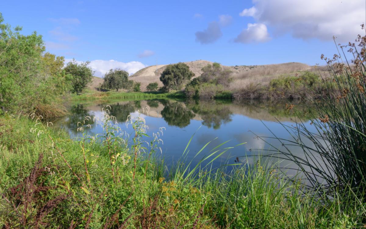
Do you remember these classic horror movies— the Creature from the Black Lagoon, Swamp Thing and The Legend of Boggy Creek? What do swamps, bogs and marshes all have in common besides being settings for scary movies? They are all types of wetlands and, far from being scary, they are essential to our health and the well being of our planet.
As we begin wading into wetlands, we better make sure to have some tall boots on; things can get complicated and confusing fast. Wetland classifications and definitions vary depending on the source. In fact, the Federal government uses one designation for wetlands, while the state of California has another.
| | |
In California, wetlands are designated by three properties:
-
Hydrology: The area where plants can root and grow is filled with water (saturated).
-
Hydric Soils: The saturated soil causes anaerobic conditions (no oxygen).
-
Hydrophytic Vegetation: The vegetation in the area is dominated by plants that grow either partly or totally submerged in water (aka hydrophytes) or the area is lacking vegetation. (CA Water Boards)
Federal wetlands management is overseen and regulated by the US Army Corps of Engineers and also by the Environmental Protection Agency and the US Department of Agriculture. Federal wetlands lost some protections and their designation became more confusing in 2023. The Supreme Court ruled that a wetland, to gain federal protections under the Clean Water Act as “waters of the United States,” must bear a “continuous surface connection” to perennial navigable waters.
Our local and regional conservation plans do not include coverage for wetland impacts—they still require a separate permitting process through state and federal agencies
| | |
Adding another layer, the CA Coastal Commission plays a role in protecting wetlands too. Their jurisdiction extends 3 miles out to sea and varying distance inland. Impacts in those areas require Coastal Development Permits from the Commision. All jurisdictions along the coast are required to update their Local Coastal Programs to address Sea Level Rise by 2035.
| | | | |
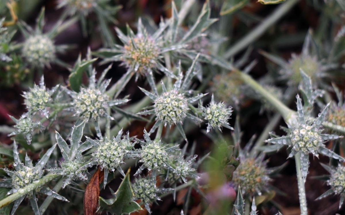
Flowering SD button celery. Photo credit Pacific SW Region USFWS.
Large vernal pool at the south end of the Poinsettia Station Vernal Pool Preserve. San Diego button celery is visible growing throughout.
Photo credit: Scott McMillan
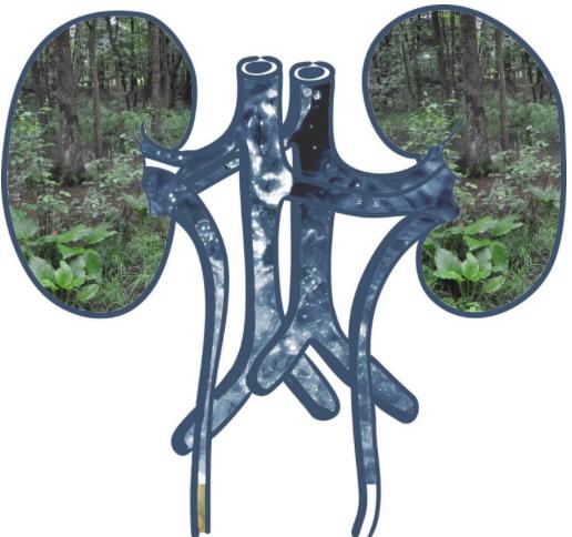
| | With fewer federal protections, this could open up wetlands to more development and more pollution. At stake in California are seasonal streams, ponds and vernal pools, which are only saturated with water part of the time. This would exclude them from wetlands designation under the Supreme Court ruling since they are not continuous. In California, an estimated 80% of all linear miles of streams and rivers are ephemeral or intermittent. And already at risk vernal pools (read more April 2025) would lose vital protections. California will ensure that these waters of the state will continue to be protected even if protections for federal waters are narrowed by administrative actions or the courts. | | Although it is estimated that wetlands only make up 4-6% of earth’s land surface, they are among the world’s most productive and biologically diverse environments—rivaling rainforests. | | The outsized role of wetlands in maintaining healthy ecosystems is often compared to the job our kidneys do for our bodies; filtering and remove pollutants. Wetlands do this by slowing down water as it travels through the watershed. This allows suspended materials in the water to settle out so pollutants are trapped before reaching the ocean. Some of the pollutants are absorbed within soil layers and some taken up by plants. Soils and plants are able to break down many of the pollutants over time using their biological processes. | | Imagine wetlands acting as the kidneys in your body and helping to purify our environment. Illustration credit University of Florida. | | The graphic below from the National Oceanic and Atmospheric Administration describes the value of Coastal Welland Habitat. | | |
California has lost more than 90% of its historical wetlands and today, many of the remaining wetlands are threatened.
Wetlands continue to be drained for agriculture, dewatered from groundwater withdrawals, filled for development, or disturbed by changes to the watershed such as dams or water diversions. Pollution and invasive species have also contributed to wetland loss. Climate change poses a significant threat, as many wetlands today are dependent on artificial water delivery systems or high groundwater levels, and may be impacted by changing climatic conditions. Further, wetlands along the coast face flooding from potential sea level rise. (Source)
Sea level rise is also causing saltwater to move inland, which is then mixing with the fresh groundwater and other freshwater systems (such as marshes) along the coast. This impacts humans and wildlife that are dependent on freshwater. This process is known as saltwater intrusion. Please read more about saltwater intrusion and its threats to the freshwater supply: USGS
| | |
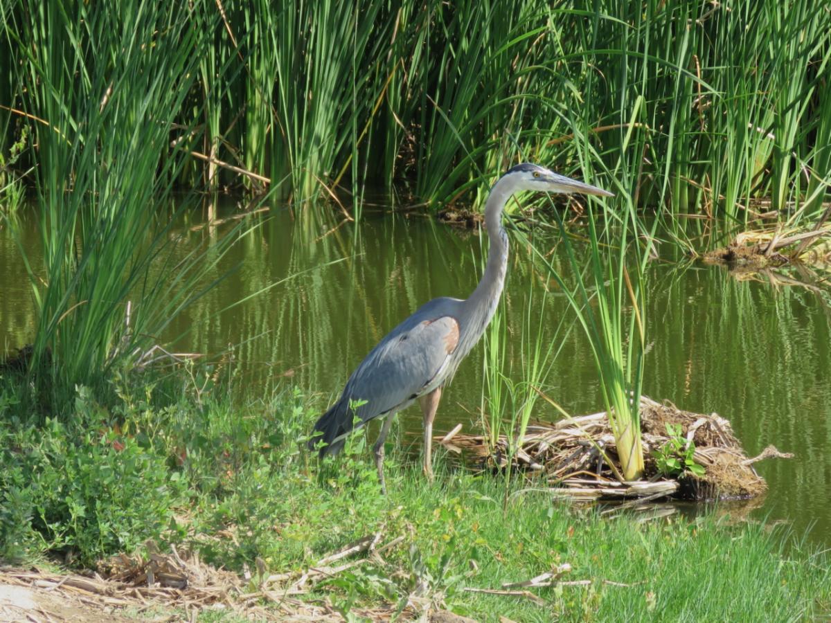
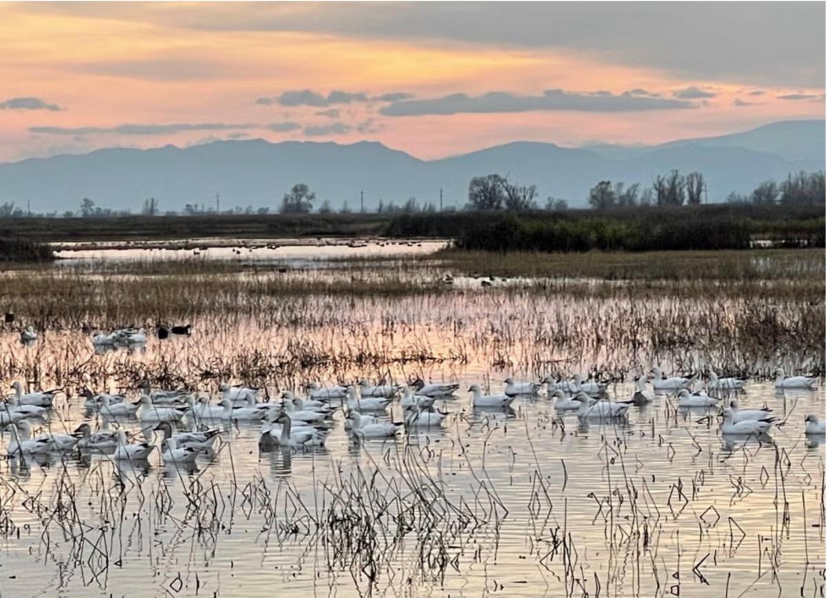
Wetlands are essential habitat for waterfowl, shorebirds and other wetland-dependent species.
California's wetlands provide stopover, wintering, and breeding habitat for vast numbers of waterfowl along the Pacific Flyway—the bird-migration corridor extending from the southern tip of South America to Alaska.
Below, snow geese stopping off along the flyway at the Sacramento National Wildlife Refuge Photo credit: Jenn Bowles, Water Education Foundation.
| | |
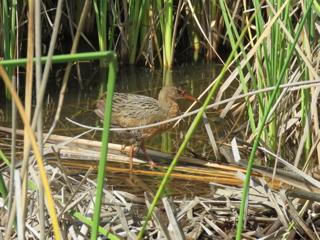
The Buena Vista Lagoon is a sanctuary for many local birds, like the light-footed Ridgway's rail, as well as those passing through on the Pacific Flyway.
The Ridgway's rail is marsh dependent all year round. It can only be found in Southern California and northern Baja California. It lives and nests in salt marshes, brackish marshes and freshwater marshes with cattails (its habitat at the Buena Vista Lagoon). It relies on shallow water and mudflats for foraging.
The light-footed Ridgway’s rail is federally and state-listed as an endangered species. Unfortunately, Its population has declined as a result of habitat loss.
| | |
Above: Light-footed Ridgway's rail at Buena Vista Lagoon.
Photo by Jane Mygatt
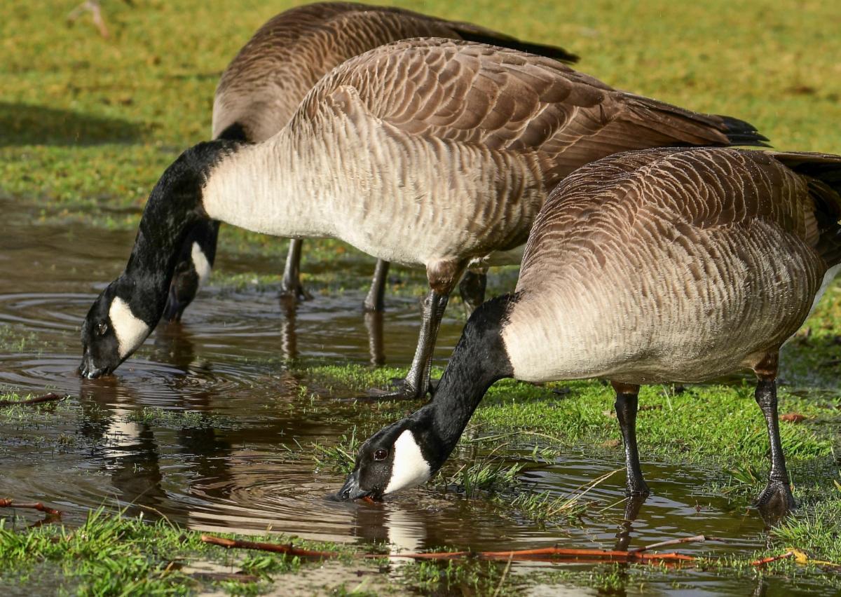
| | Below: Whelan Lake, a freshwater marsh in Oceanside. At right, Canadian Geese stopping by the lake. Photo credits: Whelan Lake Bird Sanctuary. | | |
Because of their critical role, wetland habitats have the highest level of environmental protection.
A potential project impacting wetlands is first obligated to eliminate impacts and, if that is not possible, mitigation is used. Land use mitigation refers to purposeful actions taken to lessen the adverse impacts of human activities on the land and to the environment. The CA Coastal Commission has generally accepted that permanent impacts to wetlands are mitigated at a 4:1 ratio. This means that four acres of mitigation would be required for every one acre of impact on the wetland. In contrast sensitive Coastal Sage Scrub habitat is generally mitigated at a 2:1 ratio.
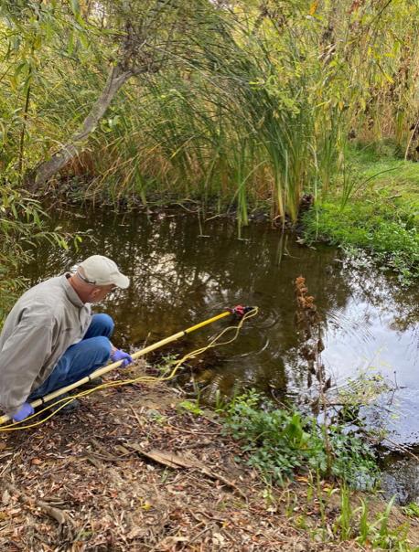
| | Wetlands Delineation: How do you find the boundaries of a wetland area? | | |
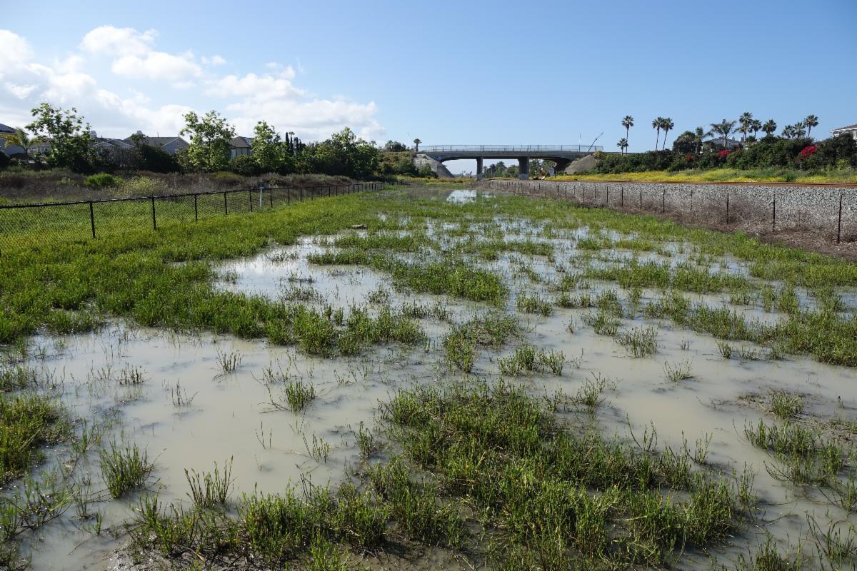
Wetlands can be deceiving as some wetlands are only wet on a seasonal basic. Some may only hold water for 6 weeks of the year, but they are still classified as wetlands.
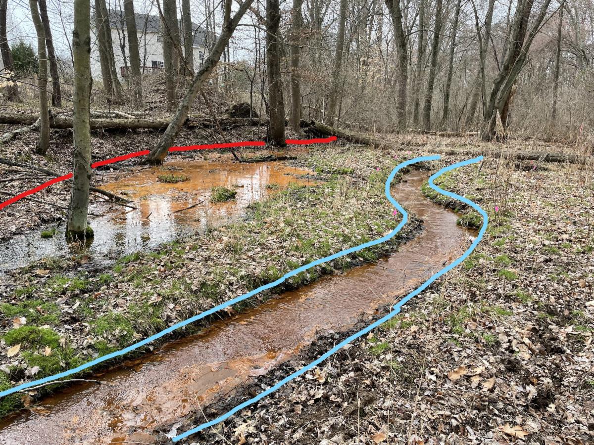
If a suspected wetland is present on a site, the Environmental Impact Report has to include a formal wetland delineation. This is a procedure to find the boundary between a wetland and upland; the approximate extent and location of wetland on the site of interest.
| | For example, the marked up image above indicates the upland, wetland, and stream. The red line marks the boundary between a wetland and an upland. The blue line marks the boundary between a stream and the wetlands on either side of the stream’s banks. Photo credit: Princeton Hydro. And if you have ever wondered what your day would be like as an environmental scientist doing a wetlands delineation, you will enjoy checking out Princeton Hydro's: A Day in the Life: Performing a Wetland Delineation! | | Five major wetland types are generally recognized-- but that's complicated too! | | |
Below are the five general types of wetlands but there also various ways they can be classified.
-
marine: coastal wetlands including coastal lagoons, rocky shores, and coral reefs
-
estuarine: including deltas, tidal marshes, and mangrove swamps
-
lacustrine: wetlands associated with lakes, reservoirs, and large ponds
-
riverine: wetlands along rivers and streams
-
palustrine (meaning marshy):marshes, swamps and bogs, fens
| | |
If you would like to dive into the classification and definitions of wetlands, the US Geological Survey gives a nice historical perspective: LINK
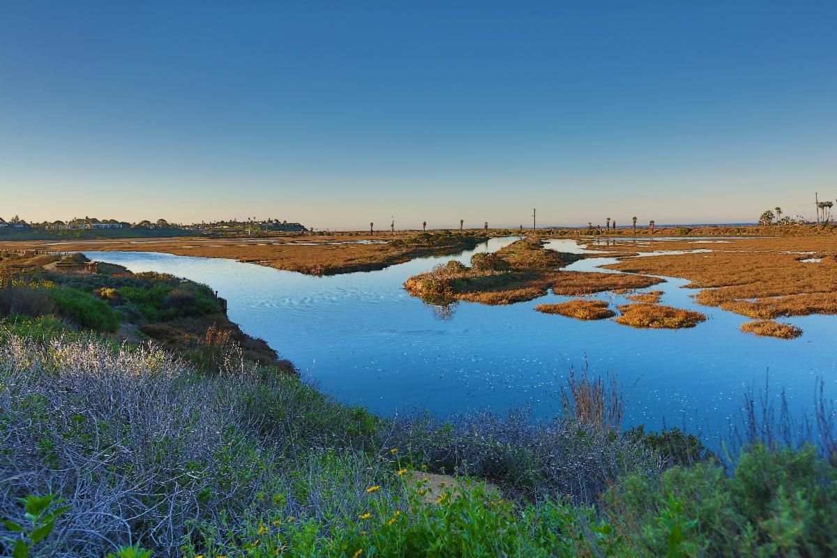
Below: San Elijo Lagoon, a primarily shallow-water estuary (photo by Rennett Stowe)
| | What can you do to help protect our diminishing wetlands? | |
-
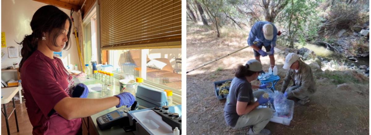
Volunteer for our Water Quality Monitoring Team: We do testing 6 times a year (bimonthly). We monitor each site for nutrients (ammonia, nitrates, and phosphorus), turbidity, dissolved oxygen, pH, conductivity and bacteria (total coliform and E. coli). You can learn more about our North San Diego County Watershed Monitoring Program, view the sites and our data at this LINK. Please contact Paige at pdecino@preservecalavera.org if you would like more information.
| | Volunteers at work in the lab and in the field! This could be you! | | | |
-
Volunteer for local community cleanup events: To find out more, check out I Love a Clean San Diego's Website. And see the article below about our recent clean up event.
-
Reduce your everyday trash footprint: Pick up litter and dispose of it in appropriate trash containers. Reduce, reuse, and recycle whenever possible to stop waste from ending up in our wetlands and. waterways.
- Always pick up and properly dispose of pet waste
| | | | |
-
Plant native species: Avoid planting non-native species that can quickly become invasive. Landscaping with native species requires less maintenance and helps to preserve the ecological balance of nearby wetlands. Calscape is a great resource!
-
Recreate responsibly: Respectfully enjoy wildlife viewing and other recreational opportunities that wetlands offer by staying on trails and boardwalks and practicing Leave No Trace Principles
-
Contact your state representatives to request increased funding for the CA Coastal Commission for enforcement: This is essential to protect public access- and the natural resources along the coast. Find your representative here: State Senate and Assembly
-
Act on Climate: Wetlands are impacted by changes in temperature and precipitation, and sea level rise and storm surge can lead to wetland loss. Do what you can to reduce your greenhouse gas emissions and encourage others to implement large scale solutions. Visit CalEPA for more about climate solutions. And a guide to climate change for kids of all ages—NASA Climate Kids
| | | | Event Calendar for October | | |
Sat, Oct 11
Rancho La Costa Restoration
9:00 am - 10:30 am
If you would like to volunteer you must RSVP to:
info@preservecalavera.org
or call Anne-Catherine: 858-353-6232
| |  | |
Removing non-native plants and watering native plants as needed.
Prepare: Wear appropriate (preferably long pants/sleeves) clothing, closed-toed shoes, and hat. Bring gloves, sunscreen and water.
| | |
Sat, Oct 18
El Corazon Restoration
9:00 am - 10:30 am
If you would like to volunteer you must RSVP to:
info@preservecalavera.org
or call Diane: 760-724-3887
| | | |
Removing invasive plants from this site.
Prepare: Wear appropriate (preferably long pants/sleeves) clothing, closed-toed shoes, and hat. Bring gloves, sunscreen and water.
| | |
Sat, Oct 18
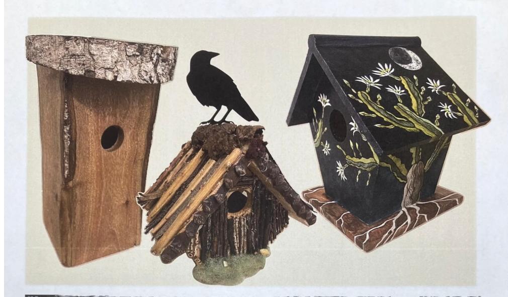
Buena Vista Audubon's 15th Annual Birdhouse and Nature-Themed Art and Auction
Where:
BV Nature Center, 2202 S. Coast Hwy, Oceanside (760) 439- 2473
4:00 pm - 6:30 pm
**You can also support the BVAS by donating artwork for this event**
Art must be dropped off at the Nature Center by October 15.
For more details: Donation Flyer
| | | |
Tickets are $20 per person (children under 18 are free)
- Bird houses, art work in many media and lots more!
- Live auction at 6:00 pm
- Live music
- Appetizers, desserts, and a variety of drinks; including wine and beer
For more info: Event FLYER
| | Another Coastal Clean Up Day at El Salto Falls! | | |
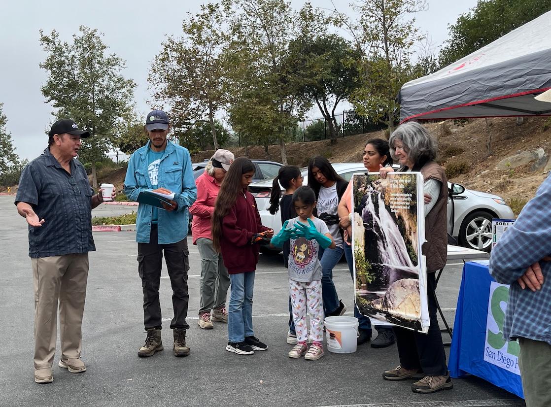
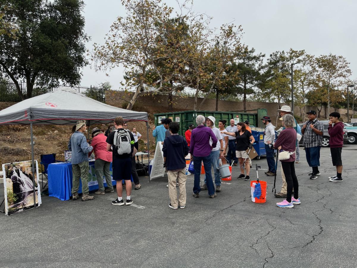
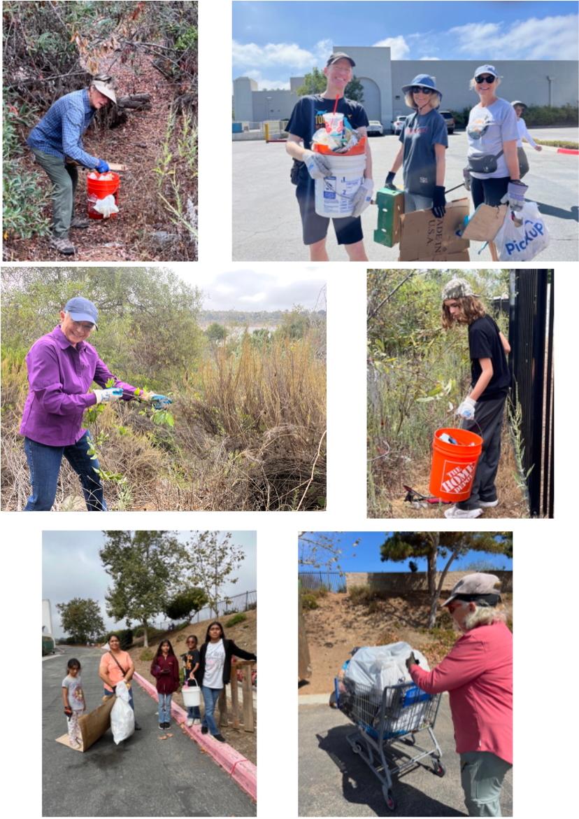
On September 20th, El Salto Falls (aka Quarry Creek) was one of around 100 sites around San Diego County that was part of the I Love a Clean San Diego's Coastal Cleanup Day. Once again, Preserve Calavera sponsored the site along with the San Diego Habitat Conservancy (SDHC).
Mel Vernon, Tribal Captain, San Luis Band of Mission Indians, was at the site and spoke to volunteers about its history and significance for the Luiseño people.
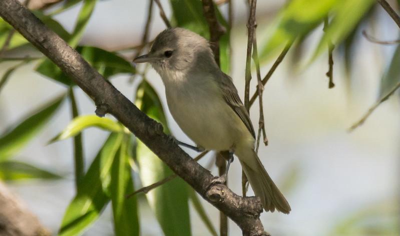
| | El Salto Falls has been identified by the Luiseño people as a sacred site for tribal religious ceremonies and its significance in their cultural history. It is also home to endangered, threatened and sensitive animal and plant species—including the least Bell's vireo, a small song bird placed on the endangered species list back in 1986 due to its loss of habitat. | |
Least Bell's Vireo photo by Wendy Miller
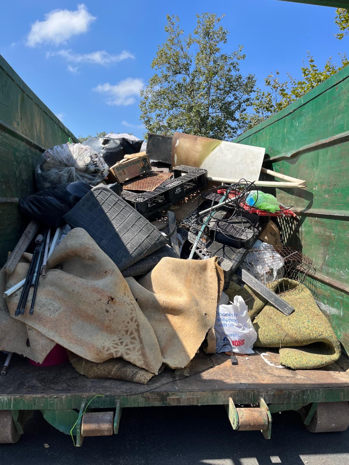
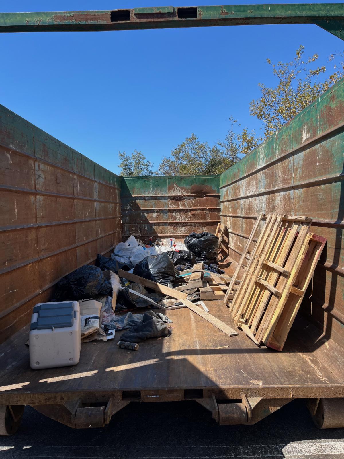
| | Above, Mel Vernon (far left) with site captains Vince Rivas (blue shirt) and Diane Nygaard (at right holding sign). | | Volunteers signing in Saturday morning before the clean up. The fence that was erected in 2023 is visible near the top left of the photo below the tree. (photo by E. Bartlett) | | The amount of trash at the Quarry Creek site has decreased sharply since a fence was erected along the site 2023. There was about 4000 pounds of trash collected in September 2023, 1900 pounds in September 2024 and 403 pounds collected this year (September 2025). | Above photo 2023 waste bin after clean up. Below photo 2025 bin after clean up. | | | |
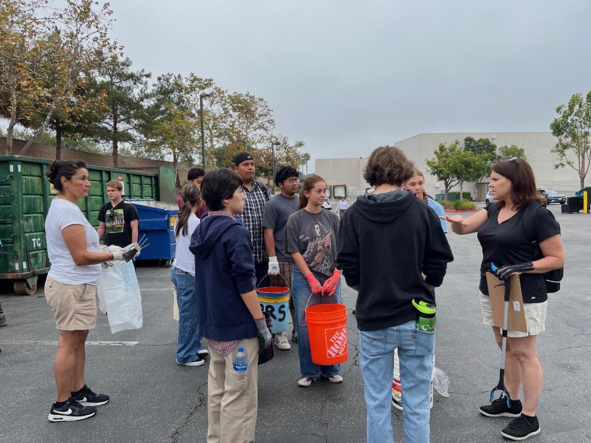
Below, Some of our hard working volunteers of all ages collecting trash and removing invasive weeds. Photos by Vince Rivas and E. Bartlett
| | | |
BY THE NUMBERS:
44 volunteers
403 pounds of trash
200 pounds of recycling material
40 pounds of scrap metal
15 shopping carts
| | |
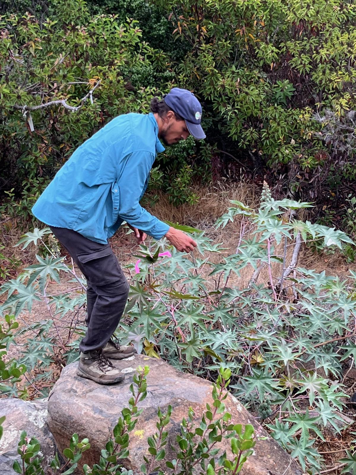
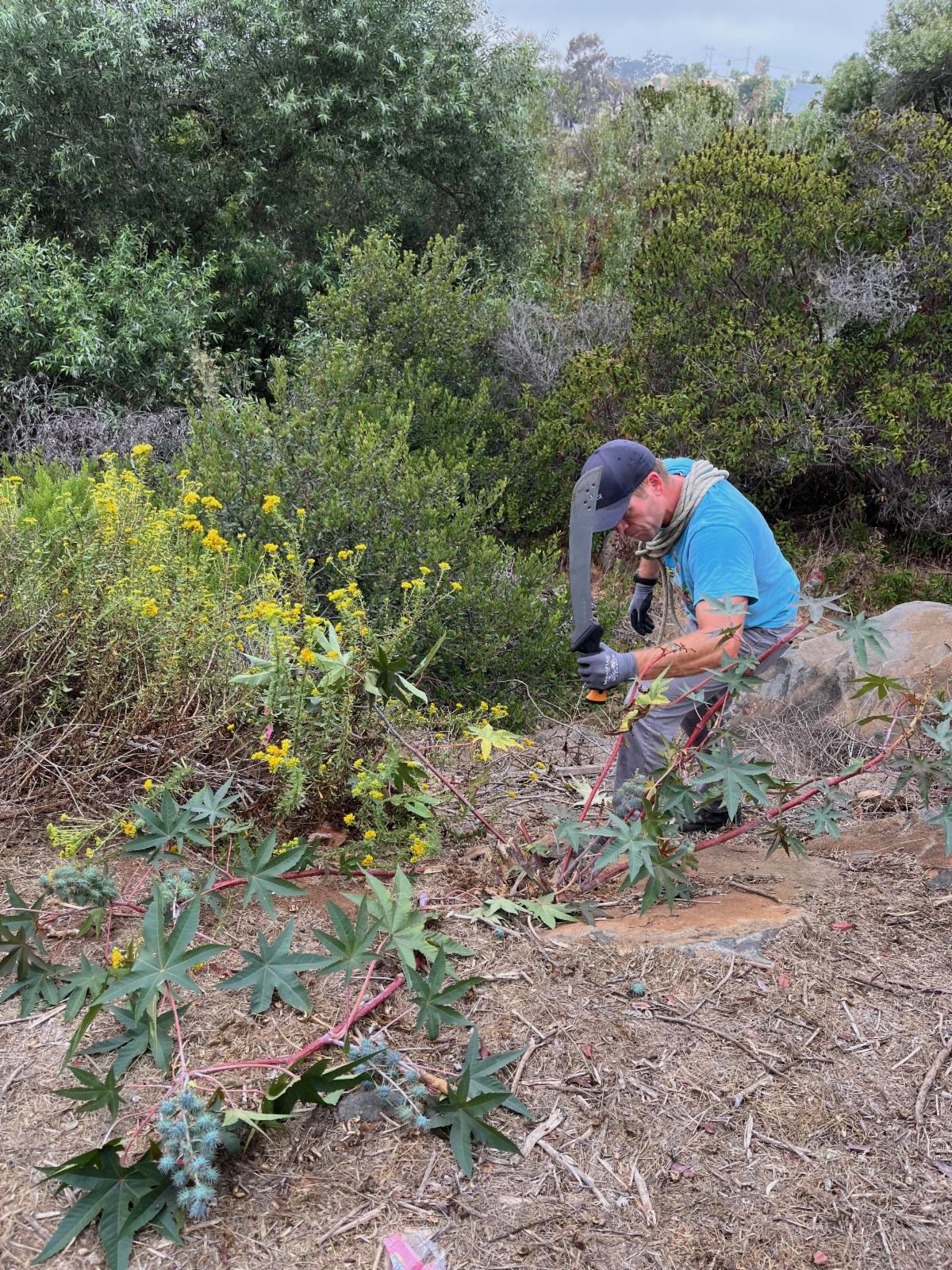
And volunteers helped remove invasive weeds along the creek; targeting castor bean and Virginia creeper.
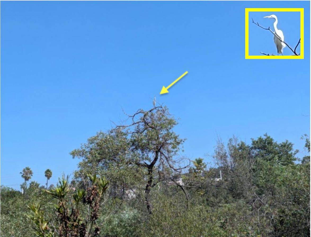
| | Below left, Vince Rivas (SDHC Conservation Habitat Manager) tagging invasive castor bean for removal. At right Justin Gamble (City of Oceanside, Sustainability Program Administrator) deftly wielding a machete to remove the castor bean plant. | | As we were wrapping up the clean up, we noticed a great egret perching atop a willow tree along the creek. Cleaning up the creek is not just for the humans but for all of the wildlife that calls El Salto Falls home. The planet belongs to all creatures great and small so let's work at keeping it clean. Photo by GT Wharton. | | | | |
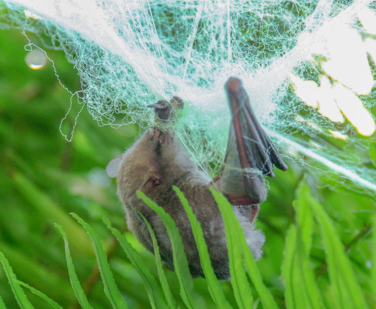
Your Halloween Decorations Can Entangle Real Bats
Bat themes are all around us during the Halloween season, but no one wants to accidentally injure a live bat.
Please don’t use fake cobwebs outdoors for Halloween décor. It can entangle bats and birds and all kinds of other small victims, such as this Mexican Long-tongued bat. He was rescued and released, lucky to be unharmed by his ordeal. (photo credit Dick Wilkins)
You can read more about bats in our August 2024 Newsletter.
| | |
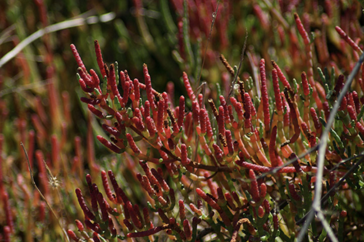
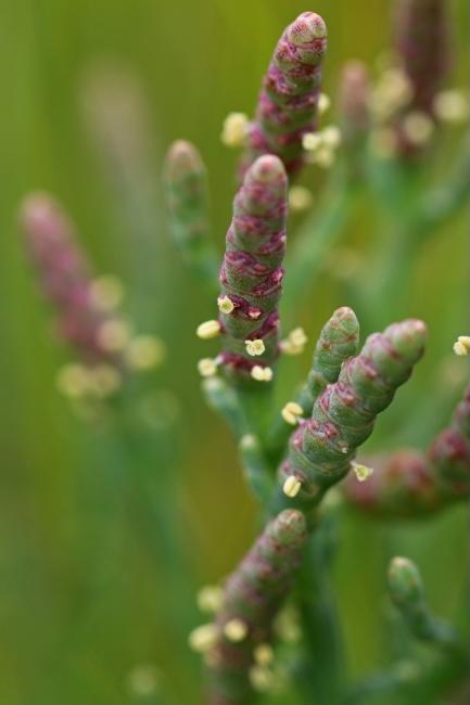
Pickleweed: a salt marsh plant
Pacific Pickleweed (Salicornia pacifica) is a low growing succulent that is native to California. The name pickleweed comes from the pickle-like appearance of its stems, along with its salty taste. Its special adaptions allow it to thrive in high salt areas. Pickleweed grows prolifically along salt marshes and beaches along the coast. If you visit the Buena Vista Lagoon Nature Center and walk along the trail, pickleweed abounds. It is an important food source and shelter for many creatures.
Pickleweed species are found in salt marshes and along coastal regions worldwide.
How is pickleweed able to live in salt water?
When salt water is taken up by the plant, the salt is removed and stored as a concentrated brine solution in vacuoles at the ends of its stalk segments. A vacuole is a large storage compartment within the cell that is able to keep the harmful salt separated from the rest of the cell. In late summer and early fall, the stem tips begin turning red as a result of salt accumulation. Chlorophyll in the stems, the pigment for photosynthesis, gives the plant its green color. Chlorophyll begins to degrade in the tips where the salt is stored. The red color results from another pigment called anthocyanin which is produced when the cells begin to break down as the vacuoles become overfilled with salt. The red stem tips eventually fall off— which does the job of removing the salt from the plant.
| | |
Pickleweed above is predominantly green with some reddish-pink coloring at some stem tips.
Below large portions of the stems are a deep red color from the pigment anthocyanin.
| |
Flowers on a pickleweed are greenish-yellow and quite tiny. They emerge from junctions between stem segments. (photo credit: Peter Pearsall/USFWS)
Pickleweed is known by other names
Pickleweed is also called sea asparagus since it resembles asparagus in appearance and the stems are edible. Pickleweed species belong to the Goosefoot family (Chenopodiaceae) which includes sugar beets and spinach. The leaves can be eaten both raw and cooked. Here is a link to some recipes: Sea Asparagus Recipes
Another common name for pickleweed is glasswort. In the 18th century, ash from incinerated pickleweed was used in the manufacture of soda glass. It was prized for its crystal clear color. Thus it was given the name glasswort; with our local species called Pacific glasswort.
| | | |
Our all-volunteer organization can not do what we do without your help. Your time, talent and donation can make a difference right in your own backyard.
Contact us to see how else you could get involved.
| | | And Check out our Website | And all of our past Newsletters can be accessed here. Lots of local information about our open space and wildlife issues. | | | | | |