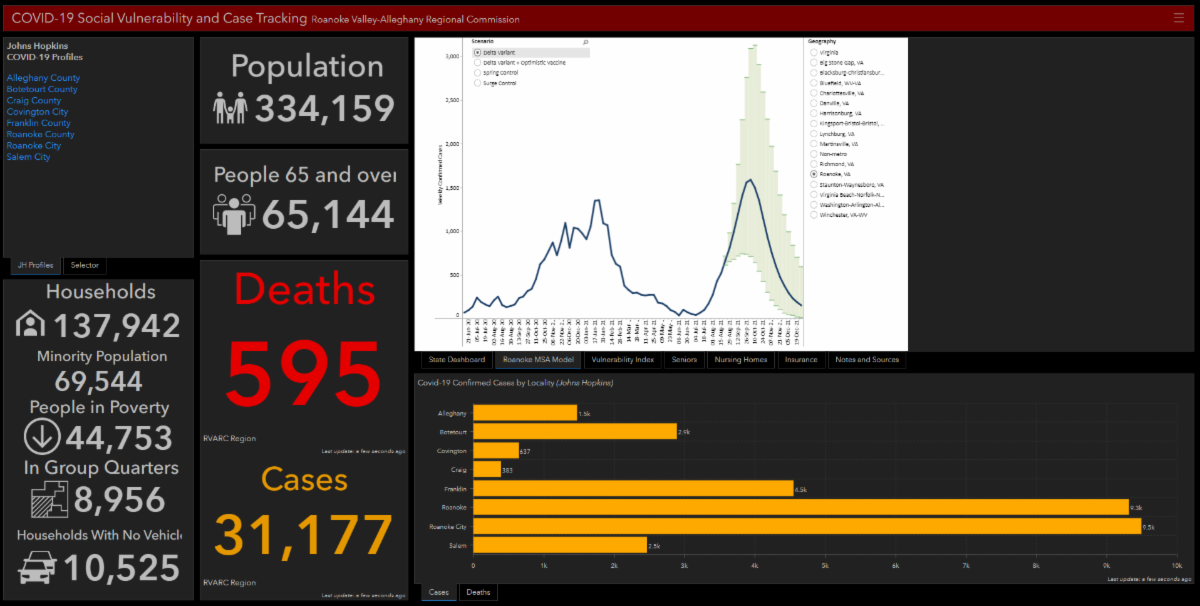
Included in the dashboard are unemployment claims, nursing home locations, and zip code COVID-19 data. COVID-19 cases and deaths are updated hourly from Johns Hopkins. To access the dashboard, click HERE.
|
|
Image captured 8/24/2021 at 11:30 AM |
|
Regional Commission Welcomes New Members |
|
The Roanoke Valley-Alleghany Regional Commission would like to welcome Mr. Peter M. Huber (Alleghany County), Mr. Robert J. Wood (Town of Rocky Mount), and Ms. Dawn Tanner Erdman (City of Roanoke), to the commission board.. |
|
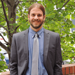
Meet Our Staff: William Long |
William is the RVARC’s new transportation planner. He grew up in Blacksburg and has a B.A. from NC State University and a masters in urban and regional planning from Virginia Tech. Before coming to the commission, William worked as a transportation planner in the Charlotte area and spent the last six years in the planning department at Total Action for Progress. He is interested in public transit and the intersection of transportation and psychology. His hobbies include watching college football, paddleboarding, and dabbling in urban sketching.
What is your favorite place to explore in our region?: With a two year old at home, our family has been exploring the area’s parks. This region is blessed with plenty of natural amenities (streams and rivers to play in, trails to hike) and urban parks (sports fields, playgrounds). The park/playground in our neighborhood was a daily destination in 2020 while we were stuck at home, but we continue to explore parks all over the Roanoke Valley.
When talking to others about our region, what is the one thing you would tell them in order to convince them it is a great place to live?: We chose to move here from Charlotte because of the mix of city amenities and small-town quality of life. I enjoy that I can taste food from most any part of the world, ride a bike on the greenway, visit an art museum, hike some of the most popular trails on the east coast, watch a minor league baseball game, and sit on the front porch to chat with neighbors passing by without hours spent driving from one activity to the next.
What made you decide to become a planner?: As a child, I was lucky enough to go to the 1996 Olympics in Atlanta. I remember riding on the MARTA train more than any athletic event. After the first trip, I was hooked. A short time later, I discovered SimCity 2000. From that point, I knew I wanted to work in planning (although I didn’t know it by that name at the time). As an undergraduate, I didn’t know that planning was an option, but I became obsessed with NC State’s “Wolfline” campus bus system. After looking into it more, I set my sights on attending graduate school in urban planning and a future in transportation planning.
|
|
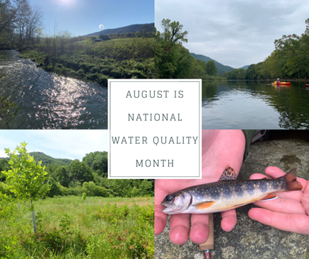
August is National Water Quality Month! |
|
The importance of water quality cannot be overstated in today’s world. Water quality is a good indicator of community health and dictates our ability to recreate in our local waterways. It has implications on the water coming out of our faucets and used in household appliances as well. Understanding land use in a watershed is key to understanding how a waterway will be impacted. Residential, agricultural, and industrial practices all impact water quality in unique ways and require specific solutions that cater to each situation. To learn more about how different land uses impact water quality and what you can do to help promote healthy waterways, visit https://nationalwaterqualitymonth.org/.
Are you interested to know more about ways we reduce land use impacts on water quality? All month long, the Upper James Resource Conservation & Development Council’s Facebook page has highlighted different land use categories, their impacts on water quality, and practices that help reduce pollutants from running off into local streams. Check out the posts here!
|
|
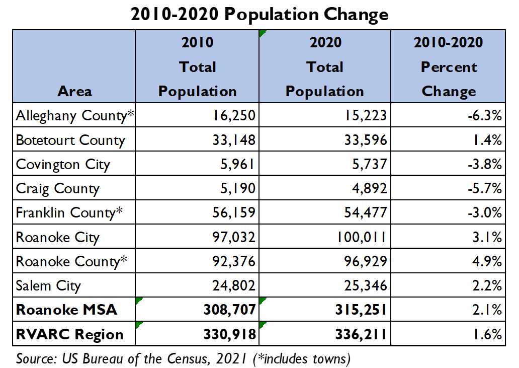
Newly Released US Census Bureau Data Shows Continued Growth in Roanoke Metropolitan Statistical Area |
An initial analysis of data released today by the U.S. Census bureau showed continued population growth in the Roanoke Metropolitan Statistical Area (MSA), which includes the counties of Botetourt, Craig, Franklin, and Roanoke, and the cities of Roanoke and Salem. According to the 2020 census, population in the MSA grew 2.1% over the previous decade. Statewide, population increased by 7.9%, which represents a lower growth rate than the previous 2000-2010 Census.
The City of Roanoke, with a 3.1% growth rate, saw its population increase to over 100,000 for the first time since the 1980 Census. At 4.9%, Roanoke County saw the largest population growth of the jurisdictions covered by the Commission. Overall, the Roanoke Valley-Alleghany Regional Commission area – which stretches from Franklin County to Alleghany County – saw a growth of 1.6%.
While more data is expected to be released by the Census over the next year, these population estimates will be used in the near term to help governments redraw local, congressional, and state legislative districts. A quick analysis by RVARC staff indicated that most localities will need to adjust their current voting districts.
|
|
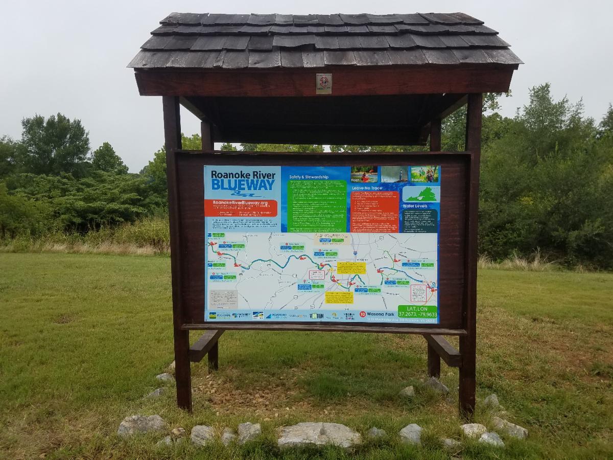
Roanoke River Blueway Committee Adds New Signage |
The Roanoke River Blueway Committee, staffed by the Regional Commission, has funded the creation of new blueway signage at kiosks along the Roanoke River. The Blueway Committee will install several more signs this year, with a planned eventual rollout to all official blueway access points. Special thanks to Roanoke City staff for installing the sign, and to Roanoke County, the Town of Vinton, and the Cities of Roanoke and Salem, and all of our community partners for their support for this and other blueway projects. |
|
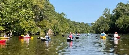
Botetourt County and Regional Commission Staff Enjoy James River Paddle |
The annual Farm and Float event, hosted jointly by Mountain Castles Soil and Water Conservation District and the Upper James Resource Conservation & Development Council, provides the opportunity to spend the day taking in the scenic views of the Upper James River in Botetourt County. The event also aims to inform participants about water quality in the James River and sources of pollution in the area.
Botetourt and Regional Commission staff were joined by staff at the local Natural Resources Conservation Service and Department of Forestry offices, as well as Valley Conservation Council staff. The event allowable for paddlers to see firsthand how our rivers are impacted by agricultural and talk to agencies who are actively working to mitigate those impacts. A special thanks to Twin River Outfitters for supplying the boats!
|
|
Regional Bicycle And Pedestrian Committee Elects New Officers |
During the August meeting, the Regional Bicycle and Pedestrian Committee elected a new Chair and Vice-Chair. The commitee would like to thank Ken McLeod (Chair), and Tim Pohlad-Thomas (Vice-Chair) for their willingness to serve.
Ken and Tim will replace Cecile Newcomb (Past Chair) and Andrea Garland (Past Vice-Chair). The committee is grateful for their time spent and would like to thank them for their leadership.
|
|
Ken McLeod (Chair)
Policy Director
League of American Bicyclists
|
|
Tim Pohlad-Thomas (Vice-Chair)
Interim Director
RIDE Solutions
|
|
RIDE Solutions Releases Bicycle Safety Video
|
On July 1st, in response to two bicycle laws in Virginia, RIDE Solutions worked with Roanoke Valley Television (RVTV) to create a bicycle safety video that explains the new laws. The video can be seen below.
|
|
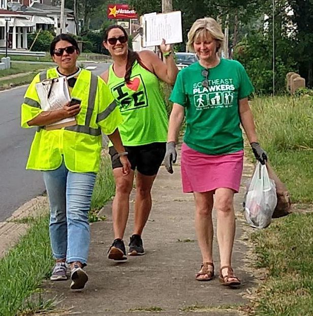
Regional Bicycle and Pedestrian Committee Hosts A Walk in the Belmont-Fallon Target Area |
The Regional Bicycle & Pedestrian Committee joined City of Roanoke staff and the Southeast Action Forum to walk the Belmont-Fallon Target Area and review conditions for pedestrians as part of the 10-Minute Walk movement. The entire Belmont-Fallon Target Area is within the ten-minute walk buffer of either Fallon Park, the 9th Street neighborhood center area, or Elmwood Park. The goal of the July 20 walk was to experience pedestrian conditions on almost every street in the Belmont-Fallon Target Area from a resident perspective. Five groups walked a total of more than five miles. The group identified strengths and weaknesses. Strengths included intact grid pattern, long, narrow lots, generally intact sidewalks buffered from the street. Weaknesses included loss of street trees, sidewalk deterioration, overgrown vegetation, trash, and traffic. The Southeast “Plawkers” (Picking up litter while walking) provide a huge service to the area with weekly trash pick-up.
|
|
The Roanoke Valley-Alleghany Regional Commission is always working with localities on projects that benefit the region. Some of these projects are listed below.
- Alleghany Highlands Economic Impact of the Arts
- Roanoke Valley Transportation Plan
- Rural Long-Range Transportation Plan
- City of Covington Downtown Revitalization Planning Grant Assistance
- City of Roanoke Neighborhood Walk Project
- City of Roanoke Pedestrian Safety Campaign
- Promotion and access improvements for the Roanoke River Blueway
- Botetourt County Community Mobility Design Challenge
- Regional Study on Transportation Project Prioritization for Economic Development and Growth in the Roanoke Valley
|
|
|
|
|
|
|