This Week's Water Conditions Update

August 26, 2022

Water Conditions Tracker
Lake Okeechobee Levels & Caloosahatchee Flow Impacts

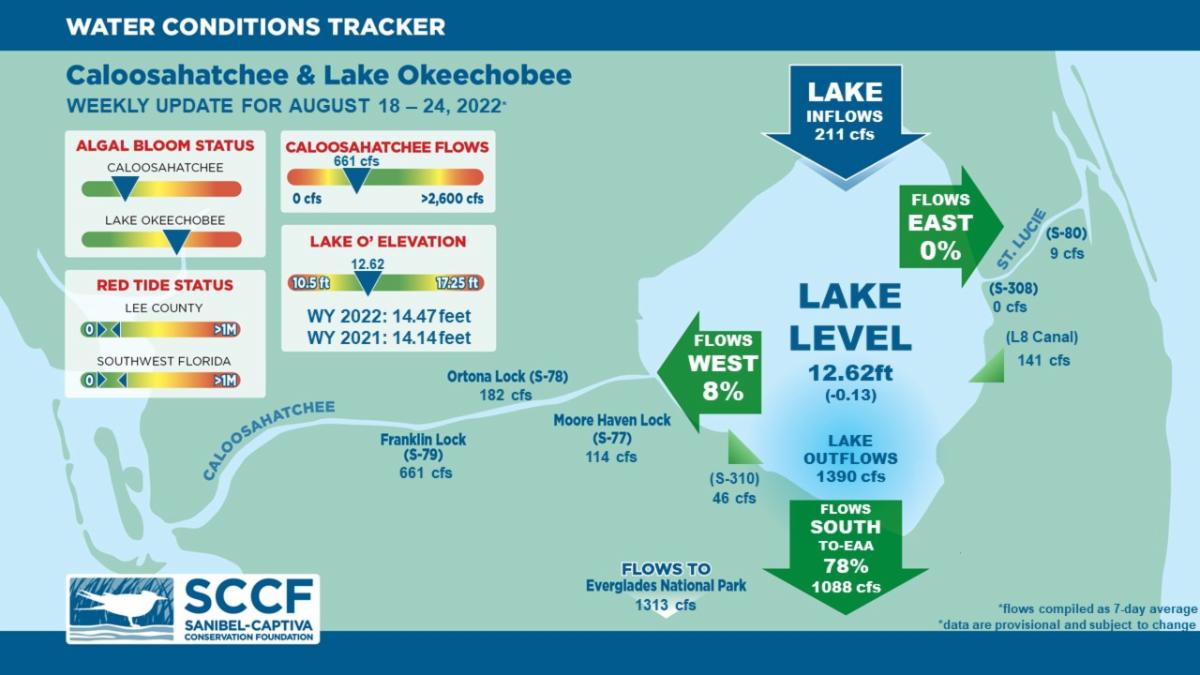
On 8/24/22 Lake Okeechobee was at 12.62 feet, decreasing by 0.13 feet in the past week. The weekly average flow at S-79 was 661 cfs (cubic feet per second) and flow from the Lake at S-77 was an average of 114 cfs. The 14-day average flow was 835 cfs and has been in the optimal flow envelope (750 - 2100 cfs) for 10 days.

For more information on Lake Okeechobee and estuary conditions go to the latest Caloosahatchee Conditions Report
US Army Corps Reduces Flow

On 8/13/22 the USACE reduced target flows at the W.P. Franklin Lock and Dam (S-79) to a 7-day average pulse release of 457 cfs from the previous target of 650 cfs. Local basin runoff has been exceeding the targets set for the past several months, so little water has left the lake from the Julian Keen Jr. Lock and Dam (S-77).


457 cfs is below the optimum flow envelope (750 - 2100 cfs) for the Caloosahatchee estuary, but local basin runoff combined with Lake Okeechobee releases have resulted in 14-day average flows in the optimum flow envelope for 10 days after being in the low flow (stress) envelope (<750 cfs) for 10 days.

Virtual Water Quality Tour from Lighthouse Beach

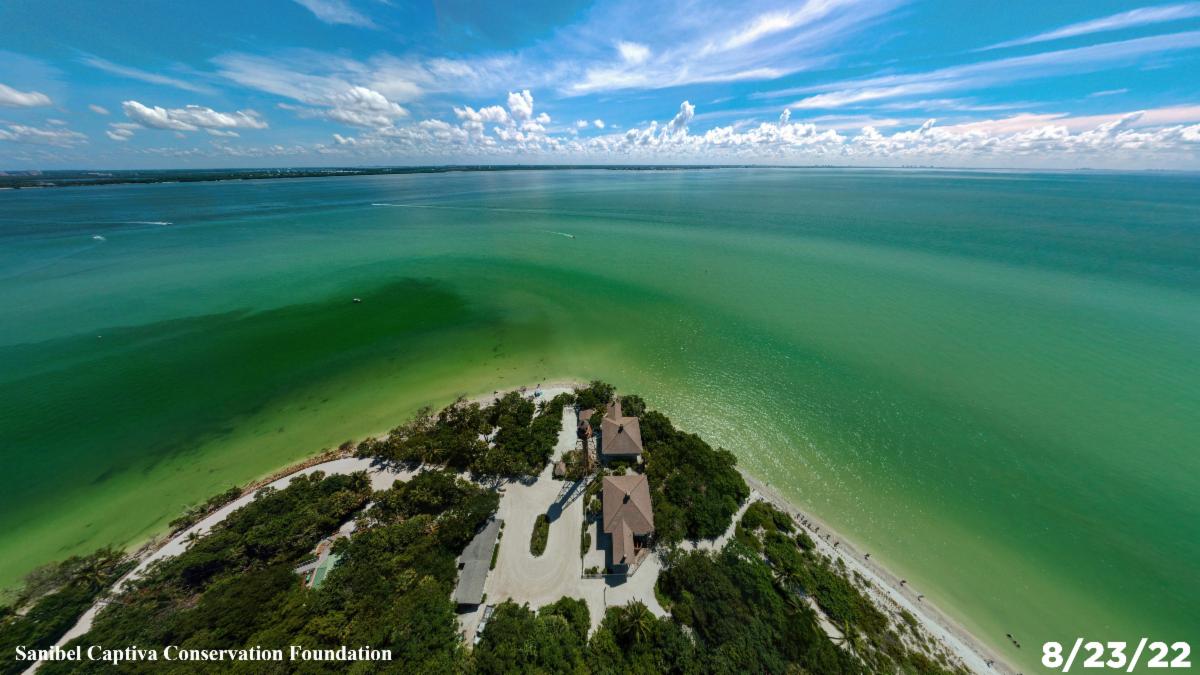
Click here or on the image above to take a virtual tour from above Lighthouse Beach Park to see how the water looked this week.


Photo was taken on 8/23/22 at 11:31 AM on a falling tide (High tide @ 9:46 PM (3.03ft)).

Red Tide

Satellite imagery over the past week has not detected any blooms off the coast of Southwest Florida.


On 8/19/22, the FWC reported that the red tide organism, Karenia brevis was observed at background concentrations in and offshore of Collier County.

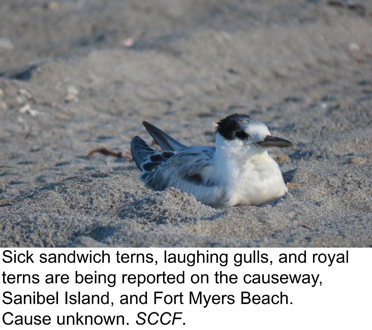
The Clinic for the Rehabilitation of Wildlife (CROW) on Sanibel received 5 birds with toxicosis symptoms (from red tide or blue-green algae) from 8/15/22 - 8/21/22. Additionally, sick sandwich terns, laughing gulls, and royal terns are being reported on Causeway Islands Park, Sanibel Island, and Fort Myers Beach. Several have been collected by the Fish and Wildlife Research Institute (FWRI) for testing.

Blue-Green Algae

On 8/22/22 sampling for cyanobacteria by the Lee County Environmental Lab reported the presence of Microcystis at the Alva Boat Ramp and Davis Boat Ramp as sparse visible specks. Microcystis and Dolichospermum were present upstream of the Franklin Locks as sparse visible specks with slight accumulation along the locks.

Data from the FDEP blue-green algae dashboard reported 82 samples collected over the past 30 days for the 10 county area. 5 sample had toxins present with 0.45 μg per L which is below the EPA recommended standard for recreational waters (8 μg per L).

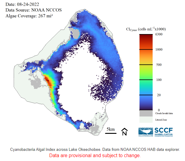
On 8/24/22, satellite imagery from Lake Okeechobee showed medium bloom potential on the northern and northwestern nearshore area of the lake. There was high bloom potential the western edge of the lake. Overall, algal blooms covered about 267 square miles (38%) of the Lake.

Become a Citizen Scientist and Get the Algae Reporting App Today!
SCCF wants to know when and where all types of algae sightings occur to monitor conditions around the islands and to investigate algae bloom occurrence with patterns in seasonal weather changes and Lake Okeechobee water management practices.

Download the algae reporting app on your phone by clicking here or by searching for the ArcGIS Survey123 app in the app store. Once installed, give the app permission to access your phone’s location to receive GPS coordinates of your sighting and camera/media to capture and attach pictures. When you open the app, click “Continue Without Signing In.” 

Next, download the algae reporting survey by scanning the QR code above or clicking here on your phone. Once the survey is downloaded, fill out the required fields and click the check mark in the lower right corner to submit your sighting. Note: If you do not have cellular coverage, you can still fill out the survey and save it in the outbox to be sent later.
Click here to download instructions.

Resources To Follow:
To learn more about our current water conditions, click on the following links:

A collaborative, weekly analysis, including recommendations for water managers regarding Lake Okeechobee flows.

SCCF's River, Estuary, and Coastal Observing Network is a network of eight optical water quality sensors deployed throughout the Caloosahatchee and the Pine Island Sound estuary to provide real-time water quality data.


Click here to subscribe to Connecting You to SCCF and other SCCF mailing lists.
DONATE TO SCCF
Stay Connected!
Facebook  Instagram  Youtube