We're Around!
Our shop is normally open:
Monday - Saturday:
10am - 5pm
Sunday:
12 noon- 5pm
We're also available after hours by appointment, and you can
shop online 24/7 at:
Or give us a call at:
508-945-1660
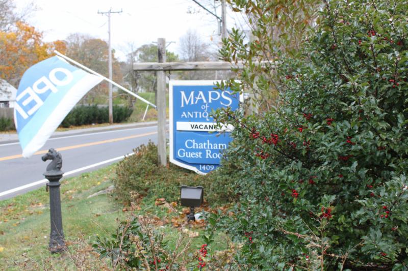
If you or your loved-ones need accomodations, send them over to our converted 18th century farmhouse,
Chatham Guest Rooms. We have been very
well reviewed on TripAdvisor!
|
|
|
Happy Summer, Map fans!
We have had great weather here on Cape Cod, and we hope you have also had a lovely summer so far. To both travellers and locals alike, summer on Cape Cod means spending time by the water. Whether sunning on the beach or sailing on a boat, the ocean is the place to be when the weather is hot! To celebrate this sunny season, we have gathered some nautical charts for your perusing pleasure!
|
|
Sea-worthy Nautical Charts
|
In order to travel across vast oceans, mariners required charts, and a lot of them! We have assembled a selection of charts that would have helped a sailor get across the Atlantic Ocean and safely to shore, and created an imaginary crossing from Europe to Boston, to show the importance of charts at a range of scales. Note that on a real journey, the sailors would require the latest charts to get safely to their destinations, so these are just examples, not charts you would have used all together, due to their varying ages. We hope you will enjoy the journey!
1.
The first leg of the trip must take you out of your home port and into the Atlantic Ocean. This 1878 chart of the North Atlantic by James Imray & Sons of London, with its helpful information about ocean currents and winds, would have been necessary to guide your ship. You navigate by calculating your latitude and longitude using the sun or stars and a sextant, then, using that, you use compass bearings and caluclate distances to move in the direction of North America. You know, based on your calculations, that you should see land in a certain number of days... if you don't, then you need to check your calculations!
See more about this chart here.
See more charts of the Atlantic here.
2.
You have made it across much of the Atlantic Ocean, but as you get closer to land, you need a chart that has more detailed information than your previous chart could contain. Luckily you have this 1828 chart, corrected to 1847, of The North Eastern Coast of North America, from New York to Cape Canso, including Sable Island by Edmund Blunt. With this chart you can safely approach land, recognize where you are in relation to land features, and locate the shallow waters and other hazards to navigate safely towards your destination.
See more about this chart here.
See more charts by Blunt here.
3.
Your general destination is in sight, which means you need even more detailed information to ensure that you can find the safest passage to Boston Harbor. This is the chart you might use. It is a coast chart from 1872, with additions to 1878, by the US Coast Survey, titled Chart No. 9 Boston Bay and Approaches. This was in a 2 chart series titled Coast Chart Nos. 9 & 10, Massachusetts Bay, with the Coast from Cape Ann to Cape Cod. This useful chart has recognition profiles to help you orient yourself using land features, as well as water depths and details on the character of the sea bottom. If it is foggy, you can drop a bucket to the bottom of the sea to gather a sample, then analyze it and hopefully make a decent guess of your location.
See more about this chart here.
See more Boston Harbor charts here.
4.
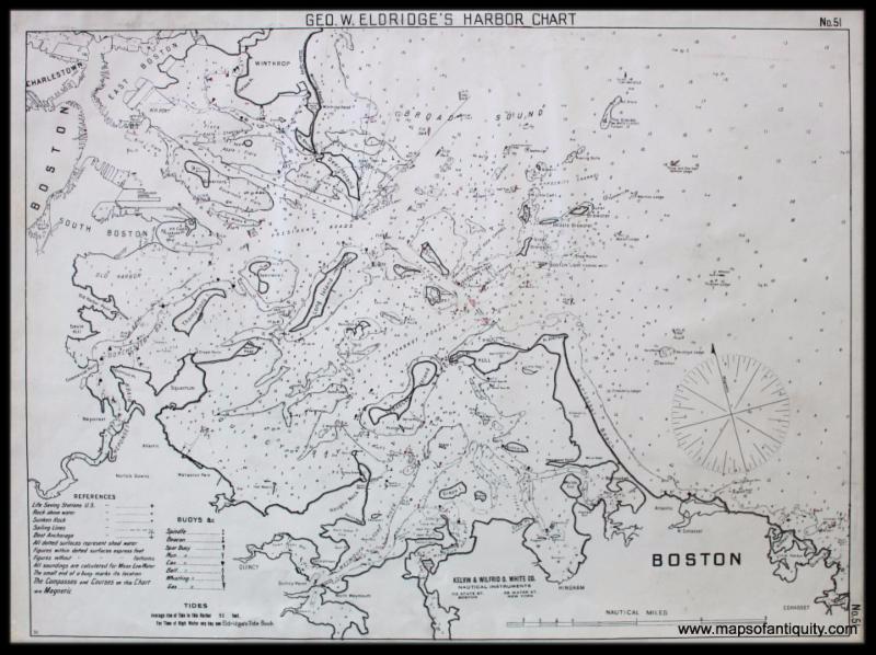
Congratulations! You made it into Boston Harbor, but don't let your guard down yet-- you still have to find your way through all those islands and rocks to find a channel to your wharf at the city. This chart's graphic simplicity will make it easy, and it will even warn you about sunken rocks and point out the locations of lifesaving stations and lighthouses. George W. Eldridge competed with the US Government and sailors loved his charts because they are so easy to read, like this 1901 Boston chart from Geo. W. Eldridge's Harbor Chart-Book. And the handy Eldridge Coast Pilot narrative of directions to the Boston waterfront will safely guide your passage.
See more about this chart here.
See more Eldridge harbor charts here.
5.
Now that you are safely on shore, we can't resist including this great bird's-eye view map of Boston looking south and showing the coast all the way to Provincetown. Published by Walker/Murphy in 1905 as a folding map, it was just for fun and shows various points of interest labeled in the index. Thanks for sticking with us all the way from Europe to Boston!
See more about this map here.
See more pictorial and bird's eye view maps here.
|
|
MAP TERMINOLOGY MADE EASY
|
|
Inset Map:
A smaller map or chart inset within a larger map or chart that shows greater detail of an area on the chart.
Click here for an example.
Recognition Profile:
Triangulation:
A technique for establishing the distance between any two points, or the relative position of two or more points, by using such points as vertices of a triangle or series of triangles, such that each triangle has a side of known or measurable length (base or base line) that permits the size of the angles of the triangle and the length of its other two sides to be established by observations taken either upon or from the two ends of the base line. (from Dictionary.com)
This technique can be seen in many survey and report charts,
like the ones here. Note the many straight lines used for triangulation in harbor areas.
|
|
 |
| Find us on Social Media for more updates |
Do you tweet, follow, like, and pin? Well, Maps of Antiquity has an active Facebook page where we post map-related articles, unusual maps and prints that we add to our website, company news, and answers to frequently-asked questions.
On Pinterest, we display some of our maps and prints and add opinions and comments about specific pieces. We also provide boards with decorating ideas.
On Twitter, Maps of Antiquity offers links to articles and brief news. We also periodically update Google Plus and LinkedIn with company news and product information.
So if you are spending time on social media, be sure to look us up. Also, if you have a preferred social media where you think we should be active....let us know!
|
|
| We are open all year round! Stop by to see us! |
|
|
|