|
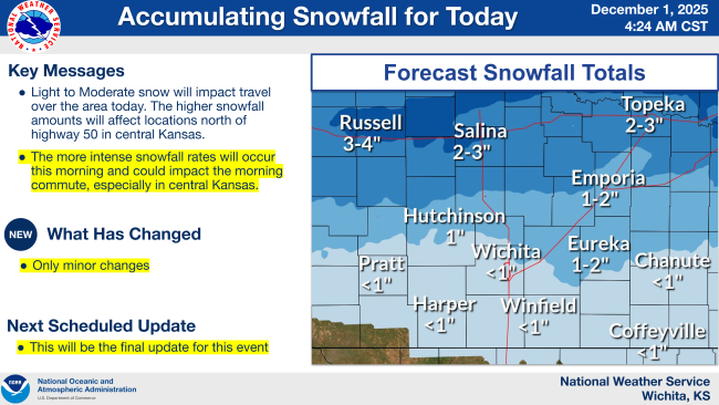
The National Weather Service reports that light to moderate snow is expected to move across the Salina and Saline County area this morning, decreasing by mid-afternoon. Totals around 2–3 inches are expected in and around Salina, with slightly higher amounts possible in the northern part of the county. Roads may become slick during the morning hours, and visibility could drop during heavier snow.
What You Need to Know:
-
Now until Noon: Snow is expected to move through Salina and Saline County. This is the main window for travel impacts.
-
Noon until 3 PM: Snow is expected to taper off from west to east.
-
Evening & Overnight: Temperatures drop, and wet roads may refreeze.
No additional snow is expected, but slick spots may linger early Tuesday morning.
|