| |
A Newsletter from the Connecticut Department of Energy & Environmental Protection Exploring Long Island Sound - Issues and Opportunities |
|
| |
|  The Long Island Sound Blue Plan The Long Island Sound Blue Plan
Gets the Green Light More than three years after Sound Outlook introduced its readers to the concept of Coastal and Marine Spatial Planning (CMSP) (please see the February 2012 issue of Sound Outlook ), Connecticut has caught up with our neighbors in Massachusetts and Rhode Island and enacted a program of marine spatial planning for Long Island Sound.
After years of background work by a coalition of environmental groups, academics, and Department of Energy and Environmental Protection (DEEP) staff, culminating in this year's legislative proposal by Governor Dannel P. Malloy, the newly enacted HB 6839, An Act Concerning a Long Island Sound Blue Plan and Resource and Use Inventory,
was signed by the Governor on June 19th and went into effect on July 1, 2015.
|
|
The Long Island Sound Blue Plan will help minimize conflicts between marine life and human uses of the Sound, such as navigation and aquaculture.
Photo Credit: DEEP OLISP
|
This "Blue Plan" bill establishes a process by which Connecticut will develop an inventory of Long Island Sound's natural resources and uses and, ultimately, a spatial plan to guide future use of the Sound's waters and submerged lands. Currently, Connecticut's Coastal Management Program (CMP) protects coastal resources and guides development along the immediate coast. The development of a Blue Plan for Long Island Sound will supplement the CMP's existing authority in the deeper offshore reaches of the Sound.
|
|
Purple sea urchins and common sea stars thrive
on a cobble substrate in Long Island Sound
Photo Credit: Long Island Sound Resource Center
|
The Blue Plan is intended to prioritize the protection of existing natural resources and uses such as fishing, aquaculture, and navigation from future conflicting or incompatible activities and would not create new regulatory restrictions for them.
LONG ISLAND SOUND RESOURCE AND USE INVENTORY
Under the Blue Plan bill, an inventory of Long Island Sound's natural resources and uses must be completed by a Long Island Sound Inventory and Science subcommittee that will be convened by the University of Connecticut. The inventory will be based on the best available information and data on the Sound's plants, animals, habitats, and ecologically significant areas in nearshore and offshore waters and their "substrates" (surfaces where marine organisms grow). The inventory must also include the human uses of the Sound's waters and substrates, such as boating and fishing, waterfowl hunting, shellfishing, aquaculture, shipping corridors, and energy facilities and interests including electric power lines, gas pipelines, and telecommunications crossings in the Sound.
|
|
The American Lobster is a species that will benefit from
a Blue Plan for Long Island Sound
Photo Credit: Long Island Sound Resource Center |
LONG ISLAND SOUND BLUE PLAN Once the resource and use inventory is complete, that information will be used to develop the Blue Plan, a spatial plan that will help avoid user conflicts in the Sound by identifying and protecting special, sensitive, and unique estuarine and marine life and habitats. The Plan will foster sustainable uses of Long Island Sound that will make the most of economic opportunity without significantly harming the Sound's ecology or natural beauty.
|
|
A small cod shelters near a boulder on the Sound floor
Photo Credit: Long Island Sound Resource Center |
The Blue Plan will also remain "fluid," adapting as necessary to our ever-evolving knowledge and understanding of the marine environment, recognizing current issues like climate change impacts and sea level rise adaptation while anticipating and addressing future emerging issues. Another significant benefit of the Blue Plan will be the identification of appropriate locations and performance standards for activities, uses, and facilities that are regulated by state permit programs, developing measures that will guide the siting of those uses in ways that are consistent with the Plan.
|
|
A lined seahorse grabs hold in a kelp forest
Photo Credit: Long Island Sound Resource Center
|
|
|
Seaweed harvesting and other aquaculture uses will be considered during development of
the Long Island Sound Blue Plan
Photo Credit: Long Island Sound Study |
The Blue Plan must be consistent with the resource and use inventory described above and must provide for the ongoing acquisition and application of up-to-date resource and use data, including seafloor mapping (please see the February 2012 issue of Sound Outlook for more information on seafloor mapping efforts). The Plan must also be consistent with the State's Plan of Conservation and Development and the goals and policies contained in the Connecticut Coastal Management Act. In accordance with the Blue Plan legislation, the Plan must be developed by a transparent and inclusive process that includes widespread public and stakeholder participation and encourages public input in decision making. Development and implementation of the Plan must also be coordinated with the State of New York, and with local, regional, and federal planning entities and agencies including (1) the Connecticut-New York Bi-State Marine Spatial Planning Working Group, (2) the Long Island Sound Study, and (3) the National Ocean Policy's Northeast Regional Planning Body. THE BLUE PLAN IS NOT MARINE ZONING
|
|
Frilled anemonies attach to a
rocky substrate in Long Island Sound
Photo Credit: Long Island Sound Resource Center
|
The Blue Plan will not "zone" the waters of Long Island Sound. There is no need to specify uses or "use zones" over every part of the water surface. But the Plan could establish priority use areas such as utility corridors or shellfish beds where no other use could interfere with the primary use. The Plan could also identify critical areas that may need greater protection and management of uses, and more intensive regulatory review. These could include important habitat areas where disturbance would not be allowed, or areas important for navigation or recreation where permanent or structural occupation of the water surface or water column would not be allowed. But these priority areas would be established where needed and only where needed. Stay tuned to future issues of Sound Outlook, as we will keep readers up-to-date on the progress of the Long Island Sound Resource and Use Inventory and development of the Blue Plan. In the meantime, please contact David Blatt at 860.424.3610 if you would like more information about the Blue Plan for Long Island Sound. Return to Table of Contents |
| Report Card Issued for Long Island Sound Students in Connecticut schools aren't the only ones bringing home report cards this time of year. Long Island Sound has also earned its own report card, and it looks like the eastern portion of the Sound can attend the Awards Banquet, but the western Sound must attend summer school.
The Report Card for Long Island Sound was issued by the Integration & Application Network at the University of Maryland's Center for Environmental Science with funding from the Long Island Sound Funders Collaborative. The report card provides an assessment of the health of the Long Island Sound ecosystem for the year 2013. Data for analysis was collected by the Connecticut Departments of Energy and Environmental Protection, Agriculture, and Public Health; the New York State Departments of Environmental Conservation and Health; the New York City Department of Environmental Protection; and the Interstate Environmental Commission; as well as other academic and federal partners.

Several indicators were considered in developing the report card, including dissolved oxygen, nitrogen, phosphorus, bacteria, water clarity, shellfish, and eelgrass.
Clearly, the results of the report card indicate that we still have some work to do. The good news is, there are no real surprises in the report, which means we're already well on our way to addressing the more pressing challenges facing Long Island Sound.
Return to Table of Contents |
|
|
|
|

Inside
|
Sound Tips
:
Help Conquer Beach Trash
Beach trash isn't just unsightly. It can cause a host of problems to the animals living in and around Long Island Sound.
For example, plastic grocery bags and sandwich bags look like jellyfish when they float, and often are mistaken for food by sea turtles.
|
|
Mistaking a plastic grocery bag or sandwich bag for a jellyfish can be a
deadly mistake for sea turtles
Photo Credits: DEEP OLISP |
Six-pack rings and fishing line can strangle wildlife.
|
|
A dead osprey strangled by fishing line
Photo Credit: Hank Golet |
And according to the Ocean Conservancy, cigarette butts were the number one category of trash found on beaches during their organized beach clean-ups in 2014.
|
|
| The Top Ten Items collected in 2014 by Ocean Conservancy-sanctioned Beach Clean-ups |
Cigarette butts are not biodegradable, and the material used to make them can leach toxic chemicals into the environment. Some marine animals can also mistake cigarette butts for food.
|
|
Cigarette butts are not biodegradeable
Photo Credit: DEEP OLISP |
Now that we know the dangers of a littered beach, here are some tips on how to help solve the beach litter problem:
- If you can't join an organized event, host your own clean-up whenever you're at the beach. In addition to disposing of your own garbage, bring a bag with you and (carefully) collect trash at the beach. DEEP's State Parks Division estimates that the state's shoreline parks will host approximately 3.7 million visitors this year (Hammonasset, Madison 2.2 million; Sherwood Island, Westport .4 million; Rocky Neck, East Lyme, .6 million; Silver Sands, Milford and Harkness Memorial, Waterford .25 million each). Just think of how clean our beaches could be if everyone visiting a coastal state park helped pick-up some trash during their visit!
- Always break or cut six-pack rings and properly dispose of them.
- Please don't use the beach as an ashtray. And don't flick butts out of your car window either, because cigarette butts on roadways can get washed into stormdrains and ultimately get deposited on the beach. Properly dispose of cigarette butts.
|
Where did all of those cool pictures come from?
Most of the photos of undersea creatures used in this issue of
Sound Outlook were borrowed from the
Long Island Sound Resource Center (LISRC), established by DEEP and the University of Connecticut in 1988 as a central clearinghouse for information and data related to Long Island Sound.
Visitors of the LISRC website can learn about the Sound' geology, view oblique photographs of the Connecticut coast, and learn about scientific research related to the Sound.
The LISRC also serves as the host of the
Connecticut Coastal Access Guide.
If you've enjoyed the photos included in this issue, be sure to check out the
LISRC's underwater slide show where you can view additional stunning images of the marine life in Long Island Sound. From sea ravens to sea robins, you'll learn about some of the other more interesting creatures living in the Sound. It's much better for you than watching another episode of "SpongeBob SquarePants"!
|
| View past issues of Sound Outlook |
| Subscribe to Sound Outlook or any other DEEP newsletter |
Look Out For Upcoming Events!
Long Island Sound Study (LISS)
|
|
Purchase of a LIS License Plate
Supports the LIS Fund
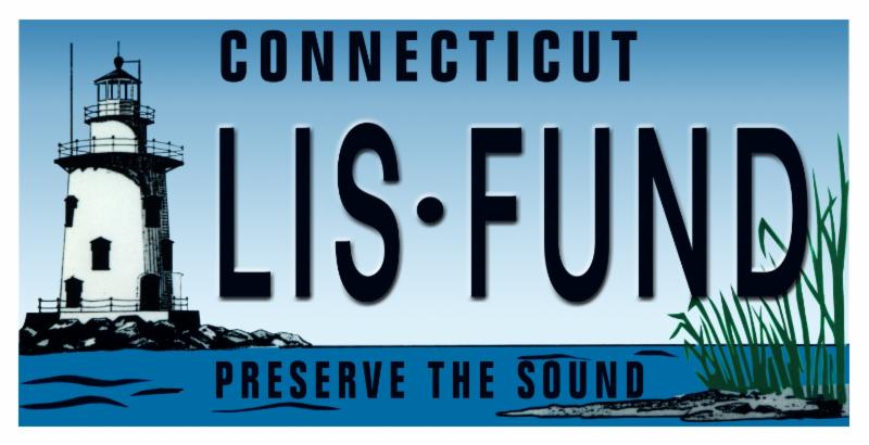
The LIS fund
supports projects in the areas of education, public access to the shoreline, habitat restoration, and research.
For information on ordering a
Long Island Sound
License Plate,
call 1-800-CT-SOUND.
|
|
|
| SPOTLIGHTED COASTAL RESOURCE:
Beachcombing on Connecticut's Beaches
|
|
A beach is not only a sweep of sand, but shells of sea creatures, the sea glass, the seaweed,
the incongruous objects washed up by the ocean. - Henry Grunwald |
We all know that the beachfronts and coastal waters of Long Island Sound provide critical habitat for countless marine animals and organisms that are essential to our coastal economy. Beaches also act as a natural buffer to coastal flooding and erosion, and reduce intense wave energy associated with storms.
But these resources also provide
a vast playground for humans,
offering recreational opportunities for visitors that include fishing, swimming, sunning, hiking and sight-seeing.
A trip to the shore is golden an opportunity to nap in the warm sun after a swim, or a chance to escape the city heat and enjoy a cool sea breeze. And many of us don't consider a trip to the beach successful unless we can take a little piece of it home with us (and that does not include all of the sand in the car). Beachcombing has become a much-beloved pastime.
As Connecticut prepares to embark on the development of the Blue Plan for Long Island Sound, this issue of
Sound Outlook is encouraging readers to look at the items we find on Connecticut's beaches in a new light. More than reminders of our shoreline adventure, these beachcombed treasures should also remind us of why we work so hard to protect Long Island Sound and its habitats in the first place.
|
| SPOTLIGHTED COASTAL ACCESS:
The Norwich Harbor Water Trail Guide
Helps You Explore the Waterside of the Rose City
The colonial founders of the settlement now known as the City of Norwich knew a good thing when they saw it! Those settlers realized the critical importance of the harbor area, where the Thames, Shetucket, and Yantic Rivers converge. In 1684, only a few decades after colonial settlement, a public dock was constructed to provision the fledgling settlement, and that dock continues to serve as the center of activity on the harbor today.
City of Norwich leaders fully recognize the importance of the harbor to the City's future. To help the public explore explore the beauty of the harbor and the recreational opportunities it provides in a city hailed as The Rose of New England, the City of Norwich's Harbor Management Commission created the
Norwich Harbor Water Trail Guide. Developed with assistance from the EPA Long Island Sound Study's Long Island Sound Futures Fund, this informative guide offers suggested routes for exploring the Yantic, Shetucket, and Thames Rivers in small paddle craft. Each route offers a unique recreational experience. All water trail routes are accessed using the boat launch ramp at
Howard T. Brown Park, also known as Chelsea Landing. Be sure to consult the
tide chart for Norwich Harbor to plan your trip to avoid paddling the Yantic and Shetucket Rivers during times of predicted low water.
|
|
1. Howard T. Brown Park and boat launch
2. West Branch Yantic River
3. East Branch Yantic River
4. Yantic Falls at Uncas Leap
5. Hollyhock Island
6. Channel connecting East and West Branches Yantic River
7. Marina at American Wharf
8. To Greeneville Dam and fish lift (1.5 miles)
|
PADDLE THE RIVERS
|
|
Kayakers enjoy the view from the base of
Uncas Leap in the Yantic River.
Photo Credit: Ken Carpenter
|
Yantic River
The slow flowing brackish water segment of the Yantic River is great place for beginner paddlers. Here the Yantic provides a unique natural-area paddling experience near the center of one Connecticut's oldest cities. Expect to see a variety of water birds including wading birds such as herons, as well as waterfowl and raptors. Paddling upstream, follow the right bank of the East Branch of the Yantic River with Hollyhock Island on your left to the base of Yantic Falls at Uncas Leap--a place of much history and legend and the only major waterfall in Connecticut accessible from a public launch by small boat. Return by following the East Branch 500 yards downstream before turning right (west) at the northern tip of Hollyhock Island. Then follow a channel of deeper water to avoid the shallows of a large tidal mudflat on your right. This channel provides the only deeper water passage to the West Branch of the Yantic River. Paddle back to Norwich Harbor and Brown Park, keeping the Marina at American Wharf to your left.
Shetucket River
The Shetucket River is one of Connecticut's premier migratory fish corridors whose recreational and cultural significance is recognized by inclusion in the federally designated
Last Green Valley National Heritage Corridor. Paddlers will likely find anglers along banks of the river up to, and beyond, the head-of-tide at the Greeneville Dam. Here,
Norwich Public Utilities' (NPU) fish lift allows migrating salmon, striped bass, and shad to continue upstream past the dam.
Paddlers must keep a safe distance from the dam which can be extremely dangerous to boaters. Don't be surprised to see a bald eagle soaring overhead or roosting within the heavily wooded east bank of the river. On the river's west bank, note the stark beauty of the nineteenth century textile mills, vivid reminders of Norwich's industrial heyday. Beware shallow water in the vicinity of NPU's building on the west side of the river one mile from the Brown Park launch. Picking your way through the river's boulders on this section will challenge even the more experienced paddler during times of at low water.
Thames River
The Thames River, an estuarine embayment and Connecticut's third largest river, offers a much different paddling experience than the Yantic and Shetucket. The deep waters of the Thames are shared with motorized vessels, and on windy days choppy waters are better navigated by only the more experienced mariner. From Brown Park, the intrepid paddler can travel 13 miles--a day-long voyage--to New London Harbor where the river meets Long Island Sound. Shorter but still challenging trips into Trading Cove on the river's west bank, alongside the Mohegan Sun Casino, and Poquetanuck Cove downstream on the Preston-Ledyard town boundary on the river's east side abound with waterbirds and are excellent destinations for nature enthusiasts. But before leaving Norwich Harbor, be sure to reverse direction for a moment to enjoy a fine view of the historic Norwich Harbor waterfront.
FISH THE HARBOR
Norwich Harbor attracts not only paddling enthusiasts but also anglers from throughout the region, especially during striped bass, shad, and bluefish migrations in the spring and fall. Norwich Harbor is both a gateway and home to many recreationally important gamefish. Some marine and anadromous (fish that spend most of their life in marine waters and spawn in freshwater before returning to the sea) species are seasonal migrants in search of suitable spawning habitat or feeding areas. Other mainly freshwater species are year-round residents.
The harbor, with its deep basin and nutrient-rich waters fed by the Shetucket and Yantic rivers, hosts an abundance of invertebrate life and small baitfish, both of which attract large predator fish. This combination of spawning and feeding grounds, as well as the upper Thames River's highly stratified conditions (warmer freshwater on the surface and cool saltwater in deeper waters) along an ocean migration route create ideal conditions for a variety of species of fish to thrive.
The most popular of these is striped bass, which can be found year-round in the Norwich Harbor area. Large adult bass (up to 50 or more pounds) migrate through the harbor during the spring and fall, feeding on abundant baitfish populations. A very important recreational winter fishery occurs in the harbor with many juvenile and adult bass overwintering in this productive location. Striped bass provide excellent fishing from either a boat or shoreside locations in Norwich and surrounding towns along the Thames River that can be identified using the
Connecticut Coastal Access Guide.
Other important gamefish include bluefish (summer/fall), white perch (year-round), sea-run brown trout, American eel, carp, catfish, broodstock Atlantic salmon, and smallmouth bass.
|
|
The American Eel is anadromous--the species
lives in the Sound but spawns in freshwater
Photo Credit: Long Island Sound Resource Center
|
Anadromous runs of American shad, alewife, and blueback herring provide additional variety for anglers, and demonstrates that this fishery, especially Norwich Harbor, is an area of regional ecological importance.
MANAGING NORWICH HARBOR'S WATER QUALITY
Let's be honest: if the water quality in the Yantic, Shetucket, or Thames Rivers was poor, there is no way anyone would be interested in paddling amongst the beauty of the Falls at Uncas Leap in the Yantic River, or checking out the Greeneville Dam fish elevator in the Shetucket, or fishing for striped bass in the Thames.
The fact is, water quality and water-based recreation like kayaking and paddling are linked for better and for worse. And thanks to the hard work of officials in Norwich, water quality in the harbor is much better.
Protecting and improving water quality in Norwich Harbor is a basic goal of the Norwich Harbor Management Plan. The Plan, prepared by the Norwich Harbor Management Commission, approved by CT DEEP, and adopted by the Norwich City Council, encourages best management practices to manage, reduce, and otherwise control stormwater runoff into the harbor and calls for continued improvements to the City's wastewater treatment facilities.
Building upon past water quality enhancements funded through local, state, and federal sources since passage of the State and Federal Clean Water Acts in 1970s, the City is pursuing a number of projects to protect water quality in the harbor. Since the 1970's, the NPU has eliminated 29 Combined Sewer Overflows (CSOs) that once discharged both sanitary and stormwater to Norwich Harbor during periods of extreme rainfall when the combined flow from these sources exceeded the capacity of the wastewater treatment system. NPU expects to eliminate the remaining CSO discharges, the locations of which can be found on CT DEEP's CSO Notification System Map. NPU has also submitted final design plans to CT DEEP for upgrades to its wastewater treatment plant on the Yantic River's Hollyhock Island. These upgrades will reduce nitrogen loads to the harbor that likely contribute to low dissolved oxygen levels in the bottom waters of the harbor. For more information on water quality in the upper Thames River and the tidal segments of the Yantic and Shetucket Rivers, and the quality of Connecticut's other surface waters, see CT DEEP's Water Quality Monitoring and Assessment Program webpage.
PLAN YOUR VISIT
To help plan your visit to Norwich Harbor, download a copy of the Norwich Harbor Water Trail Guide. You can also obtain a waterproof copy of the guide free-of-charge at the City Manager's Office in Norwich City Hall, 100 Broadway; the Norwich Community Development Corporation, 77 Main Street; CT DEEP's Marine Headquarters - Ferry Landing State Park in Old Lyme; and at Thayer's Marine, 14 Falls Avenue in downtown Norwich where kayaks may also be rented. For more information, call the Norwich Harbor Management Commission at 860.823.3751 and visit the City's website at www.norwichct.org.
|
Seaside State Park is Taking Shape in Waterford
Frequent readers of Sound Outlook may recall the October 2013 issue dedicated to the celebration of 100 years of Connecticut State Parks. Now there's another reason to celebrate the next chapter for Connecticut's state park system, as the State prepares to establish a new coastal state park for the first time in almost 50 years! The Seaside property in Waterford, formerly a Department of Mental Health sanitarium for children with tuberculosis, is a
32-acre waterfront property that boasts one-quarter of a mile of sandy beach and beautiful views of Long Island Sound. Development of this magnificent property into
a new state park will significantly expand shoreline recreational opportunities for Connecticut residents and visitors.
|
|
| A view from the beach at the Seaside Property in WaterfordPhoto Credit: DEEP OLISP |
With its substantial water frontage, the Seaside property has long been eyed for development. For decades, various proposals have been raised to transfer the property from state to private ownership in order to allow redevelopment of the property. And Connecticut's Coastal Management Program (CMP) has been there every step of the way, reviewing each proposal to ensure that the public's right to access the beautiful beachfront area was not lost in the process. State consistency reviews ensured that any transfer to a private owner would keep the state's interest in public access front and center. Likewise, the CMP's oversight of local coastal site plan review did the same for any proposals to rezone the property or redevelop the site.
Governor Malloy directed the state Department of Energy and Environmental Protection, the Department of Administrative Services, and the Office of Policy and Management to work together and with the Town of Waterford and the local community to plan and design facilities for park users. The State's over all goals for development of a park at the Seaside property include preserving and improving the site's ecology and habitat, and restoring, preserving, and reusing historically significant buildings where feasible.

Published by the Department of Energy and Environmental Protection, Bureau of Water Protection and Land Reuse.
Editor: Mary-beth Hart; Layout: Caryn Furbush; Illustrations: Tom Ouellette; Contributors: David Blatt, David Kozak, David Molnar
The Connecticut Department of Energy and Environmental Protection is an Affirmative Action/Equal Opportunity Employer that is committed to complying with the requirements of the Americans with Disabilities Act. Please contact us at (860)418-5910 or
[email protected] if you: have a disability and need a communication aid or service; have limited proficiency in English and may need information in another language; or if you wish to file an ADA or Title VI discrimination complaint. Any person needing a hearing accommodation may call the State of Connecticut relay number--711. Requests for accommodations must be made at least two weeks prior to any agency hearing, program, or event.
|
DEEP held a series of public meetings in late 2014 and early 2015 to provide information about the project, and also solicited public feedback for future use of the Seaside lands for park activities and potential re-use ideas for existing buildings. Three park options were then developed, based on public input:
- A Destination Park, including building reuse as small-scale lodging and conference space
- An Ecological Park, including restored habitats and shoreline and nature trails
- A Passive Park, including building demolition and little or no reuse or habitat restoration
Future steps for the Seaside State Park project include assessing the condition of the buildings and seawall onsite, as well as deciding on a preferred park concept. For more information as this exciting project progresses, please visit the Seaside State Park project website.
|
|
|
|
| |
|