August 2025 News & Updates | | New! Nature-Based Strategies Tool | | |
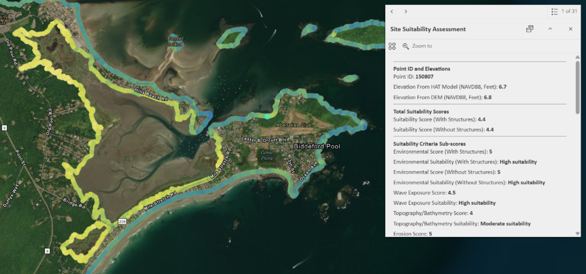
The Nature Based Strategies for a Climate Ready Southern Maine project team is pleased to share a new GIS-based decision support tool for nature based strategies to address coastal hazards in southern Maine.
This tool was developed to support implementation of the Climate Ready Coast – Southern Maine Regional Coastal Resilience Plan. Feedback received during that project indicated a need for more information about the ability of different coastal areas to support nature-based strategies.
The interactive tool includes three data layers to help support decision making:
-
Site Suitability Assessment: Indicates the relative biophysical suitability for nature-based strategies of locations along the southern Maine coastline, based on a weighted scoring system for environmental, wave exposure, topography, and erosion factors.
-
Socio-Political Feasibility Assessment: Describes proximity to key habitats, conservation lands, infrastructure, and other factors that may affect project feasibility.
-
Beach Priority Assessment: Identifies beaches that may benefit most from resilience actions using a relative scoring system that considers erosion rates, beach width, dune stability, and proximity to structures.
This tool was developed as part of a collaborative project with the Wells National Estuarine Research Reserve, Nearview LLC, and the York County Soil and Water Conservation District.
For more information, reach out to Melanie Nash, Sustainability & Resilience Planner, at mnash@smpdc.org.
| | | Kennebunk River Hydrology Study: New Tide Gauge Installed | | |
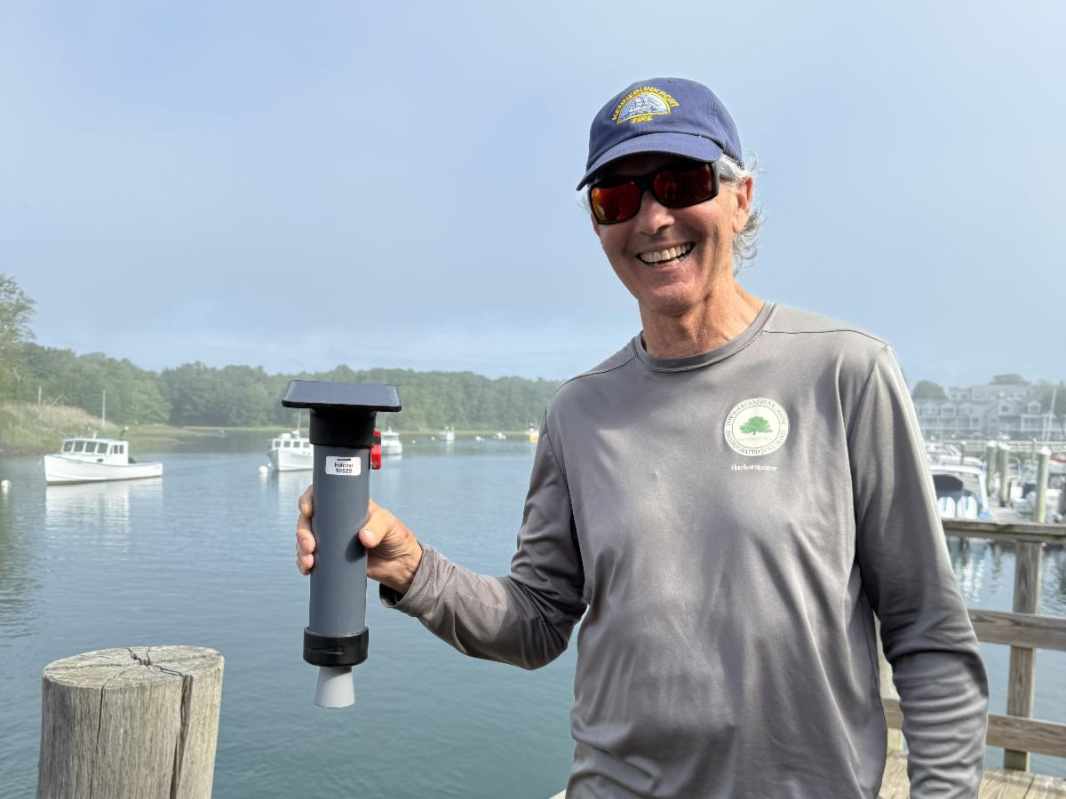
Jamie Houtz, Kennebunk River Harbormaster, with the new tide gauge.
Last month, SMPDC and staff from the Towns of Kennebunk and Kennebunkport collaborated to install a new real-time tide gauge sensor at Government Wharf in Kennebunkport. The Kennebunk River tide gauge was developed by Hohonu, a Hawaii-based flood monitoring company, and will measure water levels and flooding on the Kennebunk River for the next two years.
Real-time, historic, and projected tide level data for the Kennebunk River is now accessible to the public via Hohonu’s online dashboard and the TideCast smartphone app. Data collected by the tide gauge will also be used to develop a local hydraulic and hydrologic (H&H) model of current and projected future flooding along the Kennebunk River in support of ongoing climate resilience planning work in both towns.
To learn more about the Kennebunk River Hydrology Study project and options for local flood monitoring in your community, visit smpdc.org/kennebunkriver or contact Laura Berry, Sustainability & Resilience Senior Planner, at lberry@smpdc.org.
| | | Kennebunk Receives SolSmart Designation | | |
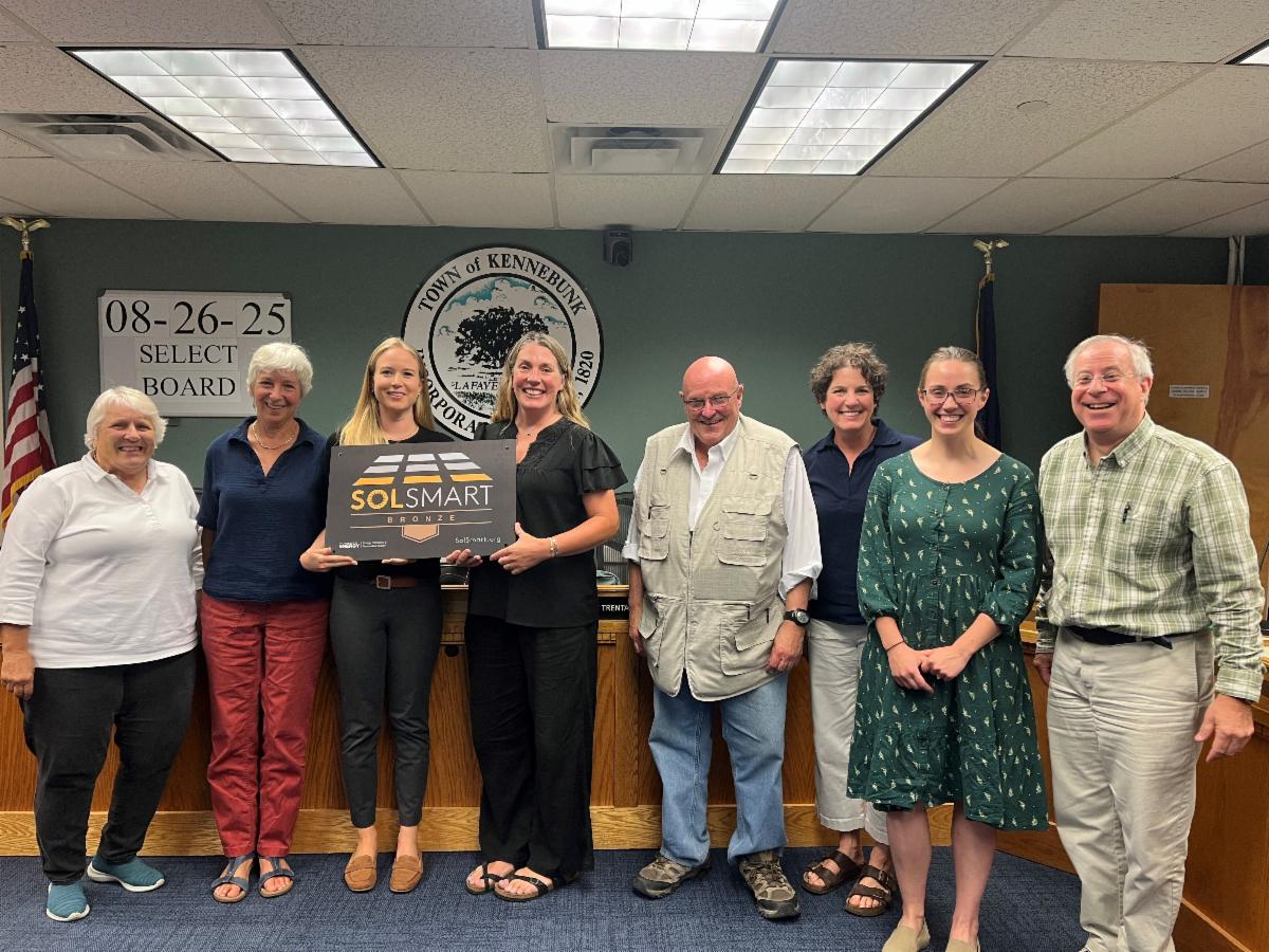
We’re excited to share that Kennebunk just became the second municipality in the state to receive a SolSmart designation! SolSmart is a national program that helps cities, towns, counties, and regional organizations become solar energy leaders. It provides free technical assistance to communities interested in encouraging small scale rooftop and ground mounted solar.
On August 26, Megan Howe from SolSmart presented the Kennebunk Selectboard with a SolSmart Bronze designation plaque. Selectboard member Lisa Pratt thanked Megan on behalf of the Town, saying “Increasing solar usage in the town is a part of Kennebunk’s Climate Action Plan, so this is a great first step.”
Kennebunk received designation by completing several SolSmart criteria, including:
- Creating an online permitting checklist, increasing transparency for community members and solar installers
- Reviewing local zoning codes and identified restrictions that intentionally or unintentionally prohibit solar PV development
-
Incorporating solar strategies and actions into the 2024 Kennebunk Climate Action Plan.
Sustainability & Resilience Division staff assisted Kennebunk’s planning staff with completing the criteria for SolSmart designation.
If you are interested in learning more about whether SolSmart might be a good fit for your community, reach out to Karina Graeter, Sustainability Division Director, at kgraeter@smpdc.org.
| | | Southern Maine Energy Navigator Program: Upcoming Events | | |
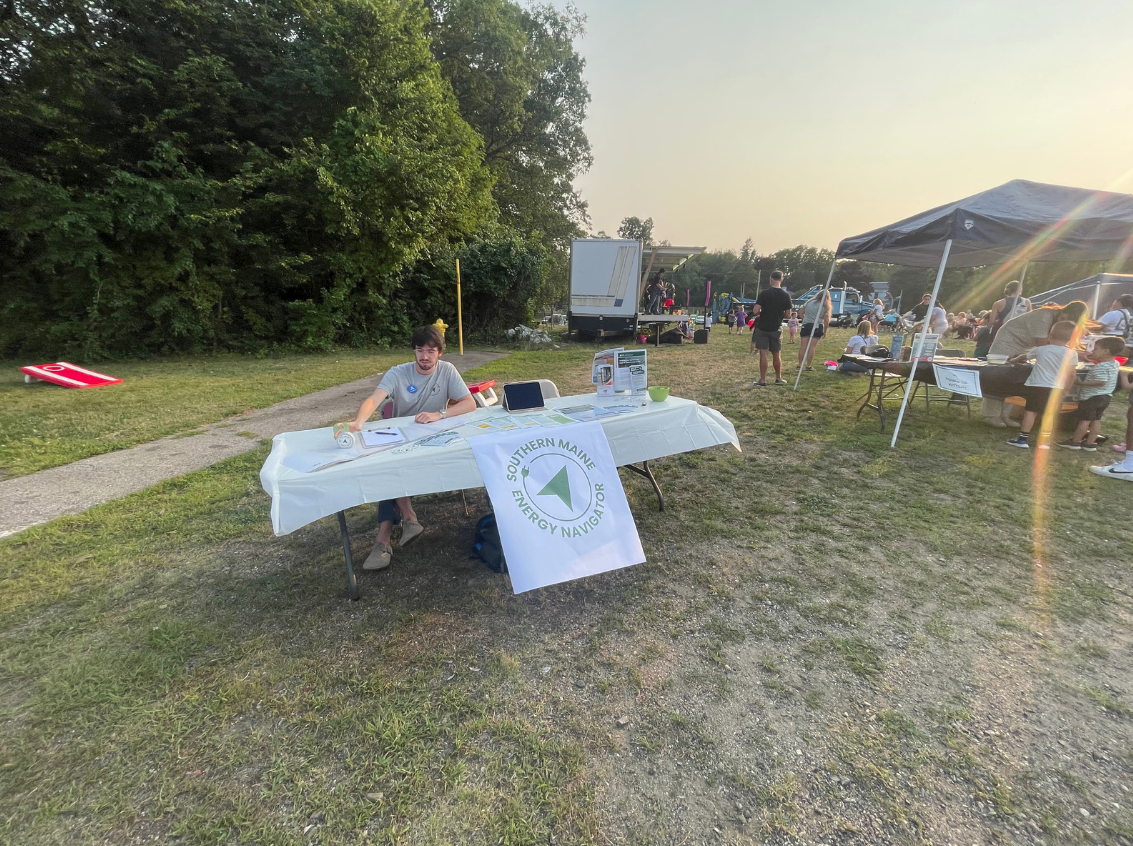
After launching in May, the Energy Navigators have been hard at work with outreach and assistance to homeowners. The Navigators recently hosted office hours at the Kennebunk Free Library and tabled at the National Night Out in Kittery.
See below for upcoming events where the Energy Navigators will be tabling. Stop by and say hello!
-
Wells EV Expo: Sunday, September 7, 1:00-4:30 PM, 1434 Post Road, Wells
-
HarvestFest Kennebunk: Saturday, October 18, Kennebunk
-
Graves Library Energy Navigator Office Hours: Date and Time TBD, 18 Main St, Kennebunkport
| | |
Coordinator Corner:
Updates from the Southern Maine Regional Coordinator Collaborative
| | |
Round 6 of Community Action Grants through the Community Resilience Partnership (CRP) are due Friday, August 29! The maximum award amount for an individual community is $75,000 and the maximum for joint/partnered grants is $175,000. For more information, visit the GOPIF website. The applicant community must be currently enrolled in the CRP. If you have questions about your community’s enrollment status, please reach out to us.
The CRP has released an updated and expanded List of Community Actions aligned with the Maine Won’t Wait 2024 recommendations. The List covers all no-match CAG activities that communities may apply for and includes new actions related to materials management (waste reduction and diversion), land use strategies that reduce emissions and build resilience, and more.
Looking for feedback on project idea or grant application? Need support with community engagement or finding the right funding source for your project? We're here to help! To get in touch about how SMPDC can support your community’s resilience projects, reach out to Melanie Nash, Sustainability & Resilience Planner, at mnash@smpdc.org.
| | | Upcoming Trainings & Resources | | |
Coastal Ecosystem Map Application Platform (CEMAP)
Nearview has released a new tool for coastal and intertidal ecosystem visualization and analysis. This tool is designed to assist with making accurate assessments for more informed decisions in coastal resource management, conservation, marine industry, and research. Learn more.
Meeting Maine’s Energy Code Training Series
PassivHausMAINE is hosting a training series on municipal code updates and compliance for the Maine Uniform Building and Energy Code (MUBEC), with sessions all around the state. Learn more and register.
Local Planning Boards Workshop
The Maine Municipal Association is hosting a workshop for Local Planning Boards & Boards of Appeal on Tuesday, October 28 from 4:00 to 8:30 PM. Participants may attend in person at the MMA Offices at 60 Community Drive, Augusta, or participate virtually. Learn more and register to attend in person or via Zoom webinar.
A Climate to Thrive Climate Action Toolkit
A Climate to Thrive has launched its Community-Driven Climate Action Toolkit, designed to help communities act at a local level to address climate change. View the toolkit.
| | | |
The Maine Trails Program is a new statewide initiative supporting trail design and development for outdoor recreation and active transportation. Up to $7.5 million per year may be awarded to trail projects. The program is administered by the Maine Bureau of Parks and Lands within the Department of Agriculture and Forestry. Applications due September 26, 2025. Learn more.
The Maine Coastal and Marine Climate Fund is accepting applications for coastal and marine climate action projects to help communities carry out recommendations from the Maine Climate Council’s Coastal Marine Working Group. Applications due October 23, 2025. Email dan@broadreachfdn.org to apply. Learn more.
The Island Institute is accepting applications for Community Clean Energy Grants and Community Climate Planning Grants. Awards of up to $20,000 are available. Applications are reviewed and awarded on a rolling basis, now through June 1, 2026. Learn more and apply.
The Maine Community Foundation’s Land for Communities Grant Program is accepting applications for community land projects that increase relationships to land for underserved geographies and populations in Maine. Maximum award of $50,000. Applications are due September 15, with the next round opening in early 2026. View the informational webinar recording. Learn more on the program website.
Coming Up: The Maine Infrastructure Adaptation Fund will be accepting applications in March 2026. Administered by MaineDOT, the program provides direct funding to public entities to adapt critical infrastructure to reduce vulnerability to climate change. More information will be available this Fall. View the full list of 2024 awards.
| | | Thanks for reading! Follow us on social media for more news and updates, or reach out to learn more. | |
Southern Maine Planning & Development Commission | Website
| | | | | |