Thank You for Standing with Us
| | |
Thank you to everyone who attended the Black Georgetown Foundation’s August 4 town hall concerning DDOT’s work near 27th Street, Mill Road, and Lyons Mill Road.
Representatives from DDOT, the DC Historic Preservation Office, DC Water, the National Park Service/Rock Creek Park, and Councilmember Brooke Pinto’s office participated.
The Mt. Zion–Female Union Band Society Cemeteries are the oldest remaining intact Black cemeteries in Washington, DC. They are listed on the National Register of Historic Places, and recognized as a UNESCO Routes of Enslaved Peoples Site of Memory.
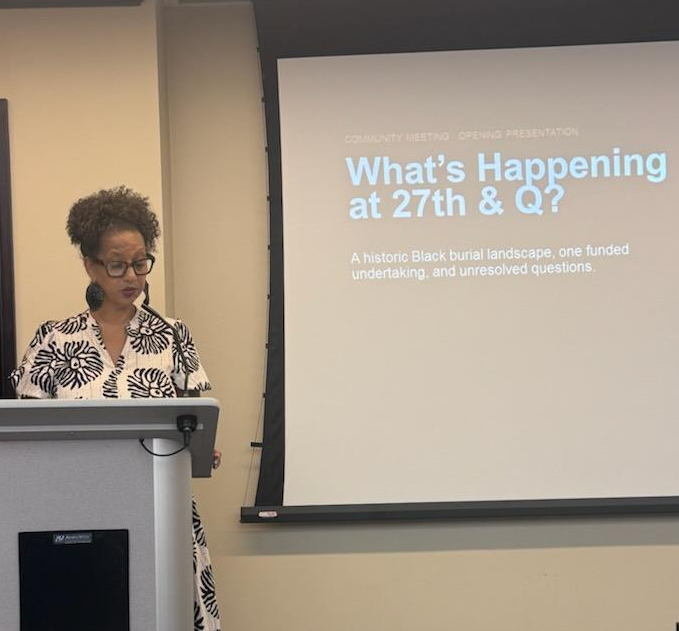
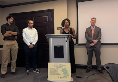
Photo: Lisa Fager opens the August 4 community town hall on the historic burial landscape and unresolved questions surrounding DDOT’s work.
| |
What We Heard
BGF supports the stormwater improvements. Runoff and erosion have damaged the cemeteries for decades.
Our concern is not whether the infrastructure work is needed. It is whether work beside a historic Black burial landscape has been conducted with the necessary care, transparency, and archaeological protection.
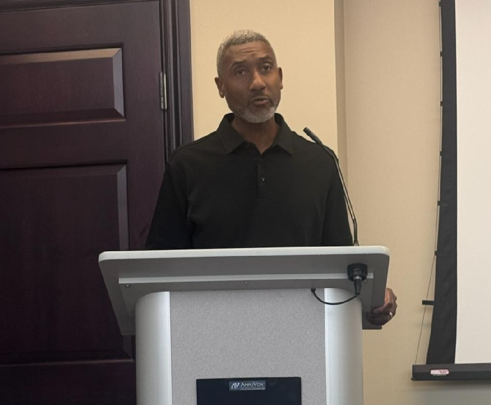
“Humans remain. Not human remains, but humans remain. They are people.”
Dr. Joseph Jones,Teaching Professor of Anthropology and Director of the Institute for Historical Biology at William & Mary
| | |
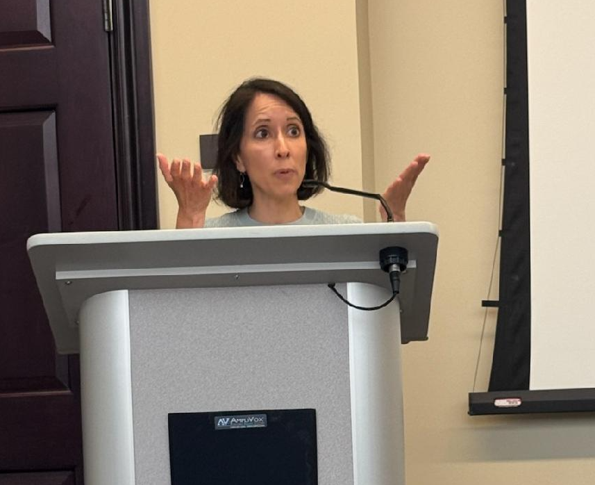
Sara C. Bronin explained that preservation review should consider the entire area affected by a project—not stop at property lines.
Agencies have a responsibility to understand the “area of potential effects, regardless of property ownership."
Sara C. Bronin, Georgetown resident, Freda H. Alverson Professor of Law at The George Washington University Law School, and former Chair of the Advisory Council on Historic Preservation
| |
Where Things Stand With DDOT
At the town hall, DDOT said its consultant had returned the revised 2025 Lyons Mill Road survey report. DDOT said it was correcting additional errors before releasing a public draft.
DDOT also described Lyons Mill Road and the 27th Street/Mill Road drainage work as separate projects.
For BGF, this is one connected burial landscape. Separate project names should not result in separate standards of protection.
Photo: DDOT representatives respond to community questions during the August 4 town hall.
| |
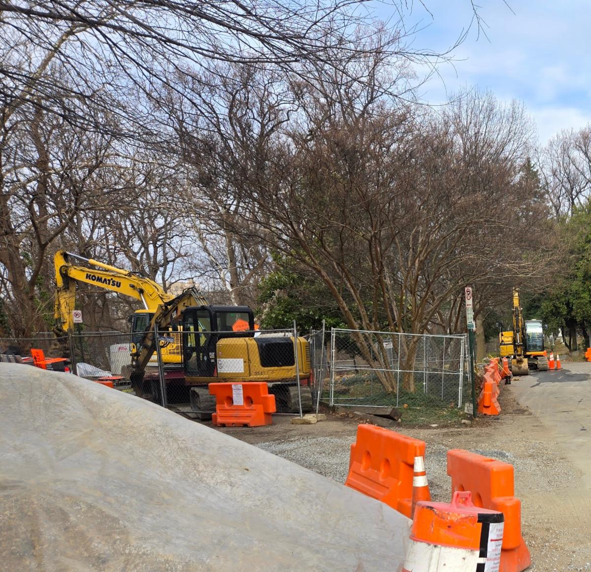
Why Was Heavy Equipment Parked Here?
Photographs taken in December 2025, through July 2026 document heavy construction equipment staged in this burial-sensitive area over several months.
DDOT said it used the area because vehicles had previously parked there. But the location was posted as a no-parking area. The District’s failure to enforce its own restriction did not make this land an appropriate construction yard—especially after burial-related findings had been identified.
Photo:
Heavy construction equipment staged in the burial-sensitive area on December 12, 2025.
| | | | |
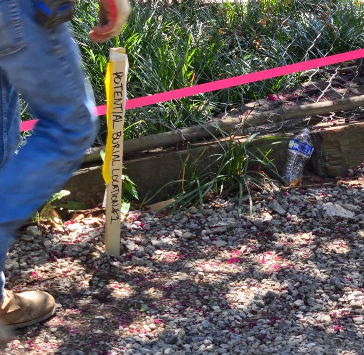
After BGF repeatedly pressed for the burial data, boundaries, and locations to be made visible, seven potential burial locations were marked in the field on July 23.
Photo: “Potential Burial Location #1” marked in the former staging area on July 23, 2026.
DDOT subsequently removed the machinery, extended the curb, mulched the former staging area, and left the markers in place. BGF welcomes those actions.
But the central question remains:
| |
Why was this area considered safe for months of construction staging, but marked as potentially containing burials only after BGF demanded answers? |
Three Immediate Questions
1. Where are the remaining burial-related findings?
The seven locations marked on July 23 came from the 2023 survey. Where are all the probable burials, targets, and anomalies identified in the 2025 Lyons Mill Road survey—and when will DDOT map, disclose, and field-mark them?
2. What happened during the unmonitored excavation?
Deep excavation proceeded for more than 30 days without an archaeologist onsite. Did crews encounter, move, discard, or miss artifacts, grave features, human remains, or other burial evidence?
3. How will DDOT and NPS protect the burials and safely reopen Lyons Mill Road?
Temporary stakes and indefinite closure are not a protection plan. BGF is asking for a coordinated plan that protects every burial-related finding, establishes archaeological safeguards and agency responsibility, safely reopens and maintains the public route, and prevents visitors from being diverted through the cemeteries.
| |
One Burial Landscape, Two Different Standards
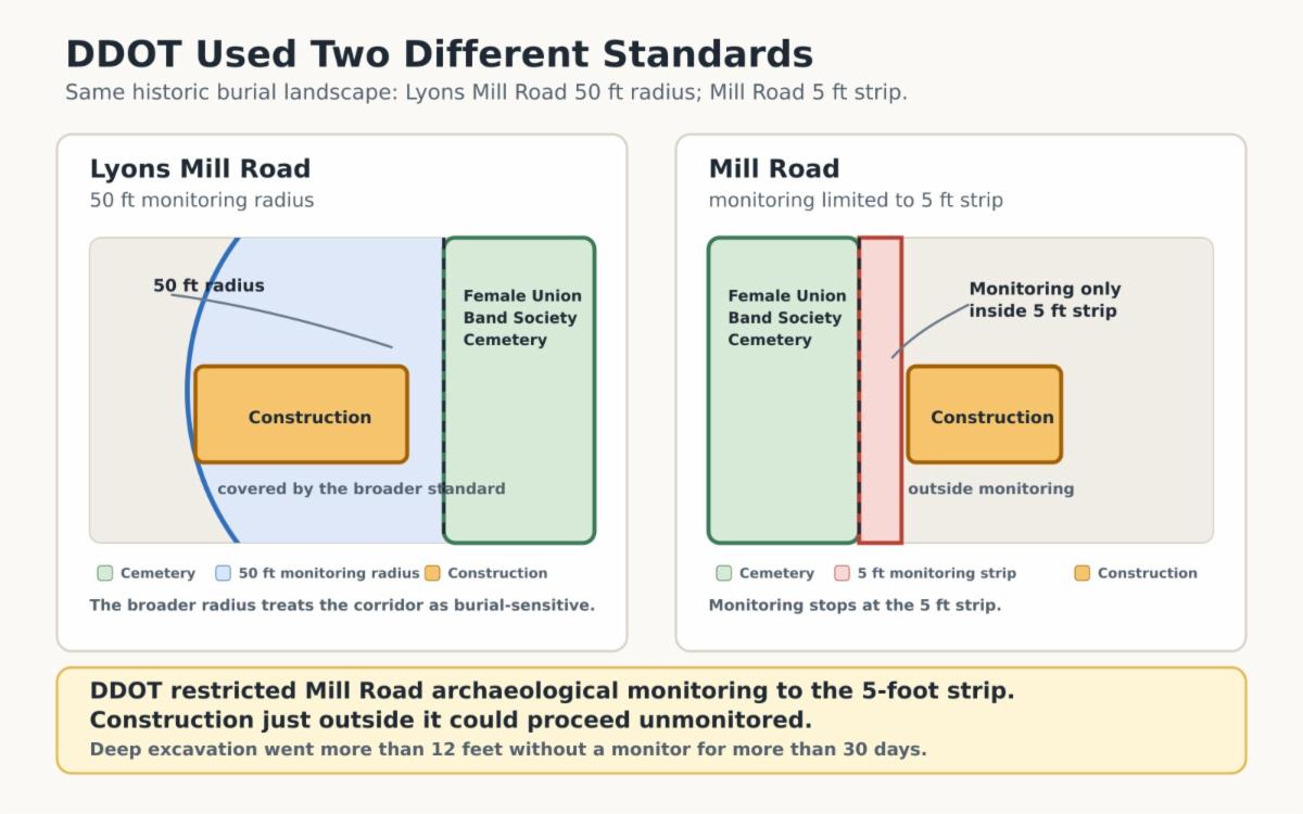
DDOT used two different archaeological monitoring standards within the same historic burial landscape.
Lyons Mill Road was treated with a 50-foot monitoring radius. Monitoring for the Mill Road work was limited to a five-foot strip measured from the cemetery boundary.
That narrower standard allowed deep excavation immediately outside the five-foot strip to proceed without archaeological monitoring.
DDOT used a 50-foot archaeological monitoring radius on Lyons Mill Road but restricted monitoring on Mill Road to a five-foot strip.
| |
What BGF Is Asking For
BGF is requesting:
- Written answers to all outstanding questions.
- Complete reports, coordinates, maps, and source data.
- An inventory of every probable burial, target, and anomaly identified in the 2023 and 2025 surveys.
- One composite map showing cemetery boundaries, public rights-of-way, agency jurisdiction, survey areas, findings, and field markers.
- A complete account of what was observed, recovered, discarded, or treated as fill during excavation.
- Independent archaeological oversight and a written burial protection and treatment plan.
- A binding citywide policy for work near known or probable burials in public rights-of-way.
The core issue is simple:
DDOT treated this like a construction site. BGF is saying this is a burial landscape. That changes the standard of care.
Transparency Update: Three FOIA Deadlines Missed
BGF’s pending FOIA request, R009906-061526, concerns the 27th Street/Mill Road project.
DDOT promised responsive records by July 22, then July 31, and then August 7. DDOT missed all three deadlines.
BGF is still waiting for the records needed to understand what occurred and how the burial landscape was protected.
|
In the News
NBC4 Washington: DDOT Failed to Protect Graves, BGF Says
NBC4 Washington reports on the seven marked potential graves, the heavy equipment stored in the burial-sensitive area, the inconsistent archaeological protections, and DDOT’s lack of transparency.
The article also reports DDOT’s acknowledgment that it should have found another location for the construction equipment.
|
Fox 5 DC: Town Hall Coverage
Fox 5 DC covered the August 4 town hall and the community’s concerns about DDOT’s work near the historic burial grounds. WATCH FOX 5 COVERAGE
| | |
Thank you for continuing to stand with us as we seek transparency, accountability, and meaningful protection for these sacred burial grounds.
Look for updates on our social media channels and at www.blackgeorgetown.com.
Black Georgetown Foundation
| | | | |