|
|
T h e T o r r e n t
A newsletter of the Connecticut Department of
Energy & Environmental Protection
exploring floodplain management issues
|
|
Volume 21, No. 1 October 2014
|
|
Shore Up Connecticut State Loan Program |
On July 28, 2014, Governor Dannel Malloy announced the availability of Shore Up Connecticut, a new state low-interest loan program which provides financial assistance to homeowners and businesses to elevate structures subject to coastal flooding.
The terms of the loan are: - 2.75% (3.027% APR) fixed interest rate;
- 1% origination fee;
 - Borrow $10,000 to $300,000 with 15 year term;
- No monthly principal or interest payments for the first 12 months;
- Borrower must maintain property, hazard and flood insurance for the life of the loan.
Eligible properties include: - Primary and secondary single family homes, or 1-4 unit owner-occupied rentals. Single-family homeowners must live in the property at least 14 days per year.
- Businesses with fewer than 100 employees and in good standing with all state agencies.
- Those subject to coastal flooding and located in either a Zone VE or Zone AE in coastal communities as defined by the Federal Emergency Management Agency (FEMA) and the National Flood Insurance Program (NFIP).
- These coastal communities are: Greenwich, Stamford, Darien, Norwalk, Westport, Fairfield, Bridgeport, Stratford, Milford, West Haven, New Haven, East Haven, Branford, Guilford, Madison, Clinton, Westbrook, Old Saybrook, Old Lyme, East Lyme, Waterford, New London, Groton, and Stonington.
- Must be up-to-date with all local, state, and federal taxes.
For new home elevation projects, properties must be elevated at least one foot above the 500-year flood elevation. Commercial structures must be elevated at least one foot above the 100-year flood elevation. Shore Up CT is managed by the Housing Development Fund and funded by the Connecticut Department of Housing (CTDOH). It has received $2 million in state bonding for start-up costs and an initial $3 million in bonding for the program. Earlier this year, the state legislature approved authorizing up to $25 million in bonding for the program. The program was formerly known as the Shoreline Resiliency Fund.
|
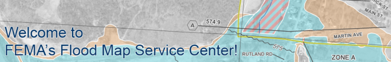
| FEMA Map Service Center Redesigned |
In the summer of 2014, the Federal Emergency Management Agency (FEMA) redesigned its Flood Map Service Center (MSC), the official public source for flood hazard information produced in support of the National Flood Insurance Program (NFIP). In addition to a streamlined user interface, the upgraded MSC provides a number of benefits: - All products are free - All products and services are now completely online and free of charge, reducing costs to the public and costs to FEMA associated with processing payments, shipping physical media, and maintaining parallel systems for paying and fee-exempt customers. Flood Insurance Rate Maps (FIRM), Flood Insurance Studies (FIS) and all other information available on the MSC may be accessed and downloaded at no cost;
- Quick and easy downloads - An enhanced map search allows the public to download their flood map, and any revisions or amendments to it, in a matter of seconds;
- Enhanced Address Search - For users looking to quickly find flood hazard information for a particular address or point of interest, the Address Search feature provides results through an easy to use map interface. New enhancements include the ability to download FIRMs and Letters of Map Change (LOMCs) directly from the search results page, as well as a direct link to view flood hazard GIS data for a selected area in the FEMA GeoPlatform;
- Everything in one place - An integrated product search allows users to locate every flood hazard product available for their area of interest in just a few clicks;
- Free subscriptions - Free customized email subscriptions make it possible for floodplain managers, local officials, and others to know immediately when new information comes out of their community;
- Direct Data Service Features - Products-as-a-service enables access to hosted flood hazard information without ever having to navigate through the actual site, thanks to a standardized product URL format; and
- Enhanced help features - Tailored help test and responses to "Frequently Asked Questions" quickly guide first-time and novice users of the site to the information they need.
A fact sheet summarizing the new and enhanced features may be found in the FEMA Library.
|
Connecticut Association of Floodplain Managers
|
|
The newly formed Connecticut Association of Floodplain Managers (CAFM) will hold its first annual meeting and conference at the Water's Edge Resort, 1525 Boston Post Road, Westbrook on Wednesday, October 29, 2014. The conference is an opportunity for municipal and state officials, industry leaders, consultants and other interested parties to share their floodplain management experiences. The opening address will be given by CTDEEP Commissioner Robert Klee and the keynote luncheon address will be given by William Nechamen, Chairman of the Association of State Floodplain Managers (ASFPM). Presentations will discuss floodplain construction, dam removal and emergency action plans, modeling of salt marsh advancement zones, the Community Rating System (CRS), Buzzards Bay climate change vulnerability assessment, recent flood insurance changes, home elevation projects in Connecticut, mitigation planning, and the map amendment process. The Certified Floodplain Manager (CFM) exam will also be administered in the afternoon. For conference agenda and registration form, visit the CAFM website.
CAFM is modeled after similar state floodplain managers organizations and is seeking support to become an officially recognized chapter of the ASFPM national organization. CAFM's mission is to develop a professional community that promotes education, policies, and activities that mitigate current and future losses, costs and human suffering caused by flooding, and to protect the natural and beneficial functions of floodplains.
|
| What is a Group Flood Insurance Policy? |
|
Following a presidentially-declared disaster, a Group Flood Insurance Policy (GFIP) is made available for property owners and renters who receive federal disaster assistance under the FEMA Individuals and Households Program (IHP). The GFIP is a 3-year policy and usually becomes effective 60 days after the declared disaster. The policy cost is $600 for the three-year period. It is paid for out of the IHP disaster grant award to help the property owner following a flood loss.
The policy is serviced by the NFIP Direct Servicing Agent and is not sold through private insurers like the typical NFIP flood insurance policy. The recipient will also receive notices prior to expiration of the GFIP indicating that the policy will expire and that in order to be eligible for future disaster assistance, they must purchase their own policy through the NFIP and is advised to contact a local insurance agent or call the NFIP Direct.
The GFIP is not a "full-scale" NFIP flood insurance policy. It provides less coverage than the Standard Flood Insurance Policy (SFIP). There is a maximum amount of coverage, currently $31,900, to be used for building, contents, or a combination of both. It also includes a $200 deductible for building and contents coverage. The limit is adjusted every October and is based on the Consumer Price Index (CPI). It is important to note that in most cases, the amount  provided under the GFIP is not enough to insure the property to its full replacement cost value. To remedy this, owners would be advised that they can purchase their own flood insurance policy at any time during the three-year period by contacting a licensed property insurance agent or broker for a quote. Once a SFIP through the NFIP has been purchased and issued, the GFIP is cancelled automatically and becomes null and void. |
| USGS Lauches iCoast & Coastal Change Hazards Portal |
The U.S. Geological Survey (USGS) recently launched a new crowd sourcing, citizen science application called "iCoast - Did the Coast Change?" that asks volunteers to identify changes to the coast by comparing and tagging aerial photographs taken before and after storms. These contributions will help USGS scientists improve the accuracy of coastal erosion prediction models and vulnerability assessments that support pre-storm planning and post-storm rescue, recovery and mitigation efforts. It is also a great educational tool for teaching students and even coastal residents about coastal hazards. More information on iCoast is available in this USGS Top Story article.
The USGS also recently launched the Coastal Change Hazards Portal, an online portal that interactively serves up information on past, present and future coastal hazard to help communities improve their resilience. The portal can aid in decisions that involve emergency preparedness, ecosystem restoration, and where and how to develop coastal areas to help ensure they are safe and resilient. One key component of the portal is the ability to explore coastal hazard risks at varied scales, from a local area of interest to a national perspective. Pick your favorite beach location, type in the name, zoom in, and view potential impacts of extreme storms, historic shoreline changes, and coastal vulnerability to sea level rise. This location-specific capability is extremely valuable for planning and preparedness and for making decisions to build coastal resilience. For example, if a hurricane warning is issued, users can input their city and state to see maps and imagery of potential impacts for a similar storm scenario. If an individual is planning to move to a beach, they can check a location into the portal to view what types of coastal hazards and impacts have occurred nearby. The Coastal Vulnerability Index feature shows the relative susceptibility of the Nation's coasts to sea level rise. Resource managers can also make decisions on how best to protect precious ecosystems.
|
| NOAA Issues Report on Nuisance Flooding |
The National Oceanic and Atmospheric Administration (NOAA) recently issues a report titled Sea Level Rise and Nuisance Flood Frequency Changes around the United States. The study looks at more than 60 years of coastal water level and local elevation data changes. Eight of the top 10 U.S. cities that have seen an increase in "nuisance flooding", which causes such public inconveniences as frequent road closures, overwhelmed storm drains and compromised infrastructure, are on the East Coast according to the report. Nuisance flooding, caused by rising sea levels, has increased on all three U.S. coasts, between 300 and 925 percent since the 1960s. The study was conducted by scientists at NOAA's Center for Operational Oceanographic Products and Services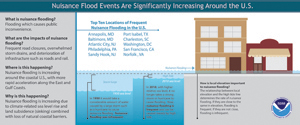 (COO-OPS), who looked at data from 45 NOAA water level gauges with long data records around the country and compared that to reports of number of days of nuisance floods. The extent of flooding depends on multiple factors, including topography and land cover. The study defines nuisance flooding as a daily rise in water level above the minor flooding threshold set locally by NOAA's National Weather Service, and focused on coastal areas at or below these levels that are especially susceptible to flooding. The report concludes that any acceleration in sea level rise that is predicted to occur this century will further intensify nuisance flooding impacts over time and will further reduce the time between flood events. The report provides critical NOAA environmental data that can help coastal communities assess flood risk, develop ways to mitigate and adapt to the effects of sea level rise, and improve coastal resiliency in the fact of climate- and weather-induced changes. (COO-OPS), who looked at data from 45 NOAA water level gauges with long data records around the country and compared that to reports of number of days of nuisance floods. The extent of flooding depends on multiple factors, including topography and land cover. The study defines nuisance flooding as a daily rise in water level above the minor flooding threshold set locally by NOAA's National Weather Service, and focused on coastal areas at or below these levels that are especially susceptible to flooding. The report concludes that any acceleration in sea level rise that is predicted to occur this century will further intensify nuisance flooding impacts over time and will further reduce the time between flood events. The report provides critical NOAA environmental data that can help coastal communities assess flood risk, develop ways to mitigate and adapt to the effects of sea level rise, and improve coastal resiliency in the fact of climate- and weather-induced changes. |
EPA Flood Resilience Checklist
|
The U.S. Environmental Protection Agency (EPA) recently released the Flood Resilience Checklist, a new tool to help communities prepare for, deal with, and recover from floods. The checklist offers strategies that communities can consider, such as conserving land in floodprone areas, directing new development to safer areas and using green infrastructure approaches, such as installing rain gardens, to manage stormwater. The checklist is part of a new report, Planning for |
Training Opportunities
|
|
WEBINARS
Register for webinars. Select the "Upcoming" tab to see a list of upcoming webinars. Below are webinars offered this autumn.
Oct 15 - Determining the Base Flood Elevation, 1:00pm (1 hour)
Oct 16 - Elevation Certificates, 1:00pm (2 hours & 30 minutes)
Oct 21 - Introduction to CRS, 1:00pm (1 hour)
Oct 22 - CRS/Developing Outreach Projects, 1:00pm (1 hour)
Oct 30 - NFIP Basics, 1:00pm (1 hour)
Nov 4 - Warning from the Past: Largest Western Flood, 1:00pm (1 hour & 30 minutes)
Nov 12 - Floodplain Development Permit Review, 1:00pm (1 hour & 30 minutes)
Nov 13 - Inspecting Floodplain Development, 1:00pm (2 hours & 30 minutes)
Nov 18 - CRS/Preparing for a Verification Visit, 1:00pm (1 hour)
Nov 19 - CRS/Flood Warning and Response, 1:00pm (1 hour)
Dec 4 - Comparing Hydraulic Models and Actual Flooding, 1:00pm (1 hour)
Dec 11 - Elevation Certificates, 1:00pm (2 hours & 30 minutes)
Dec 16- CRS/Introduction to CRS, 1:00pm (1 hour)
Dec 17 - CRS/Developing a PPI, CIP and using FloodSmart, 1:00pm (1 hour)
Dec 18 - Elevation Certificates, 1:00pm (2 hours & 30 minutes)
CONFERENCES
October 27-30, 2014: National Flood Mitigation and Floodproofing Workshop, Broomfield, CO, www.floods.org
October 29, 2014: Connecticut Association of Floodplain Managers (CAFM) 1st Annual Conference, Water's Edge Resort, 1525 Boston Post Road, Westbrook, CT, www.ctfloods.org.
November 19-21, 2014: 2014 FLASH Annual Conference, Orlando, FL, www.flash.org.
May 31-June 5, 2015: Association of State Floodplain Managers (ASFPM) 39th Annual Conference, Atlanta, GA, www.floods.org
FEMA EMERGENCY MANAGEMENT INSTITUTE
The Emergency Management Institute (EMI) is located at the Federal Emergency Management Agency (FEMA) National Emergency Training Center (NETC) in Emmitsburg, Maryland. EMI serves as the national center for emergency management training of federal, state and local government officials. Tuition, housing, and all books and materials are provided at no cost. Participants are responsible for the cost of a meal pass (approximately $150/week). Below is a select list of floodplain management classes offered until March 2015. A full list of training classes can be found at the EMI website.
E172 HAZUS for Flood - December 1-4, 2014
E174 HAZUS-MH for Earthquake - March 30-April 2, 2015
E176 HAZUS-MH for Floodplain Managers - November 10-13, 2014
E273 Managing Floodplain Development through the NFIP - March 9-12, 2015
E313 Basic HAZUS-MH - December 15-18, 2014
E317 Comprehensive Data Management for HAZUS-MH - January 5-8, 2015
|
|
|
|
|
Visit the DEEP website at www.ct.gov/deep. Published by the Connecticut Department of Energy and Environmental Protection, Bureau of Water Protection and Land Reuse, Inland Water Resources Division, Floodplain Management Program. Editor: Diane Ifkovic, State National Flood Insurance Program (NFIP) Coordinator, email: [email protected].
|
 The Connecticut Department of Energy & Environmental Protection is an Affirmative Action and Equal Opportunity Employer that is committed to complying with the requirements of the Americans with Disabilities Act (ADA). Please contact us at (860) 418-5910 or [email protected] if you; have a disability and need a communication aid or service; have limited proficiency in English and may need information in another language; or if you wish to file an ADA or Title VI discrimination complaint. |
|
|