|
IN-SCHOOL SUPPORT:
Allison Sirdar shared the following with ISST, Penny Ross
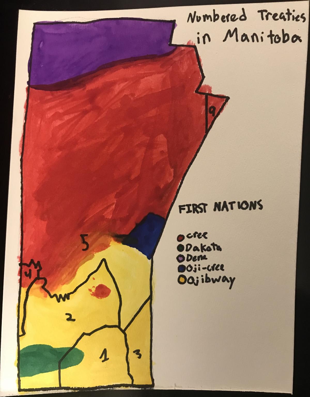
Teacher Allison Sirdar, from Robertson School (Winnipeg School Division) has shared the activity she did with her grade 3/4 class. They made these watercolour maps as part of the grade 3 Social Studies Unit, “Exploring the World.” They explored the IPAC Giant Floor Map and the Treaty Map of Manitoba as part of their learning about the Numbered Treaties and First Nations communities and languages in Manitoba. Each student drew Manitoba, outlined the Treaty areas in the province, then explored the maps to locate First Nations communities. They used different colours of liquid watercolour paint to illustrate that the traditional lands of First Nations communities in Manitoba were not fixed by borders.
******
To access the Manitoba Treaty map, clck here: 29627-treaty_poster_map_2017-web-2.pdf (trcm.ca)
To learn more about the Indigenous Peoples Atlas of Canada giant floor map, click here: Indigenous Peoples Atlas of Canada | Canadian Geographic Education (cangeoeducation.ca)
|