Not all buildings and facilities have a full CAD design. In fact, the majority of structures over ten years old were designed in 2D. Added to this is the fact that buildings and facilities change over time and not all of those changes make their way back into the CAD. Lidar and/or photogrammetry scanning has become a very popular way of capturing the actual facility design and layout.
Lidar uses a laser to measure the reflection time to generate a point cloud representing the object scanned to an accuracy within a few millimeters.
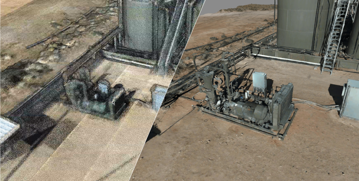
Another technique used to capture a scan of a space is photogrammetry. Here a large number of overlapping photographs are taken of an area and then an algorithm is used to knit them together into a single image. This is the technique Google uses to create Google street view.
Both techniques have limitations:
- Scans generate very large data files - 150GB is not uncommon.
- Specialized software is required to view the outputs of these techniques.
- Significant computing power is required to render them.
- The user has limited ability to navigate within the scan.
UrsaLeo has developed a range of techniques to ingest lidar and/or photogrammetry and produce a Unity-based 3D digital twin. These models are lightweight and can be run using a WebGL-compatible browser or on native iOS applications on an iPad or iPhone. This means they can be taken into the field and used on site using a simple tablet. We provide full navigation of the 3D twin, allowing it to be viewed from any angle and any depth. A recent data file of more than 150GB of lidar and photogrammetry was rendered into a 130MB fully navigable digital twin - a 1000x reduction in the data file size!
Once the digital twin is produced, we also provide a way to drop in CAD of specific pieces of equipment, add live SCADA/IoT data and use advanced visualizations such as 3D heat maps (to display the dispersion of gas or levels of liquid inside a container). We also offer collaboration tools to allow a geographically dispersed team a way to work together.
If you'd like to see or discuss our twins derived from lidar/photogrammetry, please
contact us.