|
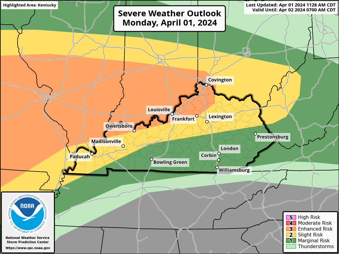
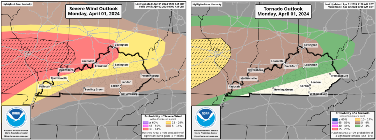
The more concerning aspect of this round is that SIGNIFICANT severe storms are possible, shown by the dashed lines on the map. This is called a 'hatched' region. When looking at the tornado outlook, this would mean there is a 10% or greater probability of seeing a strong to violent tornado (EF2-5) within 25 miles of any point in that area. In the case of severe winds and hail, 'hatched' denotes a 10% chance of wind gusts exceeding 74 mph or hail two inches in diameter or larger.
However, this forecast is not yet set in stone. A lot will depend on weather conditions later tomorrow morning. If we still have clouds and showers hanging around, the severe threat will decrease. If the sun comes out, more fuel (instability) will be added to the fire. The bottom line is, we DON'T want to see the sun tomorrow!
Another point to mention is the possibility of excessive rainfall. Portions of Northern and Northeastern Kentucky are currently under a Flood Watch, where 1.5 to 2+ inches is in play. Remember... a WATCH means that flooding is POSSIBLE and conditions are favorable. In other words, we need to prepare for the potential of flooding. A WARNING means flooding is already occurring or imminent. In this case, it's time to take action if you're in a flood-prone area!
|