|
A Message From the Core Committee
Greetings Volunteers and Friends:
As 2018 draws to a close, URISA's GISCorps Core Committee has much to be thankful for.
First and foremost, we never cease to be amazed by our 5,658 (and counting!) volunteers, who have contributed over 67,000 hours to 250 missions to bring GIS expertise to communities and organizations in need around the globe.
Second, we are thankful for our newest Core Committee member, Chris Zumwalt! Chris joins us from Marin County, California, where he works as an Environmental Scientist and GIS Professional. A GISCorps volunteer since 2009, Chris is inspired by the passion and effectiveness of the GISCorps organization and volunteers. Welcome to the Core Committee, Chris! We are so glad you are here.
Third, we are grateful for our new and returning Partner Agencies, who continue to bring us meaningful and interesting projects that allow us to fulfill our mission, learn new skills, and share our love for geospatial science and technology with communities in need.
With warmest regards and best wishes for 2019,
GISCorps Core Committee: Dianne Haley, German Whitley, Leslie Zolman, Allen Ibaugh, Carol Kraemer, Troy Wirth, Wincy Poon, Chris Zumwalt, and Shoreh Elhami
|
| Deployment and Partnership News |
Missions in Progress
Four new missions are currently in progress with a handful more in the works. More details on these projects are posted on our What We Do web page under 'New and Ongoing Projects'.
|
Featured Projects
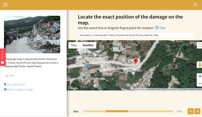
Volunteers Test Crowd4EMS Application for E2mC Project
Funded by the European Commission, Crowd4EMS is the crowdsourcing component of a suite of open-source applications collectively known as Copernicus Witness.
Copernicus Witness was designed to combine social media listening, machine learning, and crowdsourcing to produce an
accurate spatial dataset of on-the-ground conditions within the crucial first hours following a natural disaster or humanitarian crisis. When the
E2mC Project
team requested application testing support from GISCorps, 27 volunteers jumped in, contributing over 100 hours to testing the Crowd4EMS application. Read more about this project
here
.
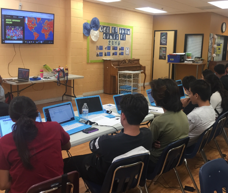
Teaching GIS to Youth at KidWorks
During the summer of 2018, GISCorps volunteers Haritha Vendra and Tarlan Razzaghi collaborated with
KidWorks
to teach web mapping and spatial analysis skills to a group of at-risk teens in central Santa Ana, California. Haritha and Tarlan developed a custom GIS curriculum and delivered it to the students in an interactive format over the course of the summer, empowering the students to analyze the availability of healthy food and recreational opportunities in their community. Read more about this K-12 GIS education project
here
.
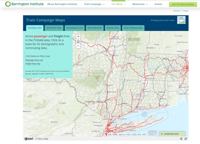
Bringing Back the Trains... One Map at a Time
Partnering with
The Barrington Institute's Train Campaign
project, GISCorps volunteers Ellen Phillips and Linda Colin developed a comprehensive web-based story map to visualize existing and proposed rail lines in Massachusetts, Connecticut, and New York. To accomplish this, Ellen and Linda synthesized datasets from disparate sources and provided context by including demographic and commuting data from the United States Census Bureau as well as OpenStreetMap data. Learn more about the Train Campaign maps
here
.
Humanity Road's Hurricane Florence Search & Rescue Map
GISCorps volunteers Adam Hufnagel and Michael Robinson joined nonprofit
Humanity Road
in a collaborative response effort to support the United States Coast Guard by maintaining a search and rescue incident heat map. The map dynamically displayed rescue and assistance request data mined from social media by Humanity Road volunteers, along with rescue request data from the Cajun Navy database. Read more about this collaboration
here
.
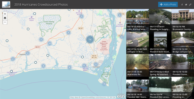
Hurricane Florence Crowdsourcing and Flood Estimation
Joining forces with the
National Alliance for Public Safety GIS (NAPSG)
and
Crowd Emergency Disaster Response (CEDR) Digital Corps
, 36 GISCorps volunteers scoured social media to find, geolocate, and validate over 900 photos of on-the-ground conditions throughout the Mid-Atlantic region. The volunteers uploaded the photos to an interactive Esri story map that was used by federal, state, and local emergency managers, first responders, and search and rescue teams to enhance their situational awareness during disaster response and recovery efforts. In a second phase of the project, several volunteers revisited each photo to estimate flood heights; the resulting dataset was used to validate the
Pacific Northwest National Laboratory's
flood models. Read more about both phases of this project
here
.
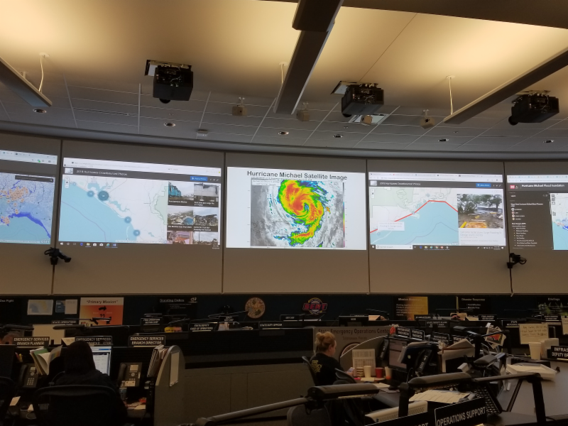
Hurricane Michael Crowdsourcing
In October, another deadly hurricane struck the southeast United States, this time inflicting devastating wind damage on Florida, Alabama and Georgia. Once again, 20 GISCorps members volunteered their time and talents to support
NAPSG
and
CEDR
in mining social media for photos of on-the-ground conditions throughout the affected area. Their collaboration resulted in over 600 geolocated and validated photos that were used by emergency managers and first responders to allocate resources and develop an effective response. Read more about this work
here
.
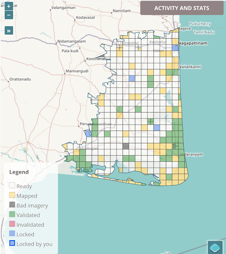
HOTOSM Projects
GISCorps volunteers continue to contribute their skills to Humanitarian OpenStreetMap Team projects around the globe. Top priorities at the moment include digitizing roads in parts of India affected by Cyclone Gaja and digitizing buildings in areas of the Democratic Republic of the Congo affected by the recent Ebola outbreak. Work on areas affected by flooding in Kerala, India, and southwestern Japan continues as well. Cumulatively at least
33
volunteers have contributed over
220
hours digitizing and validating 11 different projects, and efforts are ongoing.
If you are a GISCorps volunteer and a HOTOSM contributor, please remember to add
#GISCorps
to your changeset comment when you save your edits and don't forget to keep track of the hours you spend mapping. When you're finished, please fill out
this Google form
so we can accurately track and report GISCorps volunteer contributions to HOTOSM projects. You'll also receive documentation of your contribution, which can be used for GISP credit.
We hope to have a new HOTOSM page on our website soon, so stay tuned!
|
|
If you haven't already, don't forget to join us on social media. We have a
Facebook page, a
Facebook group
, a
Twitter
account, a
LinkedIn company page
, a LinkedIn group, and a
Slack
workspace where volunteers can ask questions, join discussions, share information and get to know each other. If you'd like to help us get the word out, please check out the resources on our website. Also, please double check that the 'giscorps.org' domain is not being sent to your Spam folder!
|
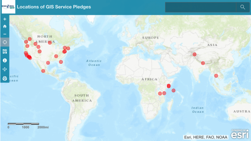
Since the launch of the GIS Service Pledge,
38
volunteers have been granted a free personal use license. You can see the names and locations of those volunteers in
this web application
.
If you know of a worthy cause that could benefit from your GIS expertise, review the guidelines and apply for the Pledge here. Send any questions specific to the GIS Service Pledge to: [email protected].
|
| Conference News & Announcements |
GIS-Pro & CalGIS 2018
URISA's GIS-Pro conference (in partnership with CalGIS) was held in Palm Springs, CA last month.
- More than 500 people participated - from 43 states, 5 Canadian provinces, and 8 countries.
- There were 8 workshops, 163 speakers in 49 breakout sessions within 7 focused program tracks.
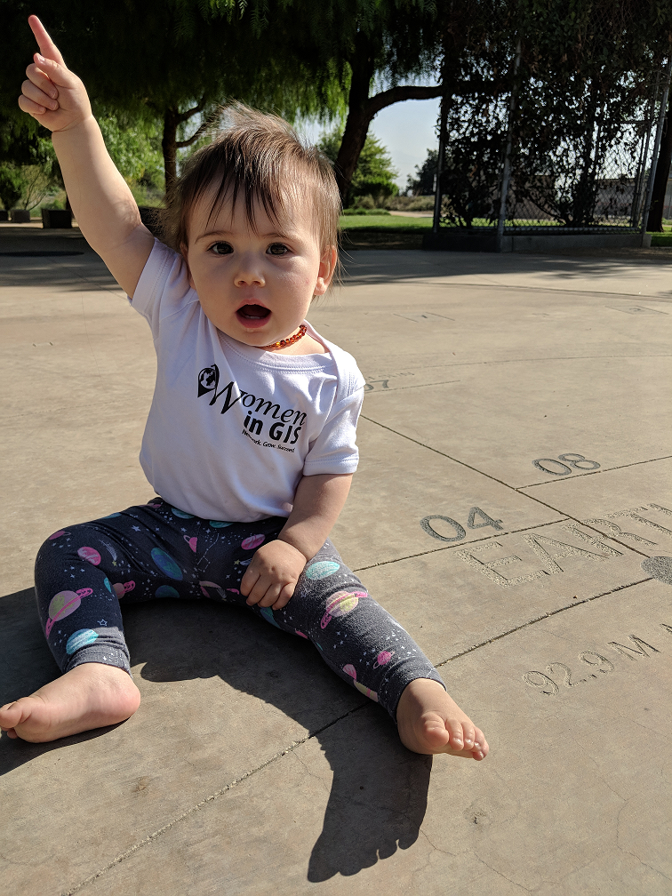
- Free onsite childcare was provided for numerous #GISBabies during the week!
Dianne Haley and Allen Ibaugh gave a presentation about GISCorps' missions and activities during the awards breakfast.
In addition, URISA members and chapter leaders from all over North America brought items for a Silent Auction to raise funds for GISCorps. Nearly $4,000 was raised this year! Thanks to all who contributed items and to everyone who placed a bid!
|
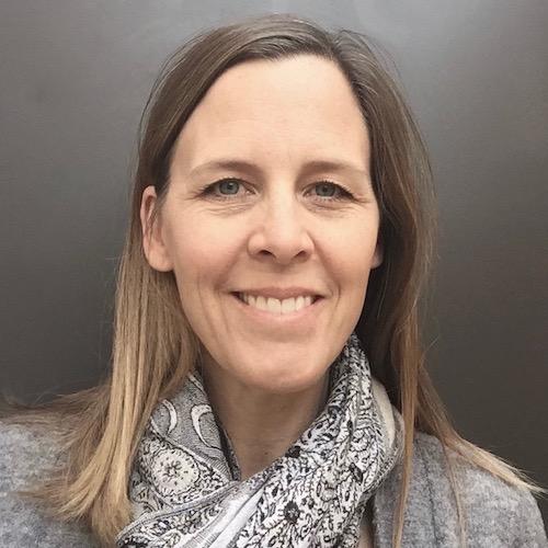
In this newsletter, we introduce GISCorps' new part-time GIS/Administrative Assistant, Holly Torpey. Holly is also a GISCorps volunteer, having worked on the polio campaign mapathons in the DRC, Horn of Africa, and Middle East, as well as the NAPSG crowdsourcing projects during Hurricanes Florence and Michael. She has also volunteered with Standby Task Force since Hurricane Harvey in 2017, and has served as a volunteer French and Spanish translator for microlending platform Kiva.org since 2012. Holly has a B.A. in Geography, an M.S. in GIST, and experience working with GIS in a variety of fields, but her favorite work has been her volunteer service.
Name:
Holly Torpey
Organization: URISA's
GISCorps
GISCorps Missions Served:
NAPSG crowdsourcing for Hurricanes Florence and Michael; DRC, Horn of Africa, and Middle East polio campaign mapathons.
Share your experience about the missions:
I love the collaboration, camaraderie, and convergence of skills, backgrounds, and time zones that characterize mapathons and crowdsourcing projects, but the best part is the feeling of being able to do something meaningful in response to a natural disaster or humanitarian crisis. I also love that every mission brings the opportunity to jump in and learn something new.
Anything else to share?:
I am so grateful for the opportunity to support the talented and dedicated GISCorps volunteer community and Core Committee in their efforts to provide geospatial expertise to communities and organizations in need worldwide.
|
| Thank you for your continued support of URISA's GISCorps! |
|
|
| URISA's GISCorps Core Committee |
| Shoreh Elhami Dianne Haley Allen Ibaugh Carol Kraemer Wincy Poon German Whitley Troy Wirth Leslie Zolman Chris Zumwalt Contact us: www.giscorps.org Email: [email protected] |
|
|
Support GISCorps with a tax-deductible donation in 2018. Your support is greatly appreciated!
If you would like to donate specifically to support the #Map4PR project, please do so
here
.
|
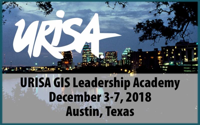
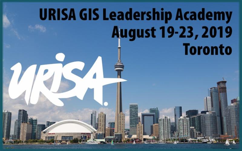
URISA Professional
Education Calendar
|
|
2019 GIS/CAMA Technologies Conference
CalGIS 2019
GIS-Pro 2019
For more information, visit
|
|
|
|