|
A Message From the Core Committee
Greetings Volunteers and Friends:
The summer is speeding by as we respond to a flurry of incoming requests for our volunteers to put their GIS skills to work solving problems and responding to crises. From mapping wildfires and hurricanes to providing spatial analysis training to public health experts and supporting NASA research, our volunteers have had no shortage of opportunities to do GIS for good lately.
In fact, we've been so busy that we brought on two new Core Committee members! Nadine Trahan and Kelly Meehan joined our team in July and August and we are thrilled to have two new project managers dedicated to making a difference through geospatial science and volunteerism. Get to know Nadine and Kelly below in our Volunteer Profile section.
With warmest regards,
GISCorps Core Committee and Advisory Board: Shoreh Elhami, Erin Arkison, Dianne Haley, Konrad Hughes, Allen Ibaugh, Carol Kraemer, Kelly Meehan, Wincy Poon, Nadine Trahan, German Whitley, and Troy Wirth
P.S. Please email [email protected] if you wish to be removed from this list.
|
|
Deployment and Partnership News
|
Missions in Progress
Twenty-two missions are currently underway with a few others in the works. More details on these projects are posted on our What We Do web page under New and Ongoing Projects.
|
Completed Missions
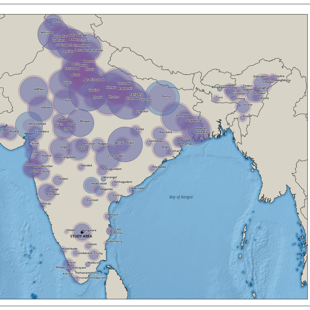
Bangalore Health Data
A grassroots volunteer group in South India requested GIS and data analysis support to study the distribution and patterns of noncommunicable diseases in Bangalore. Volunteer Nicole White took on this effort, developing a series of maps and charts to map the current state of noncommunicable diseases in the city.
Read more about this project here.
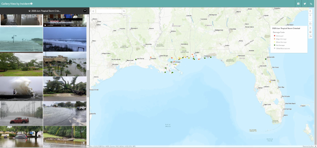
NAPSG Tropical Storm Cristobal
Twenty-one volunteers answered NAPSG Foundation's call to map crowdsourced photos as part of our
ongoing collaboration
to provide situational awareness to emergency managers during natural disasters. The volunteers mapped 152 photos in 3 days, documenting widespread impacts along the Gulf Coast from Florida to Texas and north into the Mississippi Valley and beyond.
Read more about this project here.
GIS Training for WHO GOARN Partners
GISCorps volunteers Lisa Silva and Noah Krach conducted several short-term remote GIS training sessions between July 14th and August 4th for 43 individuals from the Global Outbreak Alert and Response Network of the World Health Organization. Lisa and Noah introduced topics and performed live demonstration on ArcGIS Pro, ArcGIS Online, ArcGIS Operations Dashboard, and ArcGIS Insights.
Read more about this project here.
NAPSG Crowdsourced Photo Mapping - Hurricane Hanna
In late July, NAPSG Foundation requested support from GISCorps volunteers for the long-standing Disaster Crowdsource Photos effort. Nine experienced volunteers quickly joined the effort contributing more than 20 hours and 90 photos in 3 days.
Read more about this project here.
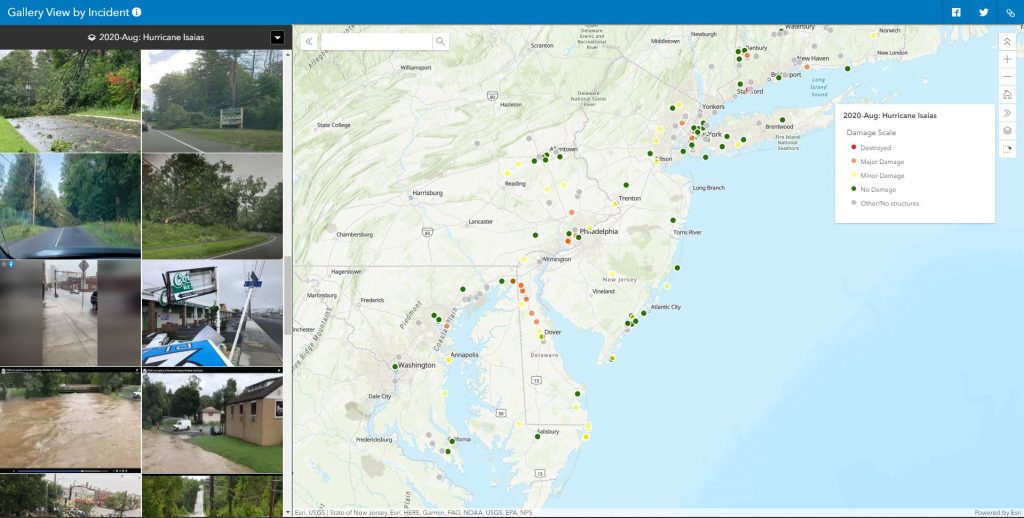
NAPSG Crowdsourced Photo Mapping - Hurricane Isaias
Hurricane Isaias was the second hurricane of the 2020 Atlantic storm season. Once again, NAPSG Foundation requested support from URISA's GISCorps volunteers. The storm caused widespread wind damage and power outages along almost the entire East Coast of the United States, and 49 GISCorps volunteers spent 7 days mapping almost 500 photos.
Read more about this project here.
New Missions in Progress
NASA COVID-19 Digitization Project - Phases I & II
A scientist at NASA's Jet Propulsion Laboratory requested the help of 20 GISCorps volunteers to digitize Los Angeles County parking lots to support an effort to use Satellite Synthetic Aperture Radar Observations to monitor human activity level change around the world due to COVID-19 lockdown and re-opening. When that trial proved successful, a second phase of the project was launched to do the same tasks in many other US counties. This time, 83 volunteers contributed their time. Read more about this project here.
Volunteers Helping Develop Marine Conservation Tools in Indonesia
 The SEA People contacted URISA's GISCorps for assistance in designing and implementing mobile data applications and backend data structures for monitoring marine conditions in the Raja Ampat's Marine Protected Areas (MPA), which cover 2 million hectares of remote archipelago. Two volunteers, Elvia Willyono, from Singapore, and Jose Francisco Sánchez Díaz, from Spain, were chosen to help The SEA People with their mission. Read more about this project here. The SEA People contacted URISA's GISCorps for assistance in designing and implementing mobile data applications and backend data structures for monitoring marine conditions in the Raja Ampat's Marine Protected Areas (MPA), which cover 2 million hectares of remote archipelago. Two volunteers, Elvia Willyono, from Singapore, and Jose Francisco Sánchez Díaz, from Spain, were chosen to help The SEA People with their mission. Read more about this project here.
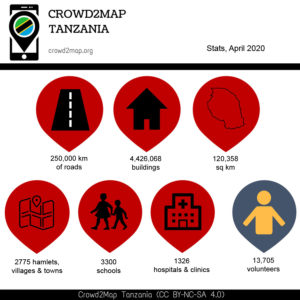
New Mapper Mentoring for Crowd2Map Tanzania
Three GISCorps volunteers with advanced OpenStreetMap editing skills, Emmanuel Jolaiya from Nigeria, Sharon Omojah from Kenya, and Katarina Spasenovic from Italy, have stepped up to meet the challenge of helping Crowd2Map Tanzania mentor new mappers. The Crowd2Map project attracts a great number of new mappers from all over the world to map schools, hospitals, roads, buildings and villages in rural Tanzania.
Read more about this project here.
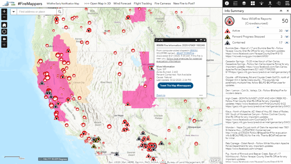
NAPSG Wildfire Initial Attack Mapping
Wildfire initial attack is a dynamic period of time where information is gathered from disparate sources, and it can be difficult to rely on a single source of information, state or region-wide. The goal of this NAPSG Foundation project is to have skilled GIS volunteers standing by during times of high fire danger, ready to quickly and accurately map and verify wildfire starts based on reports found in the news, chatter on social media, and information from agency sources.
Read more about this project here.
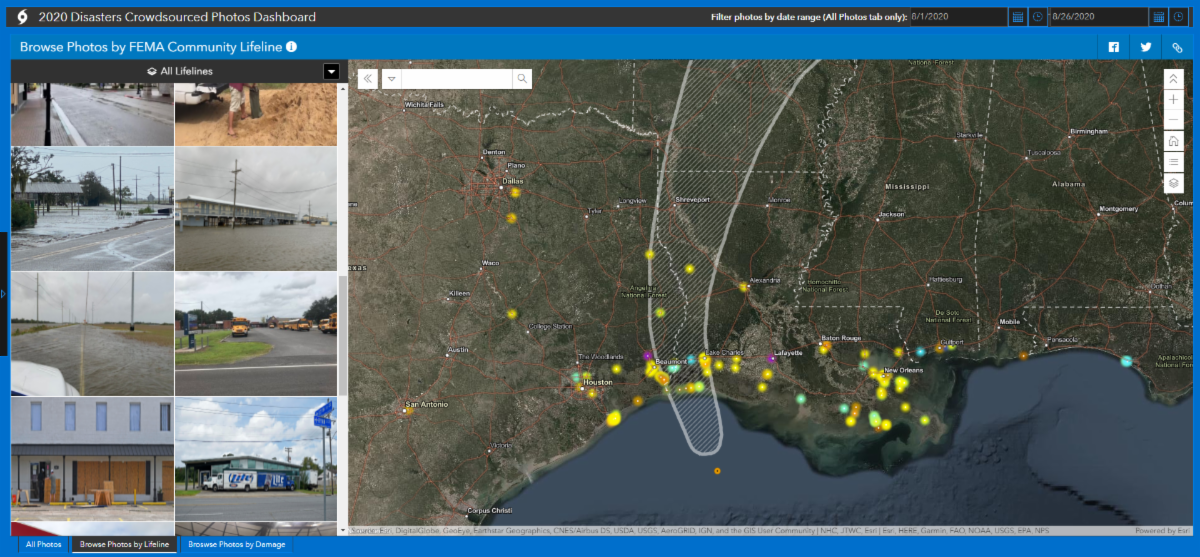
NAPSG Crowdsourced Photo Mapping - Hurricanes Laura and Marco
When Hurricanes Laura and Marco took aim at the Gulf Coast, NAPSG Foundation, CEDR Digital Corps and GISCorps stepped into their now-familiar roles, mining social media and news outlets, geolocating photos of on-the-ground conditions, and mapping them to provide situational awareness to emergency managers responding to the storm. So far, 29 GISCorps volunteers have contributed to this mission, with more joining every day.
When it's finished, you'll find more information about this mission here.
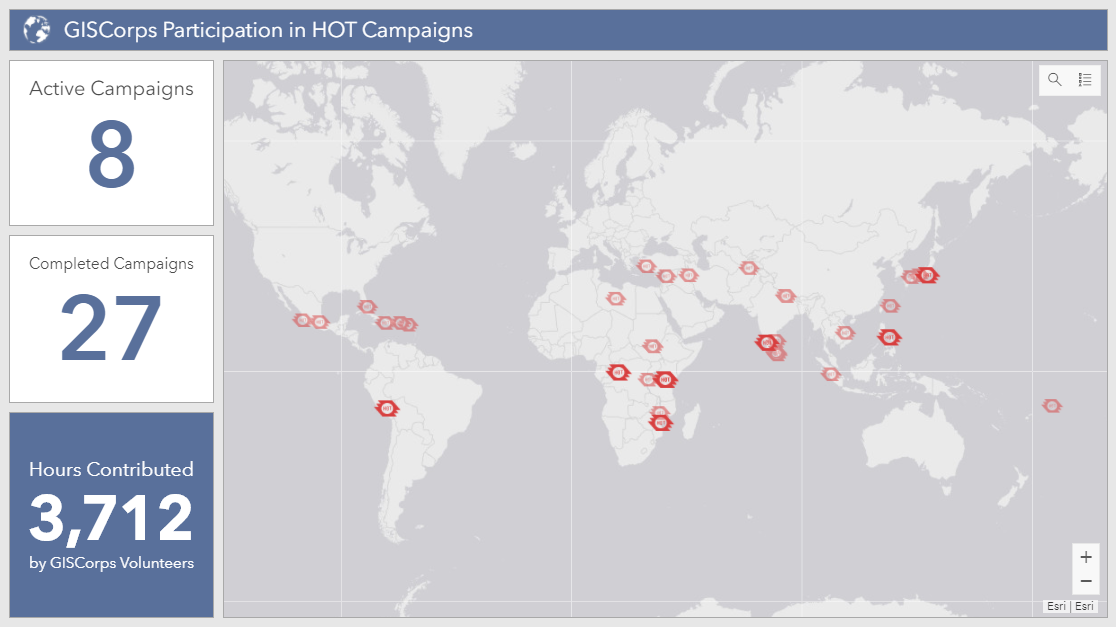
HOTOSM Projects
Humanitarian OpenStreetMap Team (HOT) continues to request support from GISCorps volunteers for urgent projects that have unmet demand for highly skilled OpenStreetMap editors. Since 2011, at least 214 GISCorps volunteers have contributed over 3,700 hours mapping and validating 35 HOT campaigns. Efforts are ongoing for the following HOT projects:
- COVID19 Projects - Beginner Mapping/Validators
- Typhoon Kammuri/Tisoy (Philippines) - Beginner mapping/Validators
- Typhoon Hagabis (Japan) - Validators
- Ebola campaign (DRC and Uganda) - Beginner-Intermediate mapping/Validators
- Tanzania Development Trust (Tanzania) - Beginner mapping/Validators
If you are already a GISCorps volunteer and a HOTOSM contributor, please remember to add #GISCorps to your changeset comments when you save your edits and don't forget to keep track of the hours you spend mapping. When you're finished, fill out this Google form so we can accurately track and report GISCorps volunteer contributions to HOTOSM projects. You'll also receive documentation of your contribution, which can be used for GISP credit.
|
|
The GIS Service Pledge (GSP) is a collaboration between Esri, URISA's GISCorps, and YOU! Invent your own GISCorps mission to support organizations or causes that would benefit from GIS expertise, applications, or analyses. Esri generously provides one-year ArcGIS personal use licenses that volunteers can use to make a difference in their own communities or across the world.
So far, GISCorps and Esri have approved 50 GIS Service Pledge applications submitted by volunteers from eight different countries. As participants wrap up their projects, we delight in reading their reports and learning how they were able to contribute to organizations they care about. You can read them, too, on this page of our website, which is dedicated to GIS Service Pledge project reports. You can also see where GSP participants are making a difference on this web map.
Here is a recent highlight:
Do you know of a nonprofit organization that could benefit from your GIS expertise? Review the GIS Service Pledge guidelines and apply for the program here. Send any questions specific to the GIS Service Pledge to [email protected]. And if you are a GISCorps volunteer who has identified a worthwhile GIS Service Pledge project idea, but would prefer to work within the supportive structure of a formal GISCorps mission, we'd love to hear about your idea too! In many cases, you can encourage the organization you'd like to help to request GISCorps support, and GISCorps can then launch a new project with you as the volunteer, bypassing the recruitment process.
|
|
Conference News & Announcements
|
|
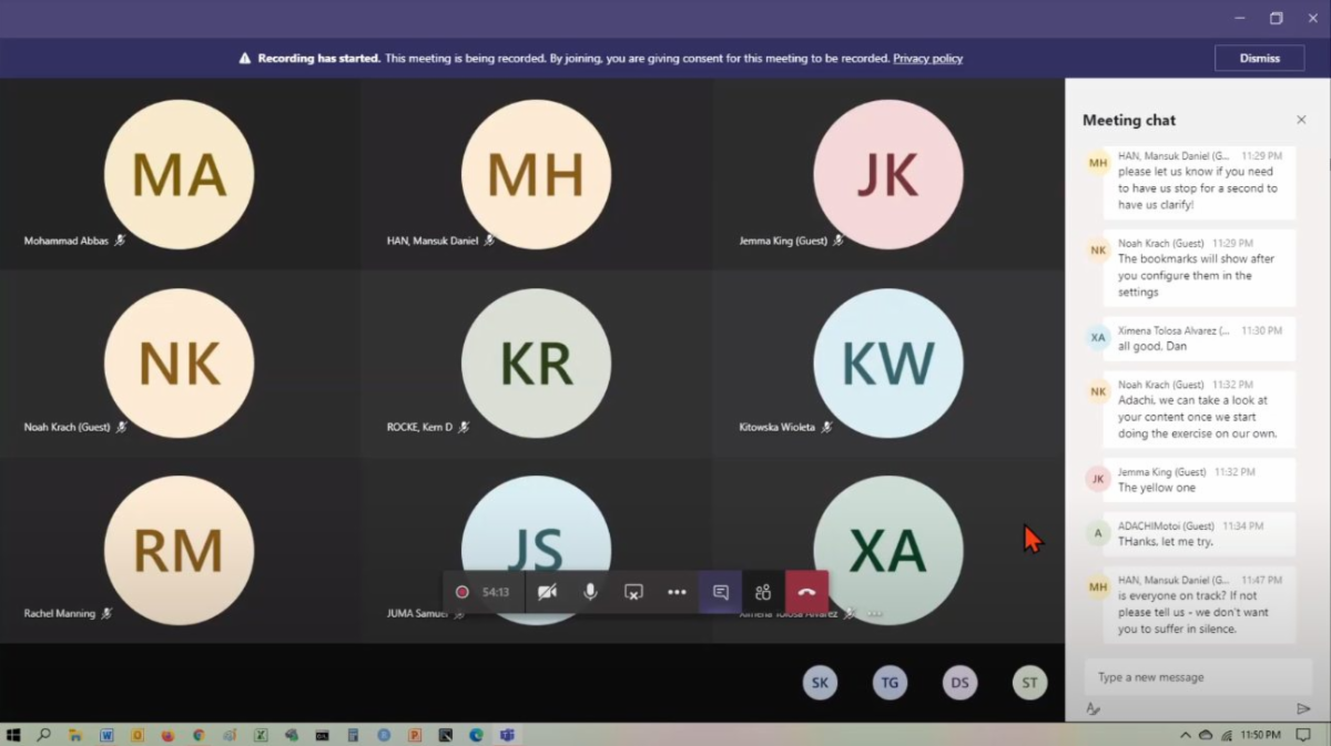
2020 Esri User Conference
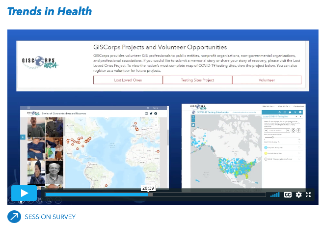
GISCorps staffed a virtual kiosk in the Sustainable World Community at the 2020 Esri User Conference, a virtual version of the annual conference that allowed over 85,000 people to attend. We were proud to see our volunteers' work referenced in some of the technical sessions and delighted when volunteers and partners (past, present, and future) stopped by our kiosk's chat room to say hello.
A screenshot of Dr. Este Geraghty's Trends in Health session.
GIS-Pro 2020: A Virtual Experience
As with nearly all conferences, GIS-Pro 2020 will be delivered virtually due to COVID-19 safety concerns. URISA has significantly reduced the cost to participate in order to make it easier for all to attend. Full and half-day workshops are scheduled the week before and the week after the main conference to work better with your schedule. Attendance at a workshop is included with full event registration and, as with in-person workshops, capacity is limited in order to facilitate interaction and engagement. Learn more here.
HUGE News! GISCorps will be inducted into the GIS Hall of Fame during the conference joining an esteemed group of individuals and organizations!!!

URISA's GIS Hall of Fame honors persons and organizations that have made significant and original contributions to the development and application of GIS concepts, tools, or resources, or to the GIS profession.
Learn about the path-breaking accomplishments of URISA's GIS Hall of Fame laureates here. |
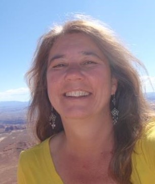
Name: Nadine Trahan
Professional Role: Environmental Geospatial Analyst
GISCorps mission(s)/Year served: COVID-19 Testing Sites Data Creation in 2020
Share your experience about the mission: I think what really stood out to me working on my first project with GISCorps was the top notch project management approach and high level of dedication of the admin team. On one hand, the project was managed with high expectations from volunteers, which made it possible to produce a quality product. On the other hand, expectations were balanced with incredible patience in supporting volunteers and understanding that volunteers had other responsibilities that might need to come first. Meanwhile, the admin team was constantly positive, no matter how many hours they had to put in or how long the project lasted.
Why do you volunteer? I am very passionate about my work because it is focused on what I care most about in life, socio-ecological health. While I have always worked in relevant jobs, my interests are wide and varied, so I've often volunteered my skills to contribute in ways I could not within a given employment capacity. In addition to supporting important work, volunteering has allowed me to learn more about various cultures, specific sustainability challenges and work with some amazing people. Below are various volunteer projects I have worked on, aside from GISCorps.
- COVID Care Neighbor Network, Together We Can - Web App for connecting neighbors in need with those who can help
- Tropical Ecology Research - conducted invertebrate sampling site delineation to
- develop biotic index for streams in Cusuco National Park, Honduras
- Capacity building for conservation
- provided species distribution modeling workshops in Hispaniola, Costa Rica, Colombia
- Drone training for rangers in Chiquibul National Park, Belize
 Name: Kelly Meehan Name: Kelly Meehan
Professional Role: Remote Sensing Analyst
GISCorps mission(s)/Year served: COVID-19 Testing Sites Data Creation in 2020
Kelly's experience on the mission: The COVID-19 Testing Location project was the first project that I've contributed to. I started out searching for sites in the area where I currently am and then began monitoring areas across the country where I've previously lived. Shortly after signing up, a member of my household developed symptoms, an experience which allowed me to appreciate firsthand the importance of this dataset. It's been really uplifting to have the opportunity to work on a project with so many dedicated volunteers during such a challenging time.
Why do you volunteer?: I began graduate school six years ago, making a complete career change. Until that point, I had worked as a social worker, environmental educator, and youth development program coordinator. While I really enjoy the work that I do now as a remote sensing analyst, I miss feeling like I have a direct impact on a community. Since graduating, I began searching for community service opportunities that allow me to apply my newfound GIS skills.
For more volunteer profiles, visit the Our Volunteers page of our website.
|
|
Thank you for your continued support of URISA's GISCorps!
|
|
|
|
Attend GIS-Pro 2020, URISA's 58th Annual Conference, Virtually!
For more information, click here.
|
| Social Media | |
If you haven't already, please join us on social media:
Facebook page
Facebook group
Twitter account
LinkedIn page
LinkedIn group
Instagram
Slack workspace
If you'd like to help us get the word out, please check out the resources on our website. Also, please double check that the 'giscorps.org' domain is not being sent to your Spam folder.
|
| Our Supporters:
GISCorps is grateful for the generosity of the following corporate sponsors as well as many individual supporters.
To see who else supports URISA's GISCorps and to learn about sponsorship opportunities, please visit our Supporters page.
| |
|
|
URISA's GISCorps Core Committee & Advisory Board
| |
Erin Arkison
Shoreh Elhami
Dianne Haley
Konrad Hughes
Allen Ibaugh
Carol Kraemer
Kelly Meehan
Wincy Poon
Nadine Trahan
German Whitley
Troy Wirth
GIS/Administrative Assistant: Holly Torpey
Contact us:
|
|
|
|


 For more information about GISCorps's involvement with HOT, as well as information about how to get started mapping with HOT, please visit