|
Good afternoon, folks! I wanted to provide a quick update on the latest regarding the winter storm, set to move through the area tomorrow and Monday, followed by a blast of Arctic air.
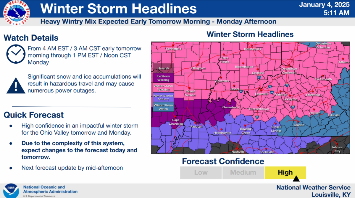
To begin, the Winter Storm Watch has been upgraded, and a Winter Storm Warning is now in effect for much of North Central Kentucky, the Bluegrass region, and Northeastern Kentucky—the first such warning in nearly a year. Go a little farther west and you'll find yourself in an Ice Storm Warning, which marks the first of its kind since early February 2022.
Bottom line: It’s been a while since we’ve seen a winter storm of this magnitude, and we all need to be prepared. You can view all the current warnings and advisories on the map below, courtesy of the National Weather Service in Louisville. One key takeaway from that image is the NWS's bold statement: "Due to the complexity of this system, expect changes to the forecast today and tomorrow." In the meteorological profession, winter storms are especially tricky to predict. A minor shift in the system’s track can result in major changes to precipitation type and accumulation forecasts. At this moment, the main focus is across the northern half of the state. However, if you're in the advisory area across the southern fringe of counties, you’re not out of the woods yet. Confidence in the forecast is increasing, but we’ll need to continue monitoring for updates.
|